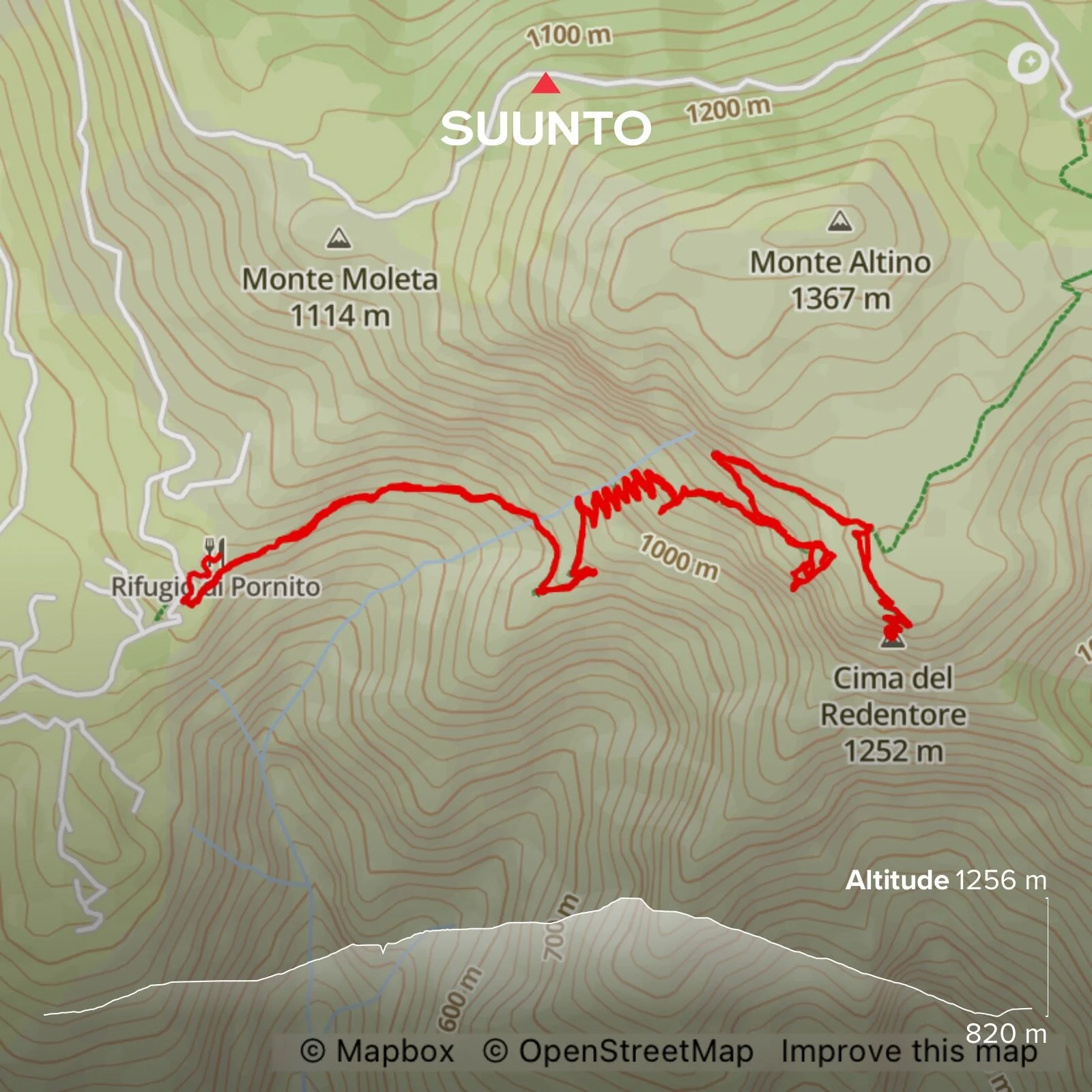
CIMA DEL REDENTORE


Length: 8.6 kilometres
Elevation gain: 624 m
Time: About 3.5 hours with time for drinks and snacks
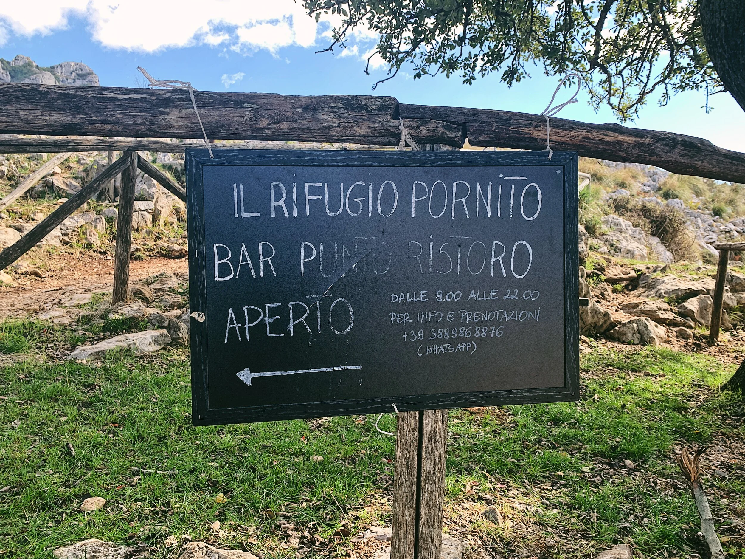
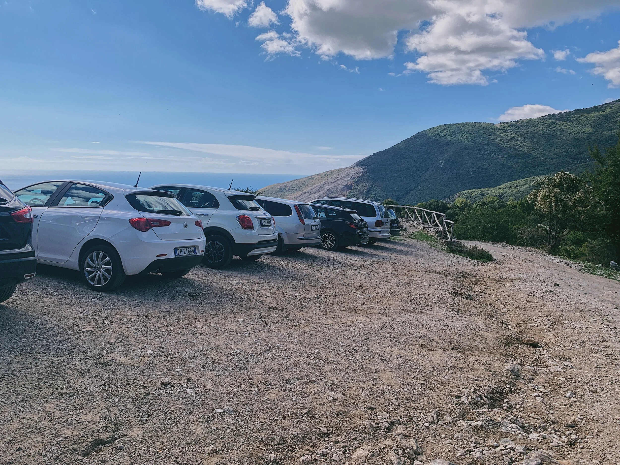
Parking: Rifugio Pornito, Maranola. Coordinates: 41.305839, 13.619256. What3words: ///diarists.suspect.shrubbery
Best time to go: Anytime, as long as there is no snow/heavy rain. Watch out for wildfires in the summer
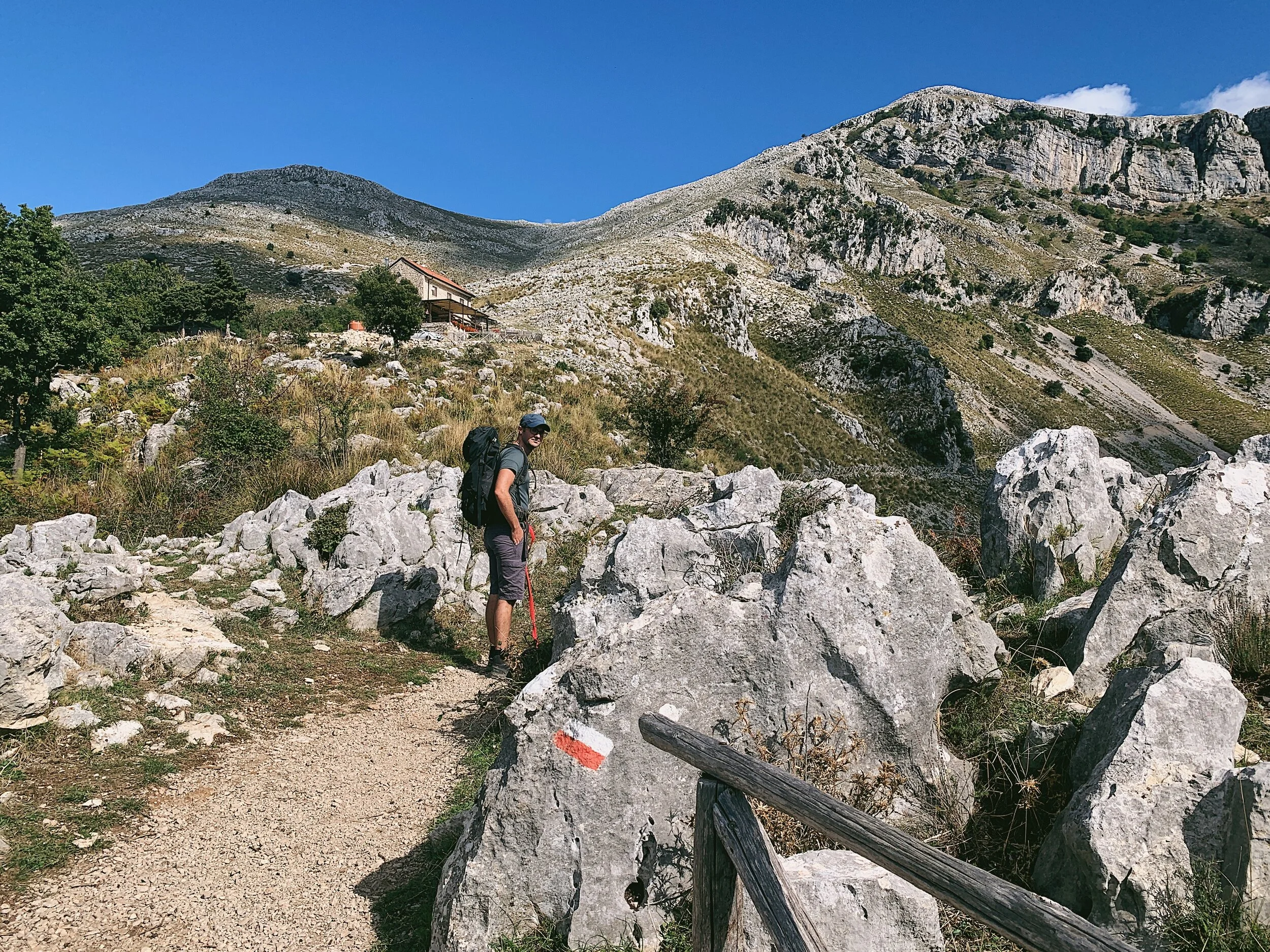
Terrain: Mountainous and rocky, sometimes unstable underfoot
Level: Moderate. Uphill all the way but the incline is steady and there is a handrail for much of the way
Suitable for children: Yes, there are three points at which it is convenient to turn around and return to the start. Recommended for ages 8+
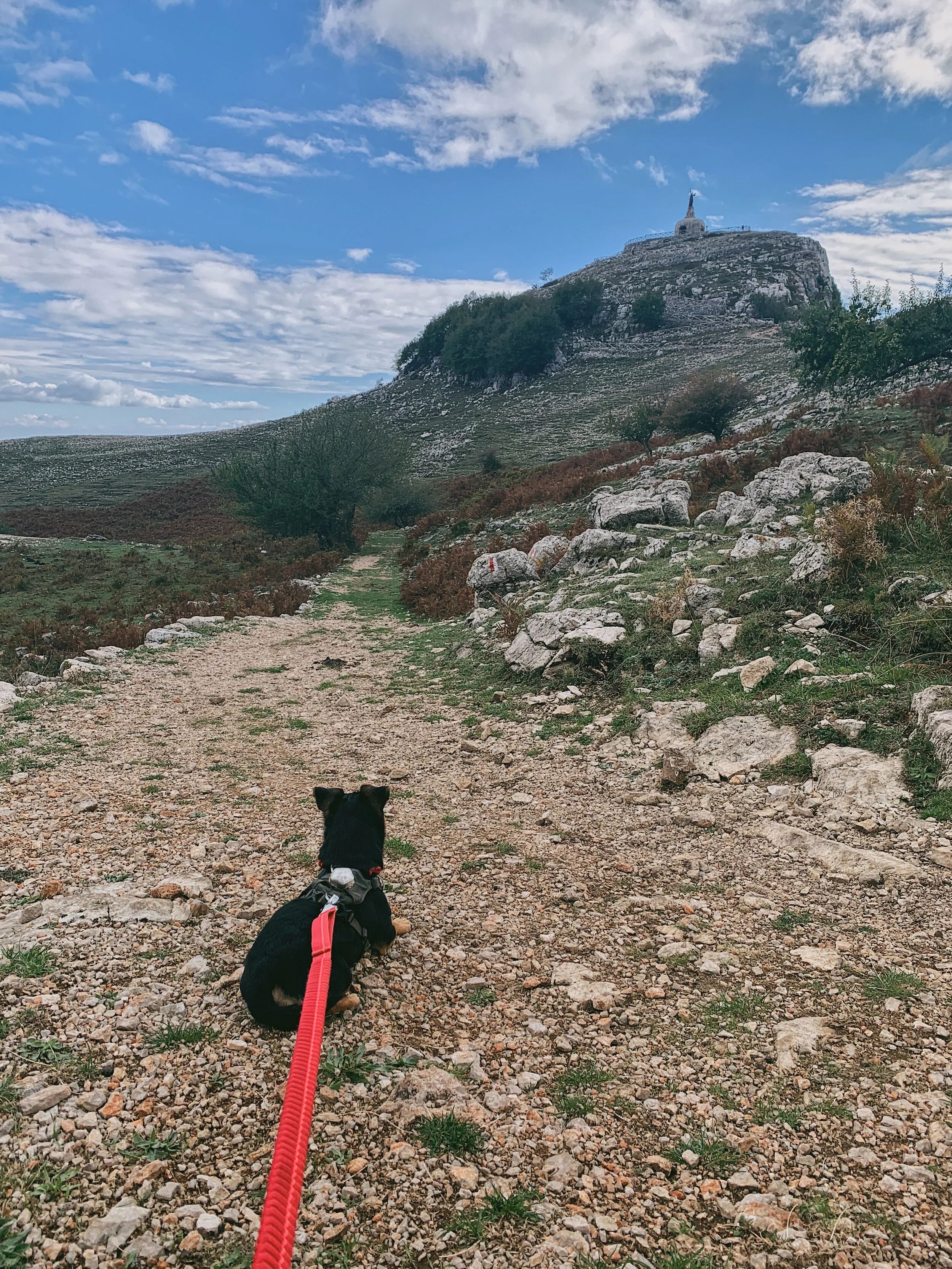
Suitable for dogs: Yes, but must be kept on a lead due to free roaming livestock and shepherd dogs
Monte Redentore: a family-friendly hike full of religious icons and captivating views
The Aurunci Mountains are situated in the region of Lazio, which though a little over an hour from Naples, feels markedly different (the driving improves, the people are inquisitively friendly and there is a lot less litter). Rising sharply from the Tyrrhenian Sea, they are capped with rocky karst plateaus with the lower flanks dotted in a continuous mix of scrub, large stones and pockets of woodland. In 1997 the mountains were incorporated into a protected park, the Parco Naturale dei Monti Aurunci.
The mountains themselves are so faulted and cracked that they retain almost no rainfall: any flowing water sinks to springs in the lower flanks while the stream beds are drier than dust. There are many forest fires here and, as of October 2021, there is a vast area of scorched earth on the hill facing the rifugio, while several sections of the handrail have been damaged by fires.
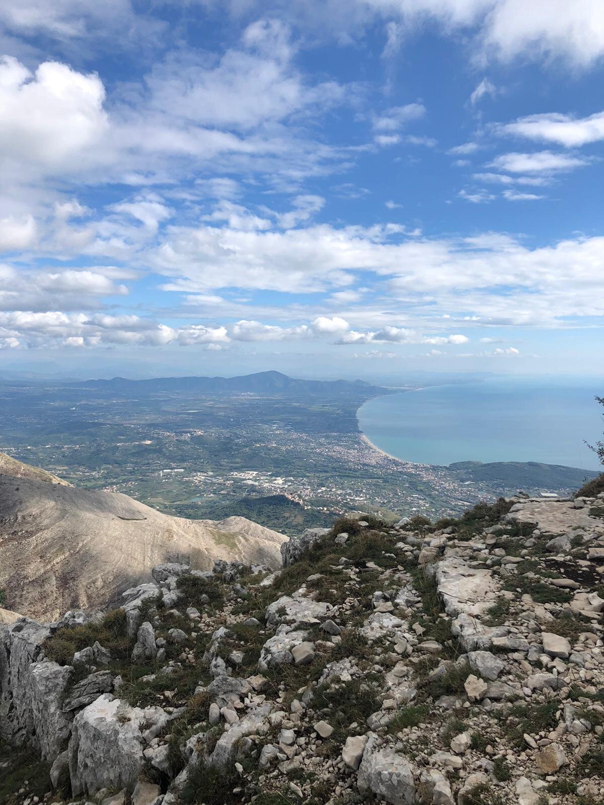
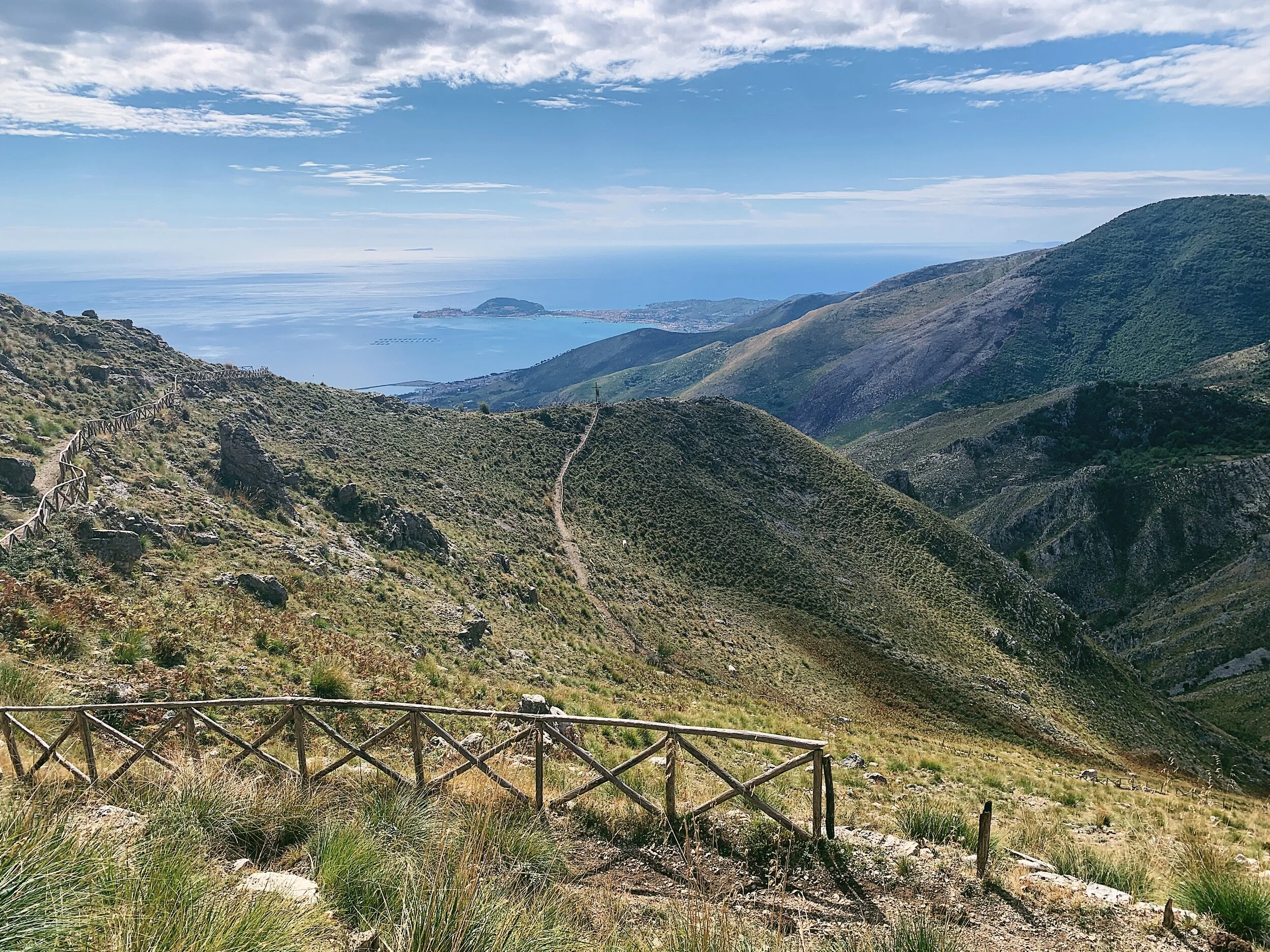
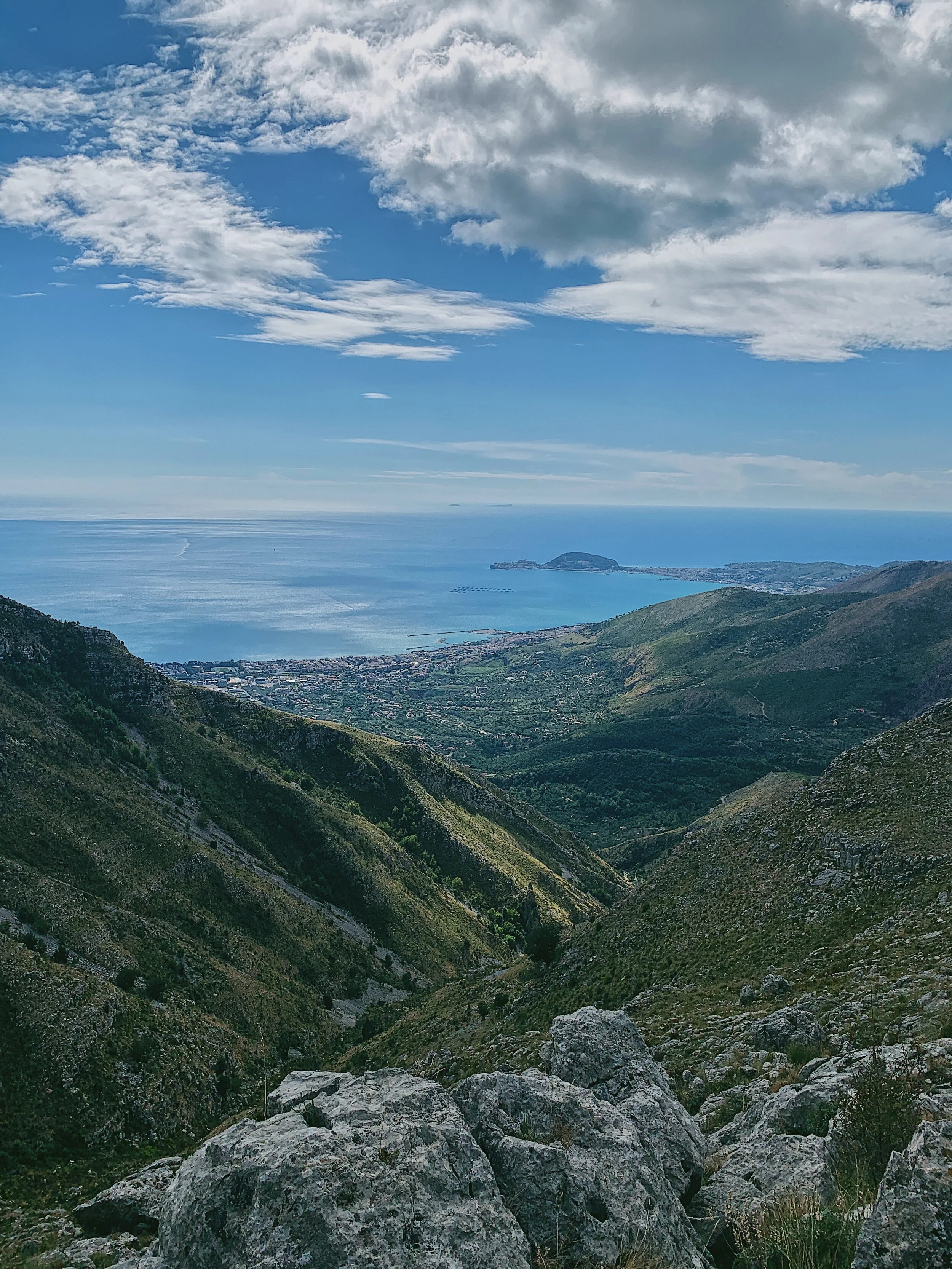
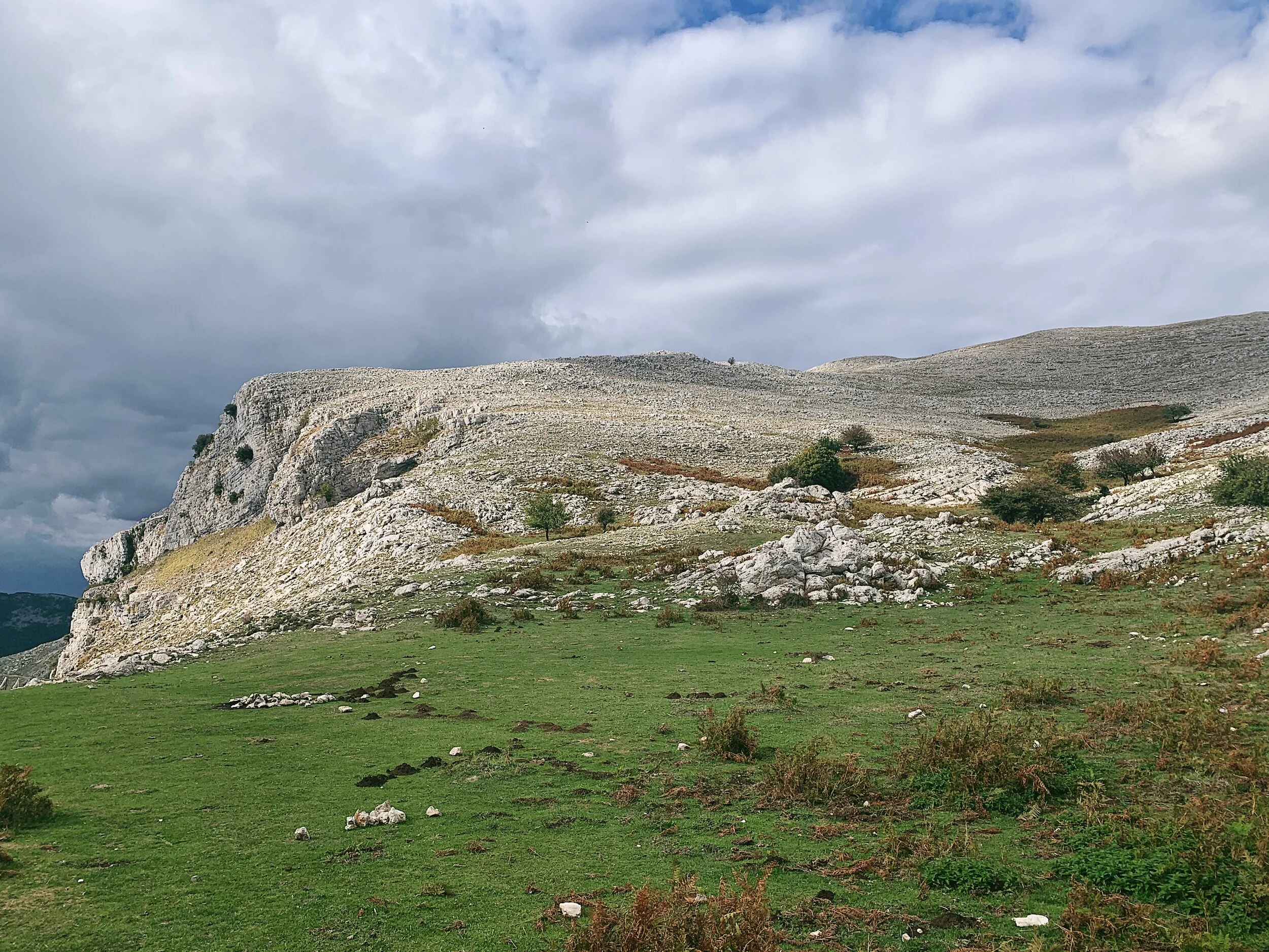
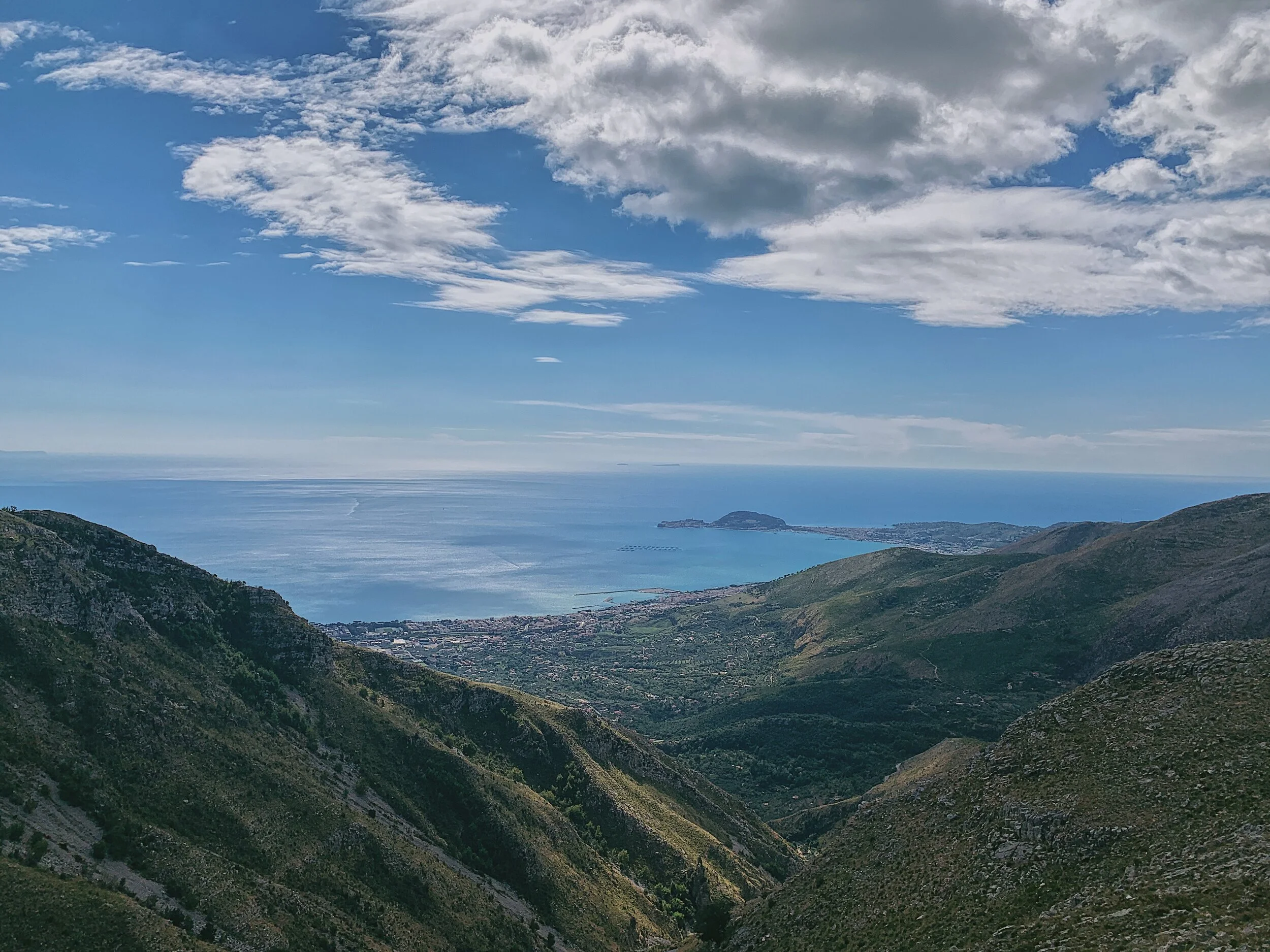
That said, the scenery is still staggeringly beautiful. The path is well marked, criss-crossing its way across the shoulder of Monte Altino with views almost the entire way up to the top at 1252 metres. The views include the beach towns of Gaeta and Formia, Baia Domizia, the hills of Mondragone, the mouth of the Garigliano river which separates Lazio and Campania, and a wide sweep of beach curving from Gaeta south towards Naples. On clear days you can see as far as Vesuvius, Ischia and Capri and the Pontine Islands of Ventotene, Ponza and Palmarola.
If you want to elevate your experience further, visit on the first Sunday after the 13th June and join the procession of villagers from Maranola following the statue of St. Michael up to the hermitage. It’s a lively cortège, accompanied by the sound of bagpipes and traditional instruments, with food and drink shared amongst the worshippers. The statue remains in place until the end of the summer, sometime around the end of September.
Flora and fauna
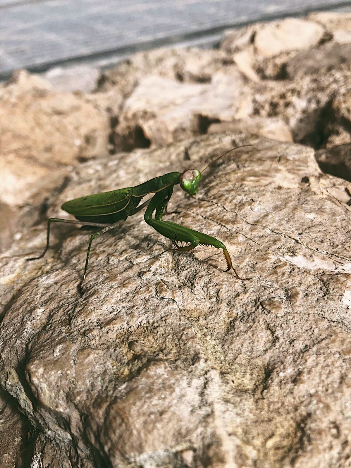
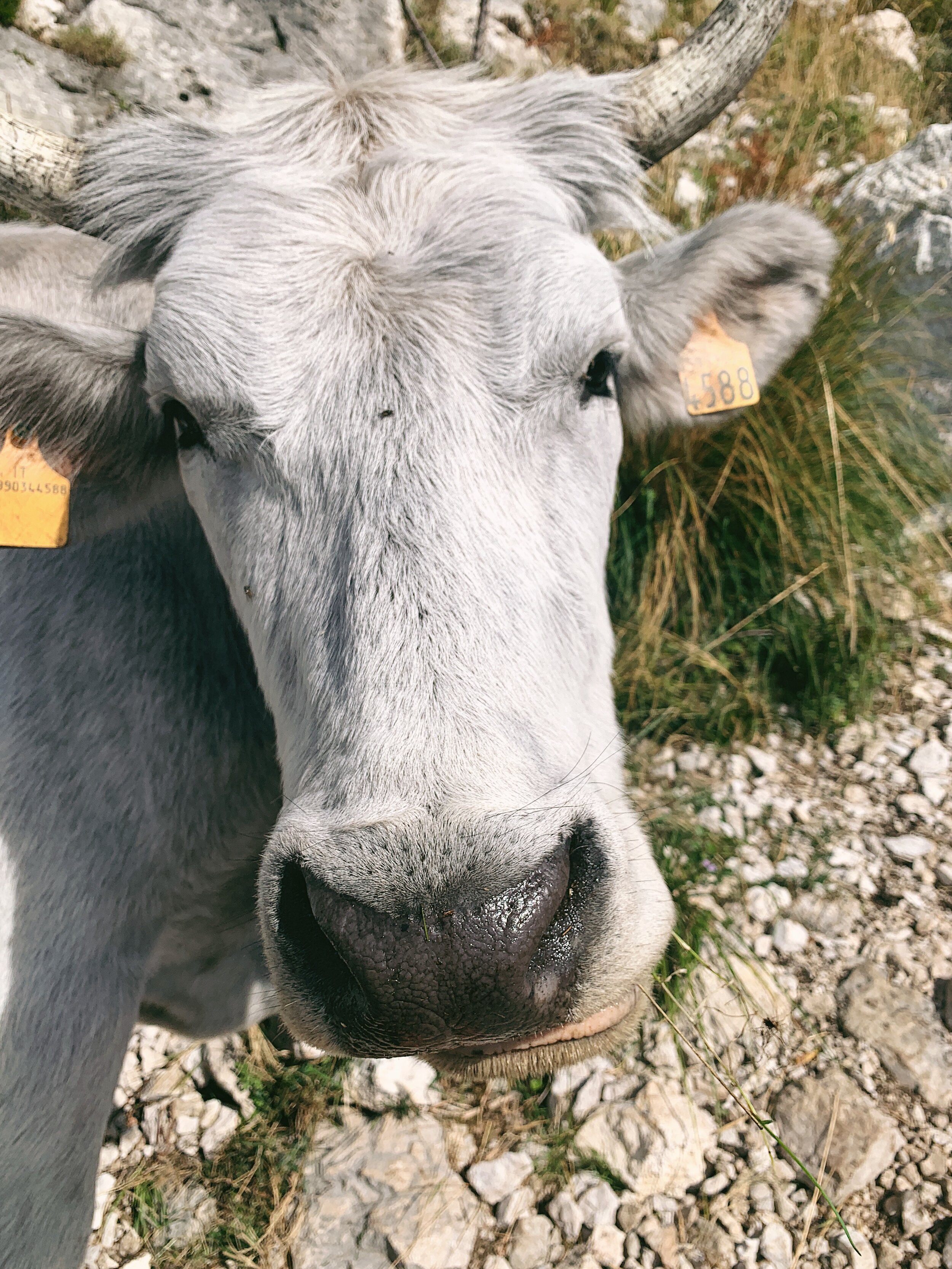
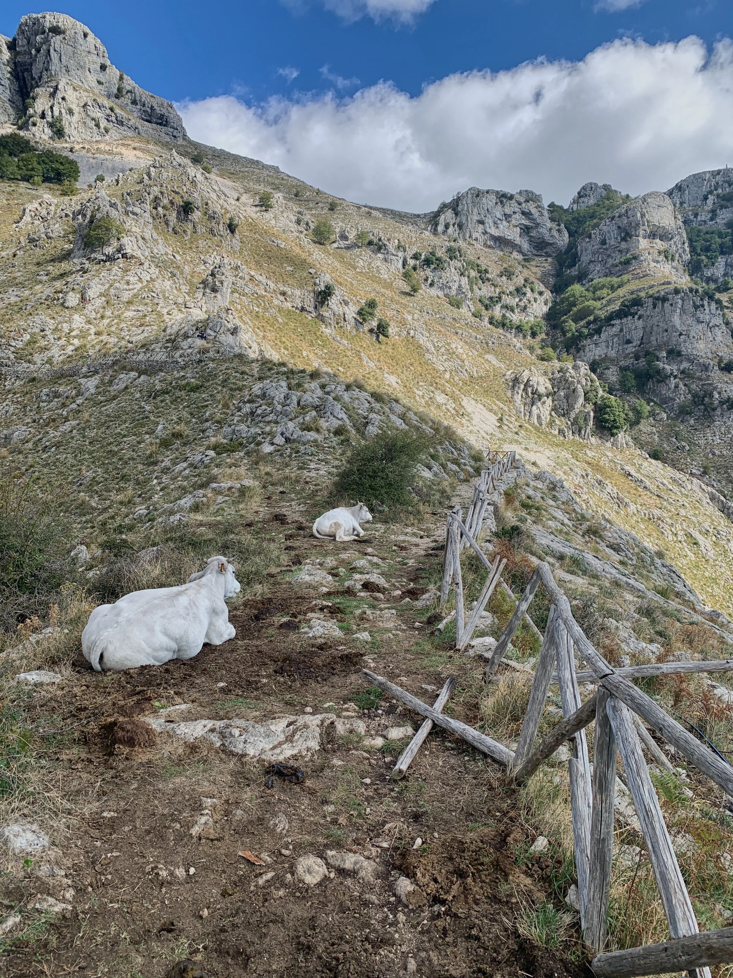
Despite the lack of water in the mountains, there is a surprising variety of wildlife. There are grazing animals here, usually elegant white cattle, swarms of black and brown goats, plus colourful salamanders and frogs, praying mantis and a wide range of large beetles including impressive dung beetles.
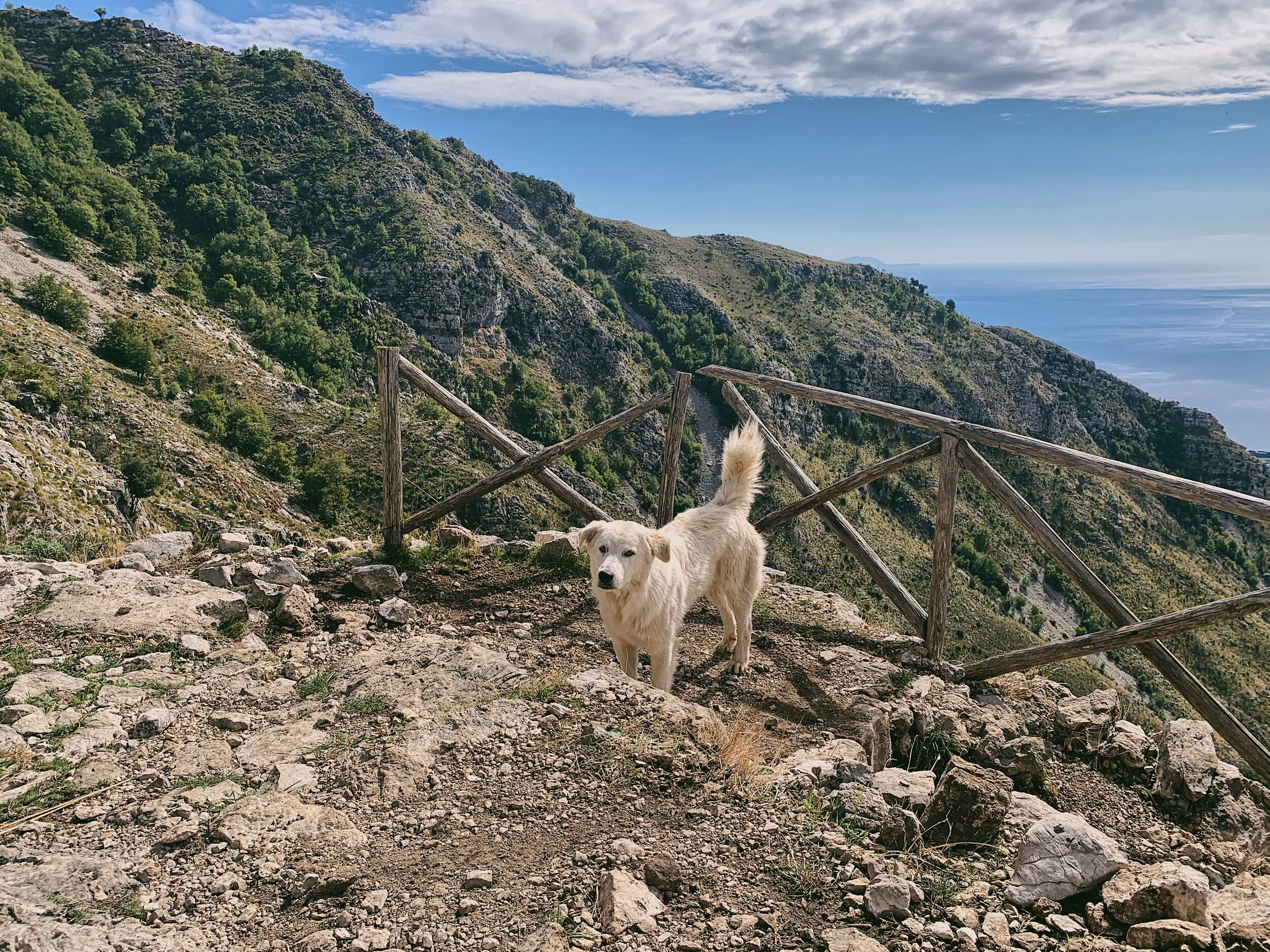
In addition to livestock you may also encounter the ‘cane da pastore’, the creamy white, thick-fleeced Maremmano dogs who serve as guardians of the mountains. If you encounter one, don’t be alarmed: simply stand still and let the dog determine you are not a threat before moving on your way.
How to get there and parking
This hike is situated over the border from Campania in Lazio, about 1 hour and 15 minutes from JFC Main Gate. Drive north on the SS7qtr following the coast and at the town of Formia turn inland and head uphill through olive groves to the village of Maranola. There are several bars, tabacchi and pastry shops here if you’re in need of supplies.
Leave the village of Maranola and continue uphill around a series of tight switchbacks following signs for ‘Redentore’. The road is not in the best condition with some loose gravel but it is fine - just beware of cattle, goats and dogs. The parking area is to the right below Rifugio Pornito and is also not the best surface but most cars will be fine. You can also park along the road where there is space if the car park is full.
The trail begins behind the car park.
Signage and trails
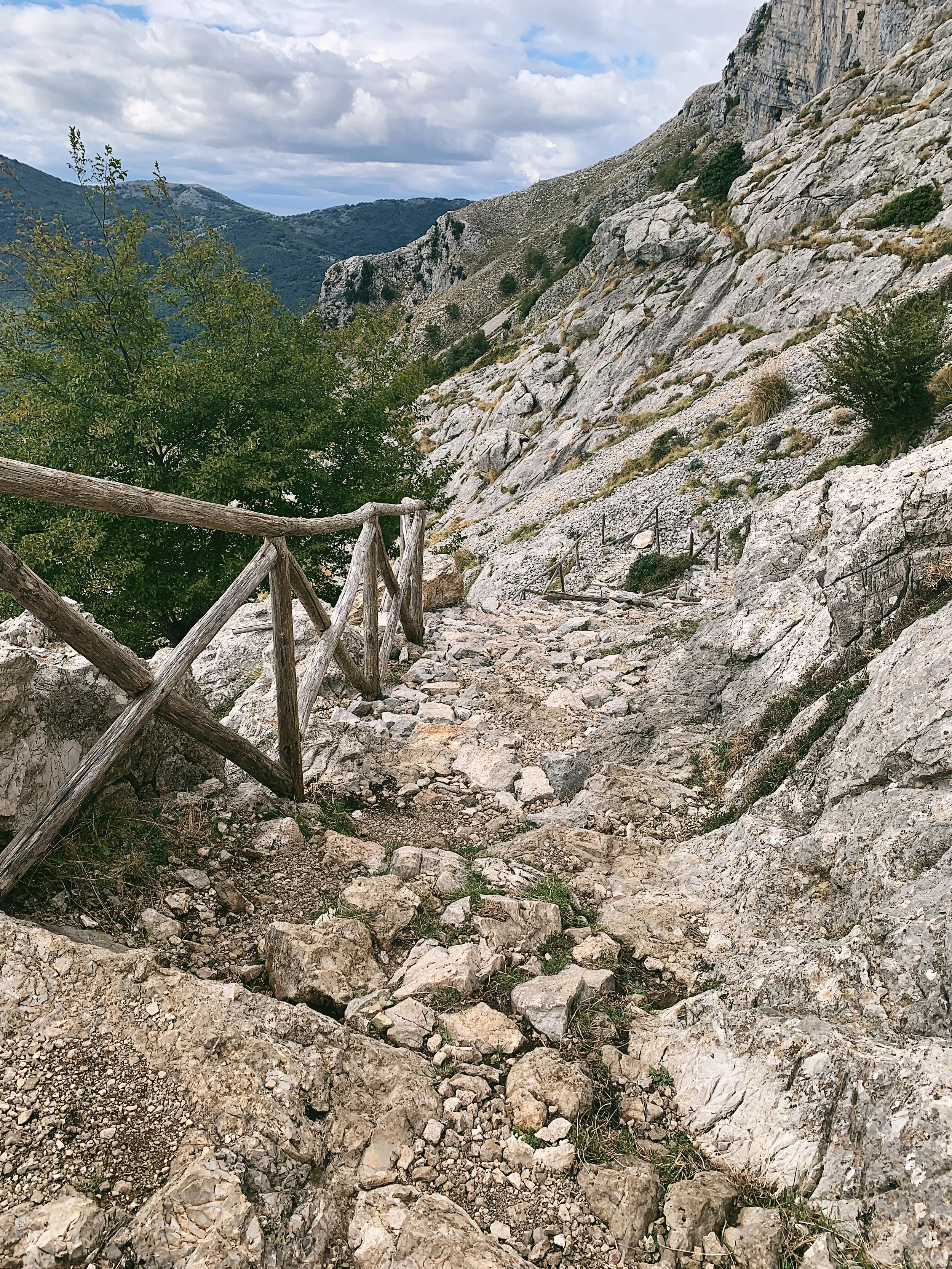
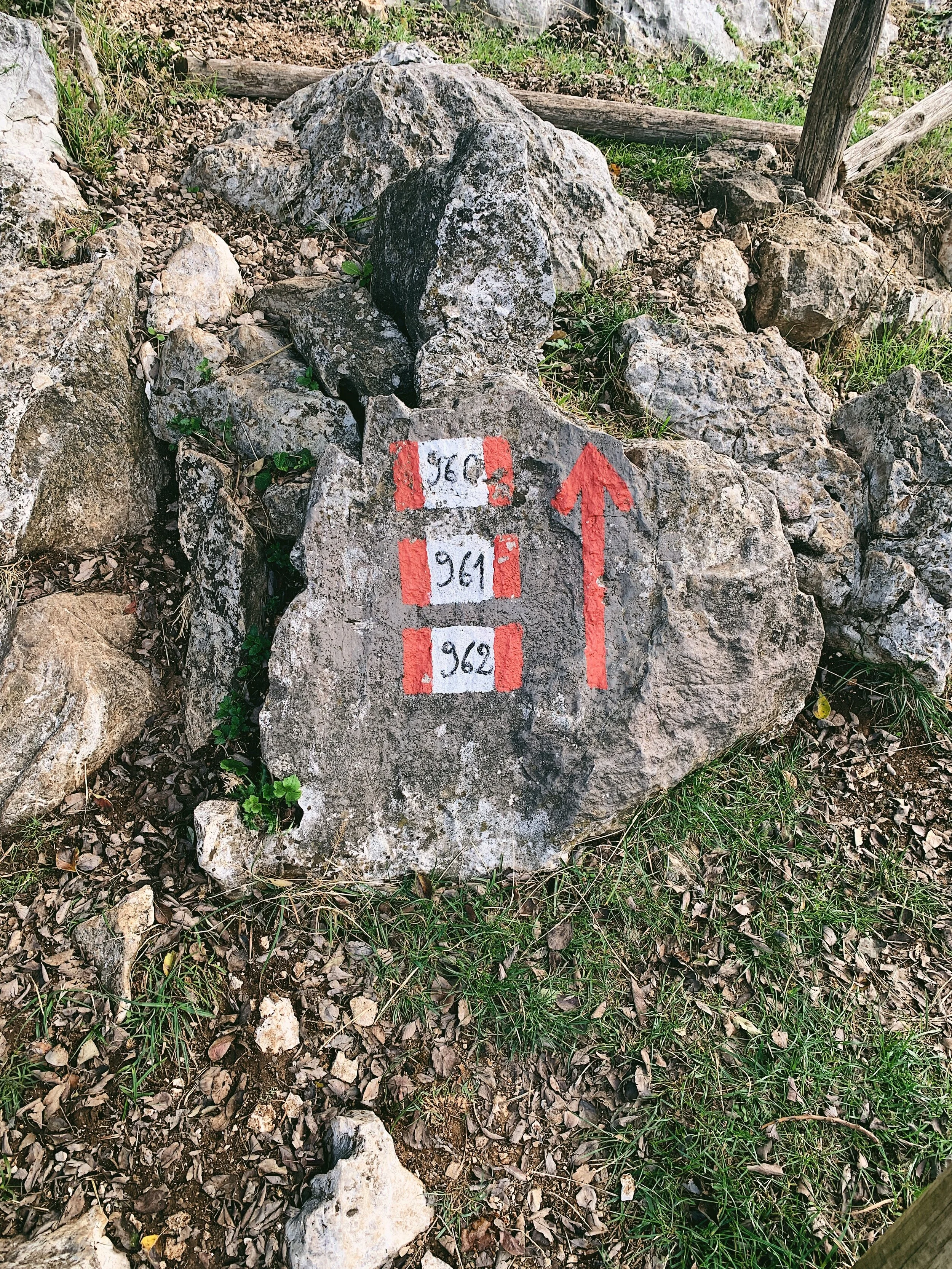
The trail is well signposted. There is a map board at the back of the car park which shows the routes nearby. The route you are following is 960; follow the red and white CAI markings which are painted along the rocks and fenceposts along the way. The route is well formed and very straightforward: straight up and down the same way. It’s very hard to get lost.
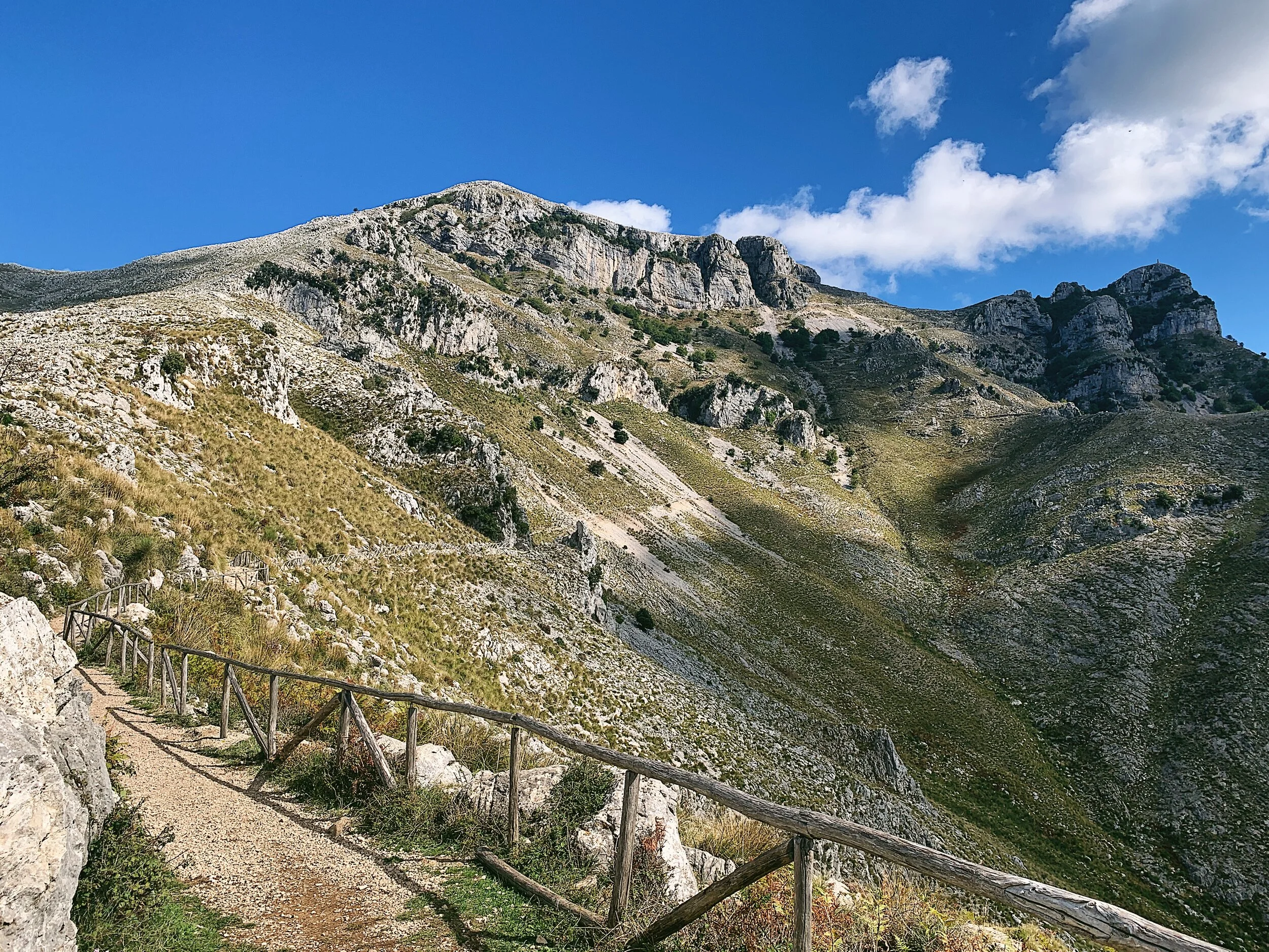
The trails are well defined but the surface is uneven. Much of it is built from compacted rock but this has been loosened by rains in places and is unstable. There is no scrambling involved but caution should be taken around exposed drops.
Some of the route has handrails but a substantial proportion has been damaged by wildfires.

Route
The trail begins below Rifugio Pornito; you can see the sea even from the car park. Follow the trail along the contour of the hill with the sea to your right. The path climbs steadily uphill, with several benches on the left with places to stop and rest if needed. After a kilometre or so the path gets steeper and rises to a cross which looks out over Gaeta and Formia below. Younger children will probably be able to make it this far.
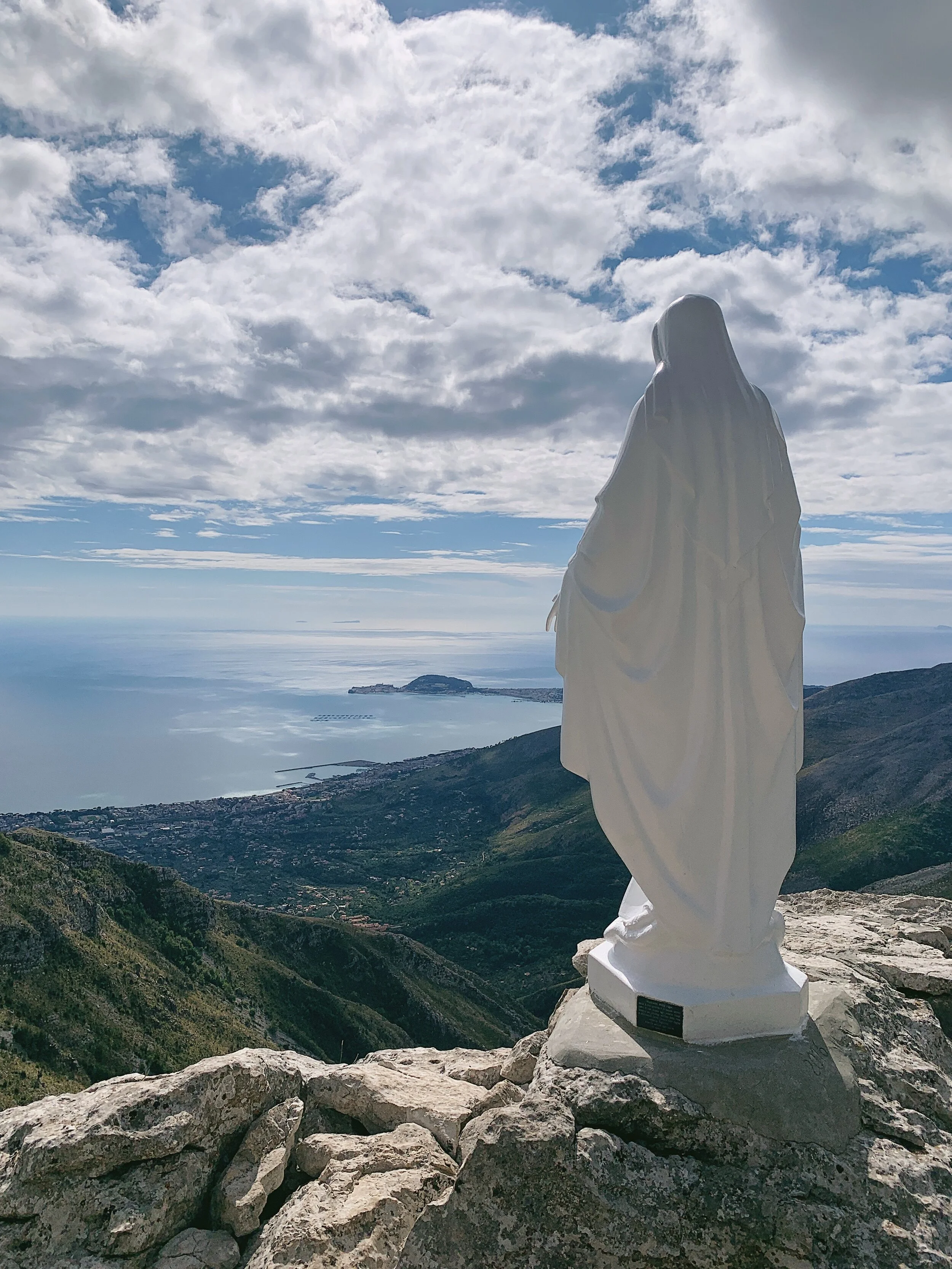
After the cross, the path turns back uphill and climbs in a series of 13 zig-zagging switchbacks. This is the steepest part of the hike though there are handrails for most of the way up. The second stop is the Madonnina - a pure white statue of the Madonna. At night there is a light which illuminates the statue.
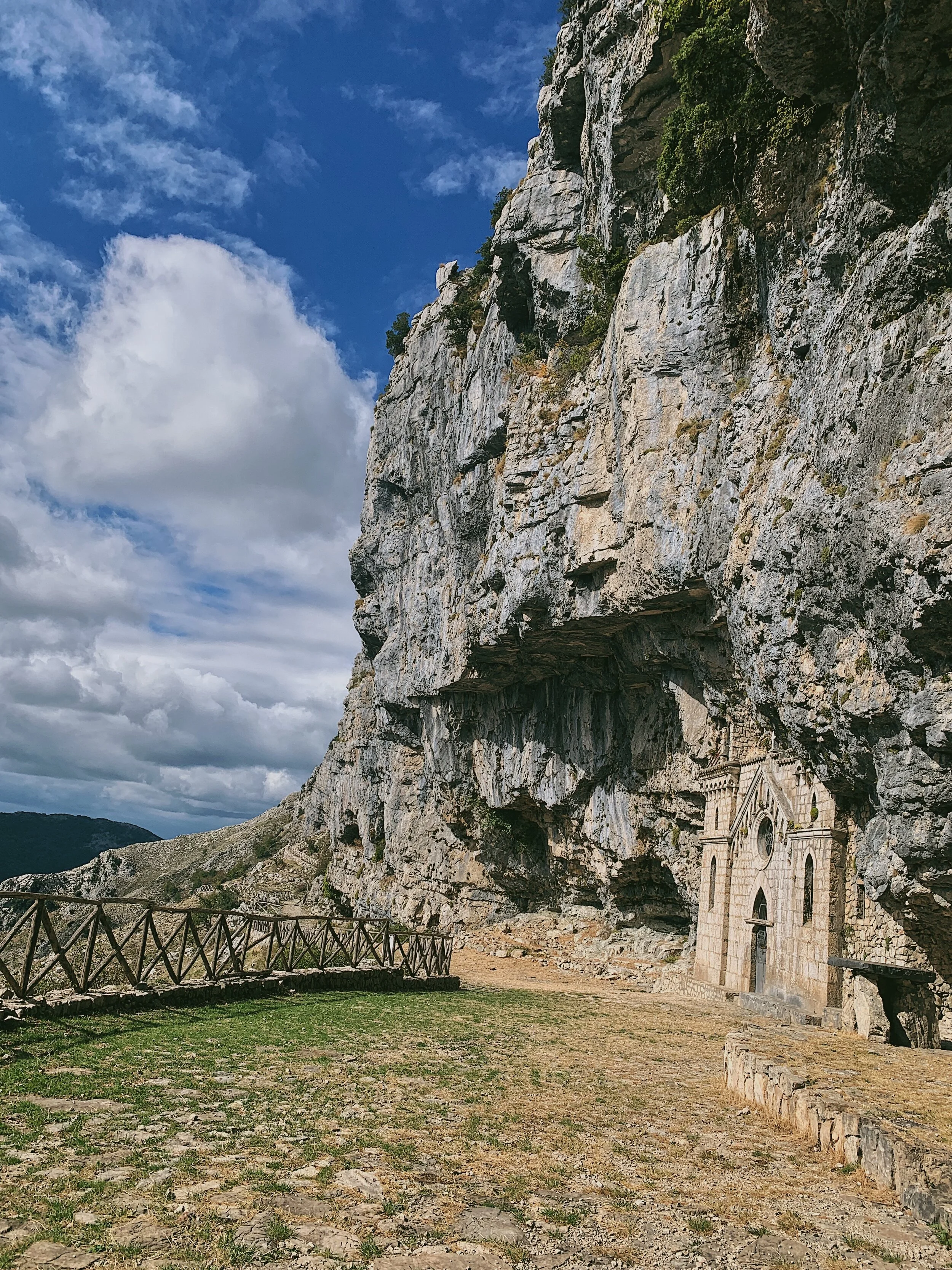
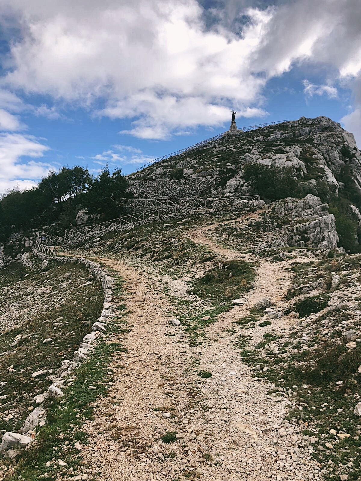
The path then continues further uphill to the third point, the Hermitage of San Michele Archangelo. The sanctuary is squished under the rocks and is barely visible until you are virtually in front of it. Dating back to 830 AD, the hermitage was rebuilt in 1893 in the Gothic style. It’s situated at 1158 metres and the views from here are spectacular. From the internal walls and the vault you can often hear the dripping of water, which is the sound of the spring dripping into a pool. Inside the hermitage (which is usually locked) there is a statue of San Michele - you can peer through the gap in the doors. It looks very spartan inside. Continue to the back of the ‘balcony’ and there is a stone pool which the cattle use as a trough. This is the third chance to turn around and return to the car park or rifugio.
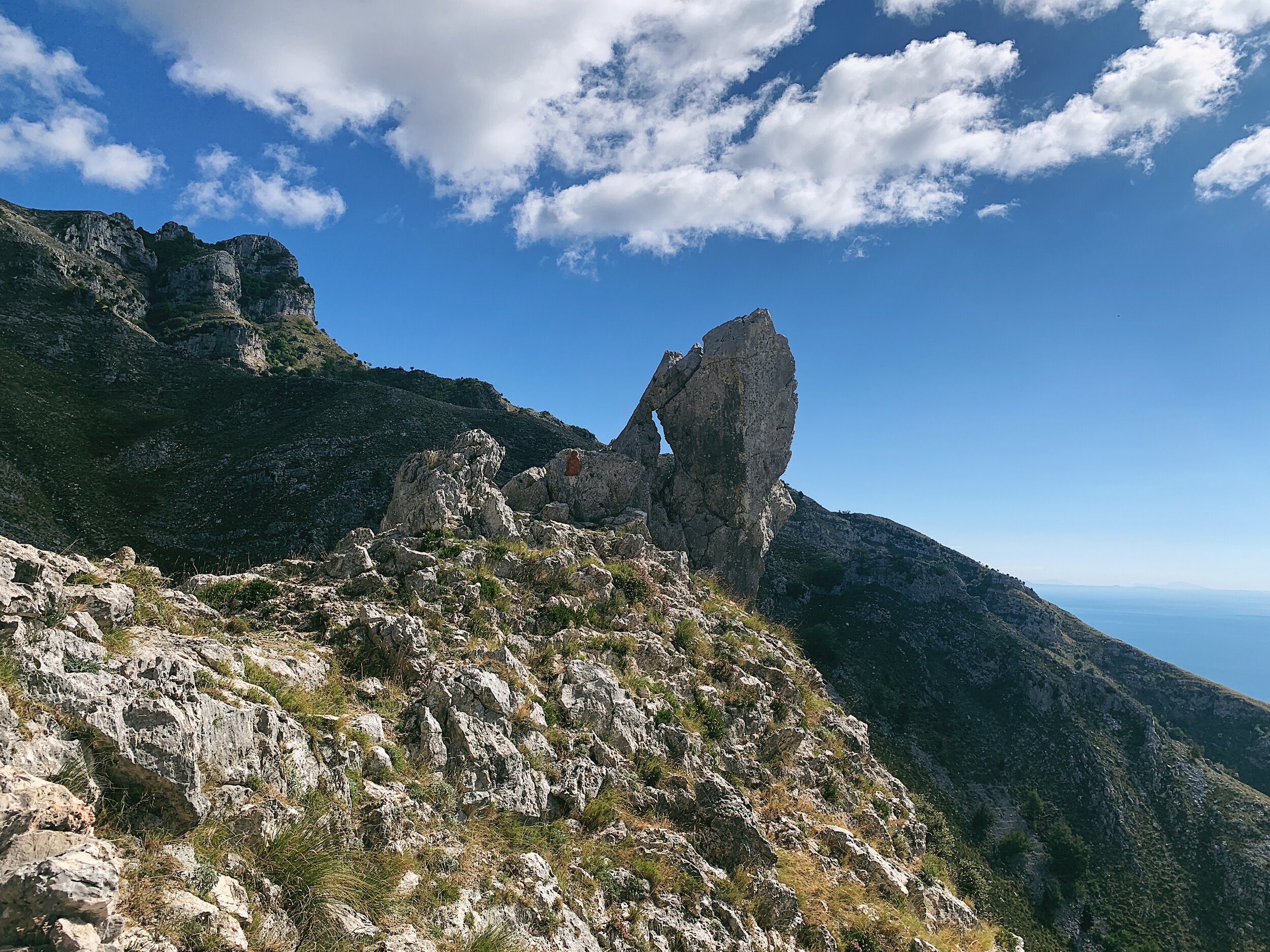
After a pause to view the hermitage, return to the path and continue uphill for the last section of the walk. This section is has, predictably, the best views, given its ascent to 1252 metres above sea level. The path continues steadily upwards until you reach a barren, karst plateau littered with pale rocks. Here there are a number of map boards and direction markings to other routes in the mountains. Ignore the path continuing through the plateau and instead head up to the right, towards the unmistakable statue atop the nearest peak. This is Cima del Redentore, often remarked as one of the most beautiful views in the Apennines.
The origins of the Redeemer date back to 1894, when Pope Leo XIII expressed his displeasure on the 19th century’s disasters and wars, wishing for a brighter and more prosperous new century. He was advised that placing 19 monuments to the Redeemer on Italy’s most beautiful and panoramic peaks would provide a just conclusion to the hard times of the previous century and ensure a more positive future for Italy. A few years later, an additional monument was placed atop Monte Capreo as a look to the future, rather than the past. The statue of the Redeemer atop Monte Redentore was cast by the Tuse Mense Foundry of Paris from a single block and then travelled by rail to Formia in September 1900, pulled by a specially made oxen cart on a 12-kilometre road between Maranola and Monte Altino.
After a visit to the top, retrace your steps back to the karst plateau and the head down the same way that you came up.
Food and drink
When you arrive back to the car park there is the option to walk uphill to the rifugio, which comes highly recommended for lunch and dinner. The only issue is that you absolutely must book in advance, even if you just want to stop in for coffee and cake. If the rifugio is fully booked or closed, there are a number of pasticcerie in Maranola, and a wider choice of shops and cafes still in Formia down on the coast. Taking a picnic up is easy as there are lots of large rocks to sit on.