MONDRAGONE
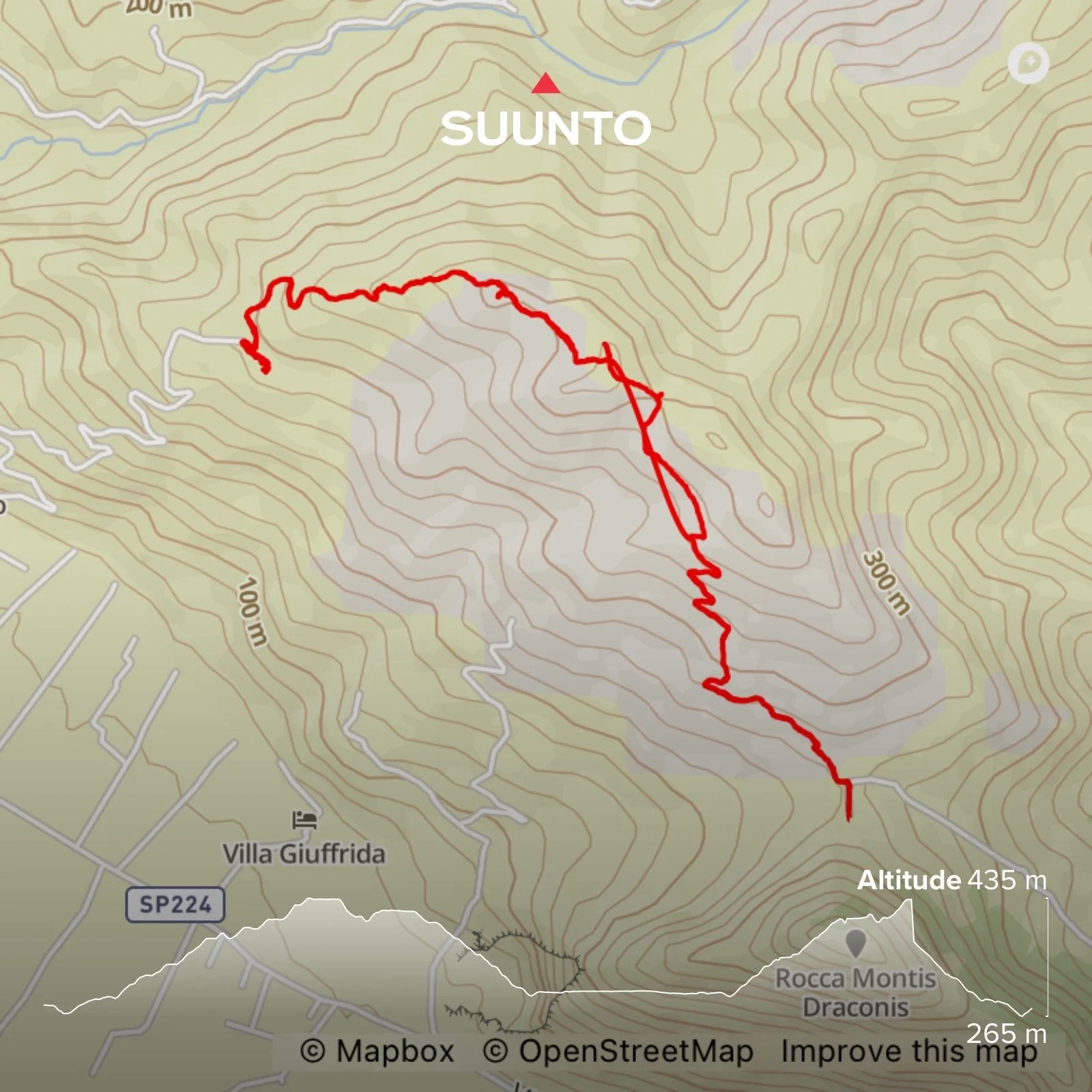
Length: 7 kilometres
Elevation gain: 350 metres
Time: About 3 hours with time for stopping
Parking: Strade Provinciale Falciano-Mondragone, Caserta. Coordinates: 41.133757, 13.899363. What3words: ///calibration.politics.exchanges
Best time to go: Pick a clear day for the view. It is extremely hot in the summer
Terrain: A mix of rocky path and single track, sometimes unstable underfoot
Level: Moderate. Undulating with some steep sections in places
Suitable for children: Yes, if they are confident with the distance. There are lots of creepy crawlies to look at along the way. Recommend 11+
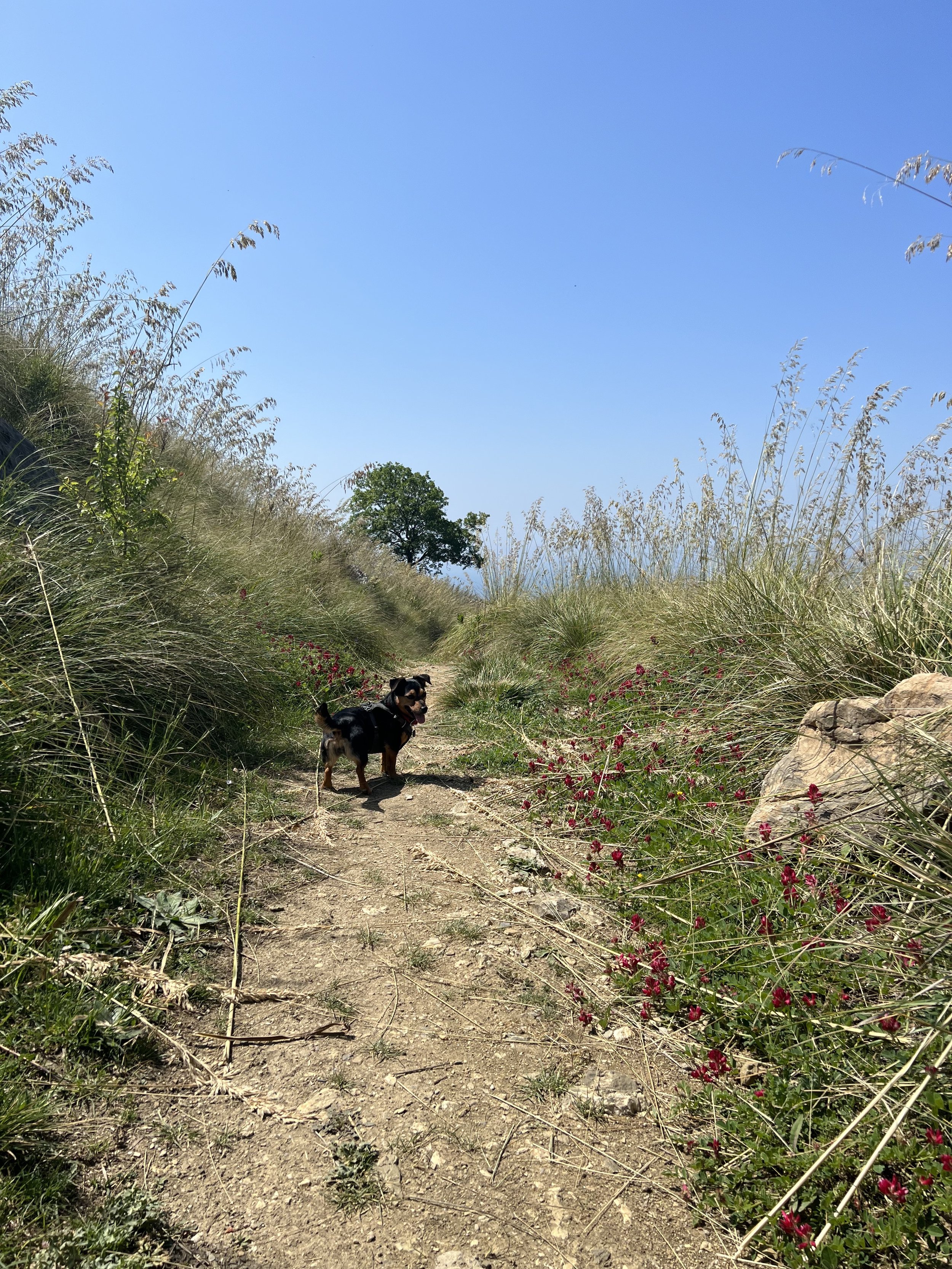
Suitable for dogs: Yes, but do check for ticks after as they are present here. Best to check yourself, too
Mondragone: a quiet oasis of calm with sea views from a long-forgotten monastery
It’s hard to believe that Mondragone is just a few minutes from one of Campania’s least appealing areas, or about 30 minutes from JFC. The track up here really makes you work for it - a four-wheel drive is recommended, though you’d manage without - and the parking is purely a field. But once you begin the hike you’ll notice that someone has maintained the trail and created a number of handmade signs along the way, pointing out various paths and mountain biking route. I have seen some local guides from Campania referring to this hike as the ‘Sentiero degli Dei Casertano’ - literally the Caserta Path of the Gods (it is in Caserta, rather than Naples), which I think is a rather grandiose moniker for what is not a particularly magical hike, but to each their own.
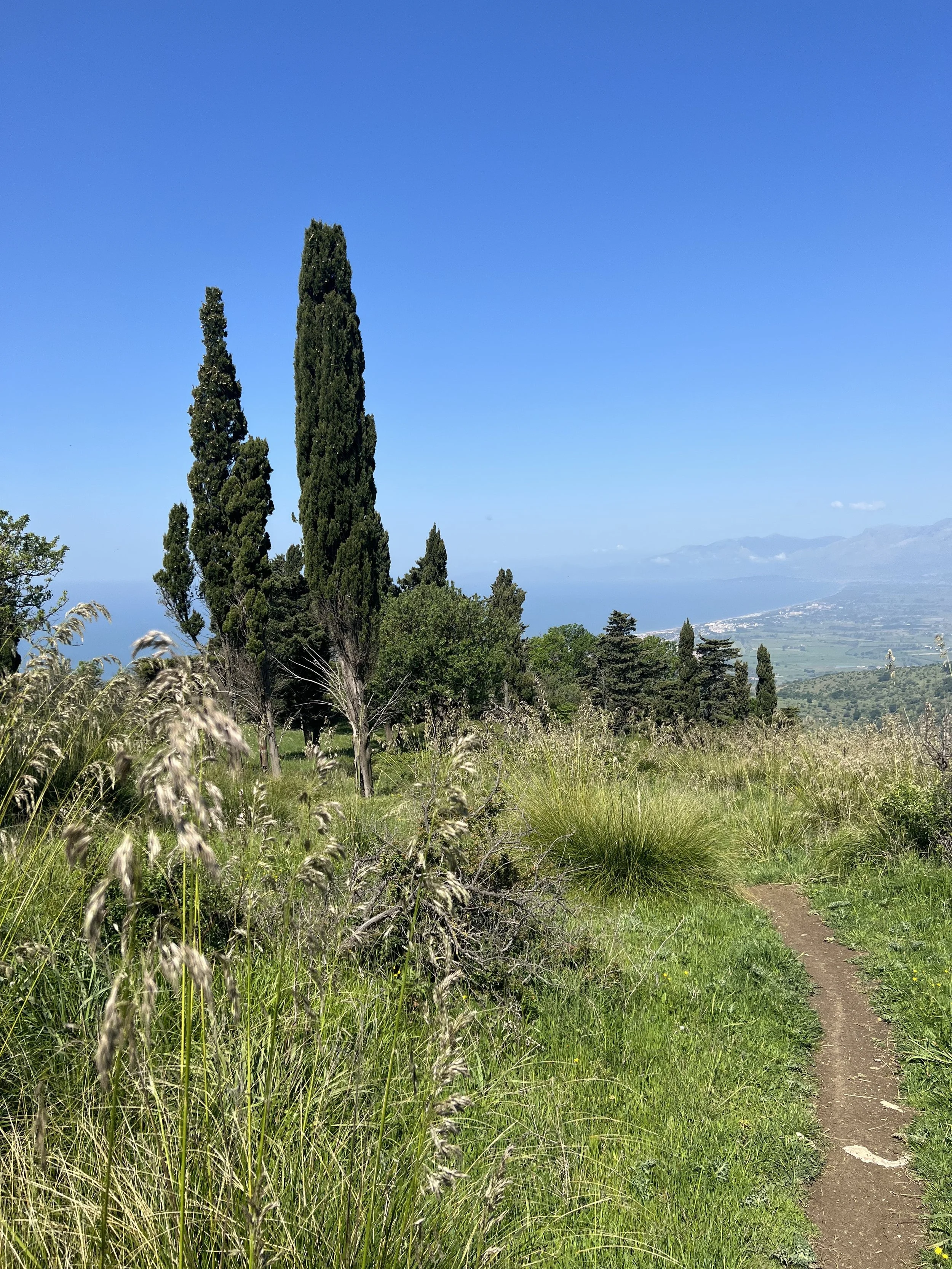
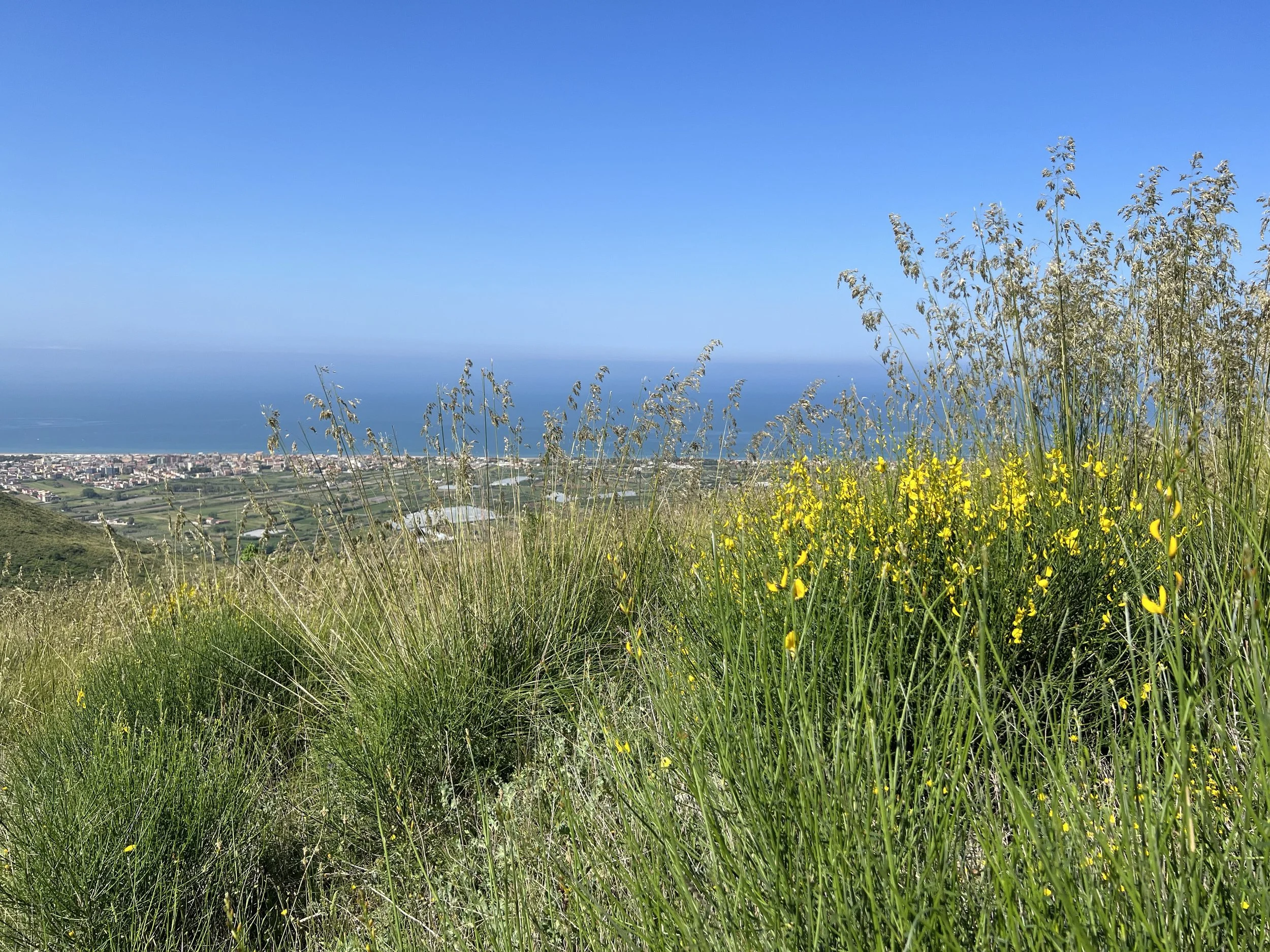
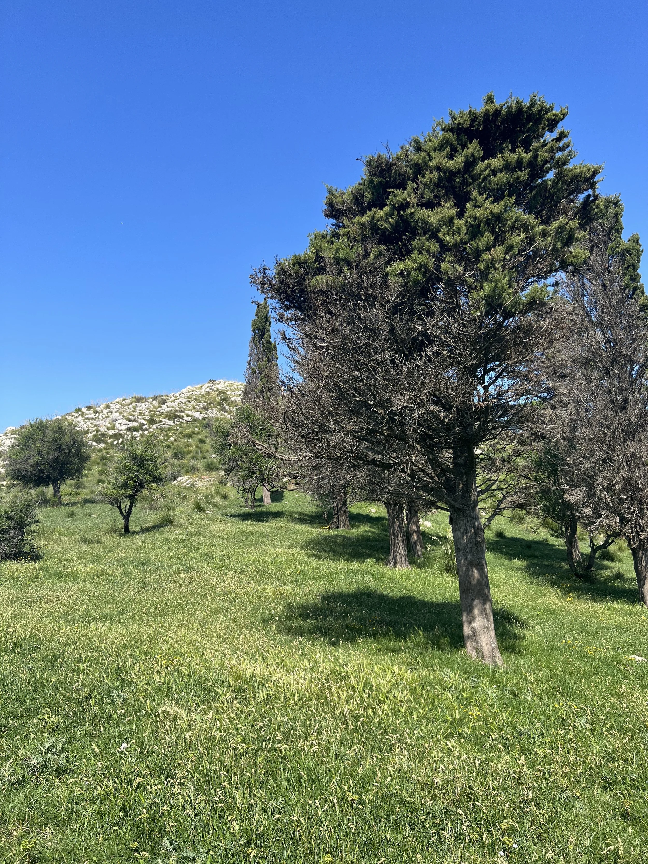
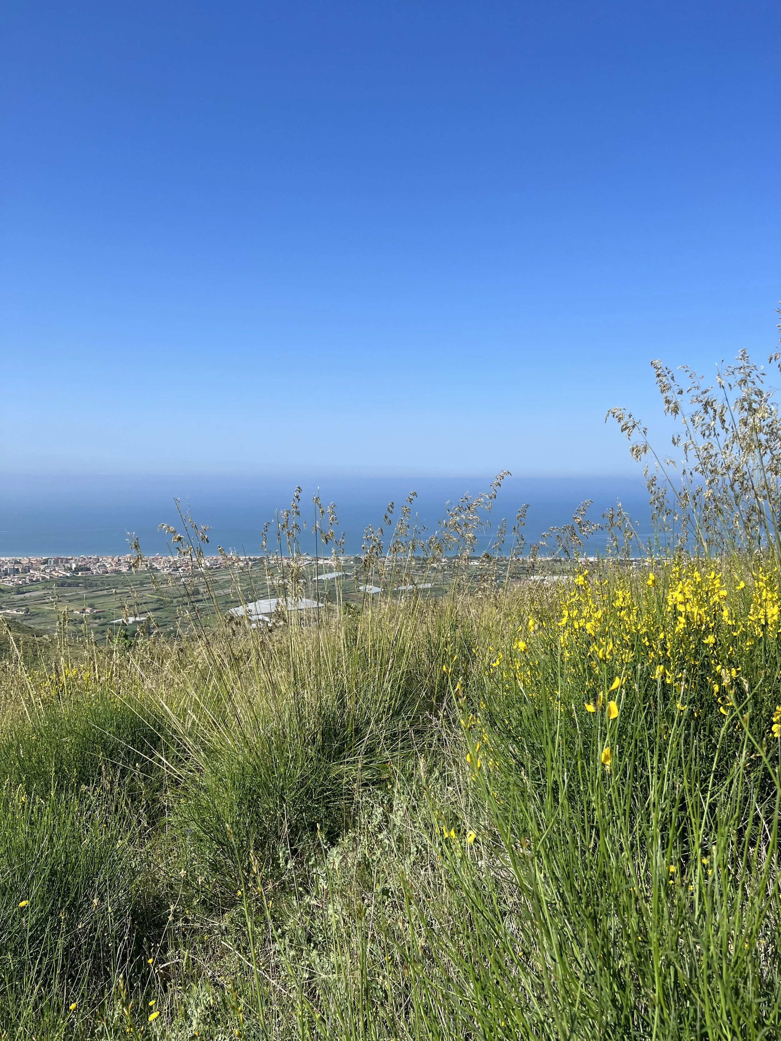
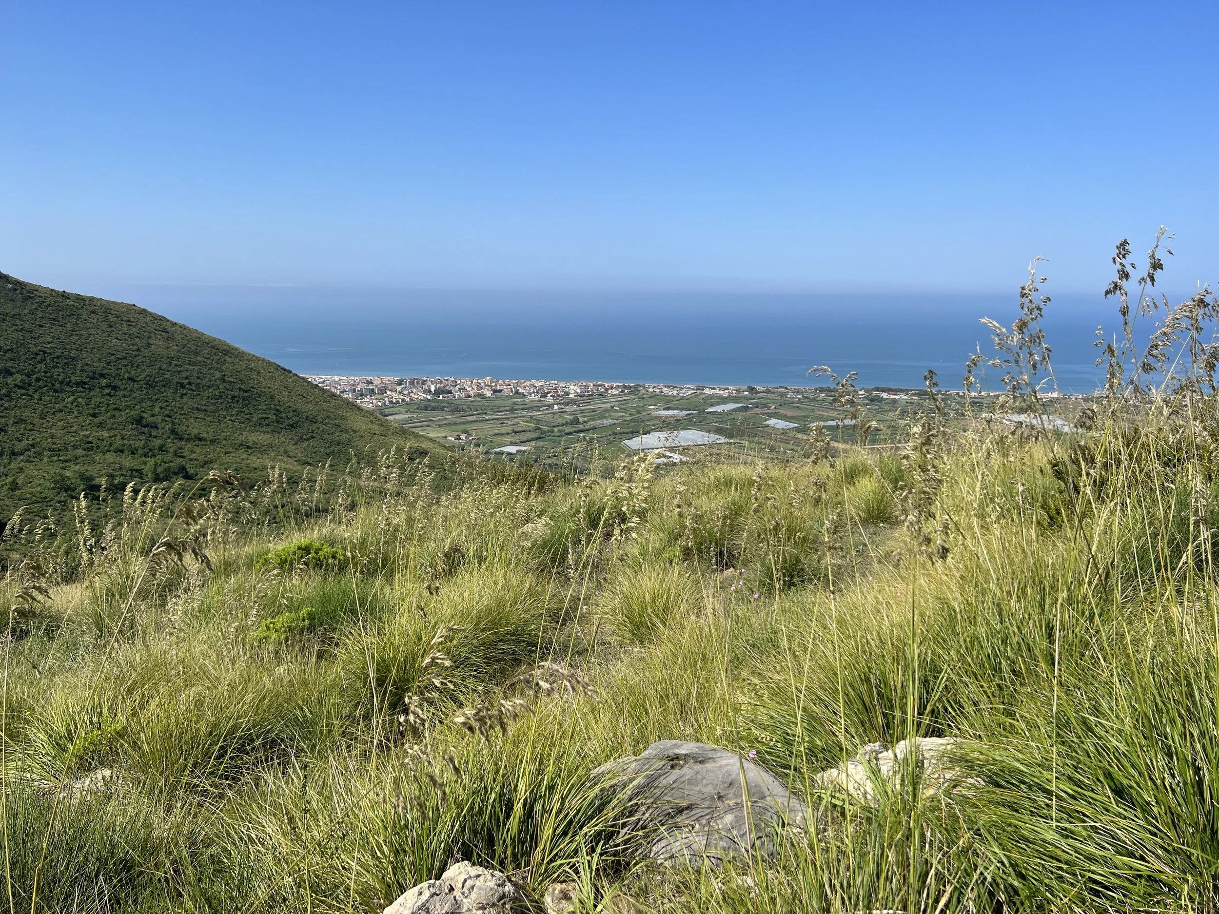
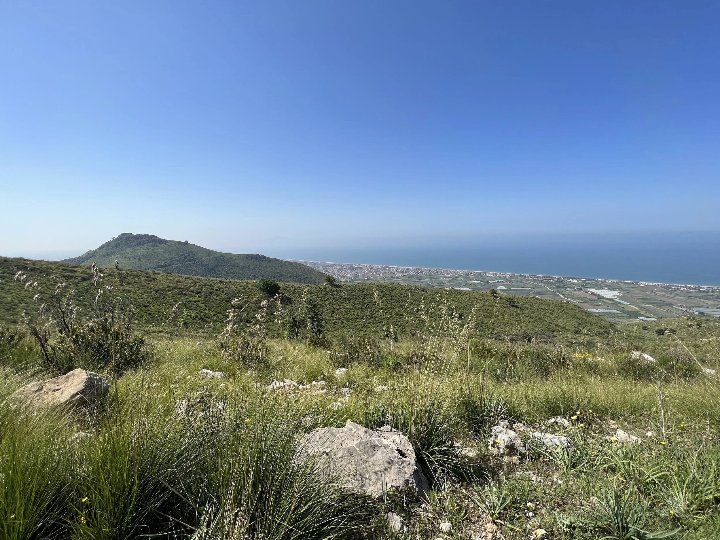
There are views of the sea and the coast the whole way up, which leads you through wildflowers and swaying grasses in the spring. The first noticeable landmark is I Pini, a stand of pines and cypresses which are evocative of a Tuscan or Umbrian landscape, standing out amid the usual Campanian brush. All year round it feels very green and lush, which is something all the people living nearby are keen to preserve - the grasses can be subject to wildfires in the summer so do keep an eye out.
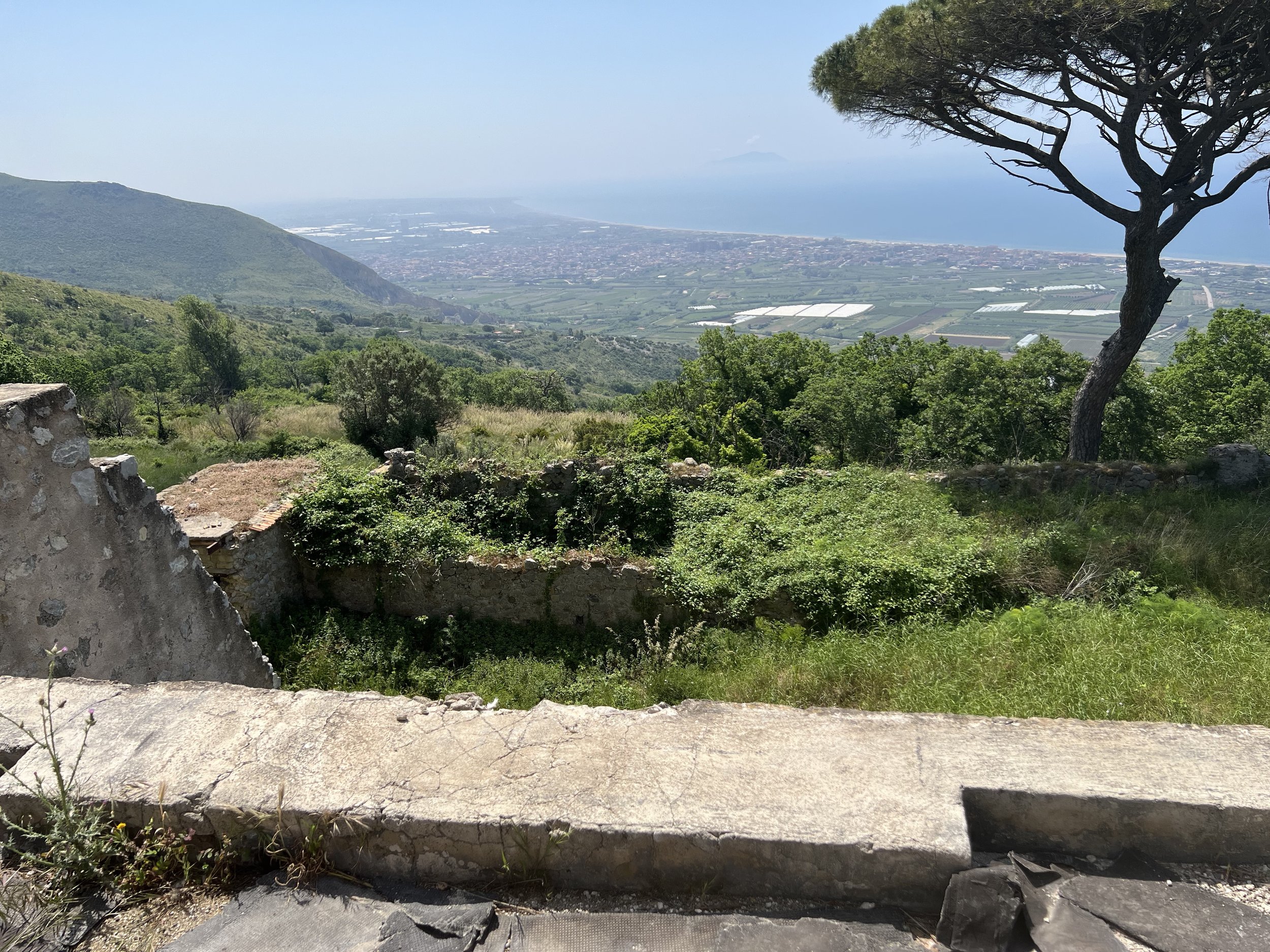
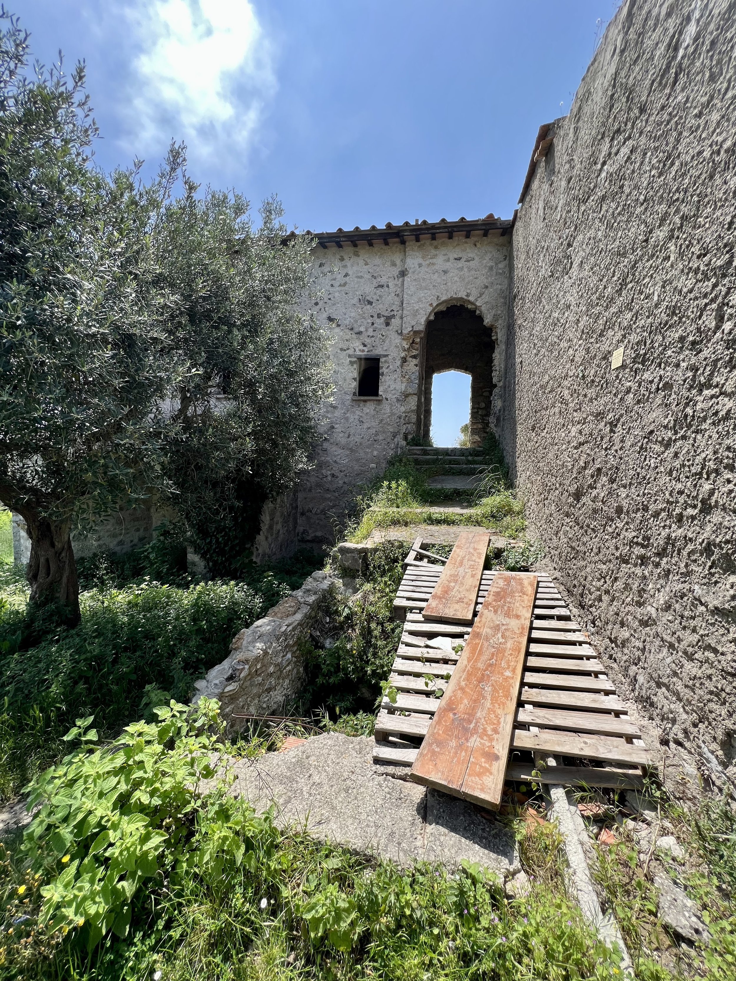
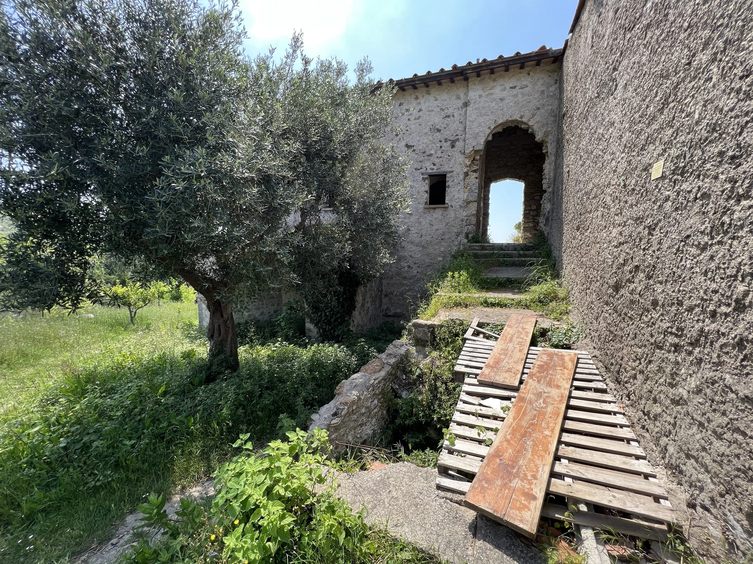
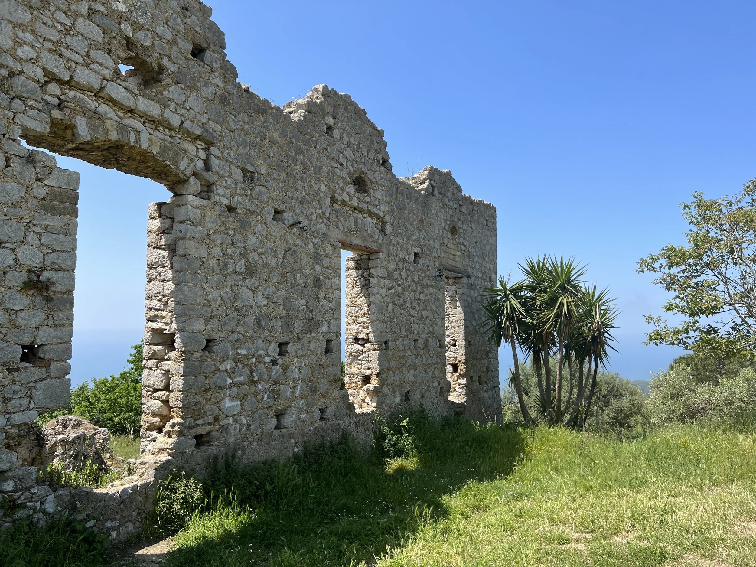
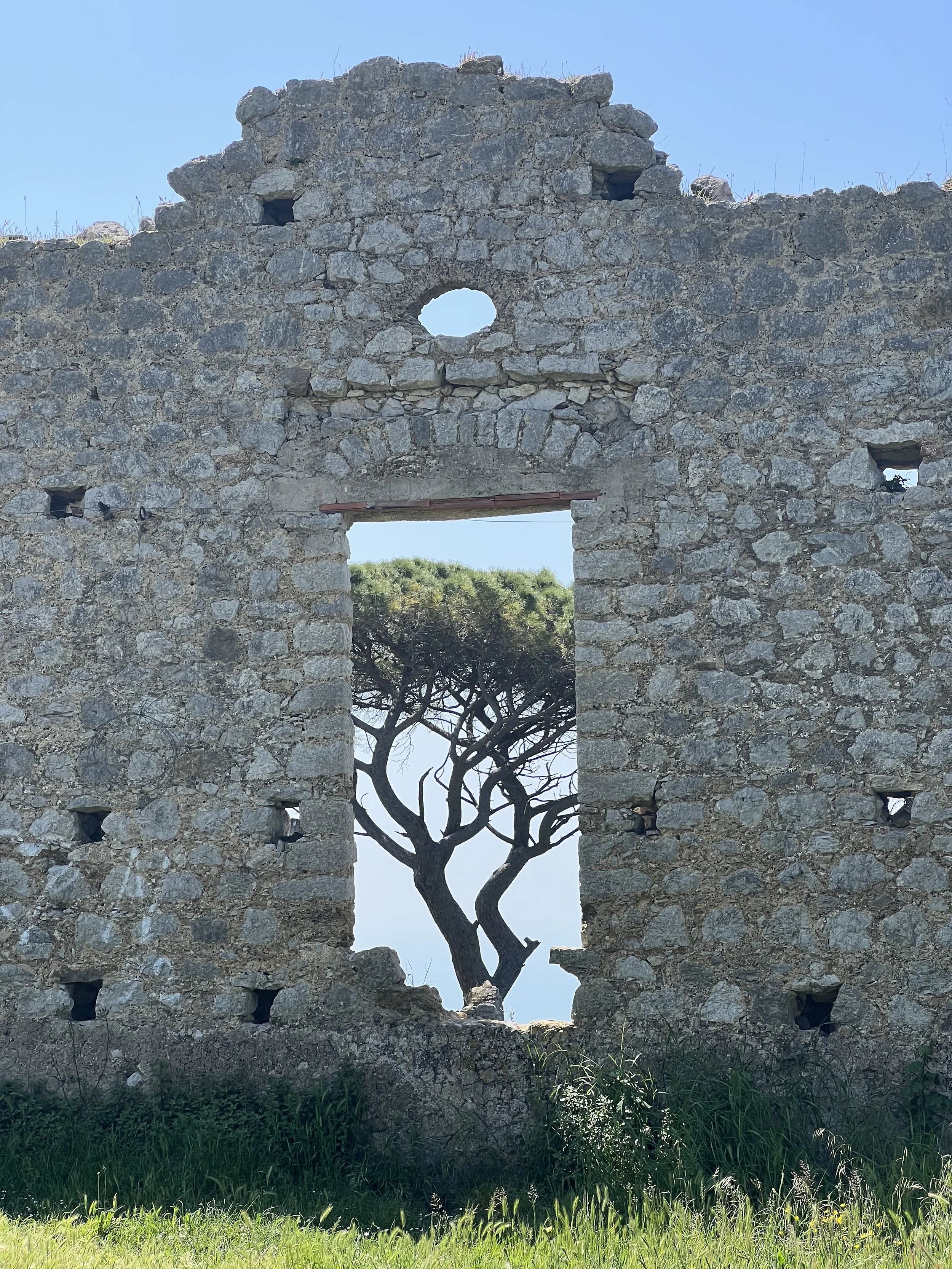
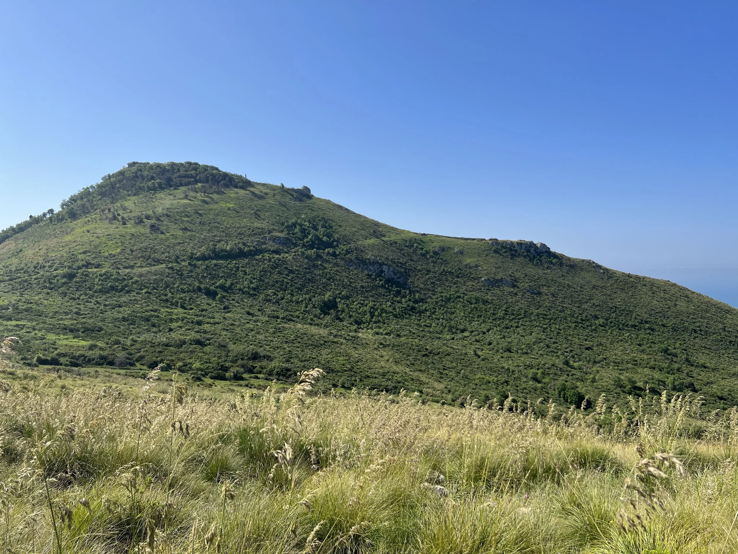
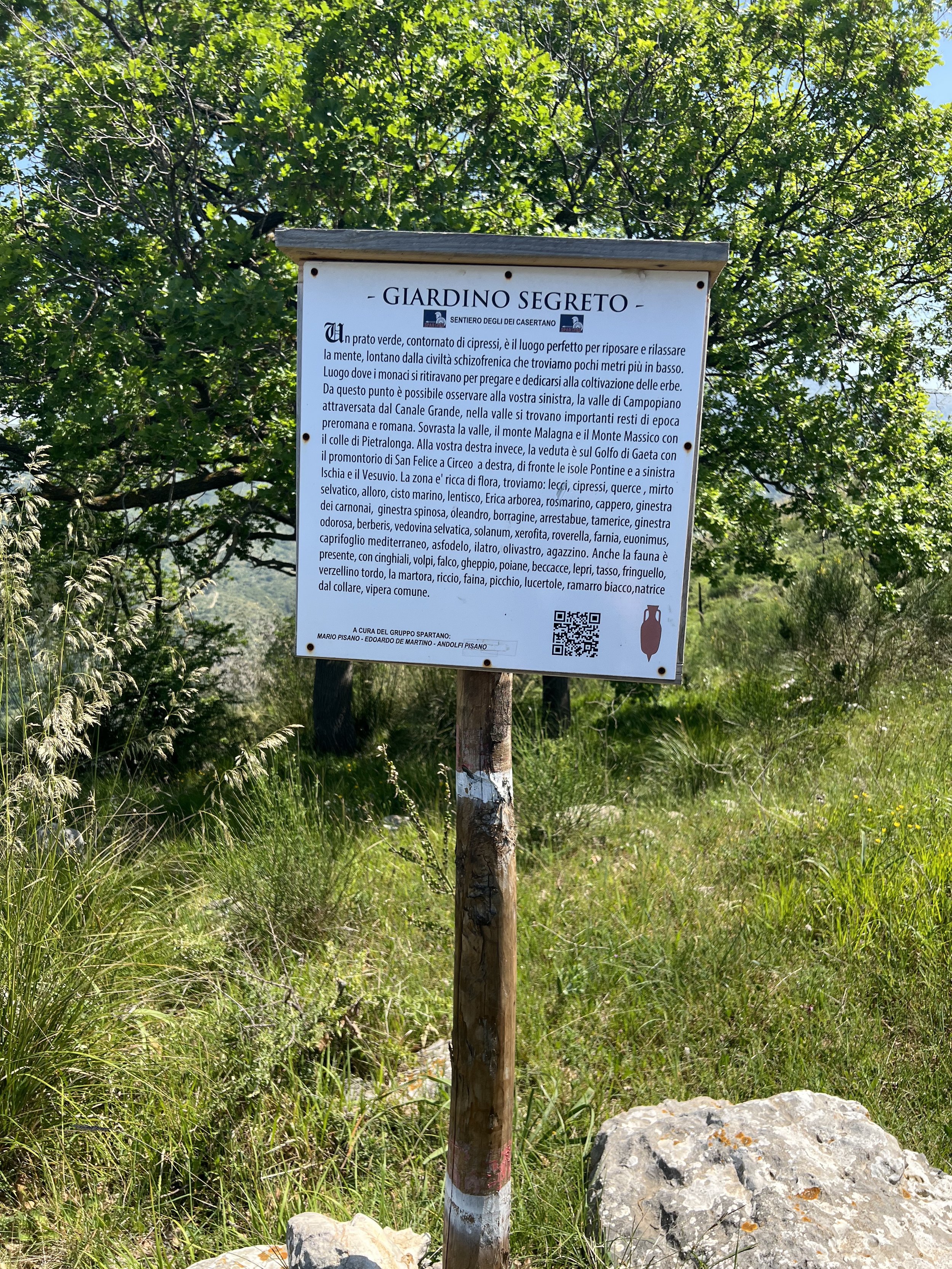
After a little ascent from the pines there is a panoramic viewpoint which has sweeping views over the coast, Rocca Dragonis immediately to the south and the Aurunci Mountains rising to the north. From here, the path slopes downwards through a shallow valley (Valle degli Asfodeli) and through the ‘Secret Garden’, to a wider farm track which eventually leads to Monastero di Sant’Anna de Aquis Vivis, which though partially in ruins is a beautiful spot to sit and enjoy the view. The monastery dates back to at least the 14th century, when hermits lived among the rough hills of Monte Crestagallo; the queen consort of Naples at the time gifted the land to the hermits and a monk, who later built a small church on the site. The monastery was built in around 1342 with later additions, such as the buttresses around the base, added in the 1600s. The monastery and church was latterly abandoned and restored over the ensuing centuries, but as the churches of the plains below became more popular, being easier to visit, the monastery declined and fell into disrepair once more.
Flora and fauna
There are a huge variety of bugs up here, some welcome (lots of butterflies, fluffy caterpillars, thousands of colourful lizards) and some unwelcome (ticks). When the ridge rises up to I Pini, the flavour is like a little taste of Tuscany in the wilds of Campania - it feels very special. Trees that you may spot include oak, ash, hornbeam, cypresses and of course, the pines.
How to get there and parking
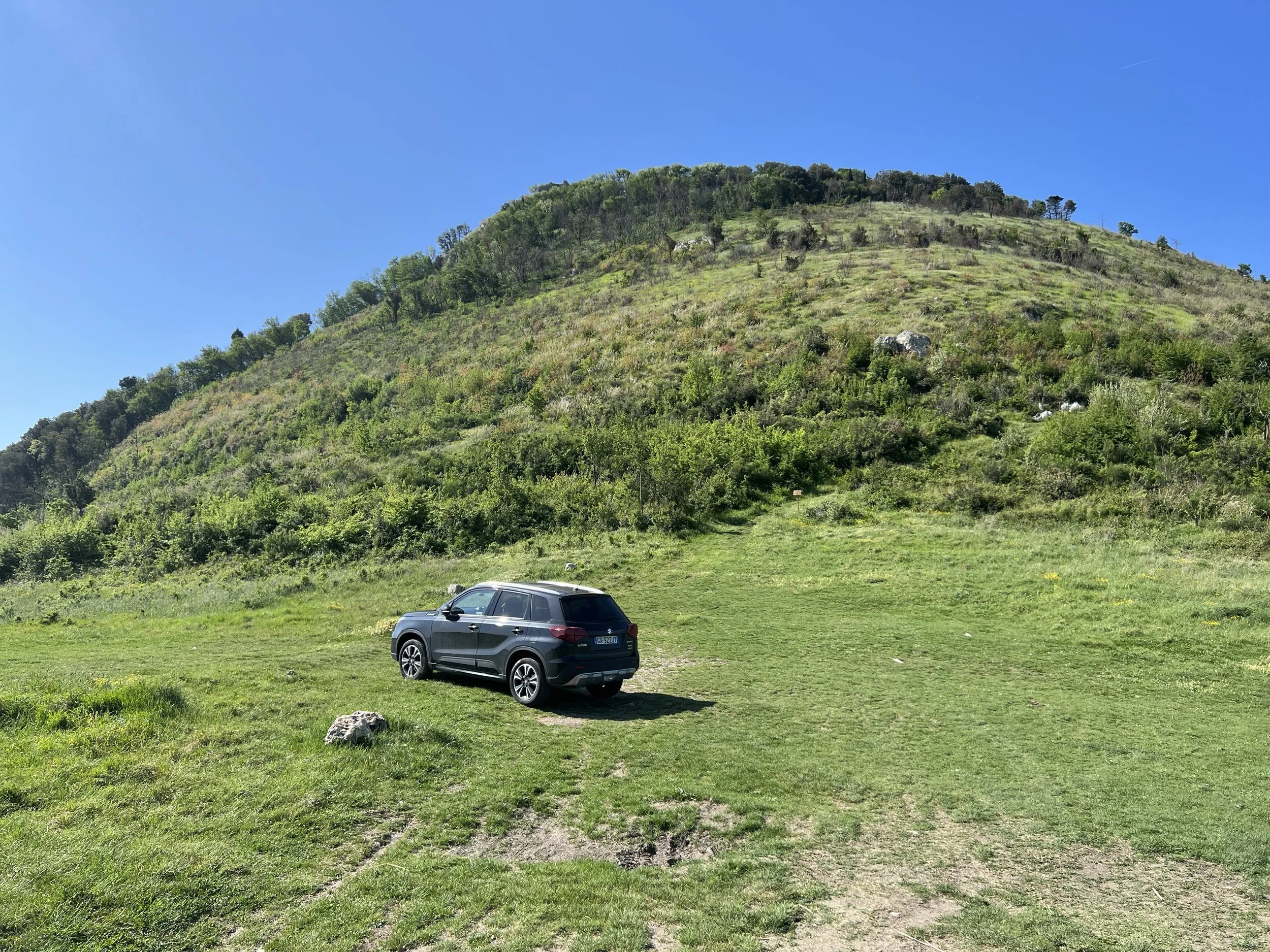
From the SS7qtr, turn into the main commercial area and drive through the town, heading east in the direction of Caserta. Leave the town on the Strada Provinciale Falciano-Mondragone. Very shortly after leaving Mondragone the area turns rural and the peak of Rocca Dragonis rises on the left. Keep an eye out for a timber bus stop on the left with a stone bench and a Madonna statue. Turn left here into a gravel parking area and then take the left-hand turn; it’s very bumpy and there are large potholes, so go slow.
Continue along this track and then go around the right-hand bend, following the track uphill until the track ends in a field. This is the rather dubious looking parking area, but rest assured that it seems fine and the landowner was very friendly.
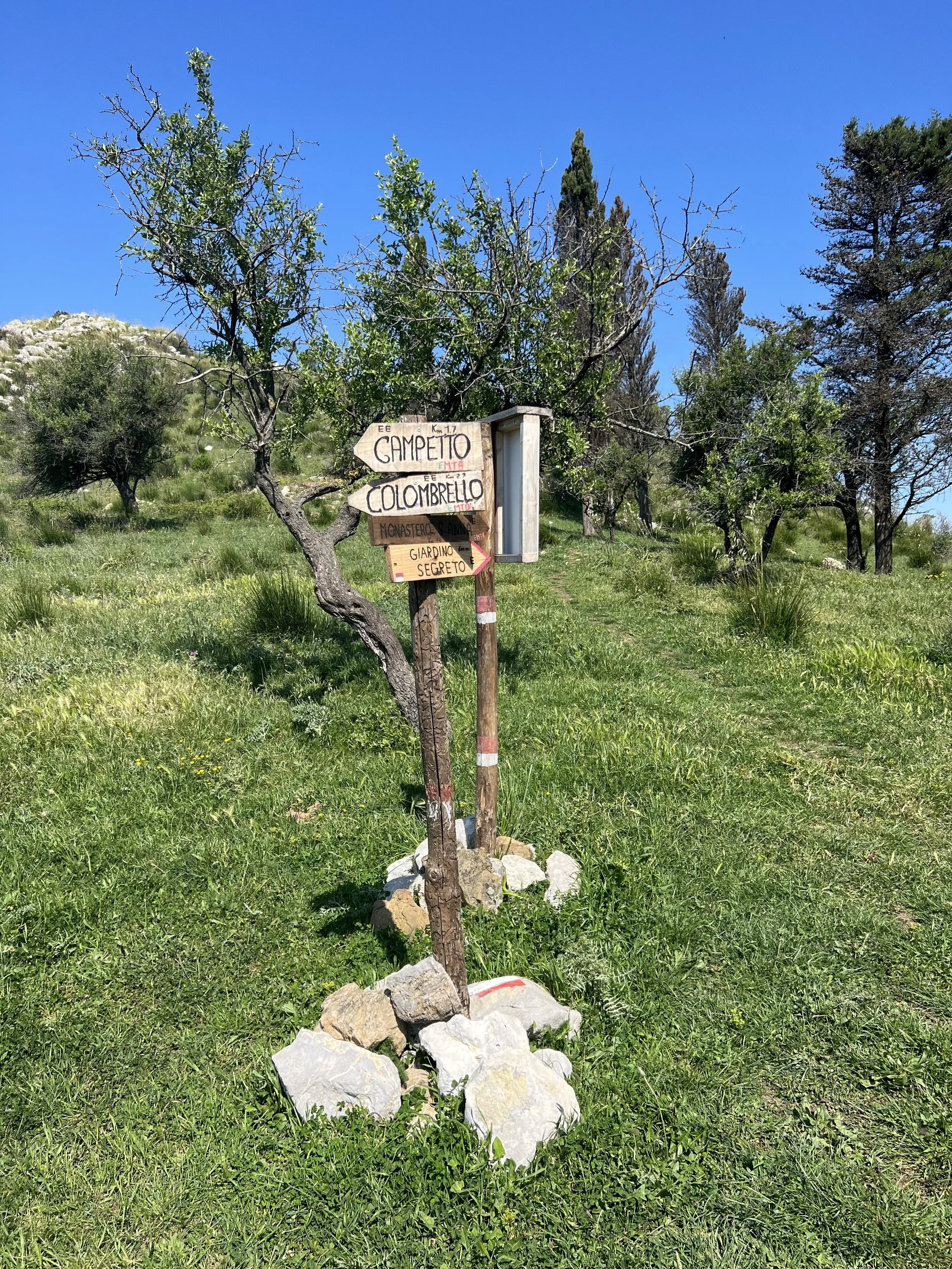
Signage and trails
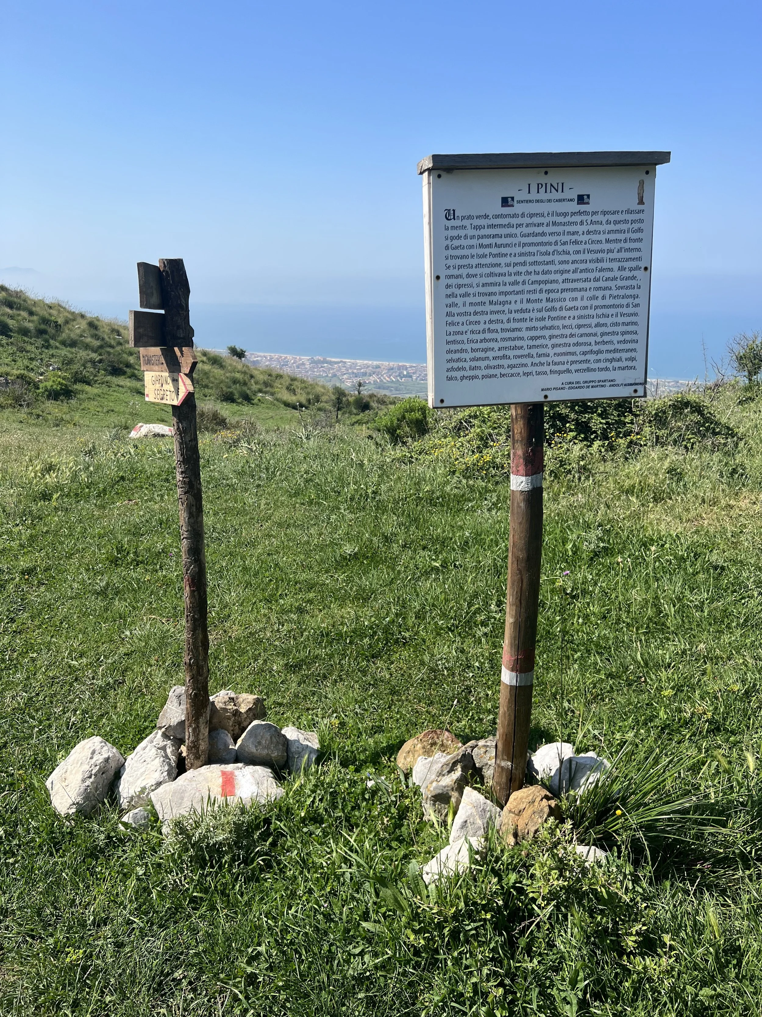
The trails here are quite refreshing as someone has created some lovely homemade signs, in addition to the ubiquitous red and white CAI markers which are painted on rocks, fence posts and tree stumps. The signs are predominantly for mountain bikers, but give a good idea of duration and terrain - they are handwritten and held up by piles of stones, and some may fall over in bad weather.
There are also a number of fixed sign boards with information (in Italian) on the flora and fauna and the history of each place. Helpfully, each board has a QR code you can scan with a smartphone in case you want to save the details for later.
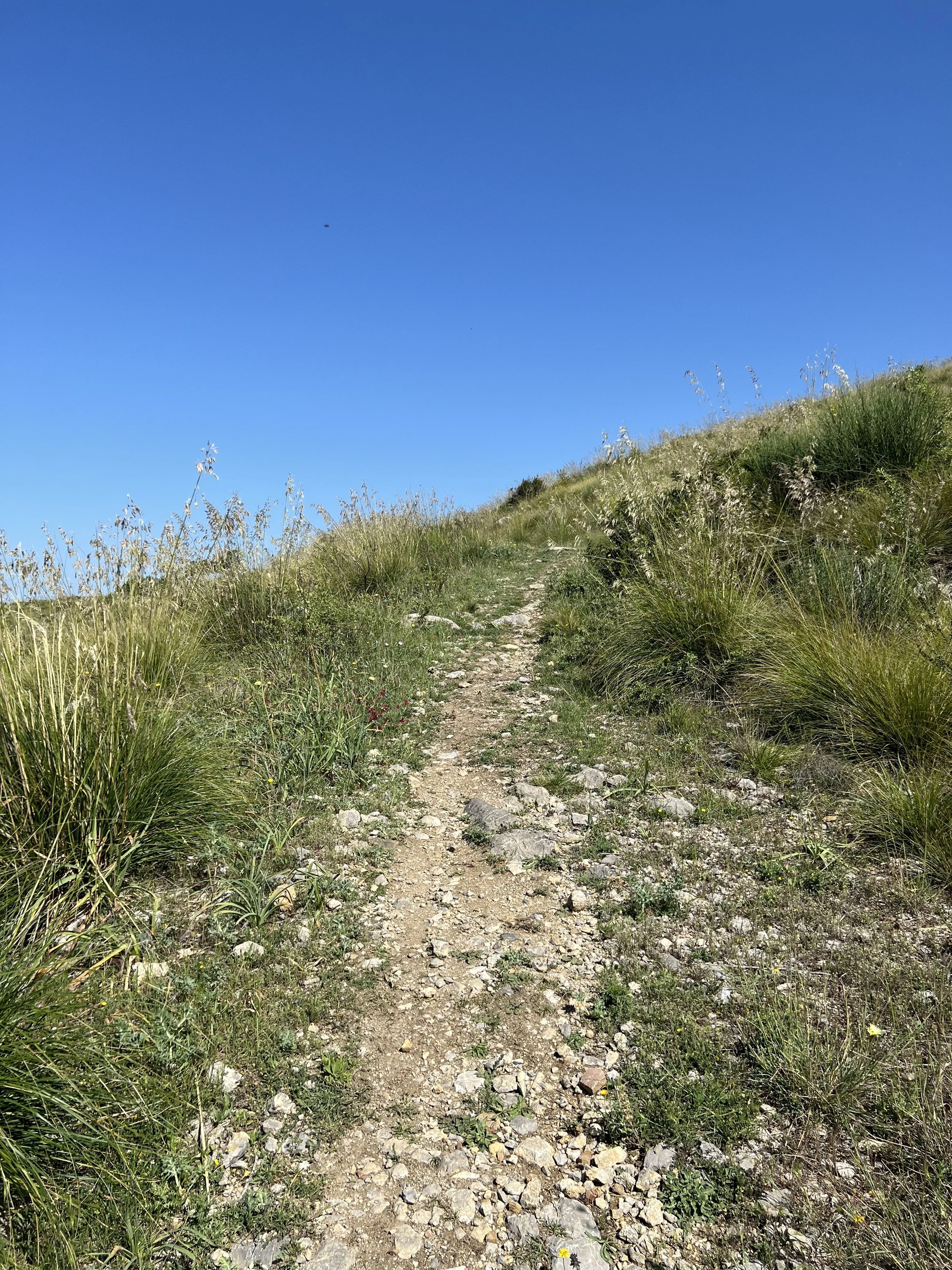
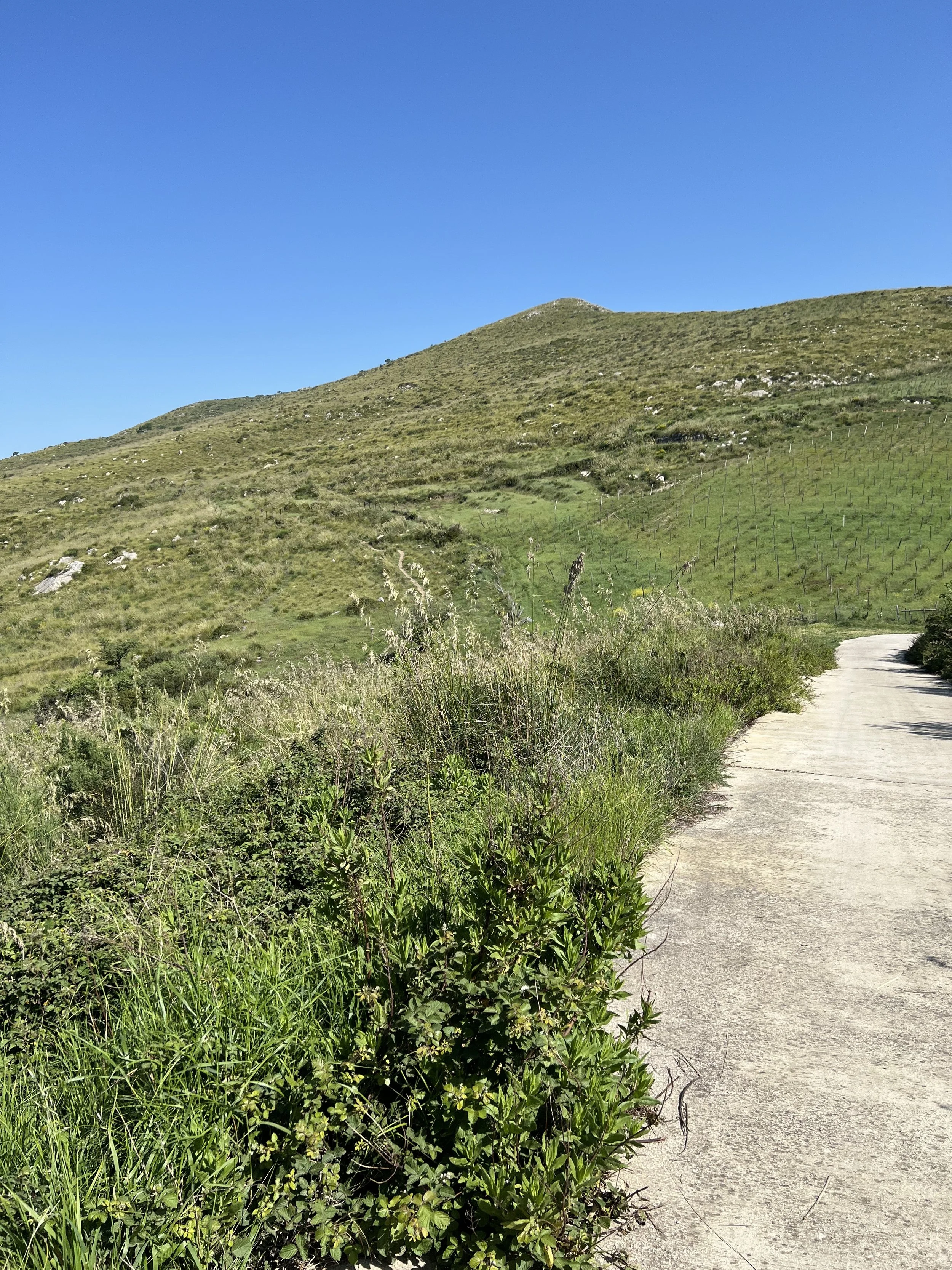
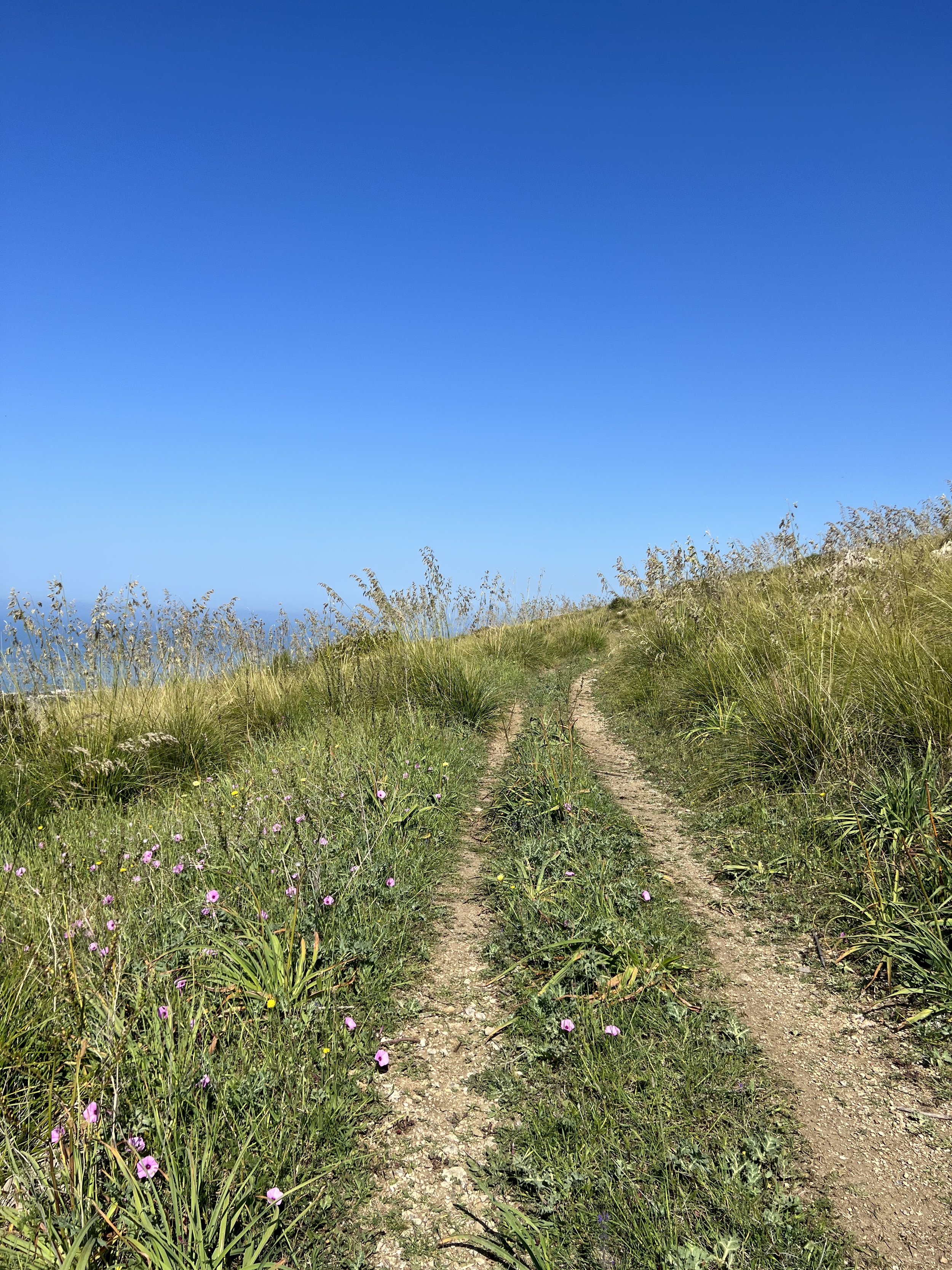
The paths are generally well trodden and easy to follow but do keep to the paths as the vegetation is quite thick and, as previously mentioned, there are ticks here. Some sections are quite rocky underfoot but it is generally easily walkable. Watch out for mountain bikers, especially in the spring when the vegetation is particularly high as it does block some of the visibility.
Route
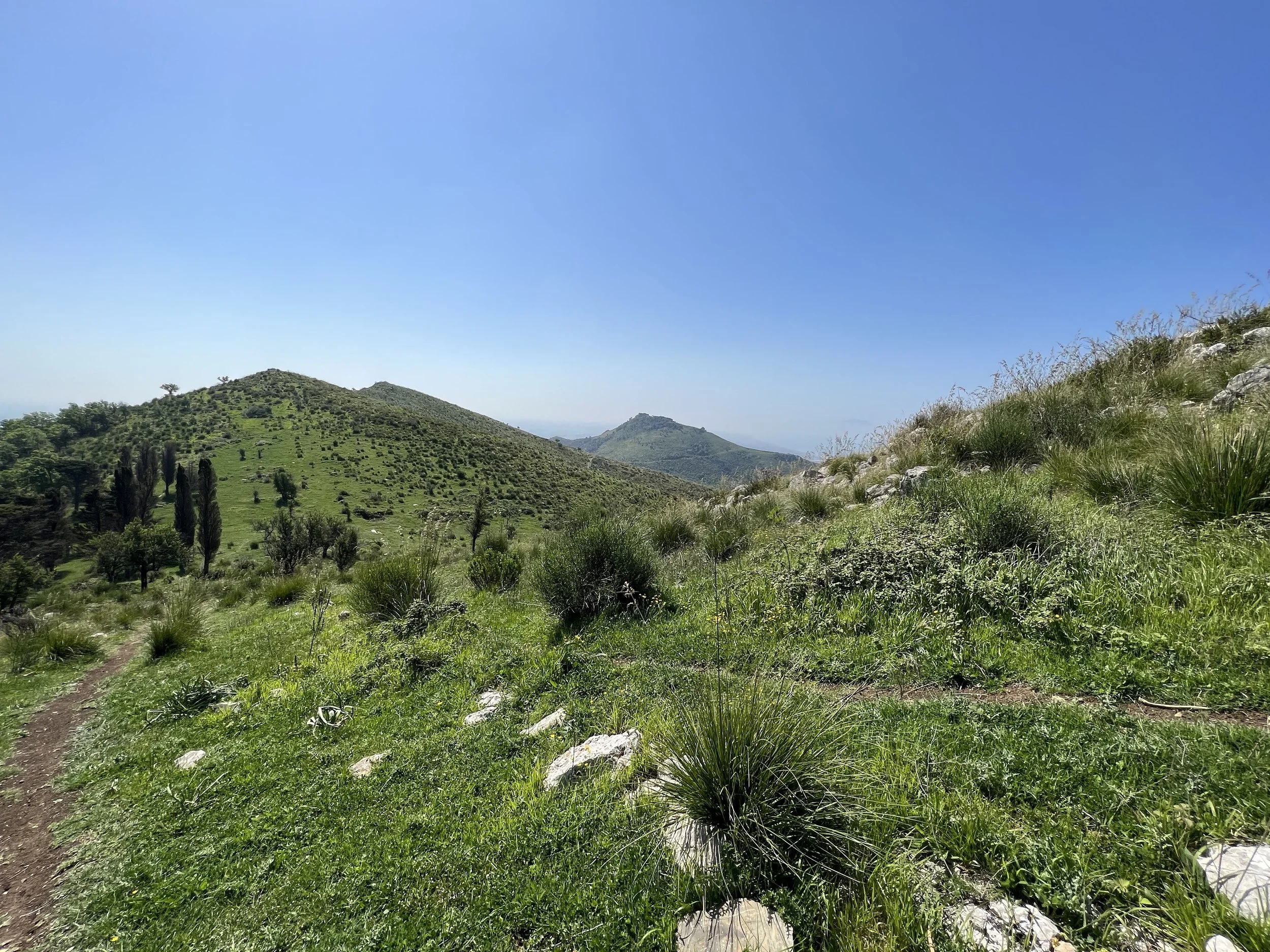
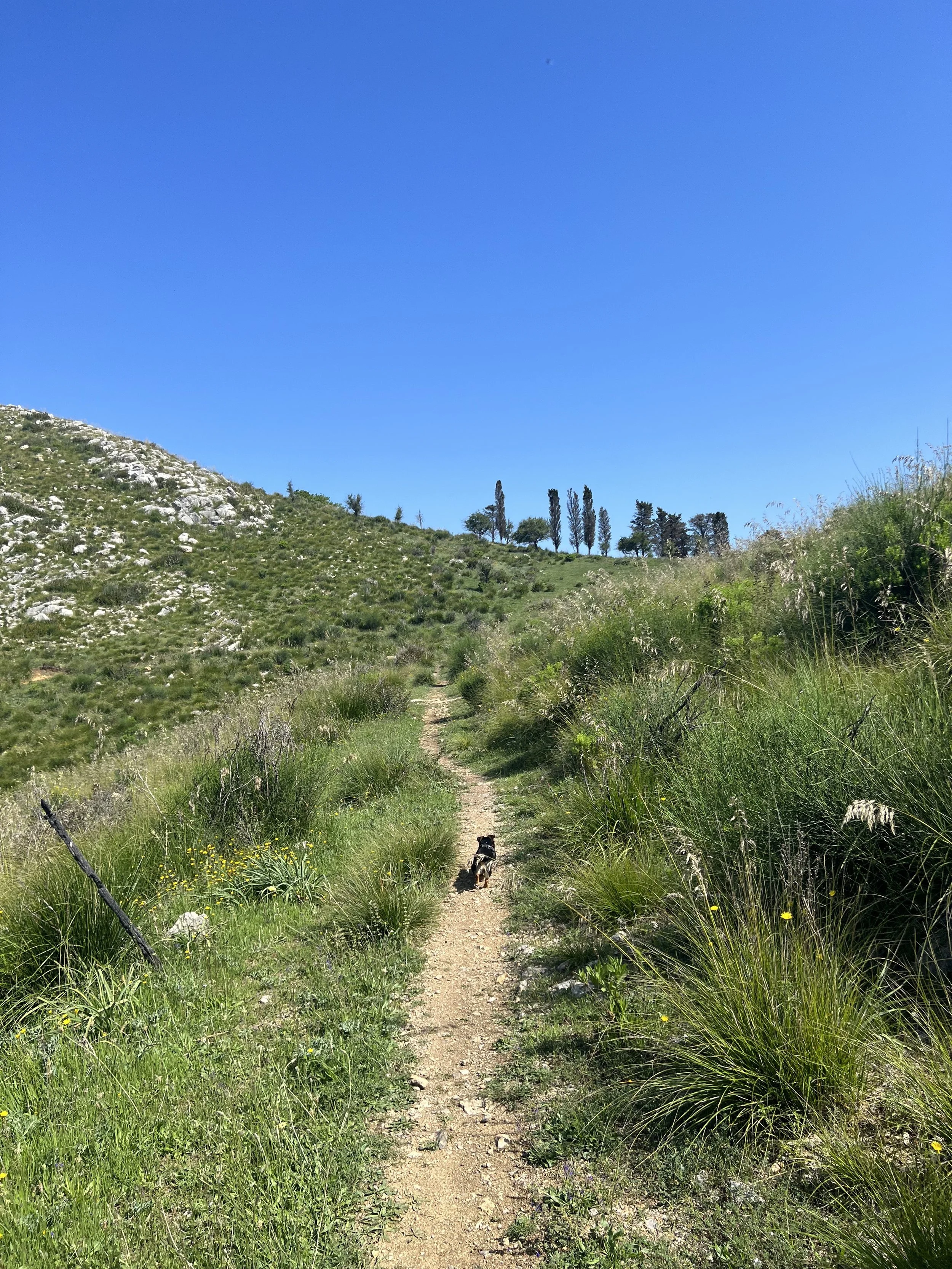
Park in the field (leaving space for access by the farmer and other walkers) and take the concrete road back to the corner. The path dips off to the left and is marked by a red and white CAI marker painted on a stone. There is (as of May 2022) a further handmade sign. The path heads up to the right and is uphill for a few kilometres, with lovely views to distract from the exertion. You can see the Domitian coast below you, the hill of Rocca Dragonis behind you and the dark mass of Monte Petrino once you near the top. The path is quite distinct and easy to follow, zig zagging its way uphill until you reach a grassier, greener section. The trail is less distinct here as it leads up to the right towards a distinct stand of pine trees; these are I Pini as marked on the map. It’s a good spot to catch your breath.
From here, take the path to the left that heads slightly uphill through the pines. At the top, you’ll traverse a wide ridge until you reach the next landmark, Giardino Segreto or ‘the Secret Garden’. There is a slight detour here - only 40 metres or so - to a panoramic terrace which has lovely views down to the coast. On a clear day you can see back towards Lago Patria and the islands in the Bay of Naples, and the mountains of the Aurunci to the north.
Head back to the main path and take the route that leads downhill. The path is mostly a dirt track and often rocky, though easy to follow - do watch out for mountain bikers. Eventually the narrower path joins a wider farm track suitable for all-terrain vehicles. This leads down to Monastero di Sant’Anna de Aquis Vivis . Here you can cross over a rather unsteady looking (though perfectly stable) homemade bridge to go through the ruins to a wide, flat upper storey which looks out to sea. This is the perfect spot for a picnic lunch or a snack and you may meet other walkers here enjoying the view.
Retrace the same route to return to the car.
Food and drink
There are no facilities at the start/end of the hike or within walking distance, so you’ll need to come prepared. There are some facilities in Mondragone, including superstores, many different mozzarella caseificio, coffee shops and bars. There are also several down-at-heel lidos on the coast. Bring a picnic if you think you’ll need sustenance - once you get to the monastery there is a flat roof where you can sit and eat with a view out to sea.