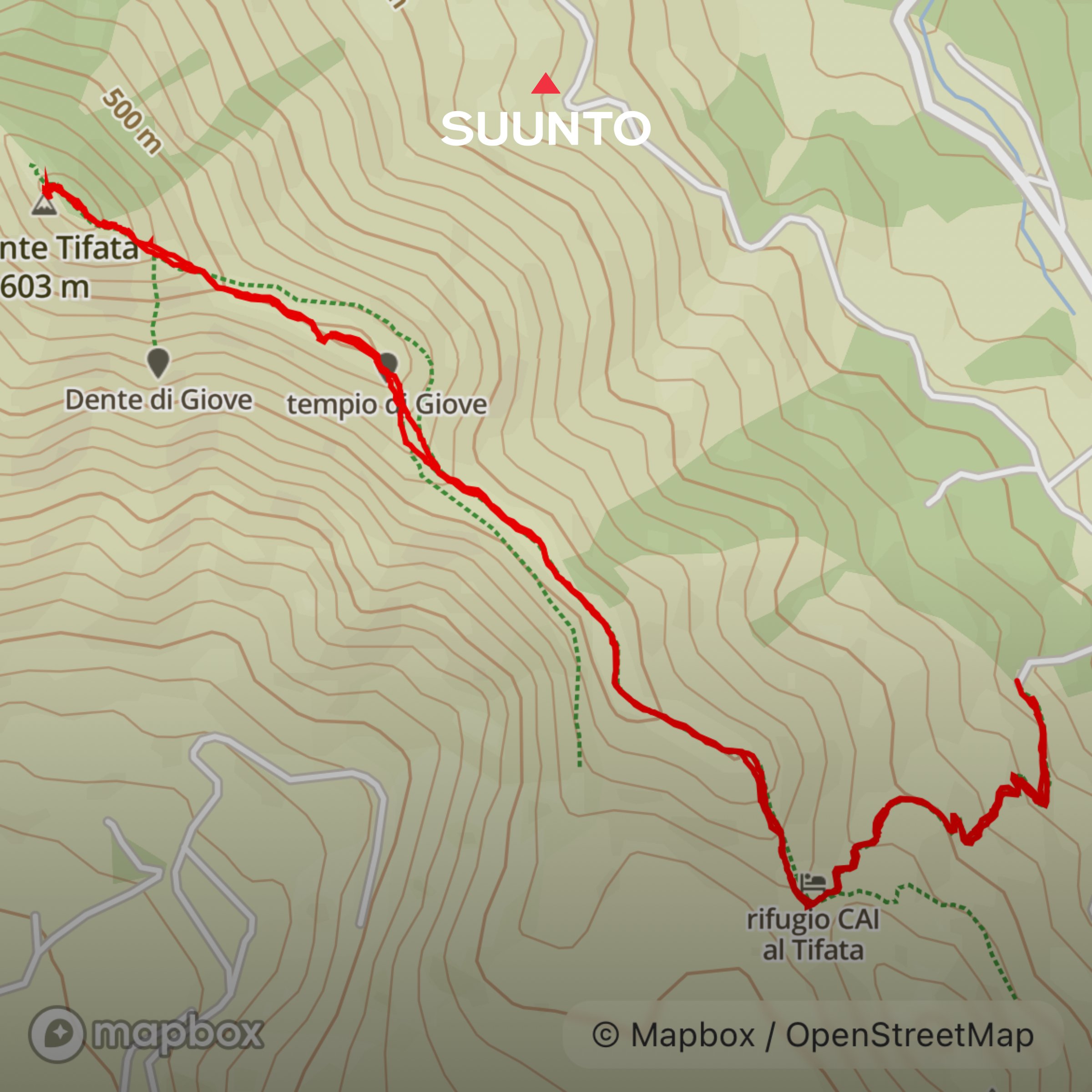
MONTE TIFATA
Length: 6.5 kilometres
Elevation gain: 580 metres
Time: About 3 hours with time for stopping
Parking: via Francesco II di Borbone, Vaccheria. Coordinates: 41.107184, 14.300191. What3words: ///runner.proud.earl
Best time to go: Anytime, as long as there are light winds as the ridge is very exposed. It is extremely hot in the summer
Terrain: Mountainous, steep and rocky, sometimes unstable underfoot. There is one section of steep scrambling which is easier with poles on the way down
Level: Moderate. Uphill all the way but the incline is only very steep for the final section. Return via the same route
Suitable for children: Yes, if they are used to scrambling and confident with the distance. Recommend 11+
Suitable for dogs: This is not an especially dog friendly walk as there are lots of steep drops. Definitely keep on a lead and close to you
Monte Tifata: a steep ascent to a magnificent local landmark with sweeping views
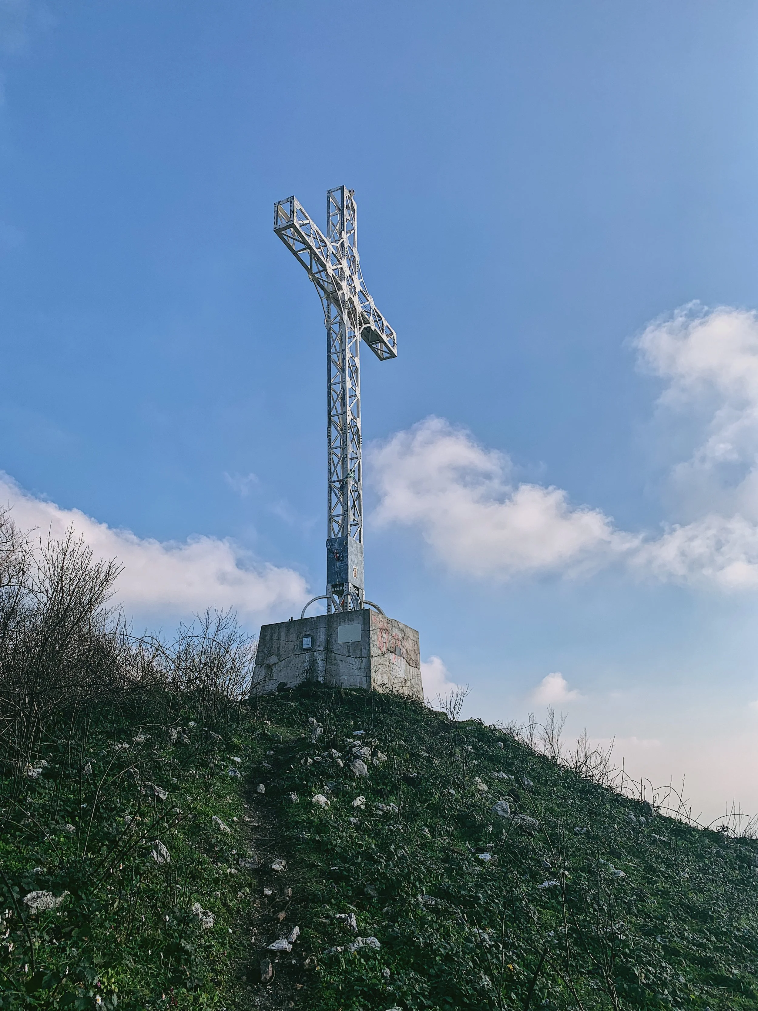
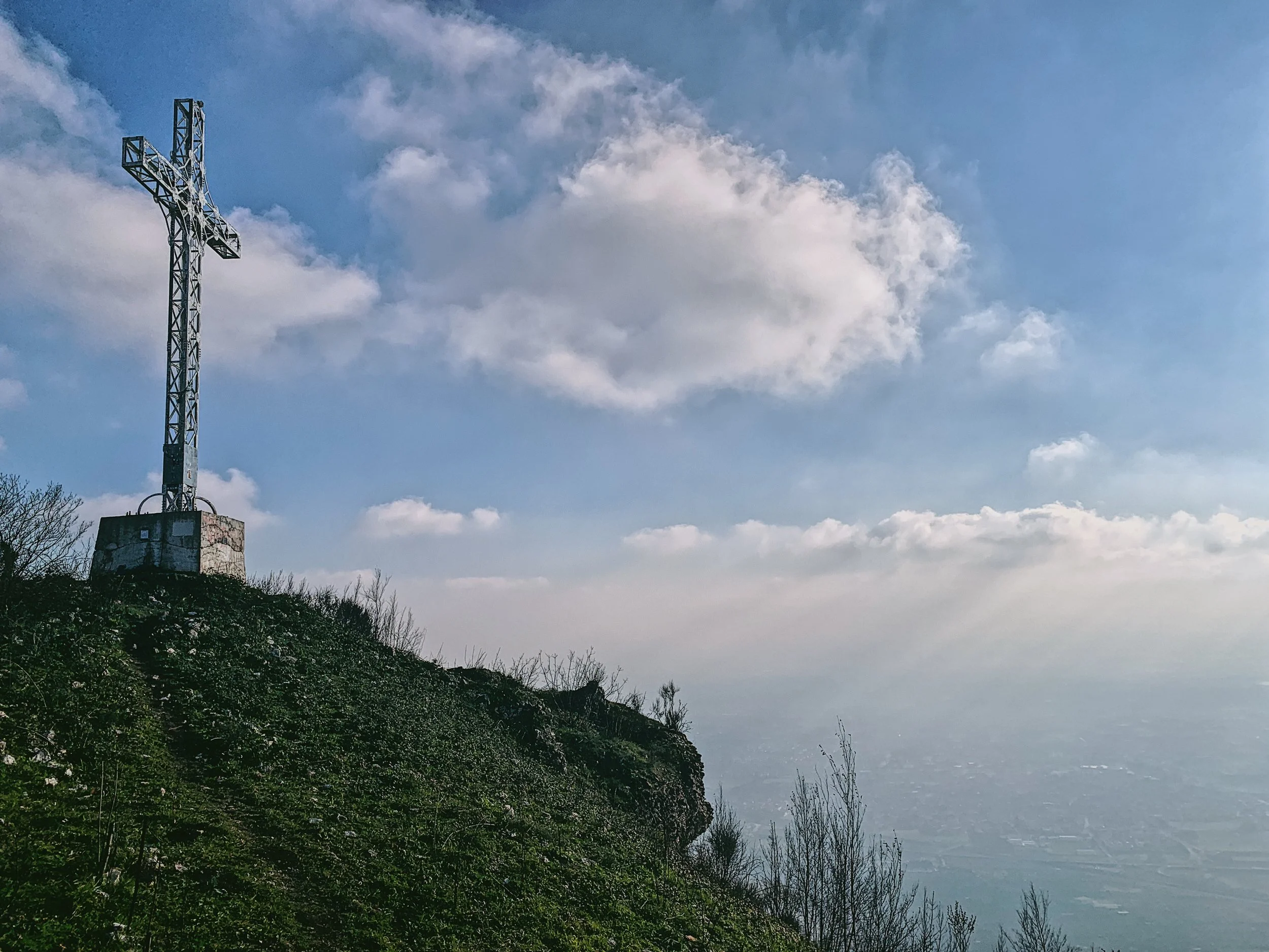
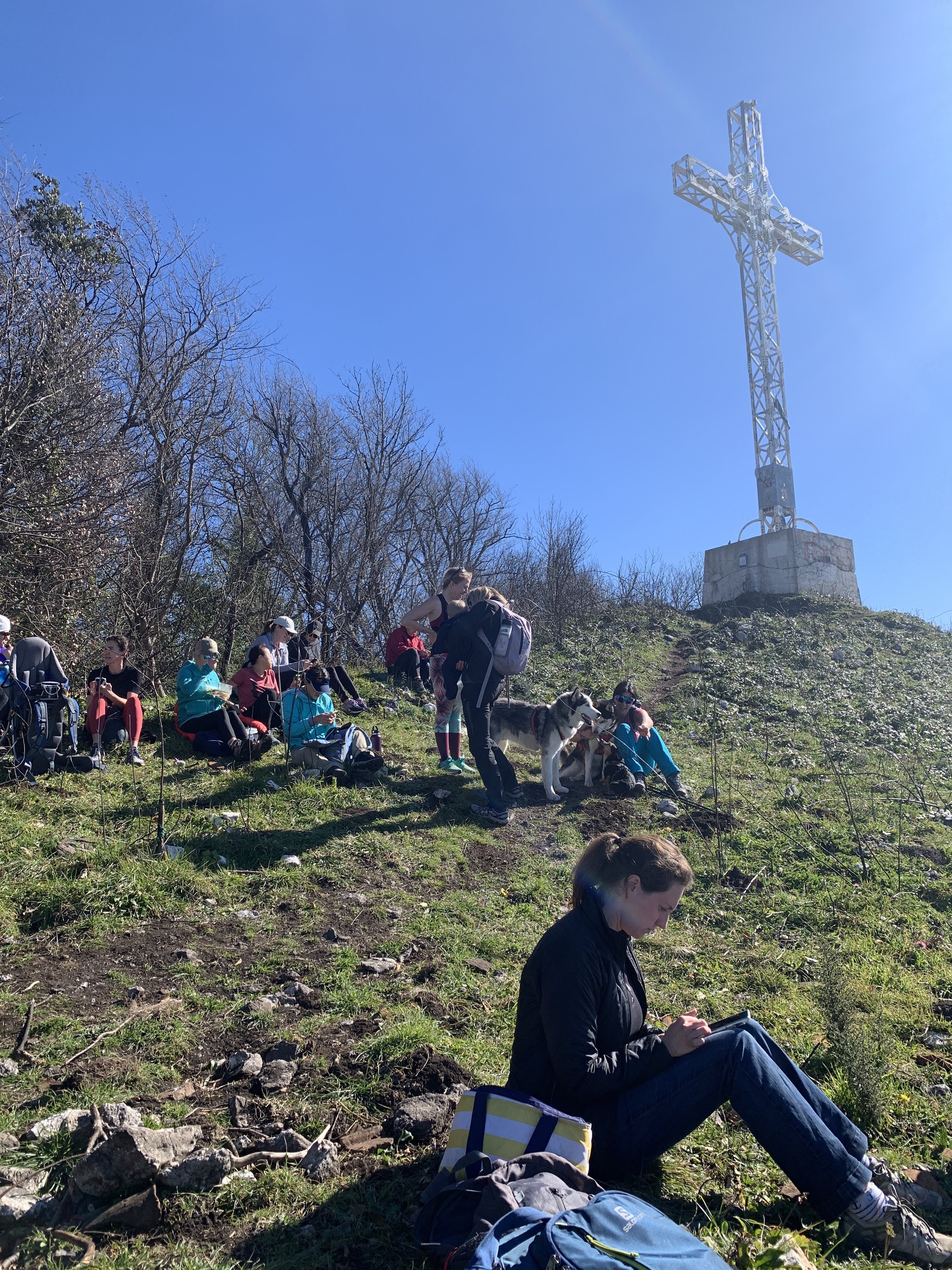
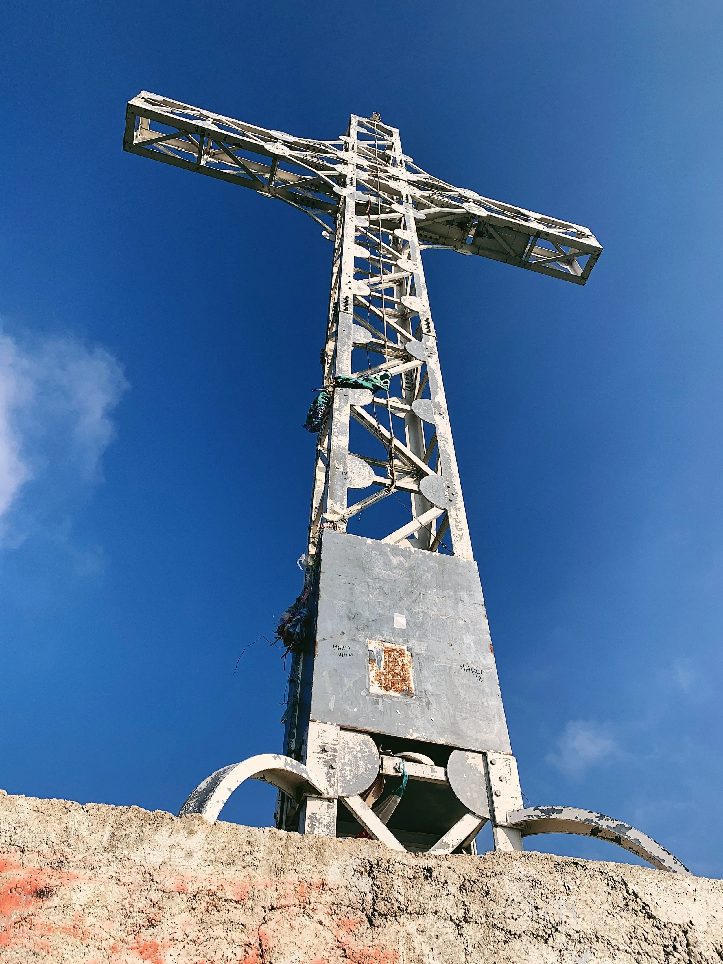
If you’ve ever driven south on the main A1 autostrada between Rome and Naples you may well have spotted Monte Tifata, a steep and jagged peak rising to a craggy summit with an enormous white iron cross perched at the very top. During the day it’s only just visible to the naked eye, but at night it lights up - not always, the electricity isn’t terribly reliable in these parts - but when it does it can be seen for miles around.
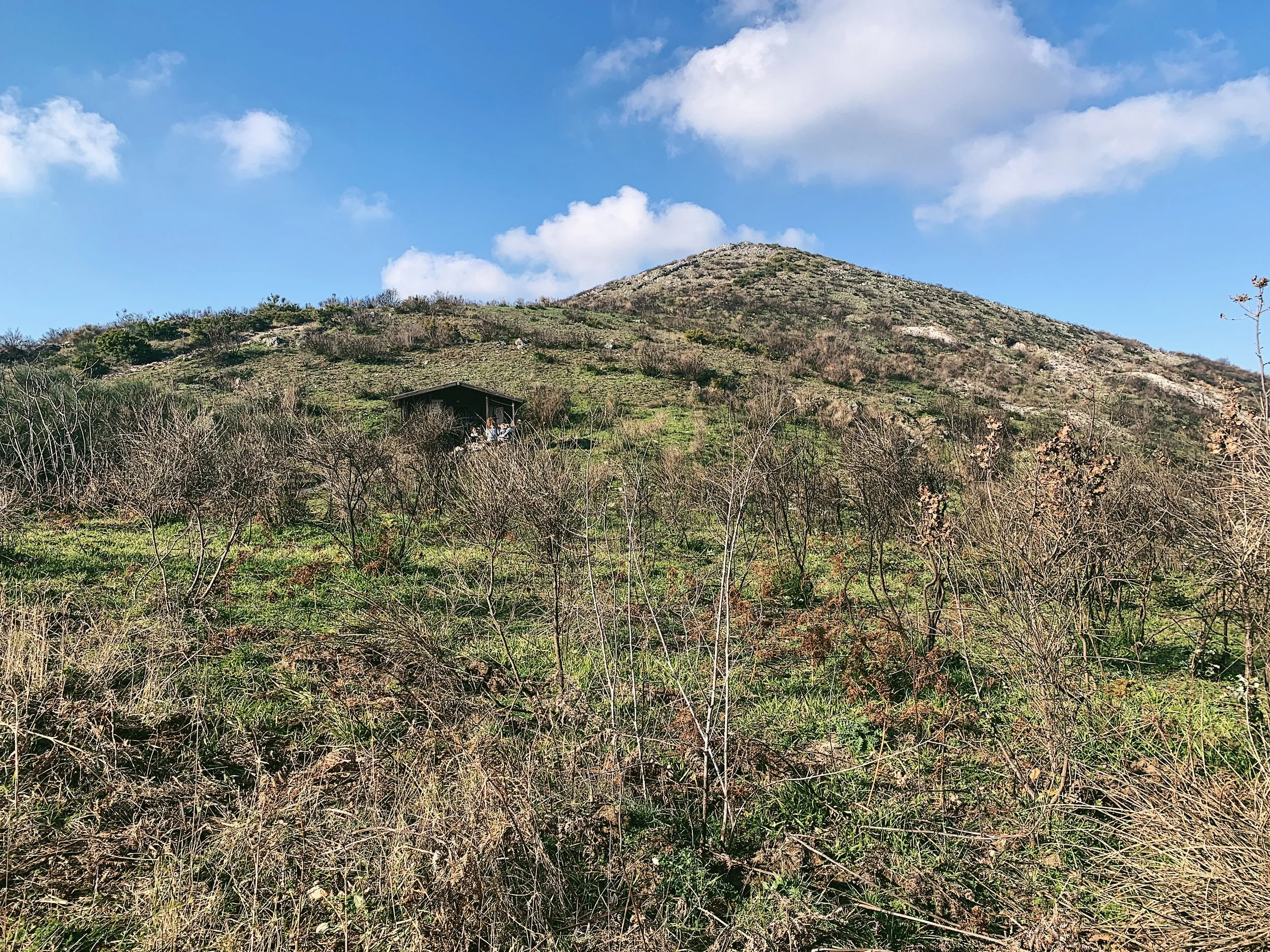
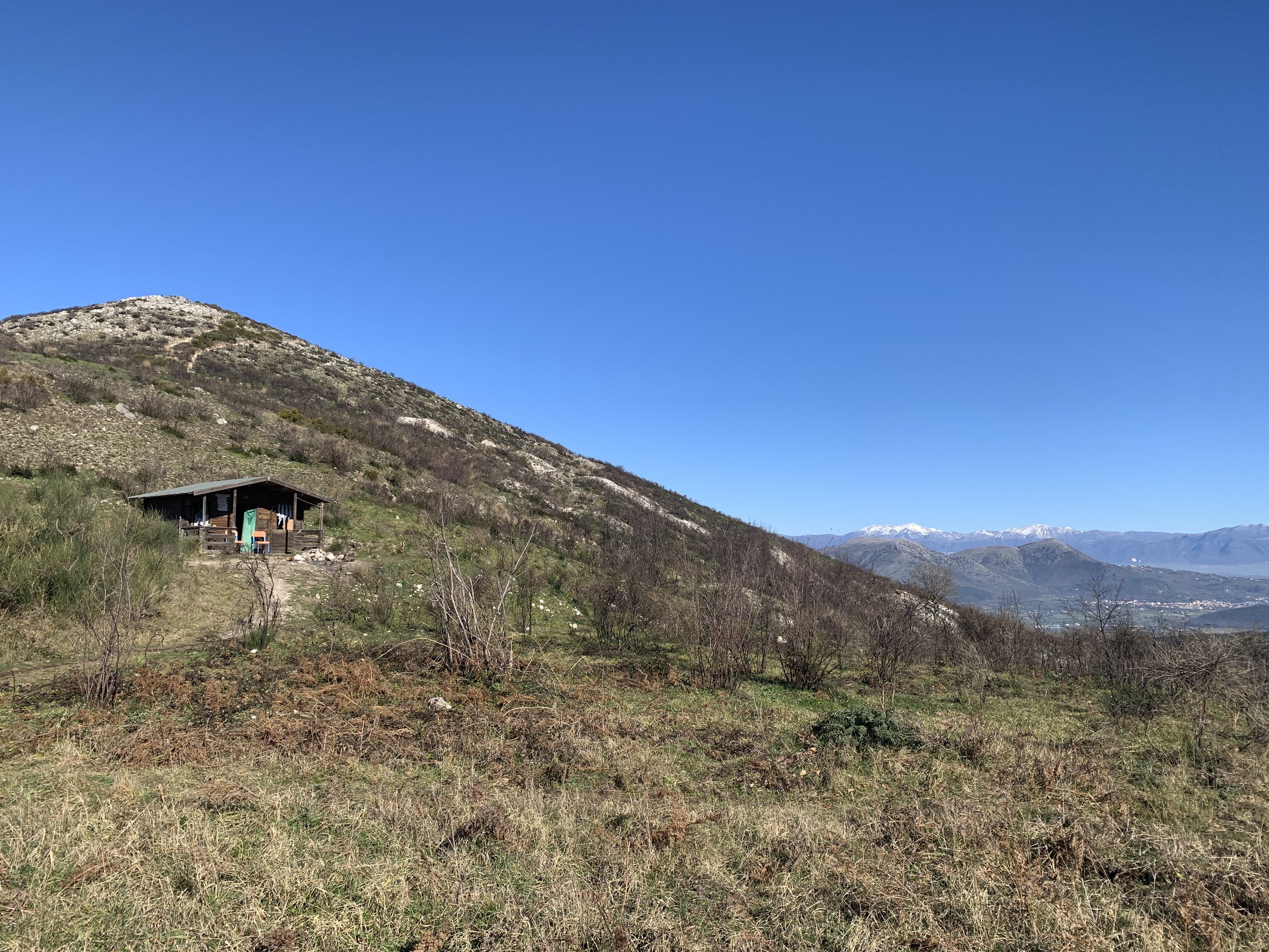
It’s a very popular landmark and those that live around the base are proud of their lofty peak; on a Sunday morning it’s not unusual to see a procession of walkers meandering up the side of the mountain. The first part of the walk is very straightforward, up a dirt track to a grassy area littered with spent shotgun cartridges of varies bores and primary colours, where there’s a small, unguarded rifugio with a firepit out the front.
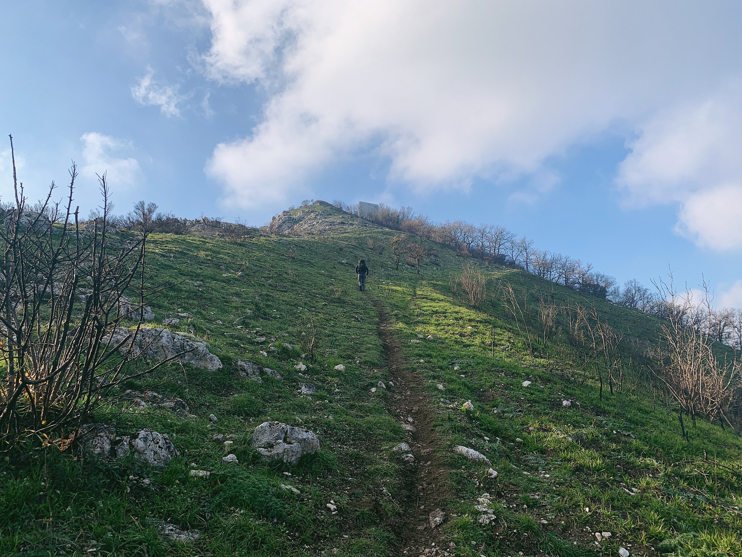
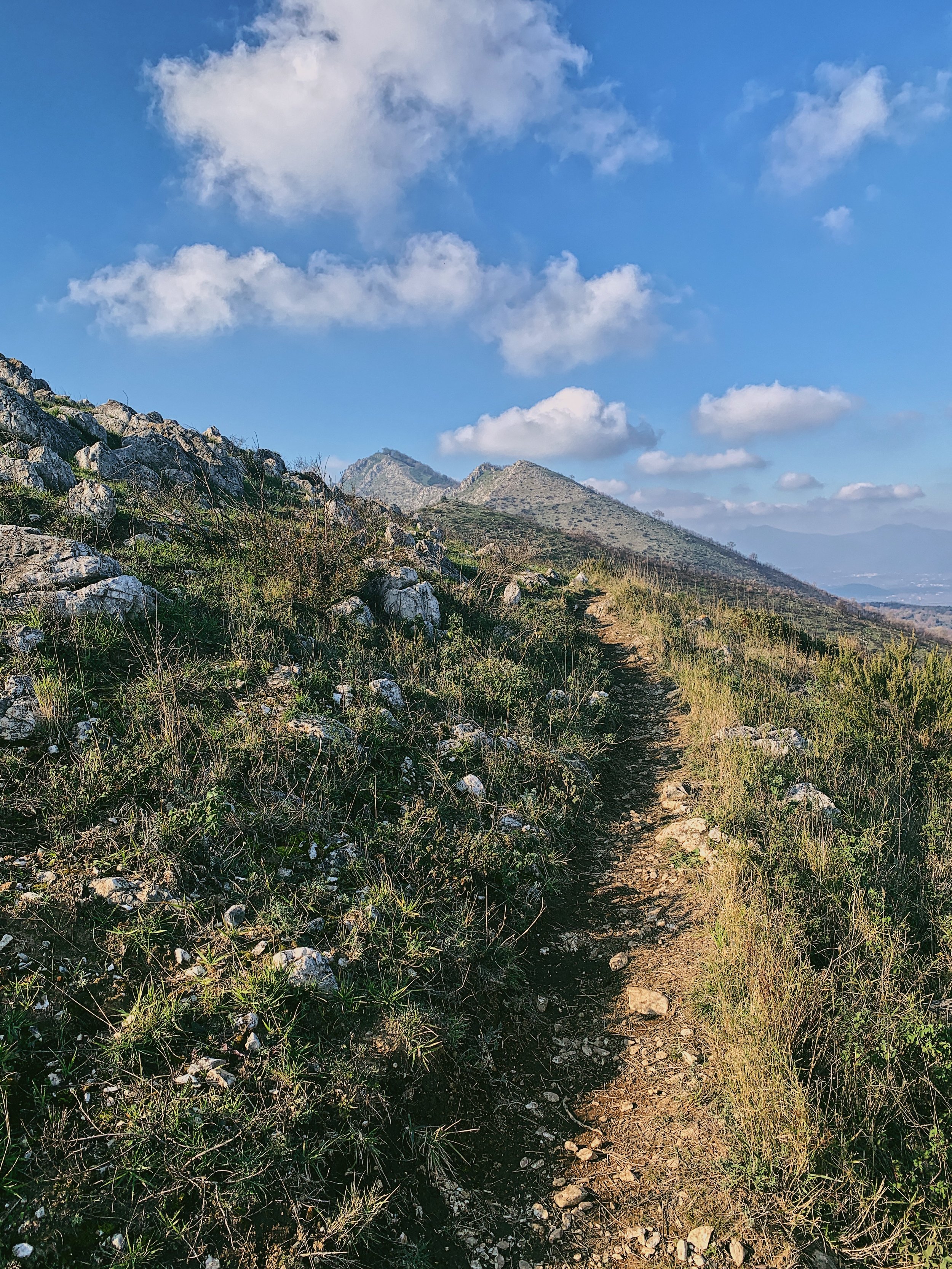
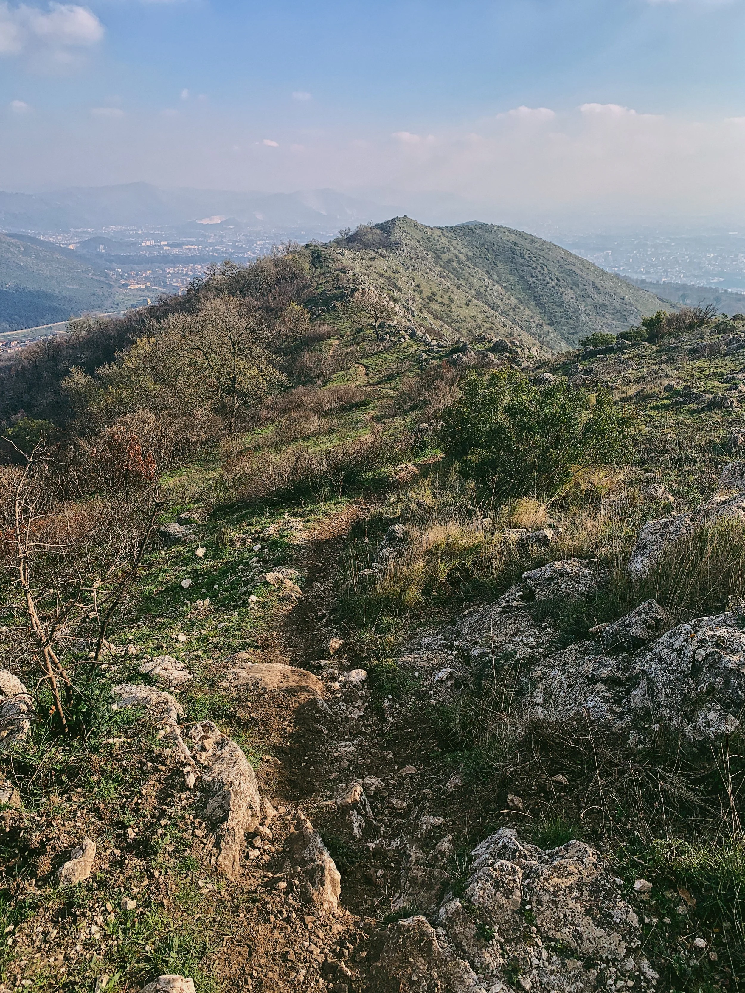
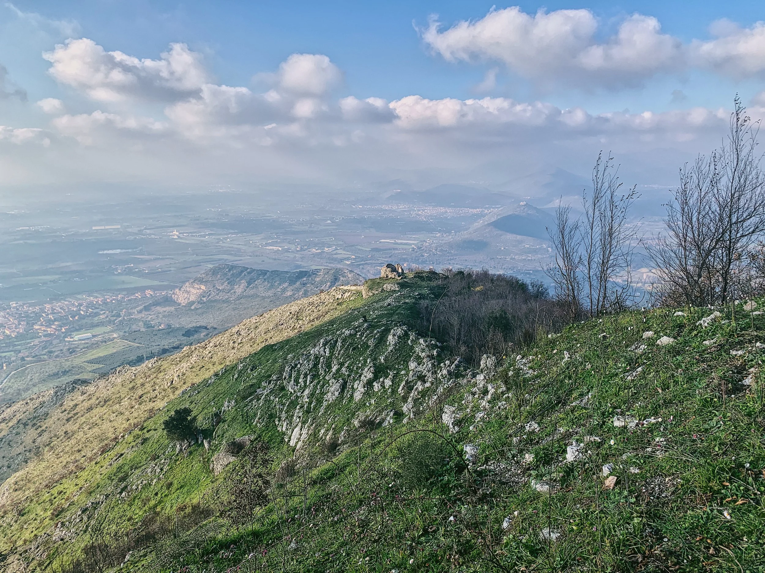
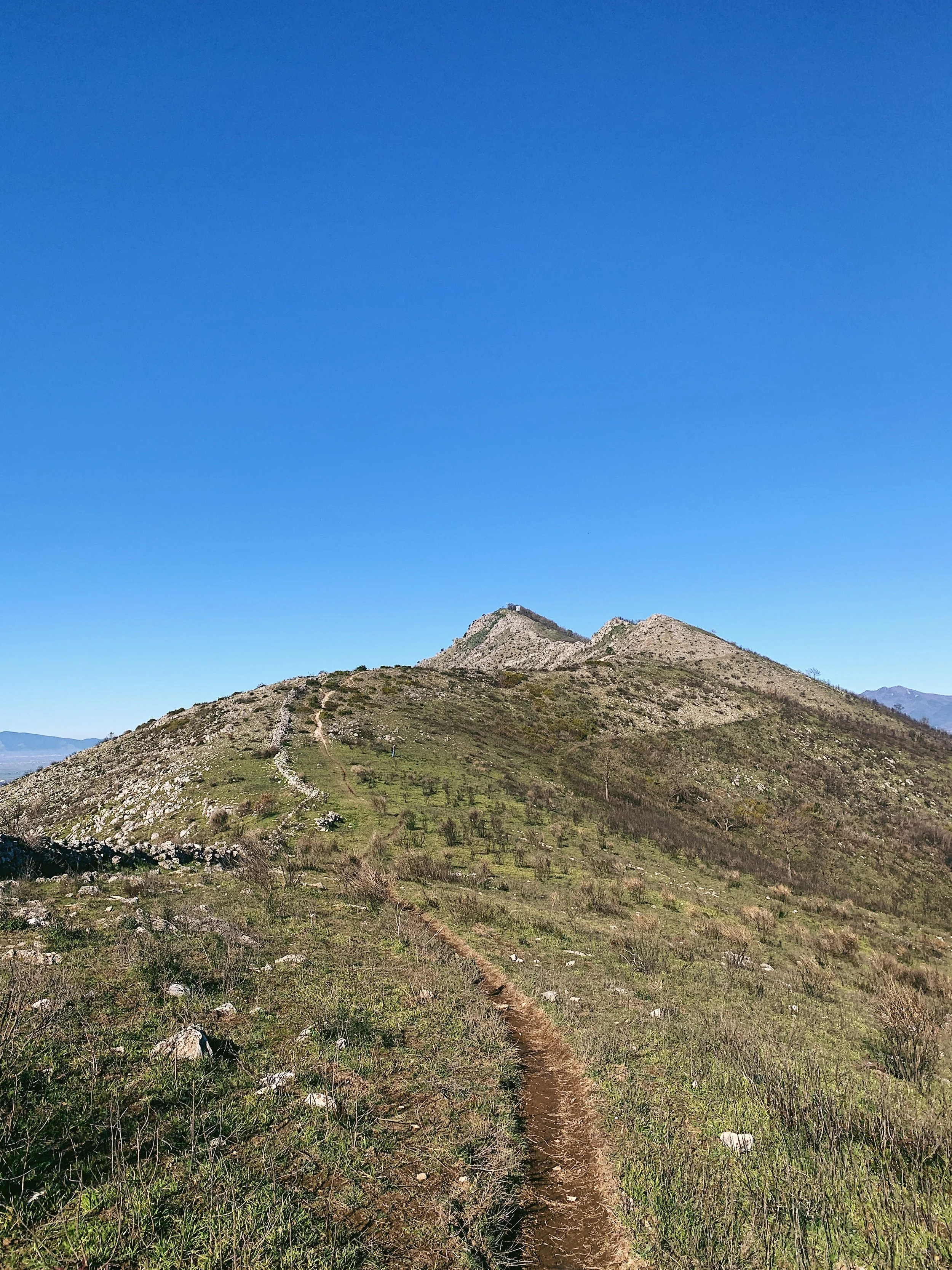
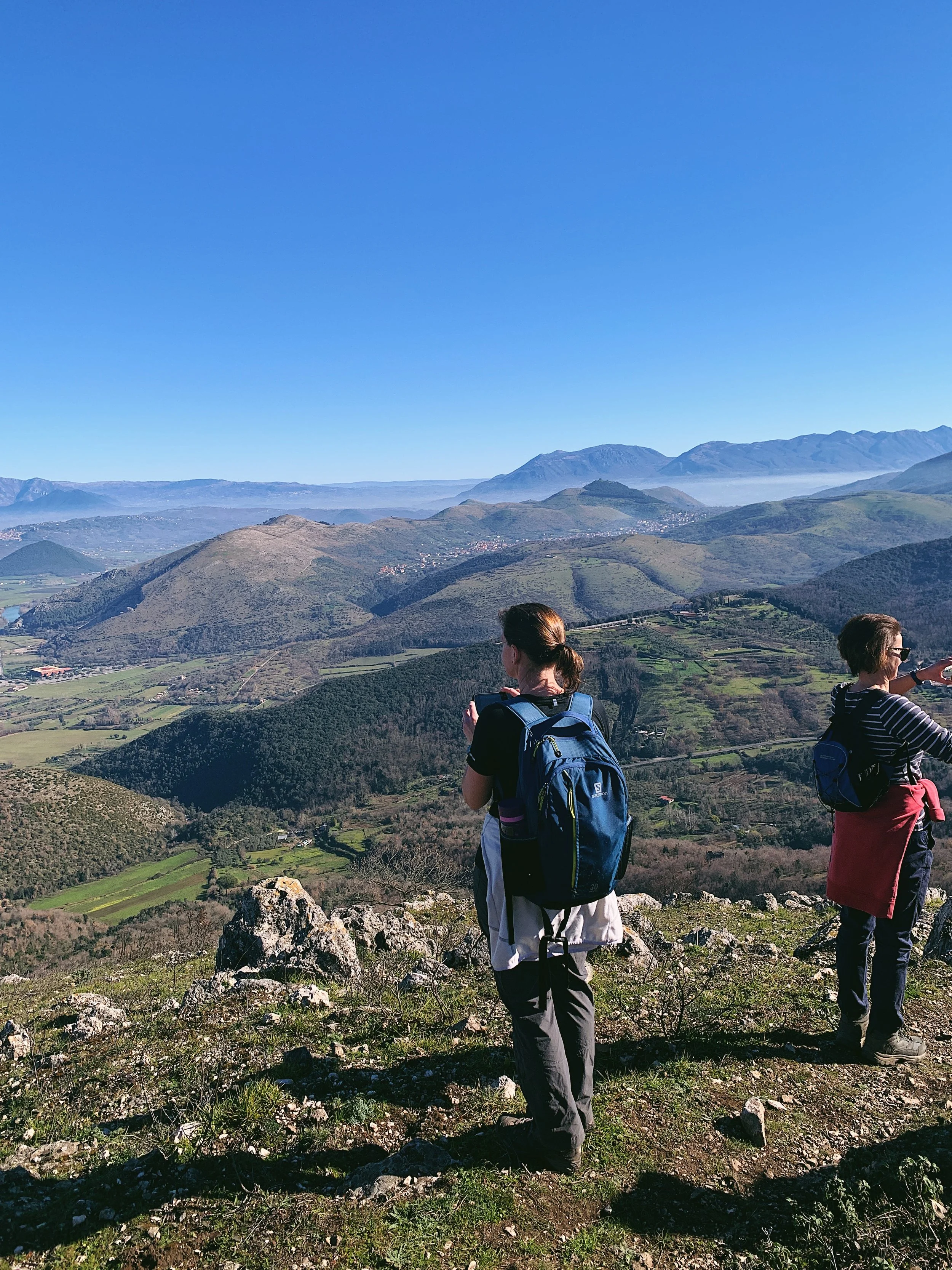
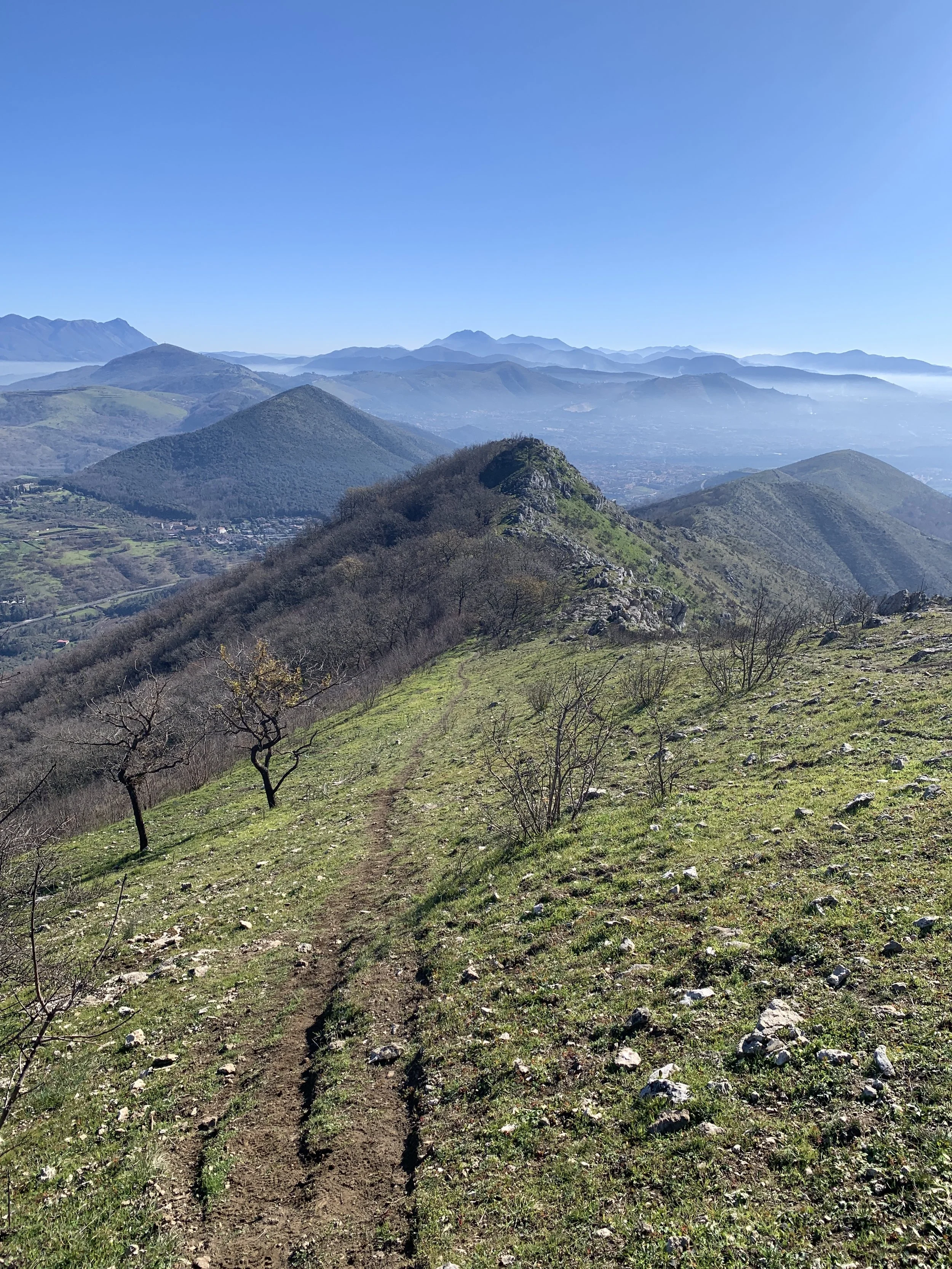
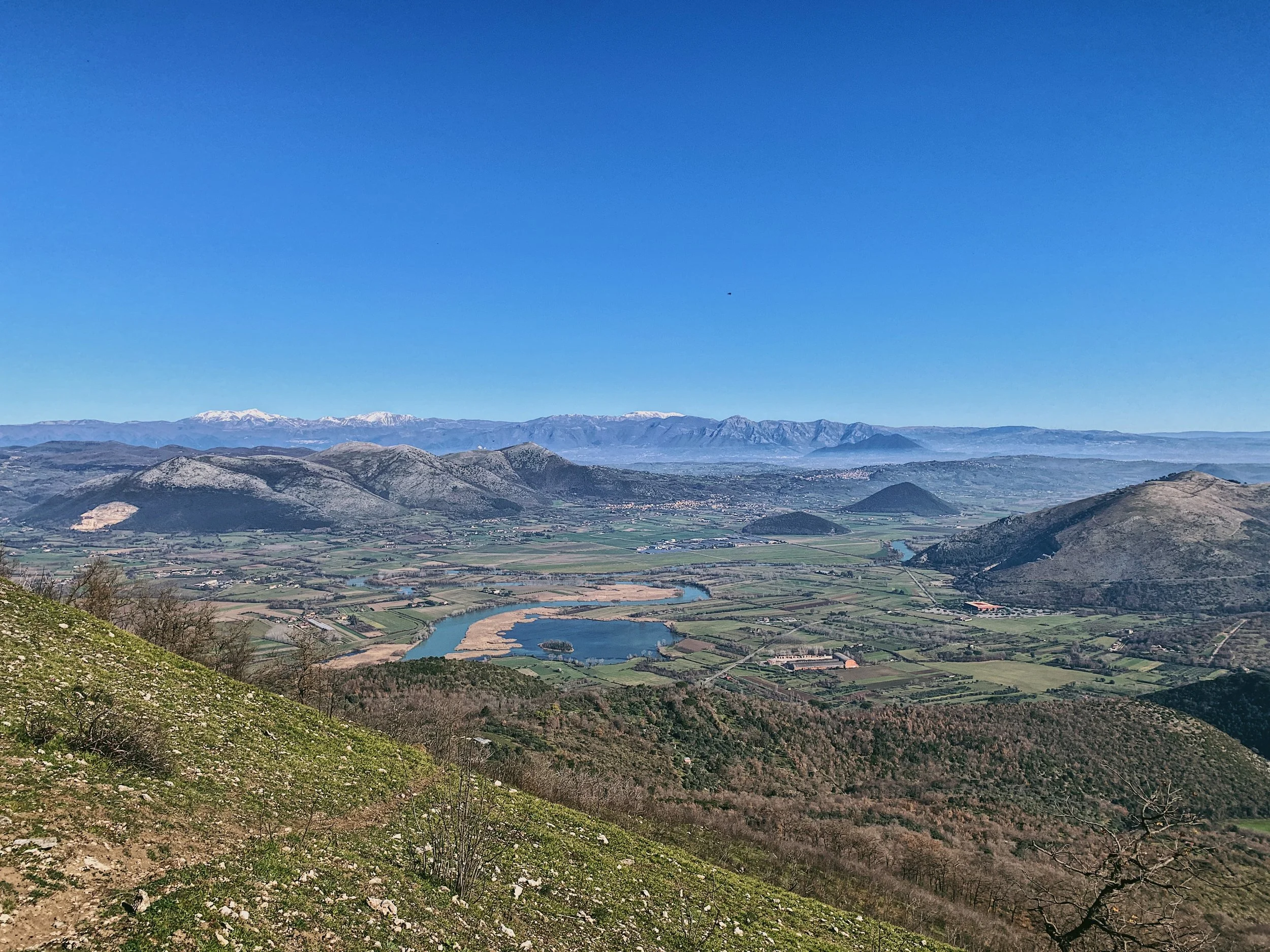
After that, the walk turns uphill and follows a magnificent ridgeline for a few kilometres until the last section, where it dips into a small copse and then reemerges on the summit just below the cross. You are rewarded with magnificent views on all sides for most of the walk, including Vesuvius and Monte Somma to the south, the Matese mountain range to the north and Parco Regionale del Taburno to the east. On a clear day you can also see the west coast, down to Lago Patria, the Bay of Naples and Castel Volturno.
Though one of the lesser-storied peaks in the area, it has its share of historical landmarks and was the site of Sulla’s civil war battle in 83 BC. Nearby is the complex of Belvedere di San Leucio, a silk factory which once made rich fabrics for the great palaces of Europe. If you continue on from the cross, down into Sant’Angelo in Formis, you’ll find the 10th-century Basilica Benedettina, which is decorated with impressive frescoes.
Flora and fauna
There are many beautiful butterflies in the spring and summer months, which flock to the various small wildflowers that dot the flanks of the mountain. In the summer you’'ll see the ubiquitous lizards, but there is rarely livestock up here.
How to get there and parking
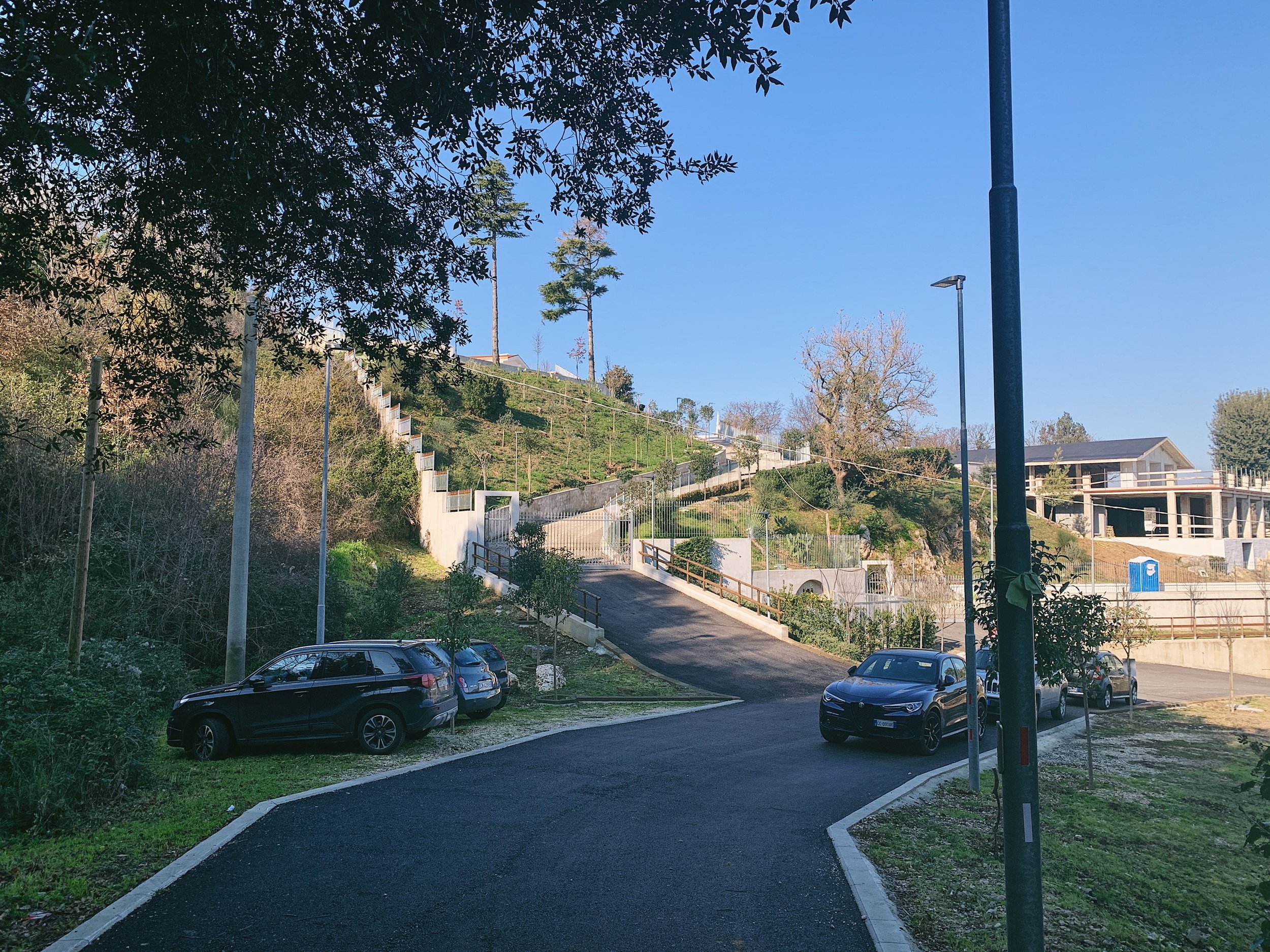
Leave Caserta on the SP336 and after leaving the little row of shops, slow down and take a sharp left turn onto a very narrow track, called via de Maria Francesco Saverio. This follows a residential road around several large villas up a very steep hill to a parking area where there are lots of solar lamps. The parking is limited but you can pull onto the grass - just don’t block the driveways of the big houses.
The trail begins behind the car park, leading up a stone track.
Signage and trails
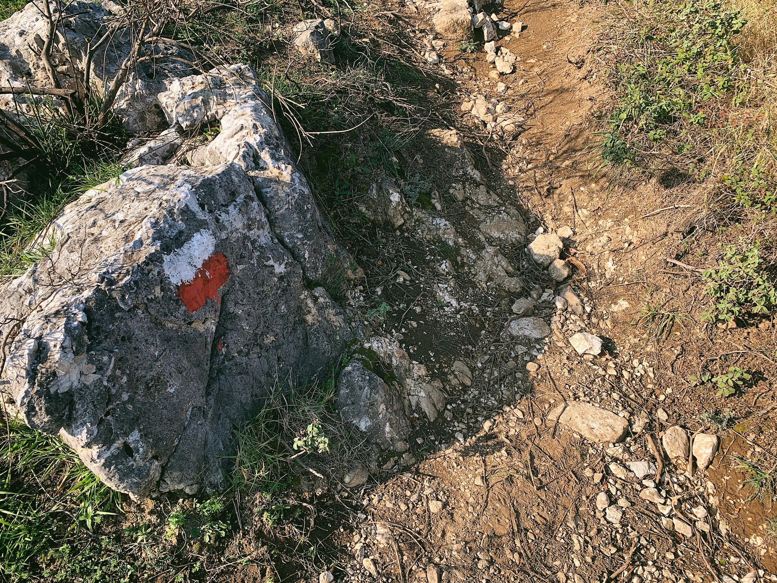
The trail is easy to follow as it’s well trodden in most places and marked by the usual white and red painted CAI signs. There are no signs or map boards to give information, but there is a small wooden rifugio (mountain shelter) which may reveal some information - though it’s mostly used by local hunters as the spent shotgun cartridges littering the ground will attest.
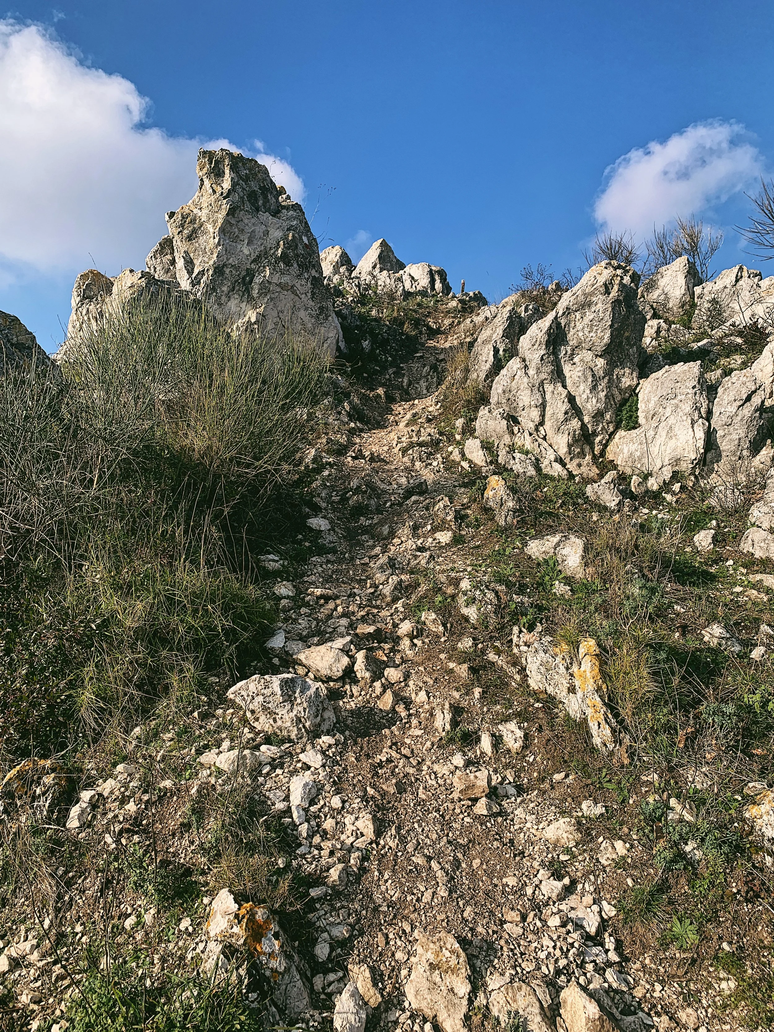
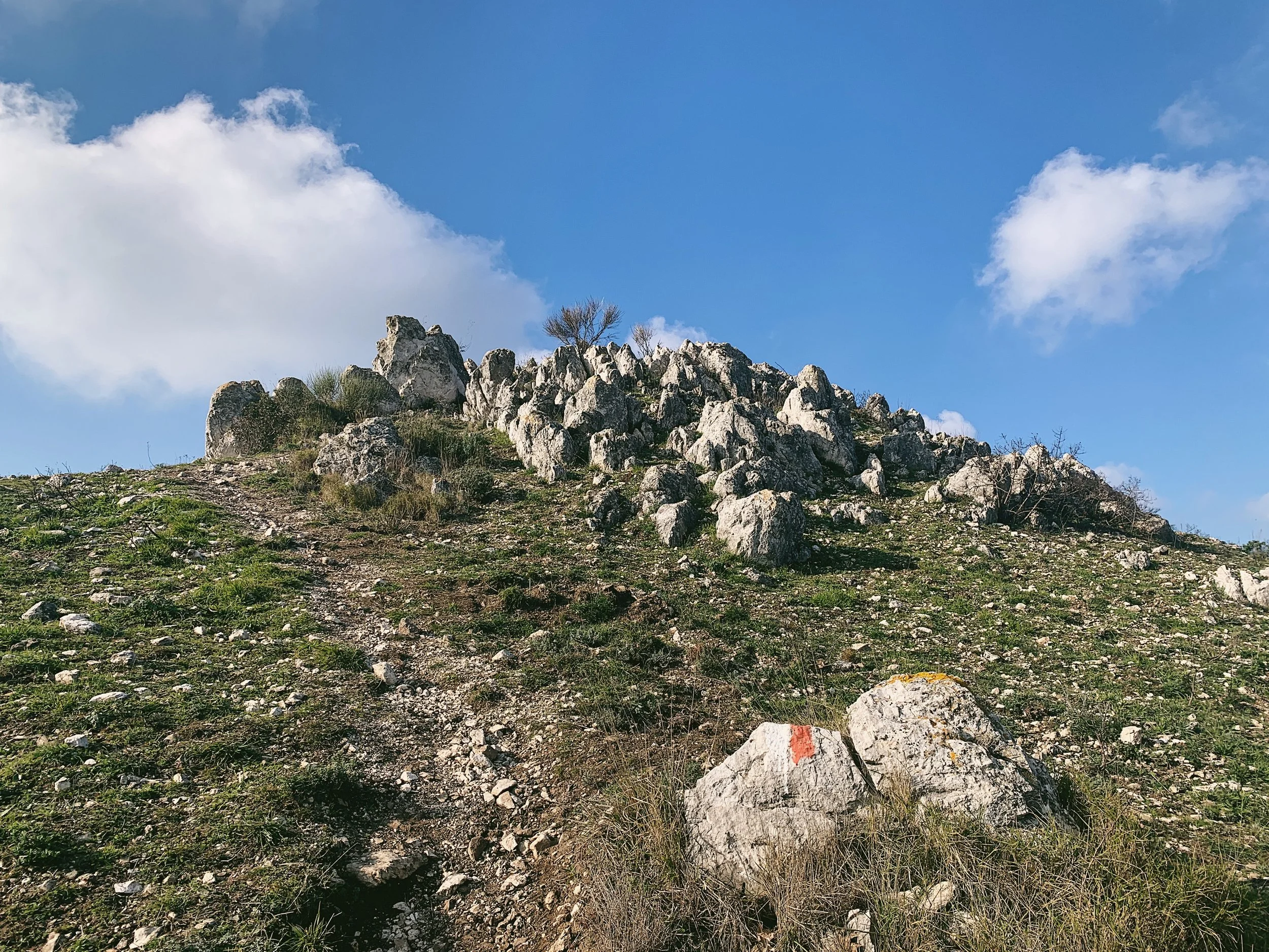
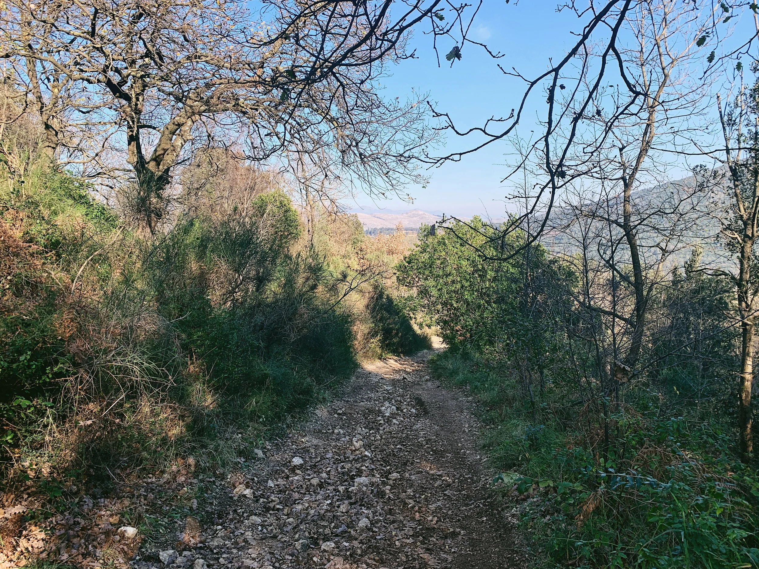
For most of the way the trail is an easy to follow single track, though in places the defined trail disappears as you need to scramble over some areas of rock. The surface is quite uneven in places and there are two short sections which are very steep, so hiking poles are definitely recommended for the way back down.
Route
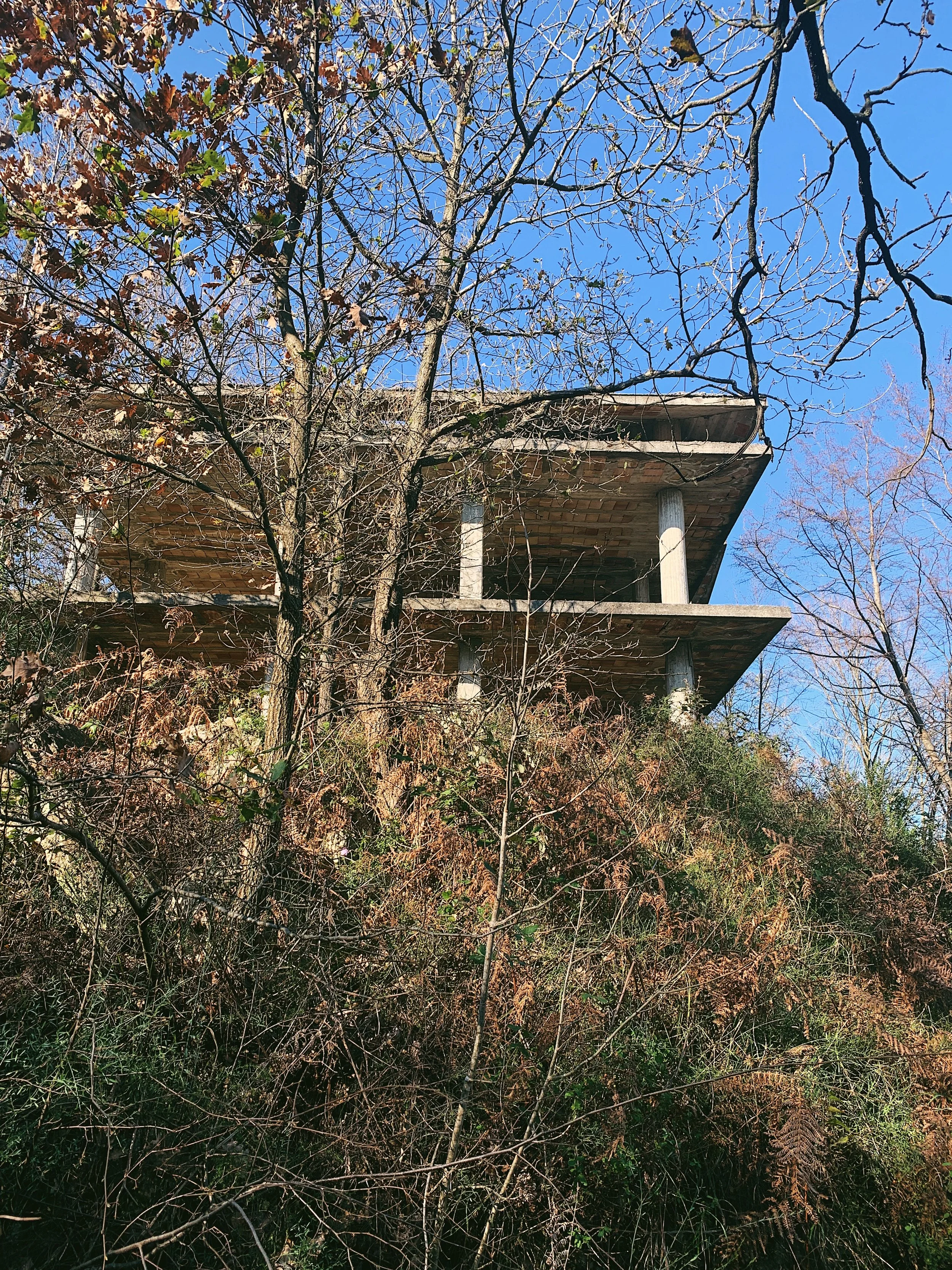
The trail begins at the car park. Follow the defined trail over the drain and past the house on the right hand side. After a short distance it splits: you can continue on the main trail where you will eventually reach a rusted iron gate. This may be locked, in which case you can retrace your steps and take the narrow trail up through the trees - this is quite uneven where the track has deteriorated, but does eventually rejoin the main path. Continue up the wide trail around a series of switchbacks: ignore the barrier that says ‘Proprieta R Donato’ and continue uphill past two huge concrete shells - these were likely planned to be villas but, like many buildings in Campania, lay abandoned.
After almost a kilometre you’ll reach the saddle in the hills with the CAI rifugio up to your right. Continue past the rifugio and then follow the defined single track up to the right - you’ll see it ahead of you disappearing up and over the hills. Several of the larger stones have CAI markers on them so you know you’re on the right track. To your right you can see the hill which towers above the Diana and Actaeon Fountain at the end of the Grand Cascade: one of Caserta Palace’s most iconic monuments.
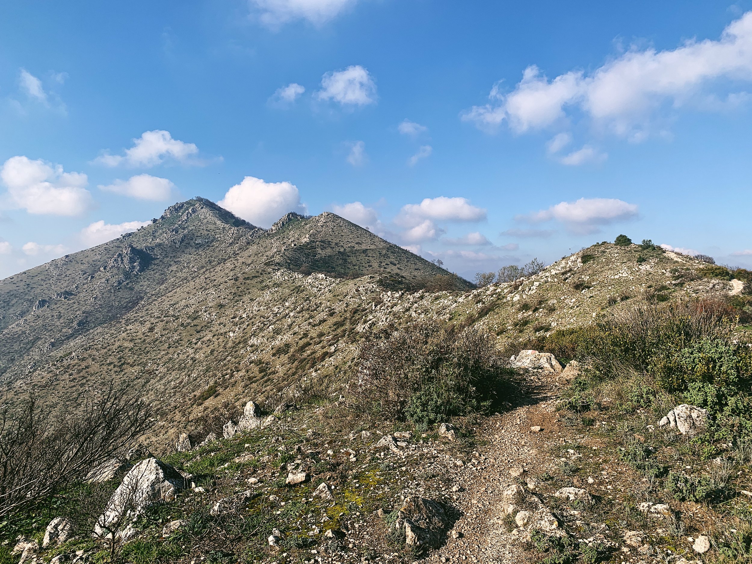
Follow the path uphill through areas of low bush and scrub, littered with large and small rocks. The path passes over several exposed crests along the ridge - go careful if it’s windy - until you reach a crown of stones atop a false summit. The path dips slightly behind the ridge here and is more sheltered, with a line of trees to one side offering protection. The path leads between the stones up to a dilapidated stone wall and then skirts a sharp drop on the left.
After this point the path becomes very steep and may require some scrambling. On the right hand side there is an abandoned advertising board (your guess is as good as mine!) and then dips into a small wood just behind the summit. Follow the track through the wood and up to the left, where you’ll emerge just below the cross.
Retrace the same route to return to the car.
Food and drink
There are no facilities at the start/end of the hike or within walking distance, so you’ll need to come prepared. There are some shops and cafes on the SP336 from Caserta, including some cornetterie, but they do seem to keep quite peculiar hours. Caserta is a 10-minute drive and has lots of different options for food and drink.