MONTE MOLARE
Length: 5 kilometres
Elevation gain: 391 metres
Time: About 2.5 hours with time at the summit
Parking: Porta di Faito, near Chiesa di San Michele, Monte Faito. Coordinates: 40.655676, 14.497708. What3words: ///outwork.receptive.ruling
Best time to go: Clear day with no storms or strong winds. September to late June
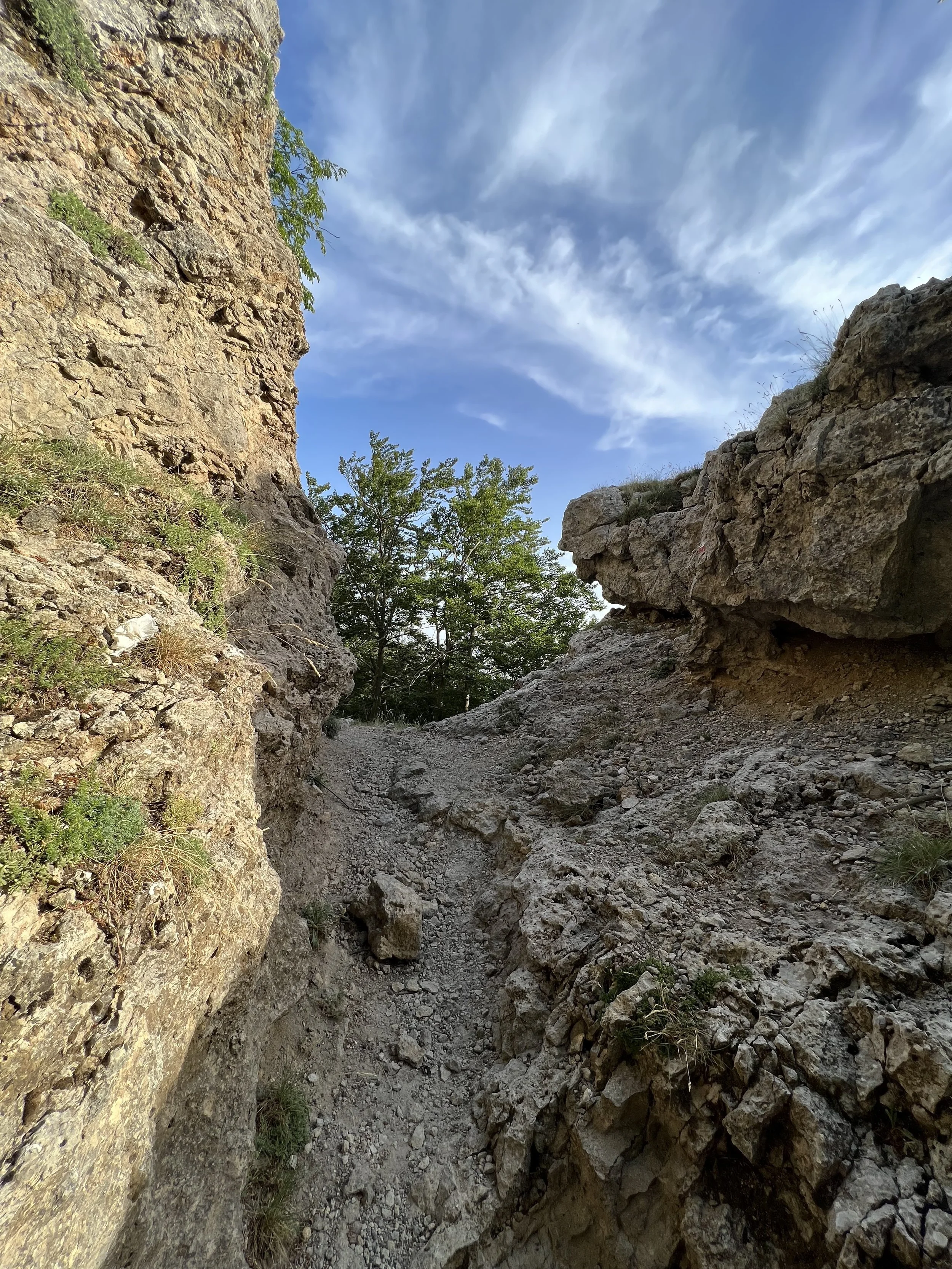
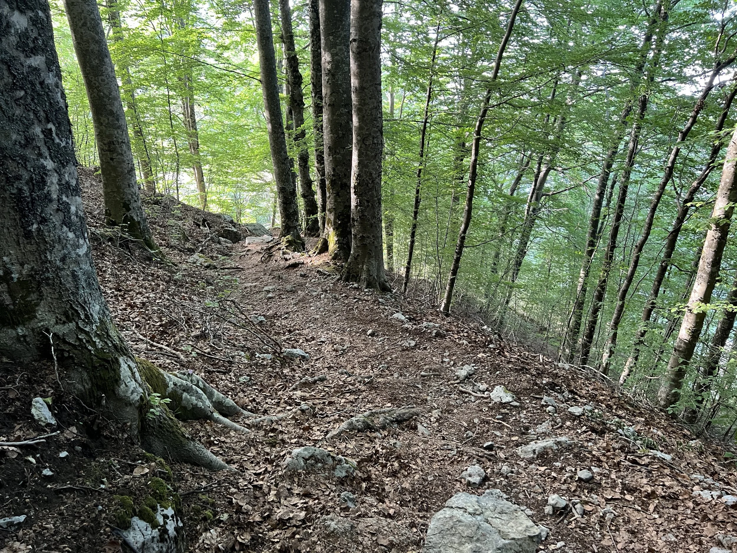
Terrain: A mix of single-track earth paths through the trees and rocky scrambles
Level: Moderate. Short but steep with some unguarded climbs and drops. Not advisable for those who suffer from vertigo
Suitable for children: Yes, if they are confident with heights and the elevation. There are a number of steep drops with no barriers. Recommend 11+
Suitable for dogs: Yes, but best kept on a lead and away from the edges. Small dogs may need to be carried to the very top section as the steps are high
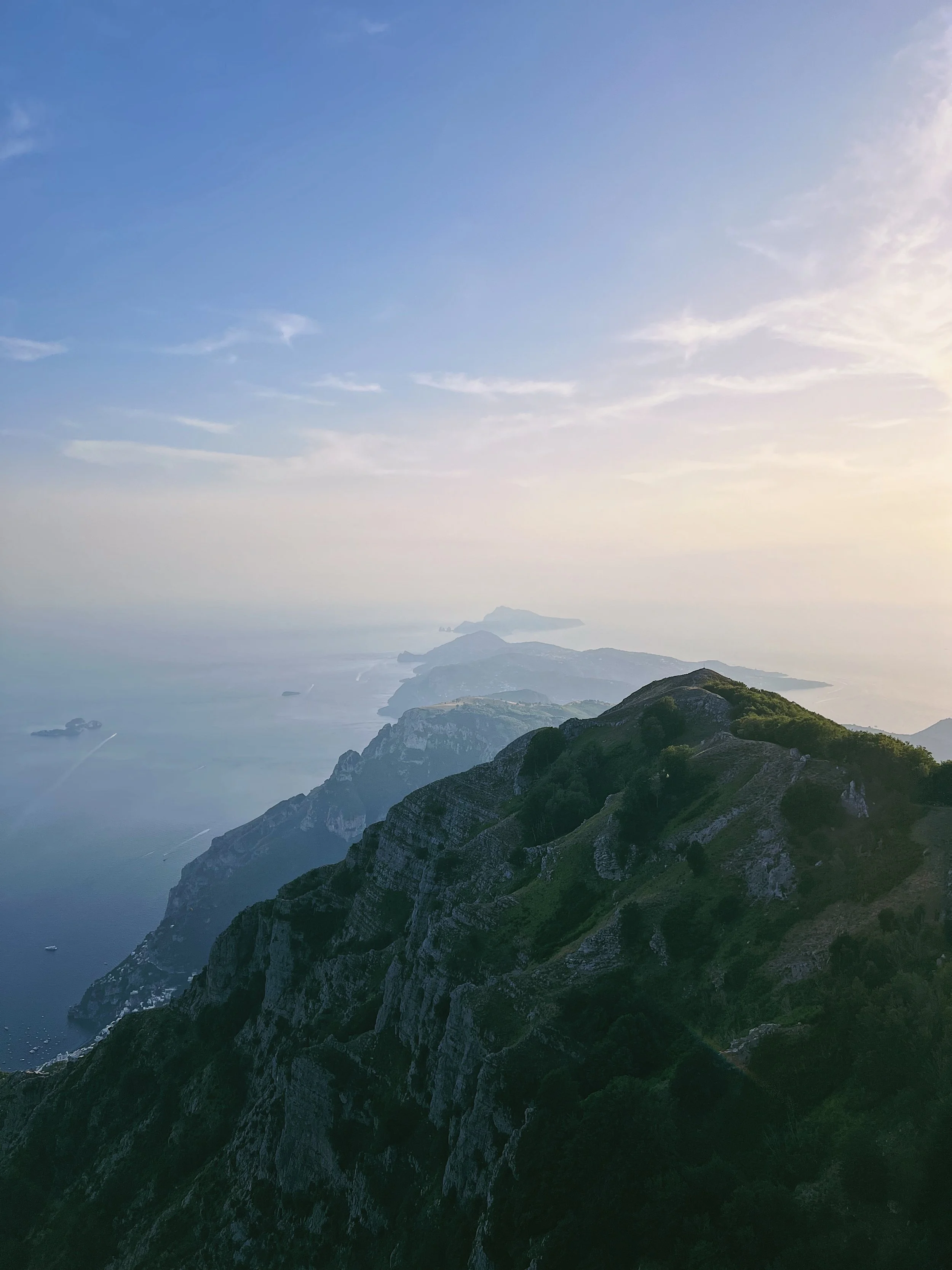
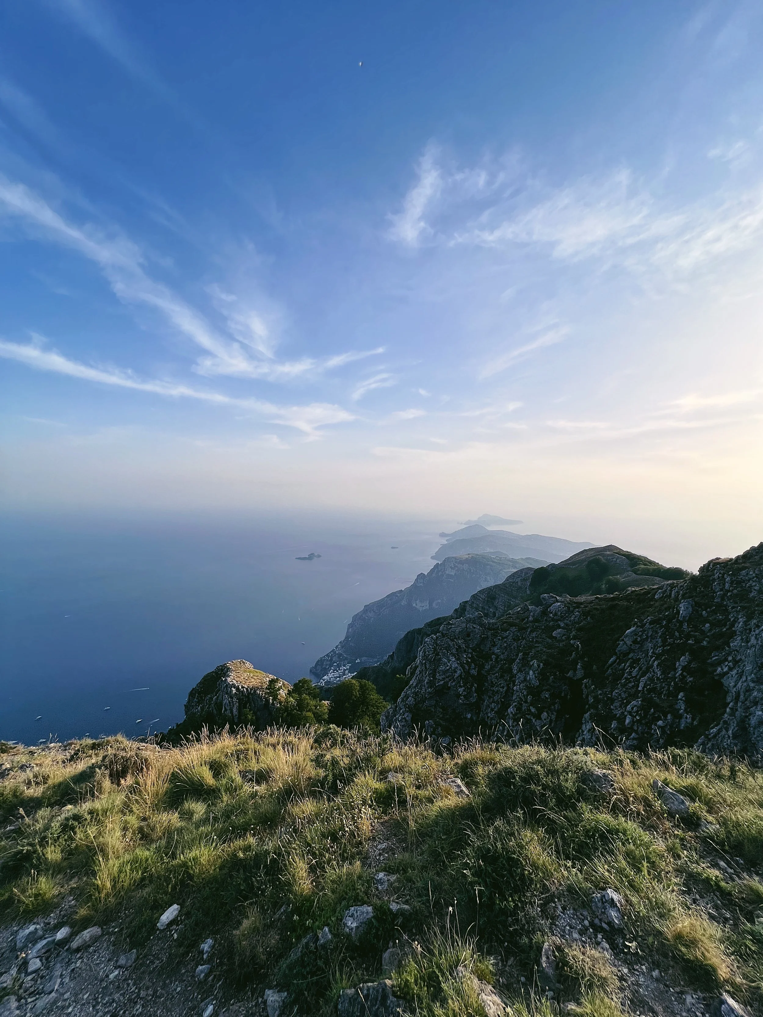
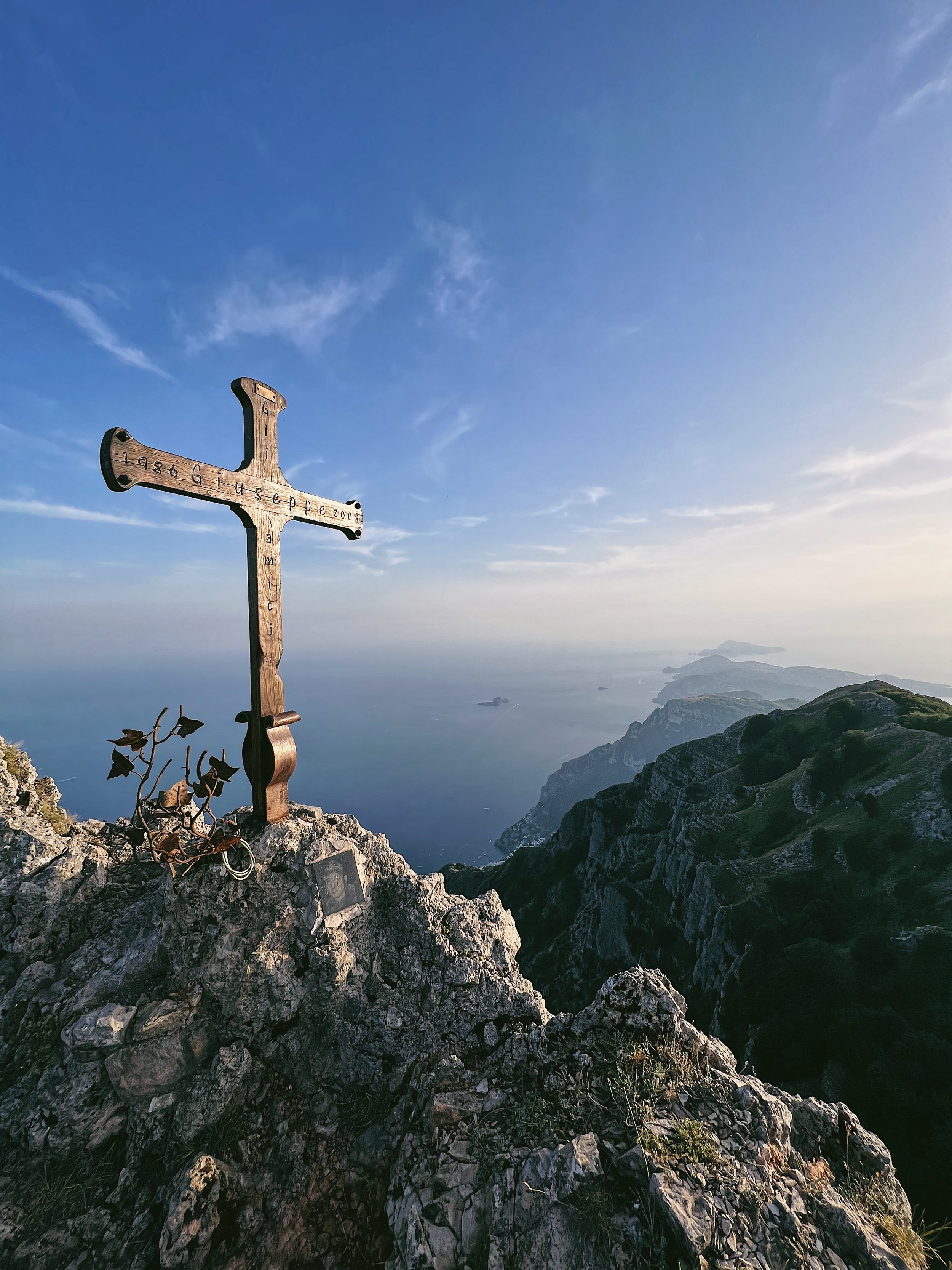
Monte Molare: the highest point on the Sorrentine Peninsular with 360-degree views
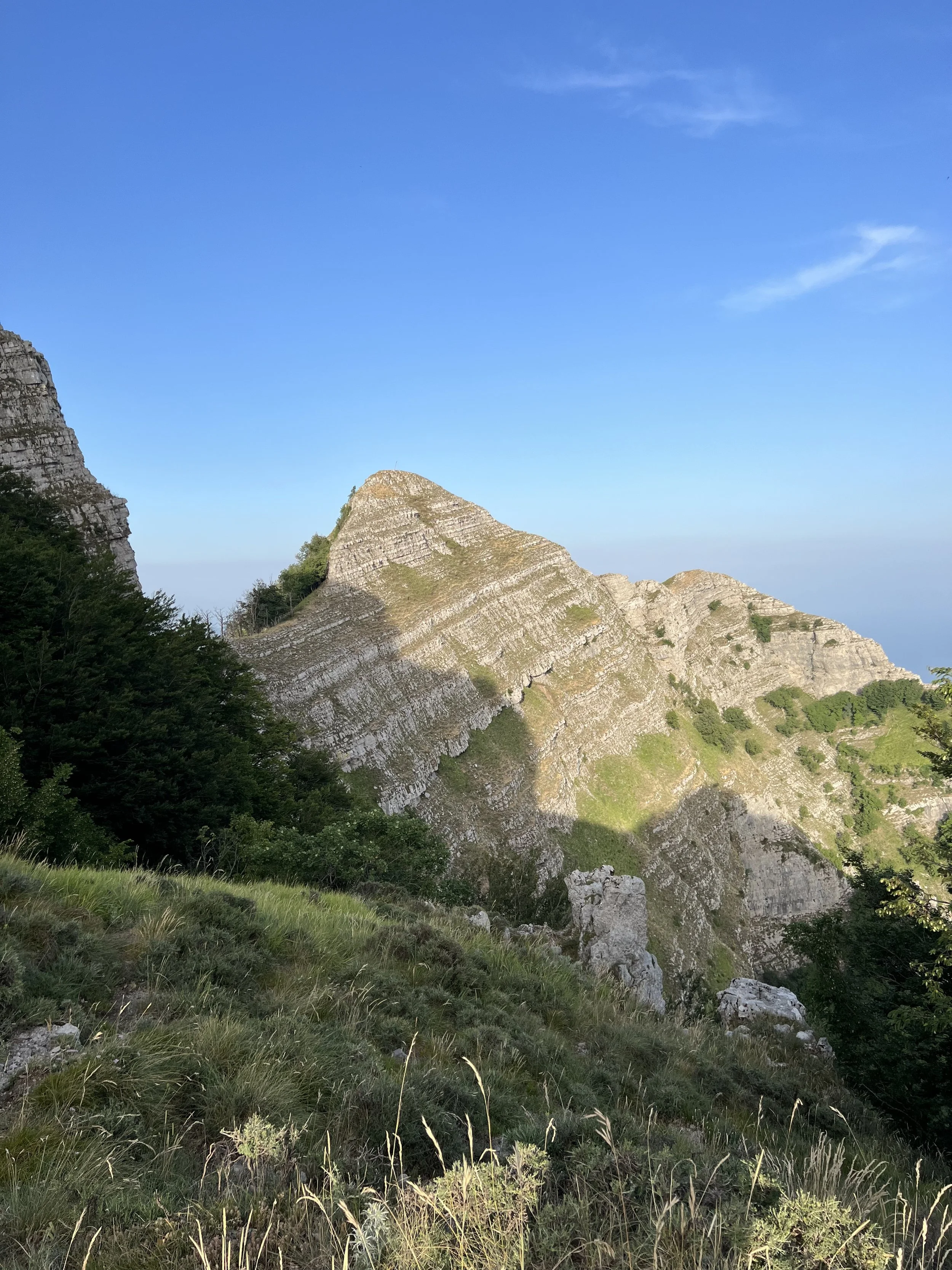
If you live near JFC NATO HQ outside Naples and are lucky to have a roof terrace, or access to one, this is the highest point you can see if you look due south over Naples and Monte di Procida. Most days it’s hazy, but on a crisp, clear day you can see the distinctive peak clearly. The summit is actually called Monte San Michele, owing to the Chiesa di San Michele on the lower slopes. This is a worthwhile diversion, and has lovely views, though it’s not one of the most attractive churches and the herds of goats that live on the flanks of the mountain are more of an attraction. The mountain is locally known as ‘Molare’ as its rounded off square top is shaped like a tooth. The mountain has a natural spring, the Acqua della Sorchie, which runs down through the rocks and trees and provides a natural water source for the aforementioned goats - local guides have told me that the water is clean and perfectly drinkable, though this is still Campania and you never know what lies further upstream.
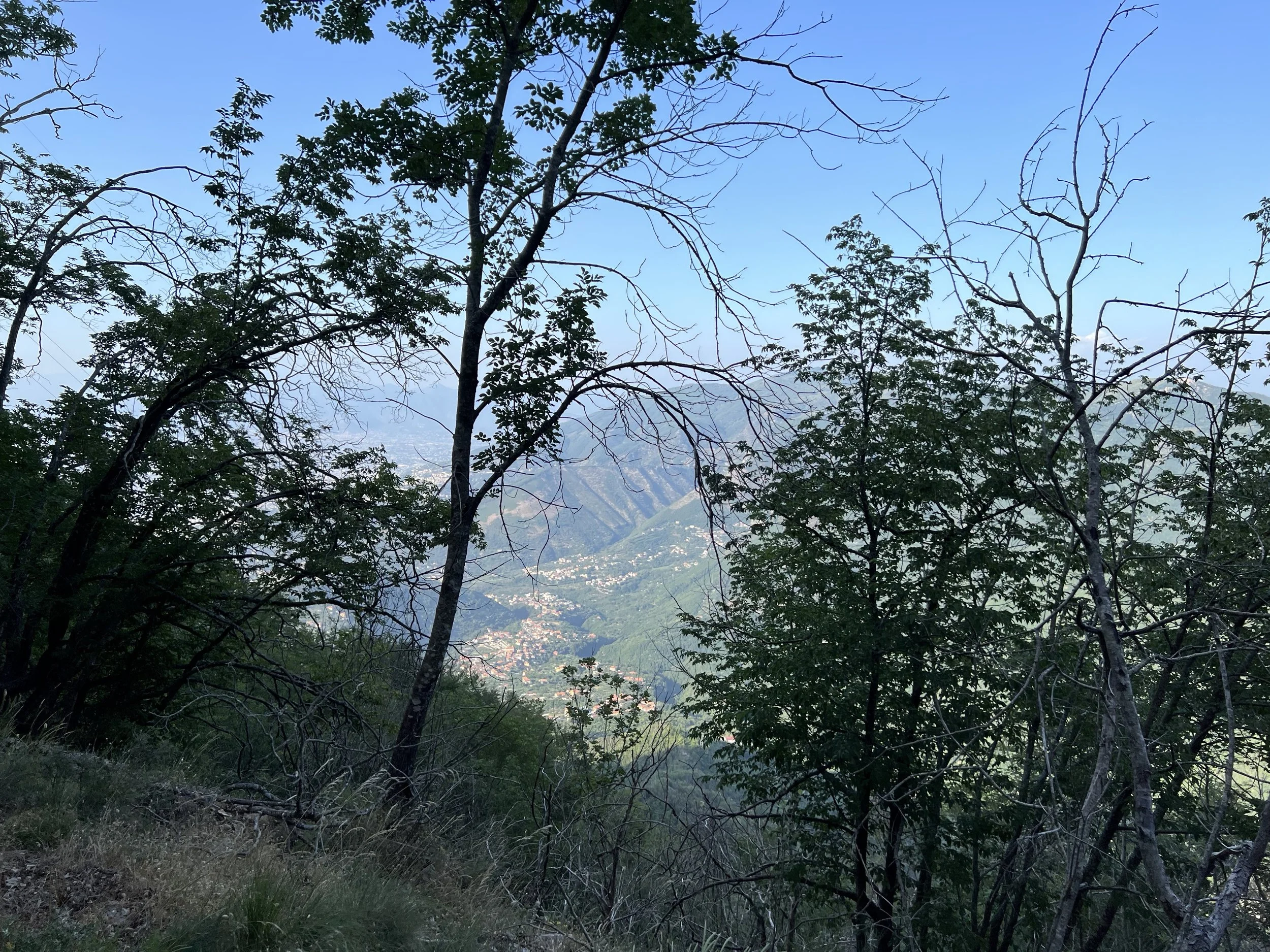
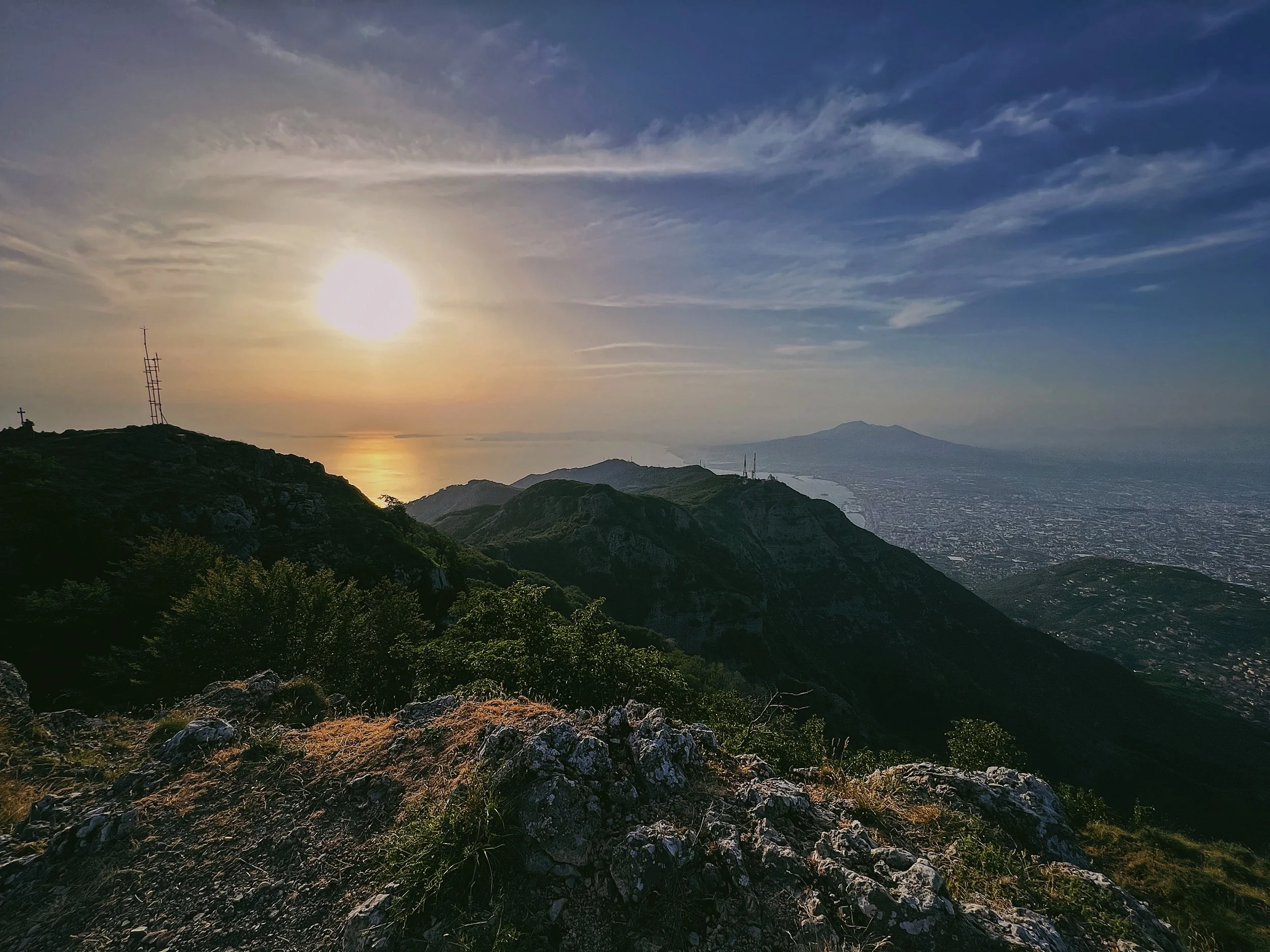
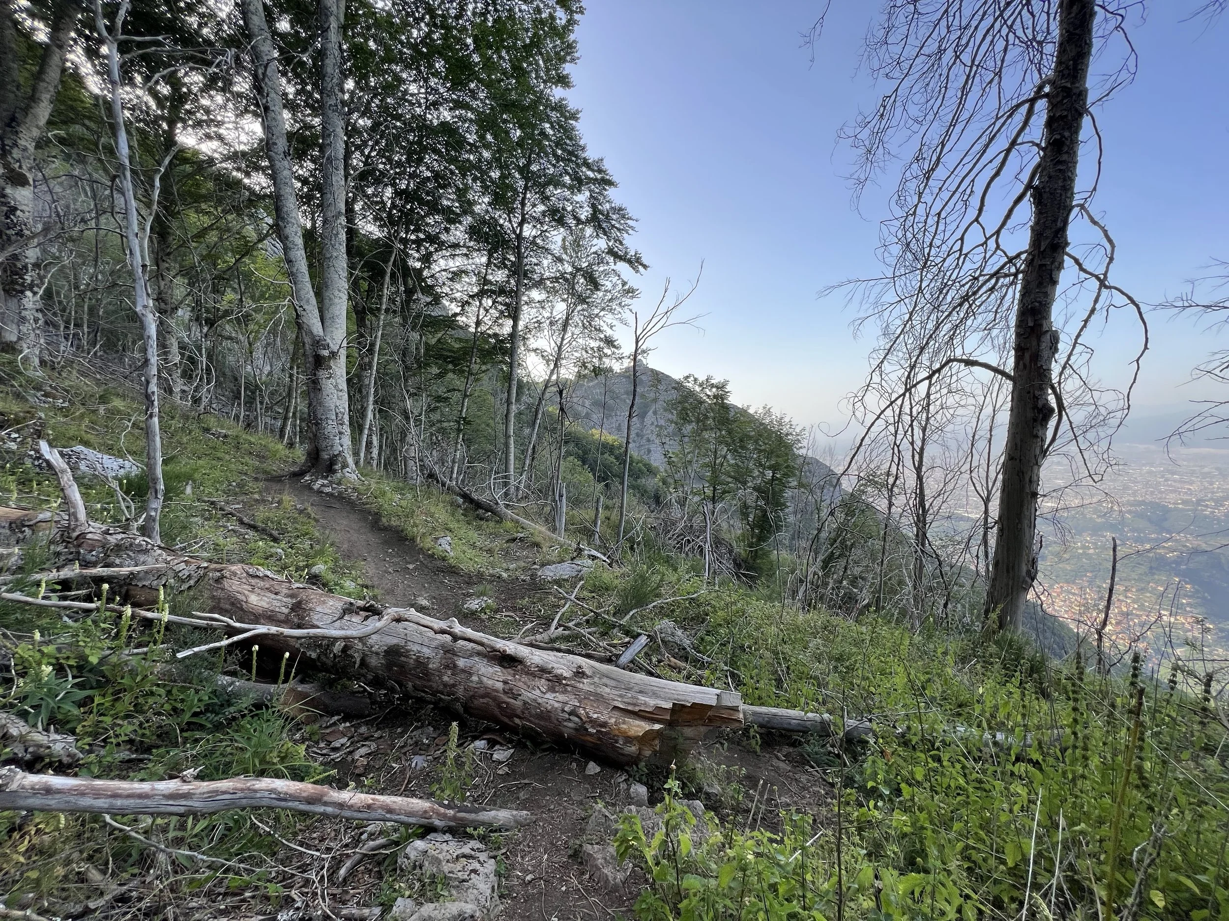
From the top of Molare there are stunning views over some of the region’s most recognisable sights: the sunken cone of Vesuvio, the wide, yawning mouth of the Bay of Naples sparkling in the sun and the undulating green and gold of the Amalfi Coast as it unfurls like a ribbon to a point, the jagged island of Capri and its famous Faraglioni at the tip like an exclamation point. Tiny villages cling to the slopes of the mountain, seemingly tumbling down the cliffs to the sea. This is one of the Amalfi Coast’s best walks - better, I would say, than the Path of the Gods, for there is much less foot traffic and the views at the top are better.
The walk is also considerably shorter to do an out-and-back trip, meaning it can easily be done in a morning. Though steep, it’s accessible to most abilities though caution should be taken with children and dogs near the steep drops and exposed edges.
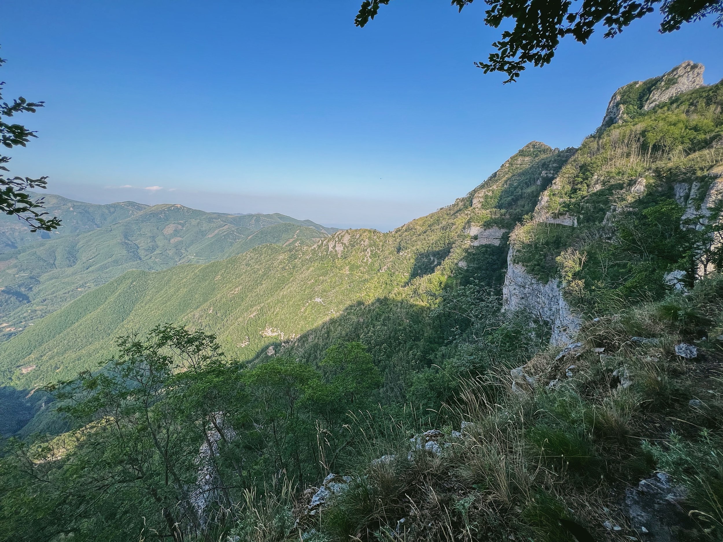
Flora and fauna
Monte Faito is thickly forested in beech and oak trees which are particularly beautiful in the autumn months. There are grazing goats and sheep, plus the ubiquitous wild boar - take care during hunting season. Note that the summit is above 1400 metres, so be careful in the winter if there is snow on the ground as the footing is unreliable.
How to get there and parking
You can take the cable car (in season) from Castellamare di Stabia up to Monte Faito, and then walk to the Porta di Faito parking area to take up the path to Monte Molare, however this is quite a walk and you would need to be certain that you could make the last lift back down again.
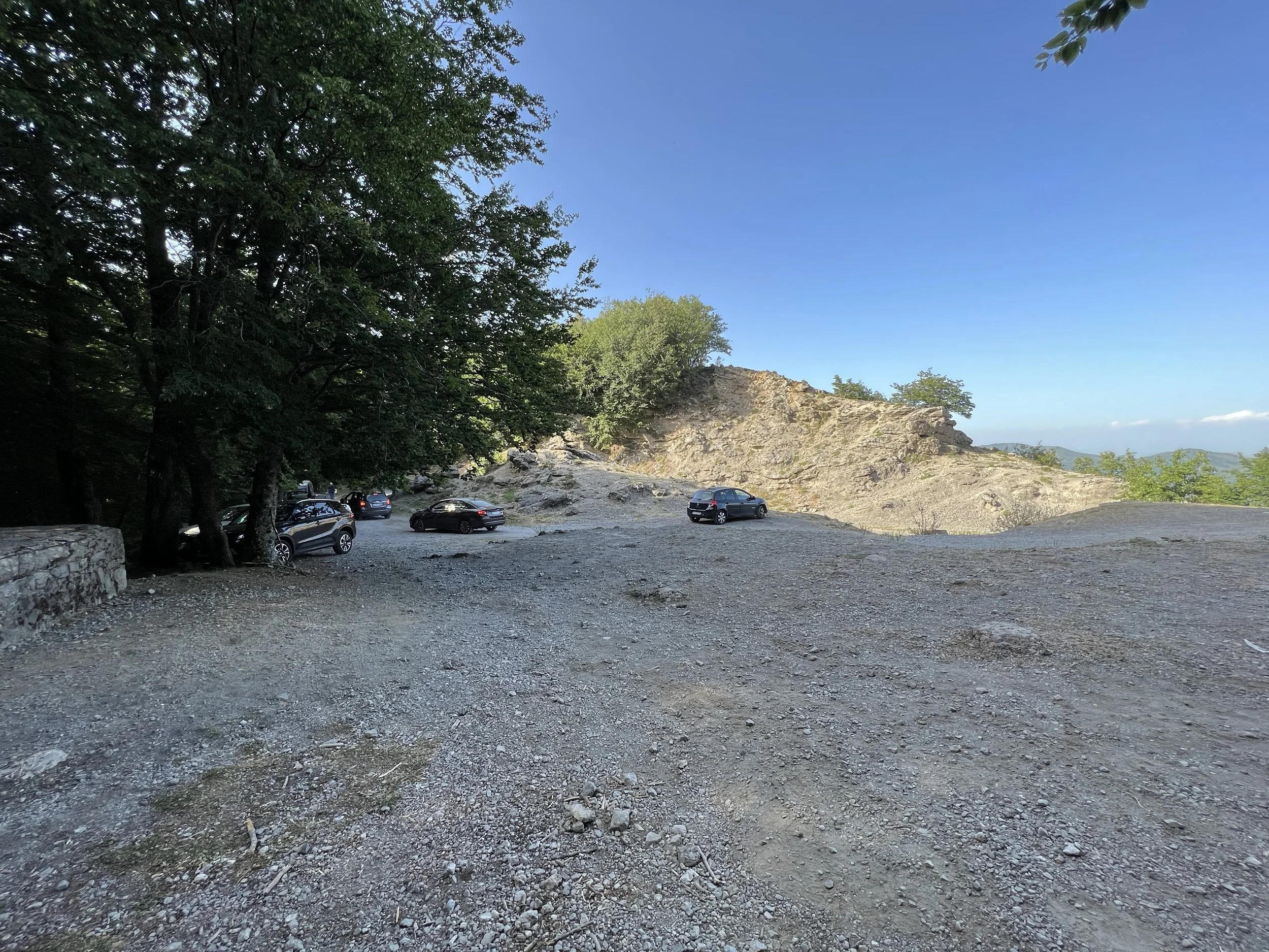
The easiest way to get here is to drive up through the switchbacks of Monte Faito to the parking area (coordinates 40.655850, 14.497733) and begin the walk from there. The drive is lovely, if a bit long and winding, and progresses up through a series of steep bends through a dense beech forest. The parking area is quite large and, though there are no facilities, it’s much more straightforward than most of the parking ‘areas’ on the Amalfi Coast.
Do note that you will require chains in the winter, as it is a mountainous road at over 1400 metres and the snow can be surprisingly heavy at times.
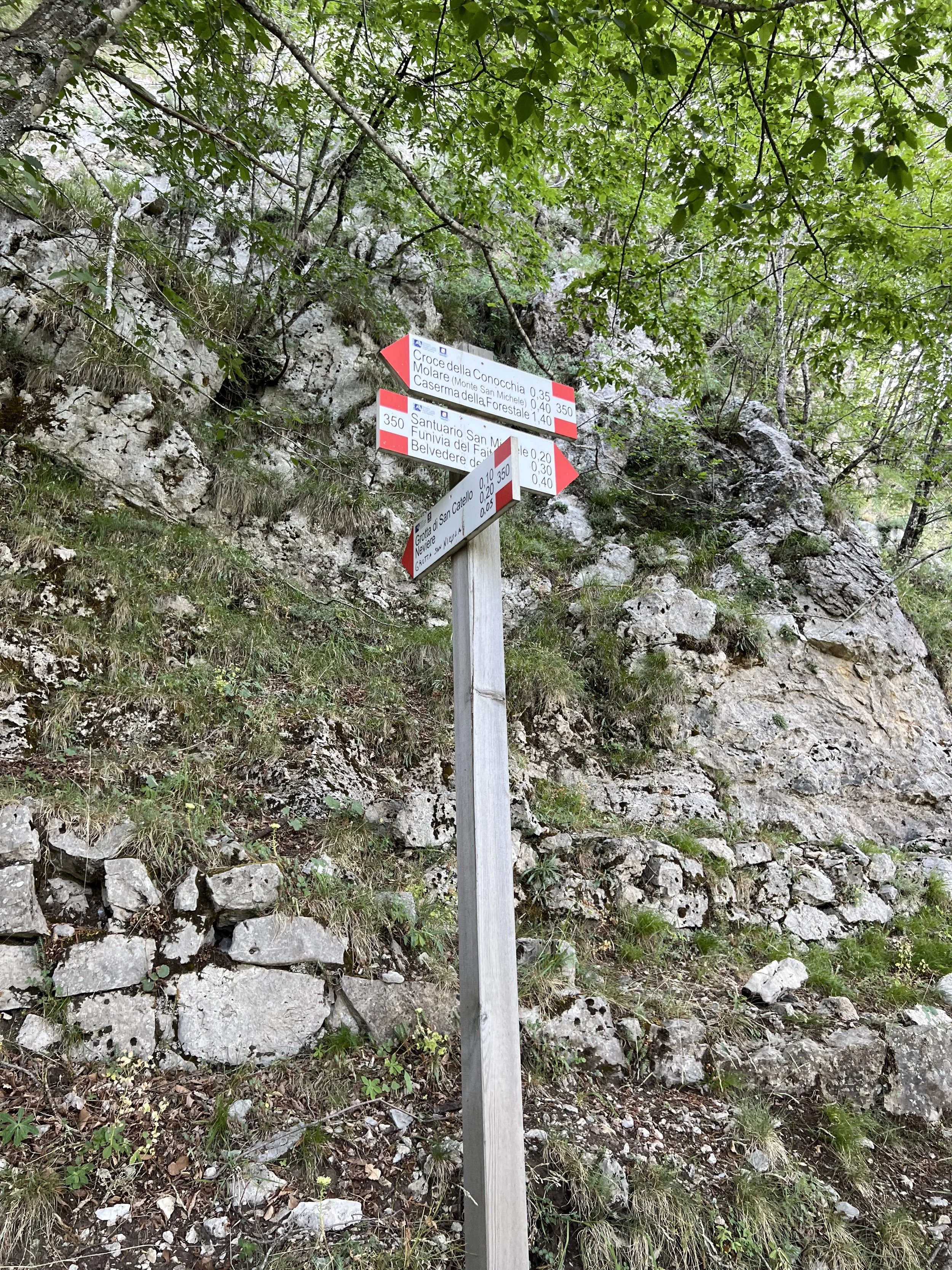
Signage and trails
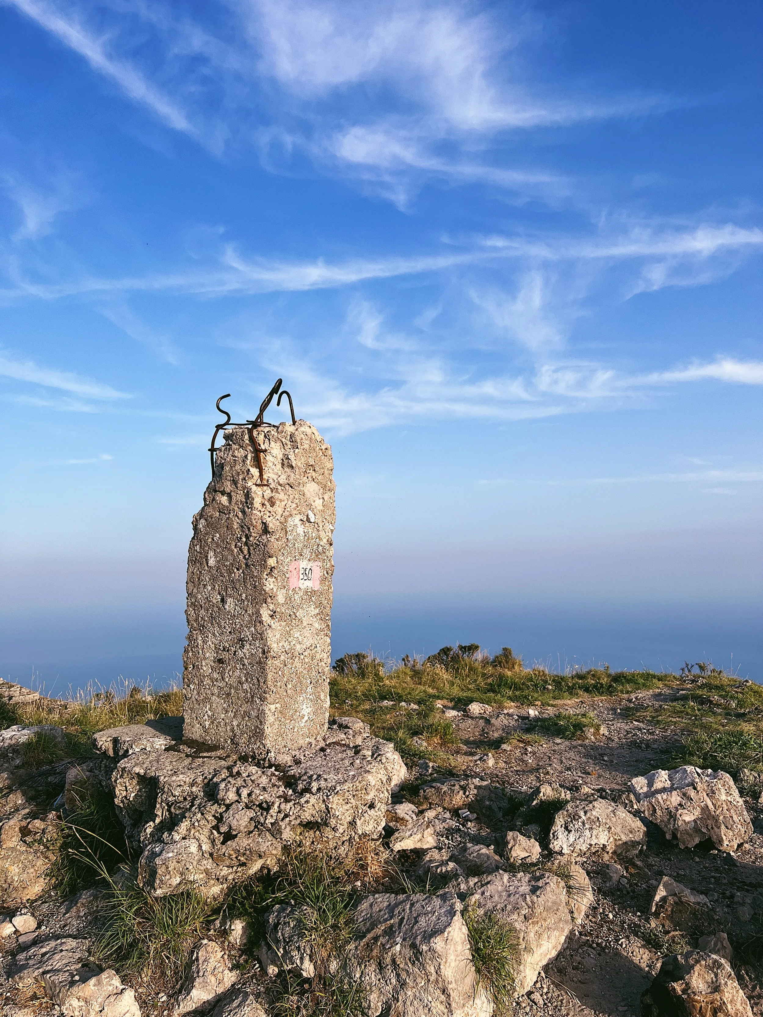
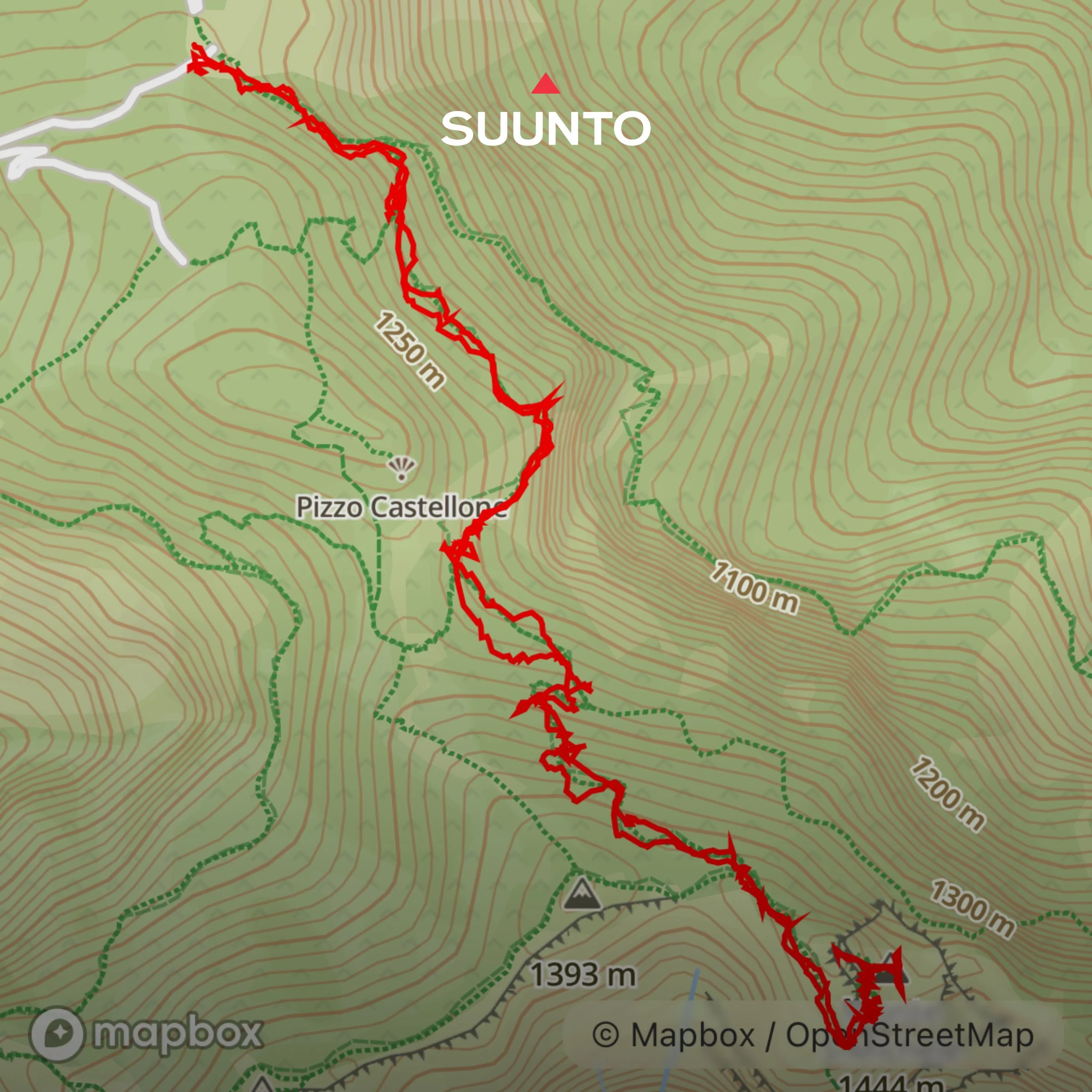
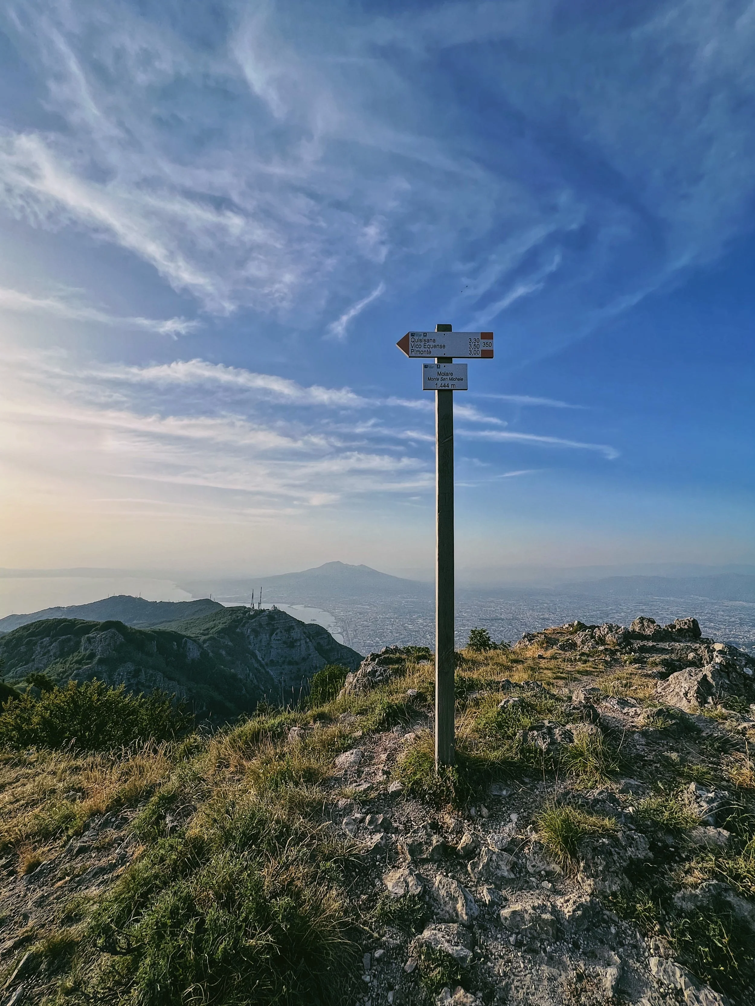
The trails are relatively well marked by the standard red and white CAI markings, with a mix of signposts, painted rocks and tree stumps. Some are faded, and in some places there are long stretches without a marking, so you need to keep your wits about you and stay on the well-defined trail rather than take any side trails, or there’s the possibility of getting lost. The trail is here the Monti Lattari 350.
Note that the route up to Molare heads downhill away from the defined track over the ‘Acqua della Sorchie’ natural spring, which is rather loose and undefined until you see the trail leading off to the right.
Route
There are a number of ways to get up here, this is the easiest and most straightforward route. Some people choose to walk up from Agerola - the village that also serves as the start of the Path of the Gods - though this is much harder and takes at least five hours through often poorly maintained trails. By driving up to the parking area at Porta di Faito you can enjoy the cool stillness of the beech forests on the slopes of Monte Faito as well as the easiest route up to the Amalfi Coast’s highest peak.
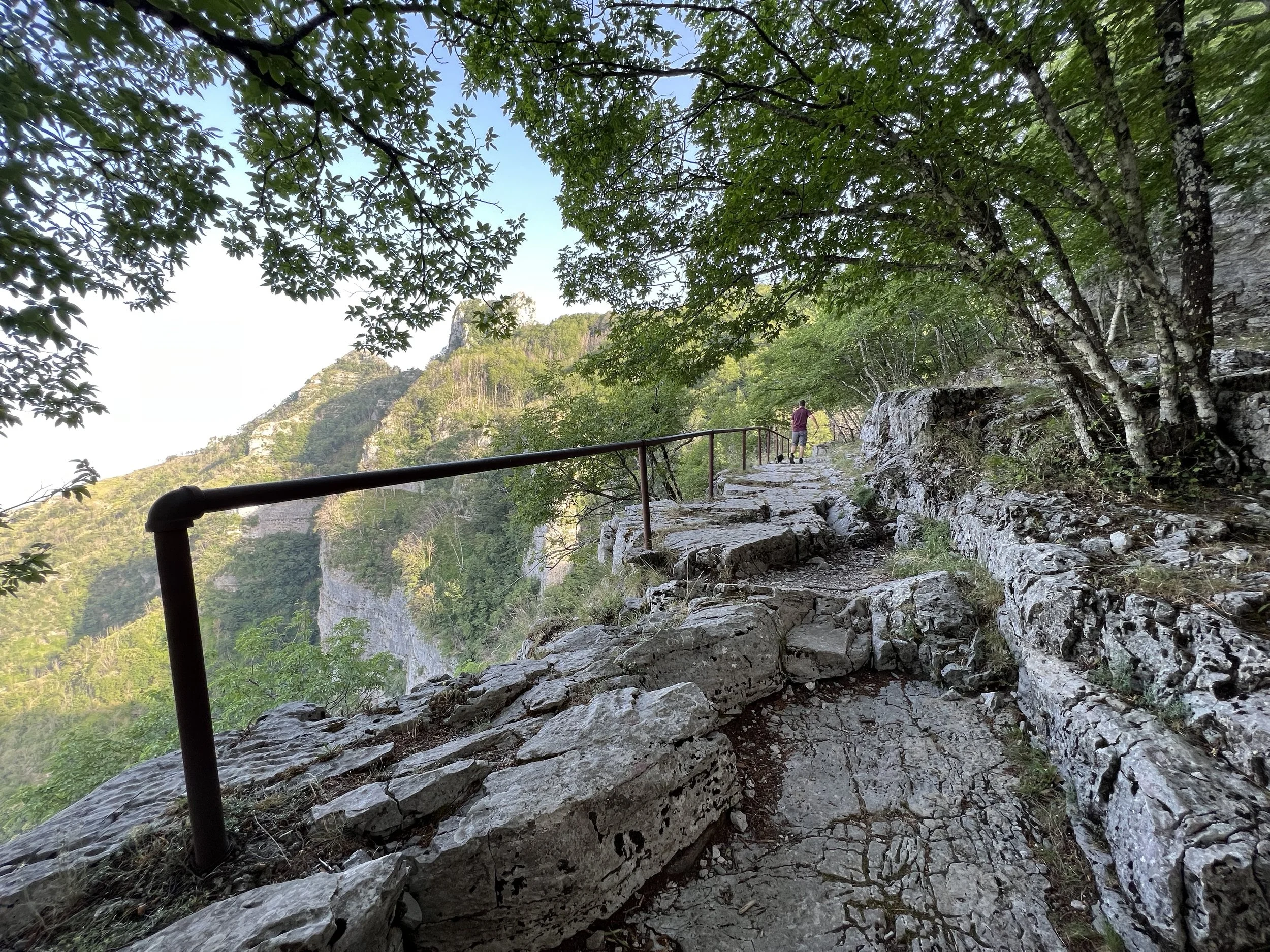
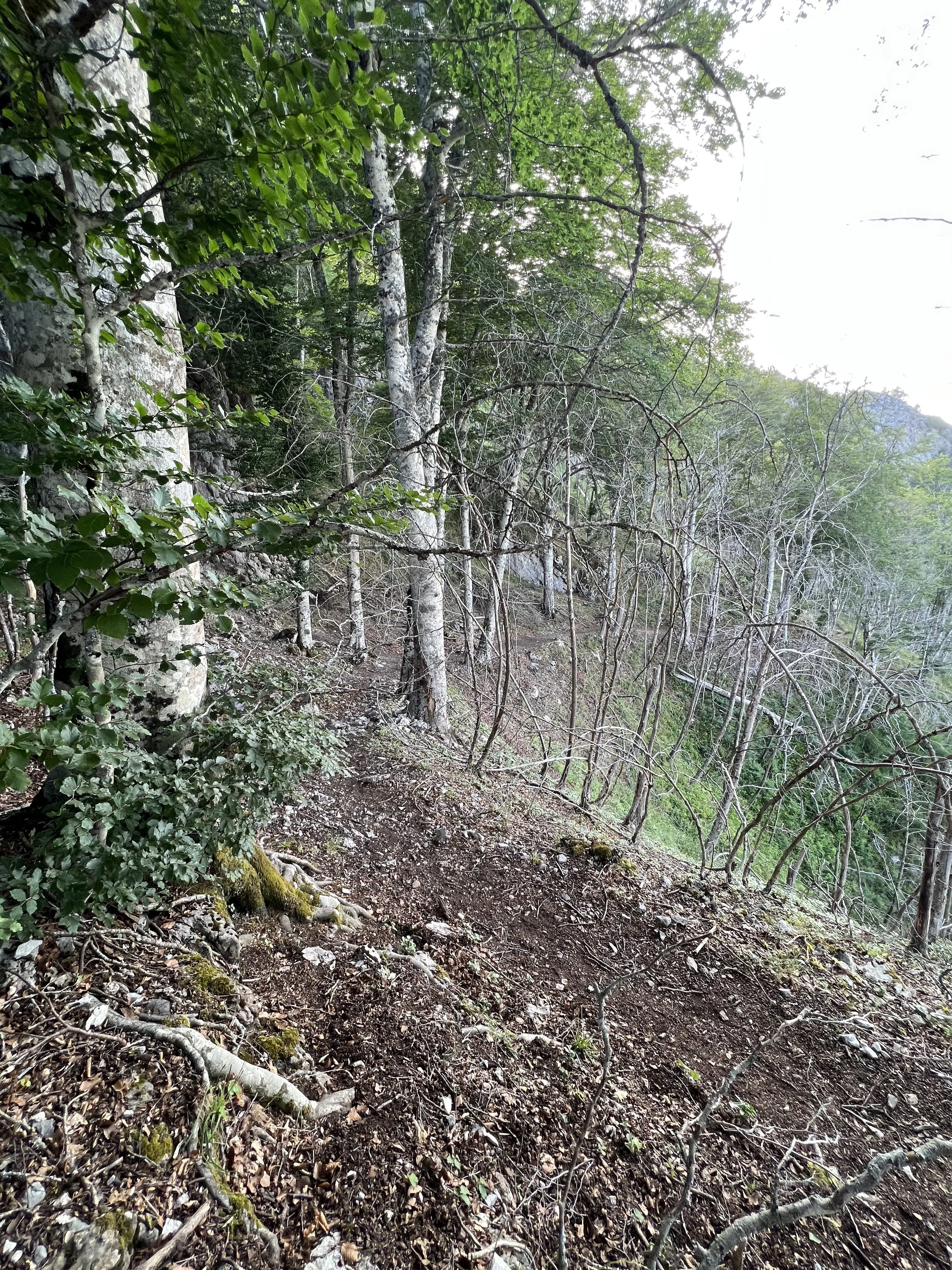
Park in the rough gravel car park at Porta di Faito (coordinates 40.655574, 14.497854). Ignore the prominent track that leads up through the trees and instead head downhill, where there is a prominent sign saying ‘Sorgente’; this is the path of the Acqua della Sorchie natural spring, so it goes without saying that it gets wet and boggy in the winter. You will pass an old bathtub (used as a trough for the goats that graze here) and after a lumpy section, pick up the path which leads off to the right through the trees. Ignore the signs pointing up to the right to the Grotta di San Catello, as this is currently inaccessible. Follow the defined dirt track uphill until you reach a sharp right-hand bend; if you get to the ledge you’ve gone too far, so retrace your steps and skirt uphill across a short section of stones and exposed roots until you reach the ledge further along, this time with a protective hand rail. Continue uphill following the distinct path.
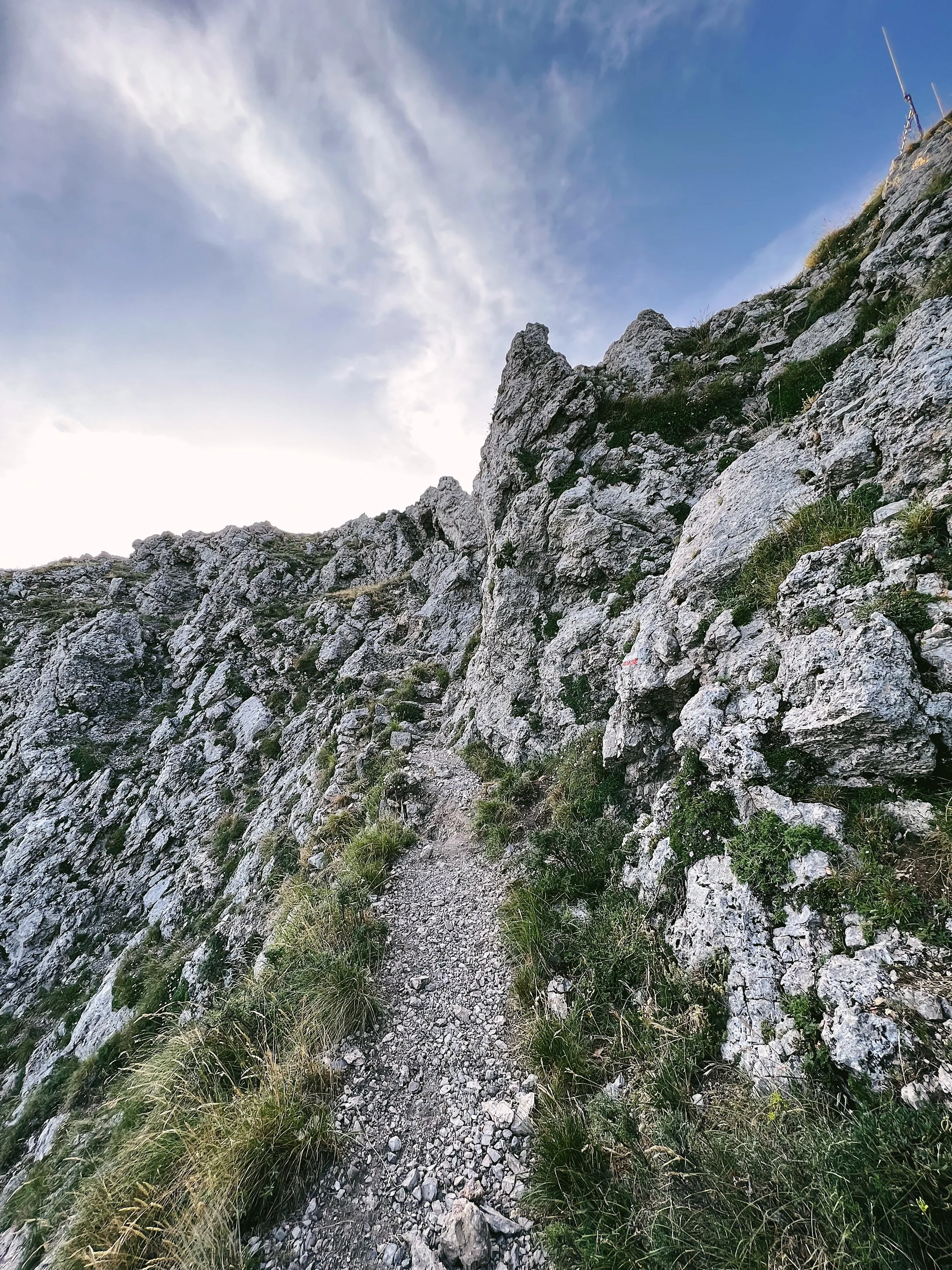
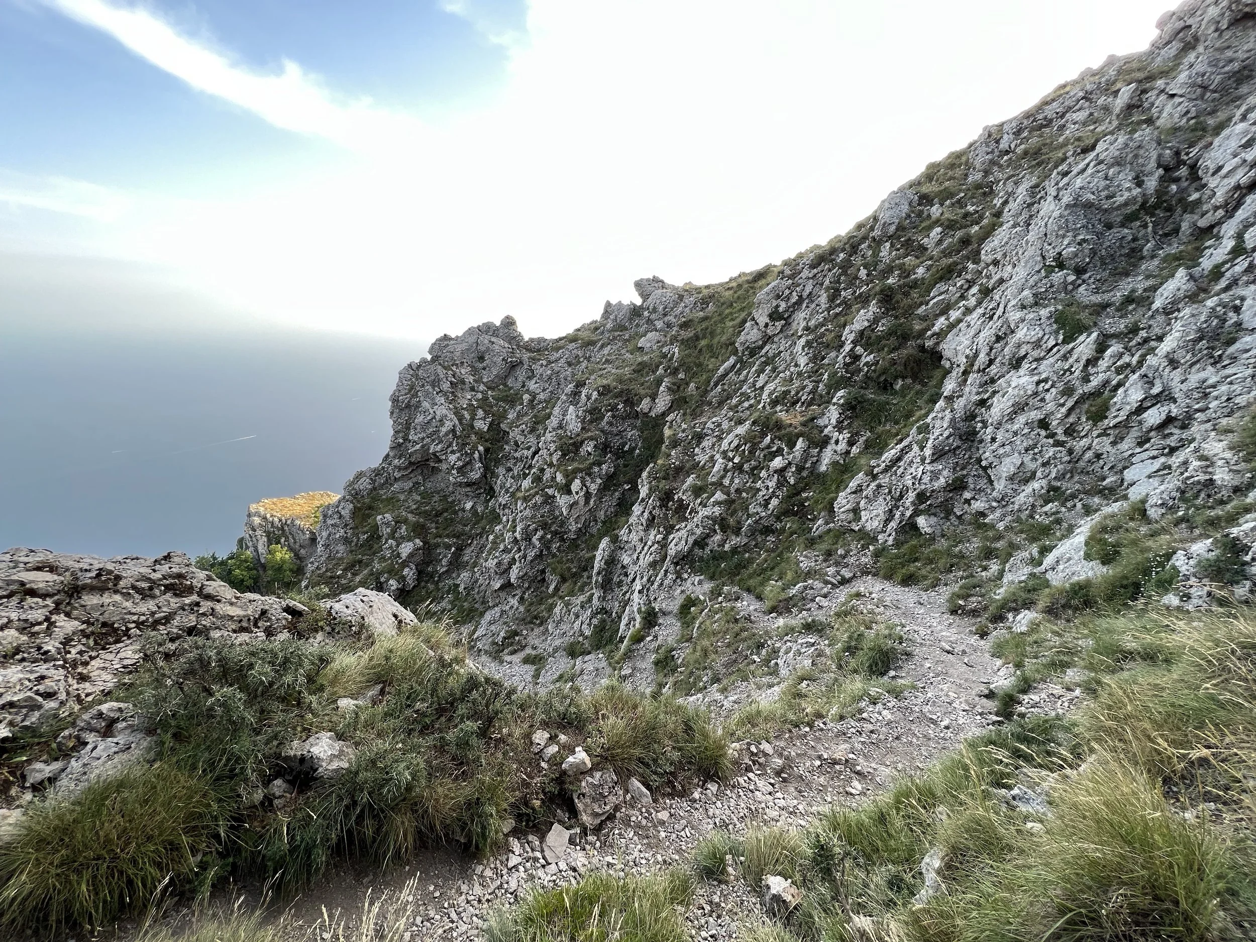
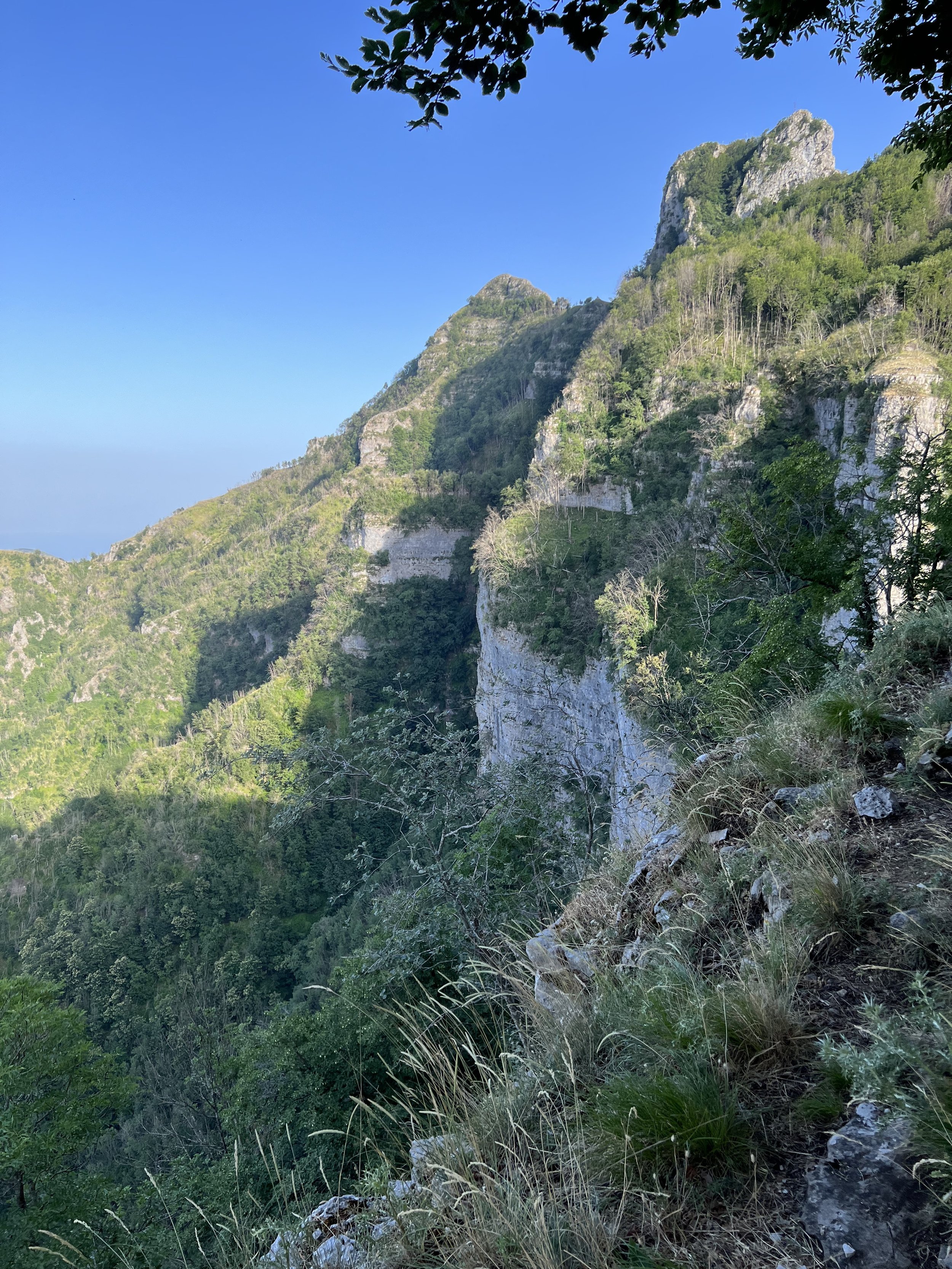
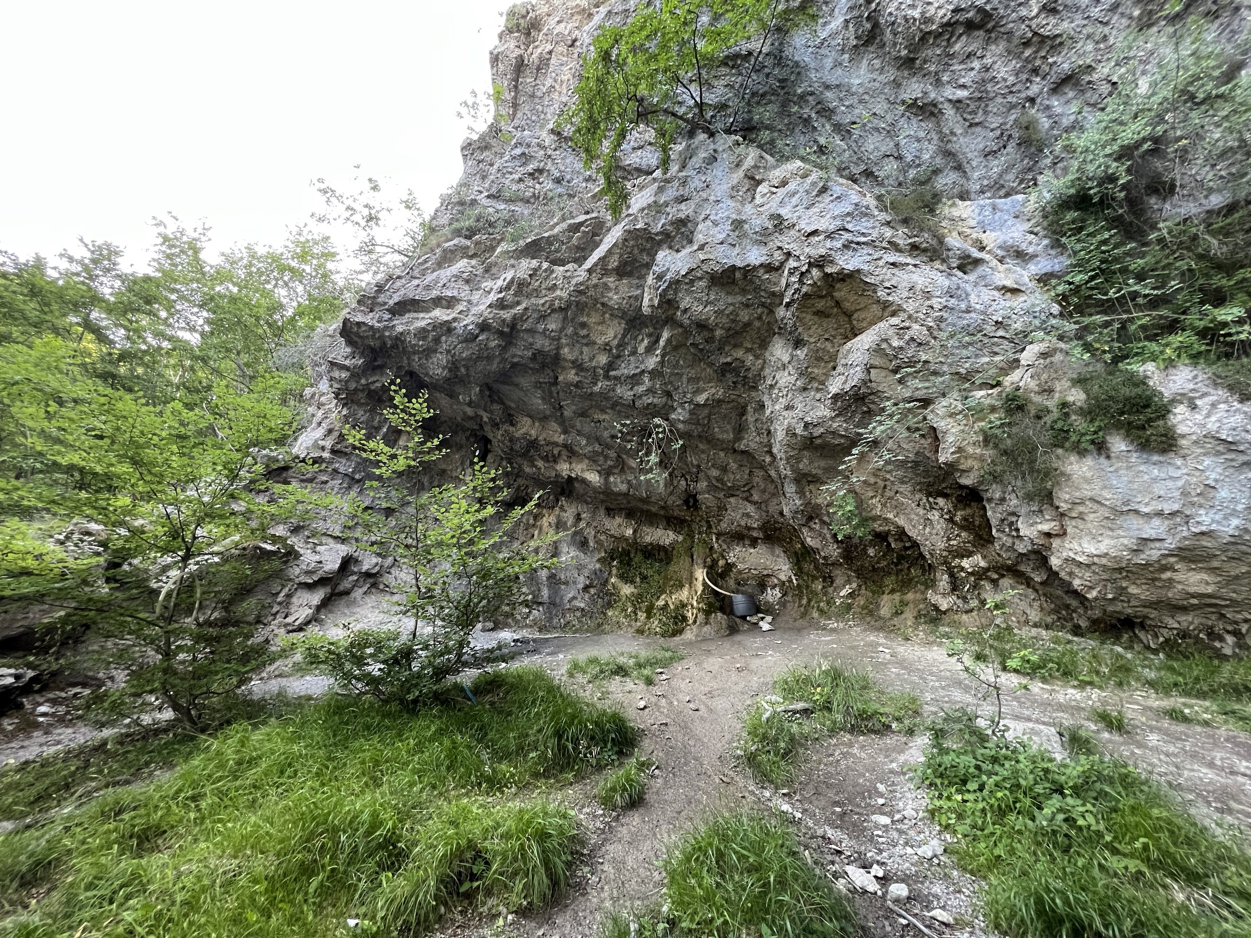
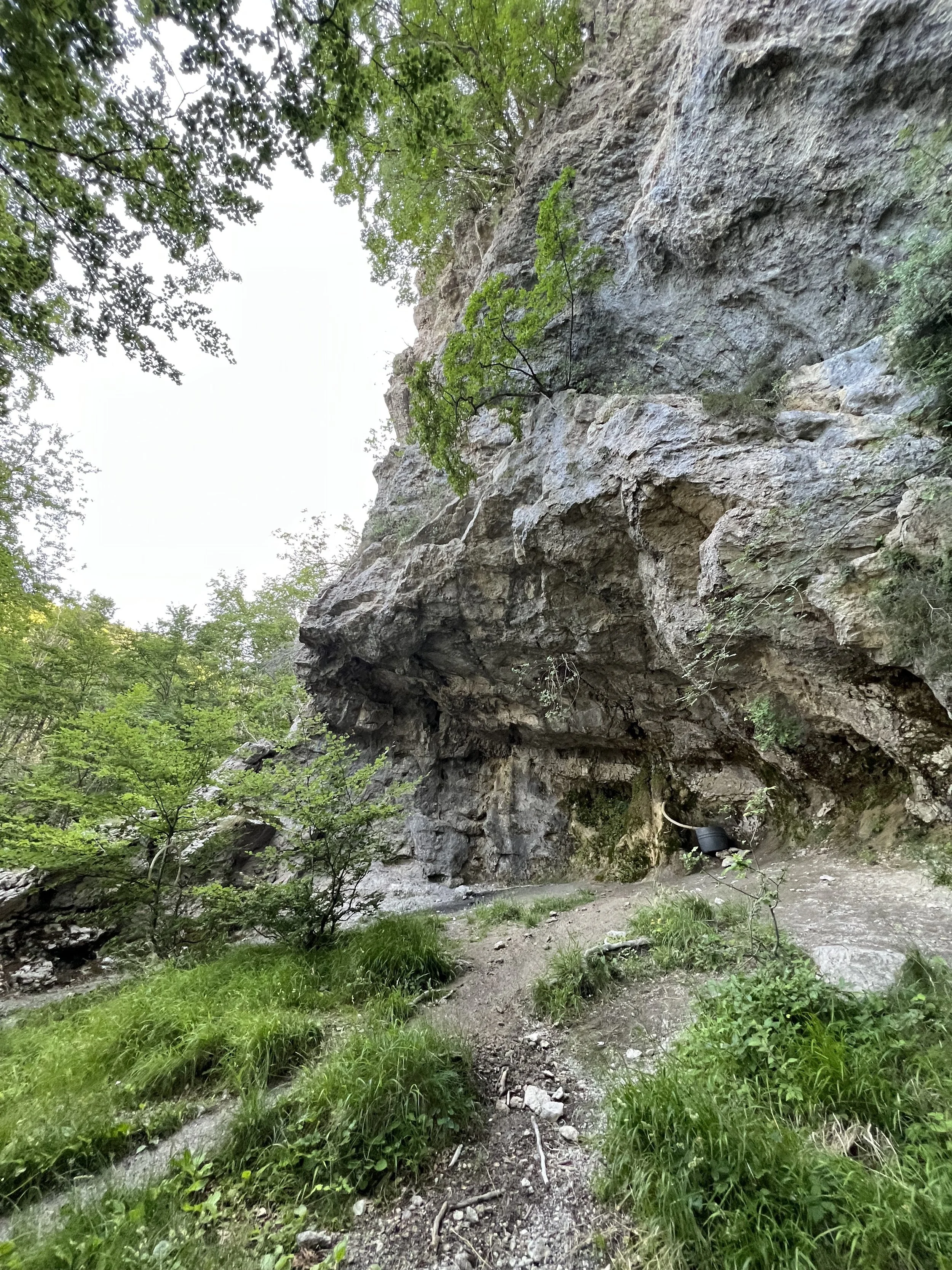
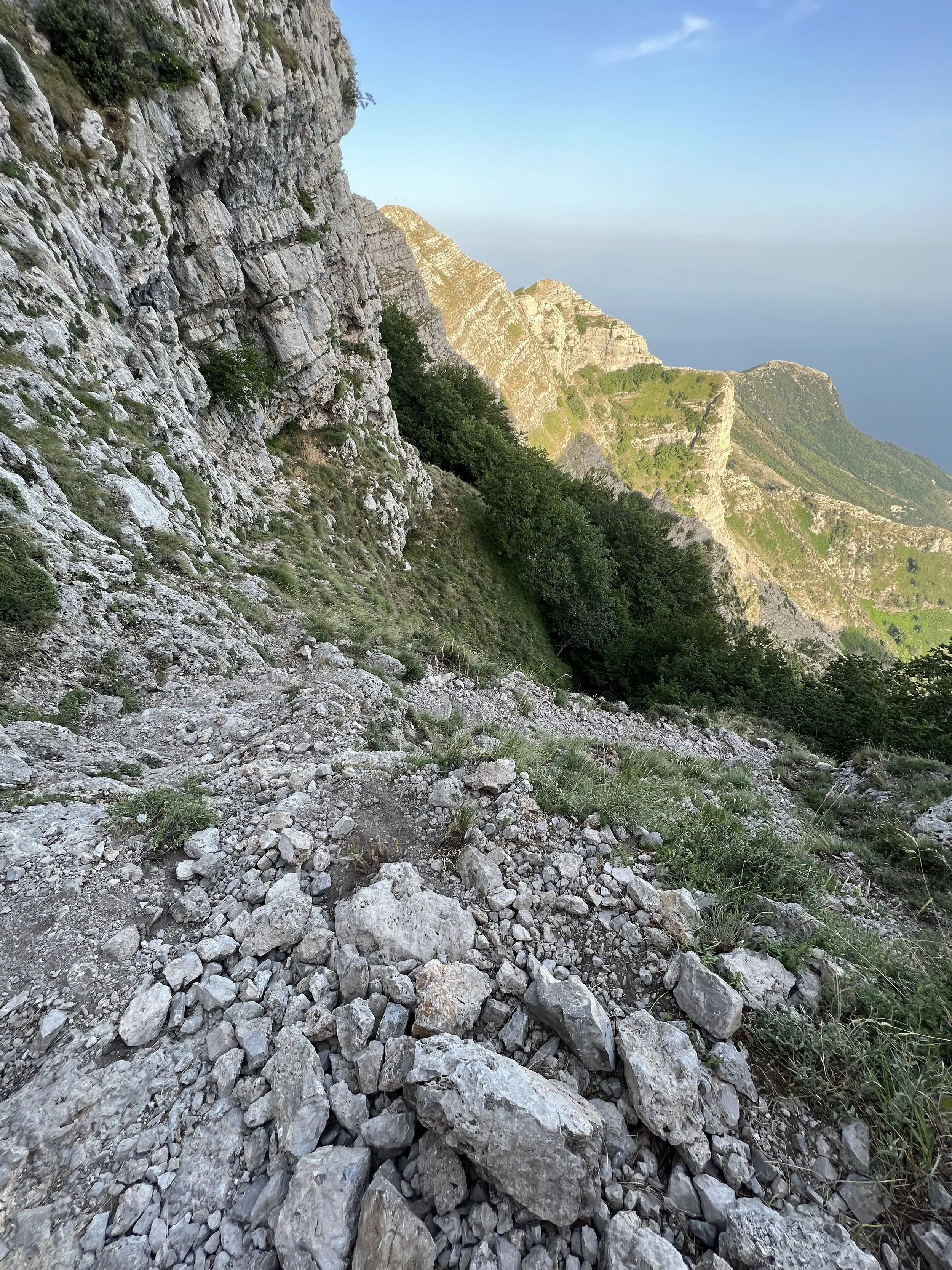
You will eventually reach a clearing area with cliffs to the right-hand side. There is a small sanctuary with a picture of the Madonna and a large black bucket fed by a hose, which collects the water that runs through the rock. The route passes the cliffs and proceeds uphill, marked intermittently by the usual CAI white and red markings painted on rocks, trees and signposts. You will pass a picnic area on the left before the path turns steeply uphill through a number of large rocks to emerge at a clearing, where you can now see the Amalfi Coast and out to sea. Turn left and follow a stony single track that hugs the mountainside and then turns steeply uphill via a series of very loose switchbacks - make sure you have your hands free at this point as you may need to scramble in places or pull yourself up.
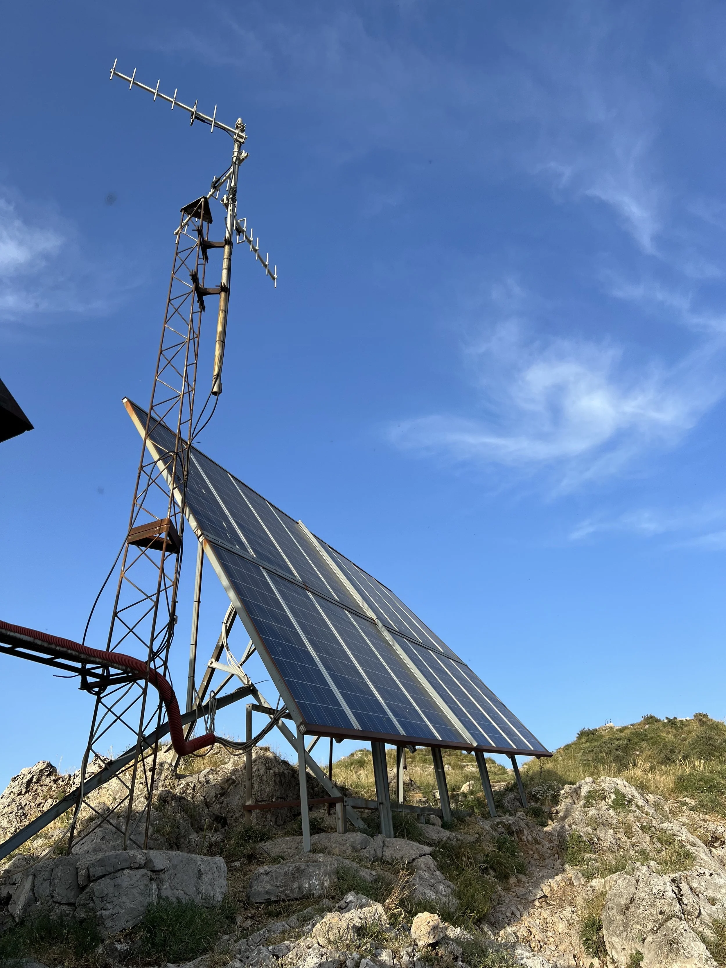
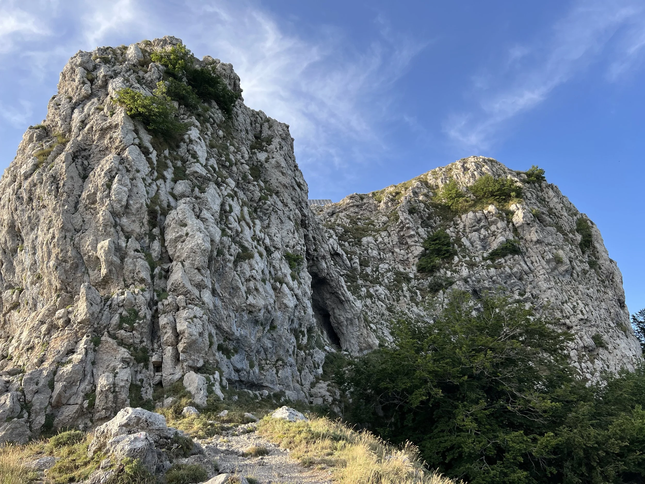
The trail comes out between two peaks: to the left, the peak looks out to Chiesa di San Michele, Vesuvio, Naples and Castellamare di Stabia on a clear day. To the right, you’ll go up past a communication tower, a small shelter and a large bank of solar panels to the ‘true’ summit, Monte San Michele, at 1444m. Enjoy the stunning views across the Amalfi Coast and all the way down the Sorrentine Peninsula to Capri.
Retrace the same route to return to the car.
Food and drink
There are no facilities at the parking area, but there are a number of restaurants and refuges on the road up to Monte Faito which always seem to be fairly busy, including some prominent restaurants on the outside of the switchbacks which have impressive views. There are plenty of options down in Vico Equense which has shops, bars and restaurants to suit all tastes.