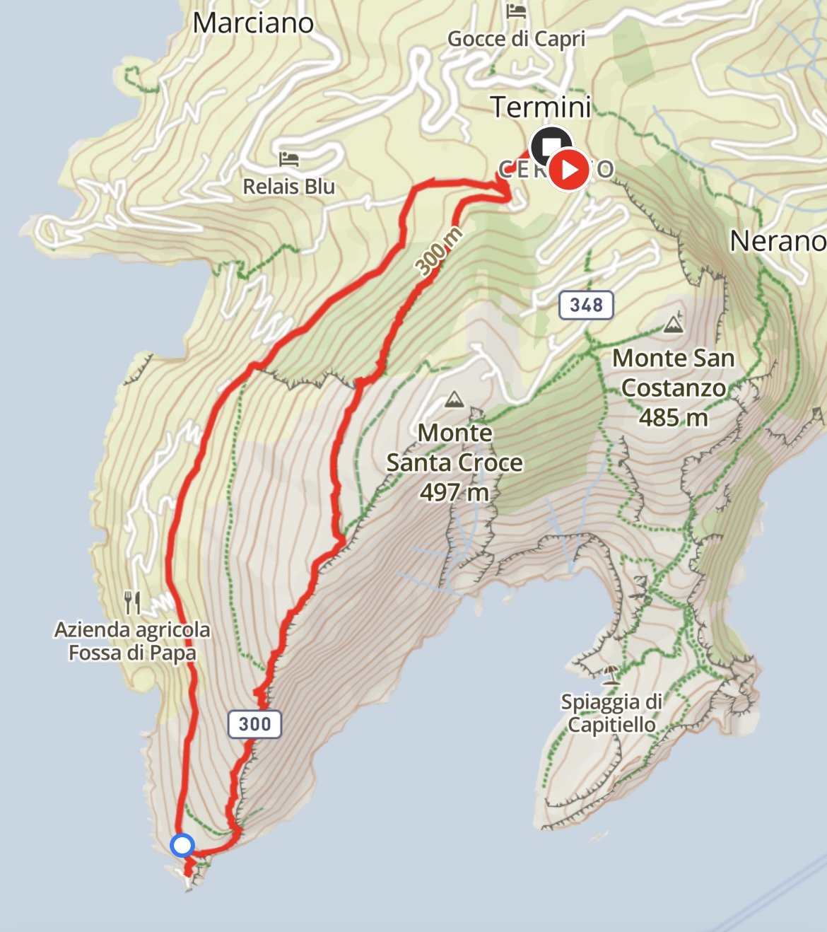
PUNTA CAMPANELLA
Length: 7 kilometres
Elevation gain: 490 metres
Time: Three hours
Parking: On the side of Via del Monte (some spaces are paid, some are free) Coordinates: 40.588513, 14.340408. What3words: ///pleat.grudges.unthinkable
Best time to go: Anytime, though in peak summer try to keep to the early morning or late afternoon as it’s very exposed
Terrain: A mix of wide, paved path and single track trails with some scrambling needed
Level: Moderate. There is a lot of climbing and the terrain is sometimes difficult underfoot
Suitable for children: An out and back option from the cafe to the lighthouse would be more suited to younger children; teenagers will be find with the longer loop
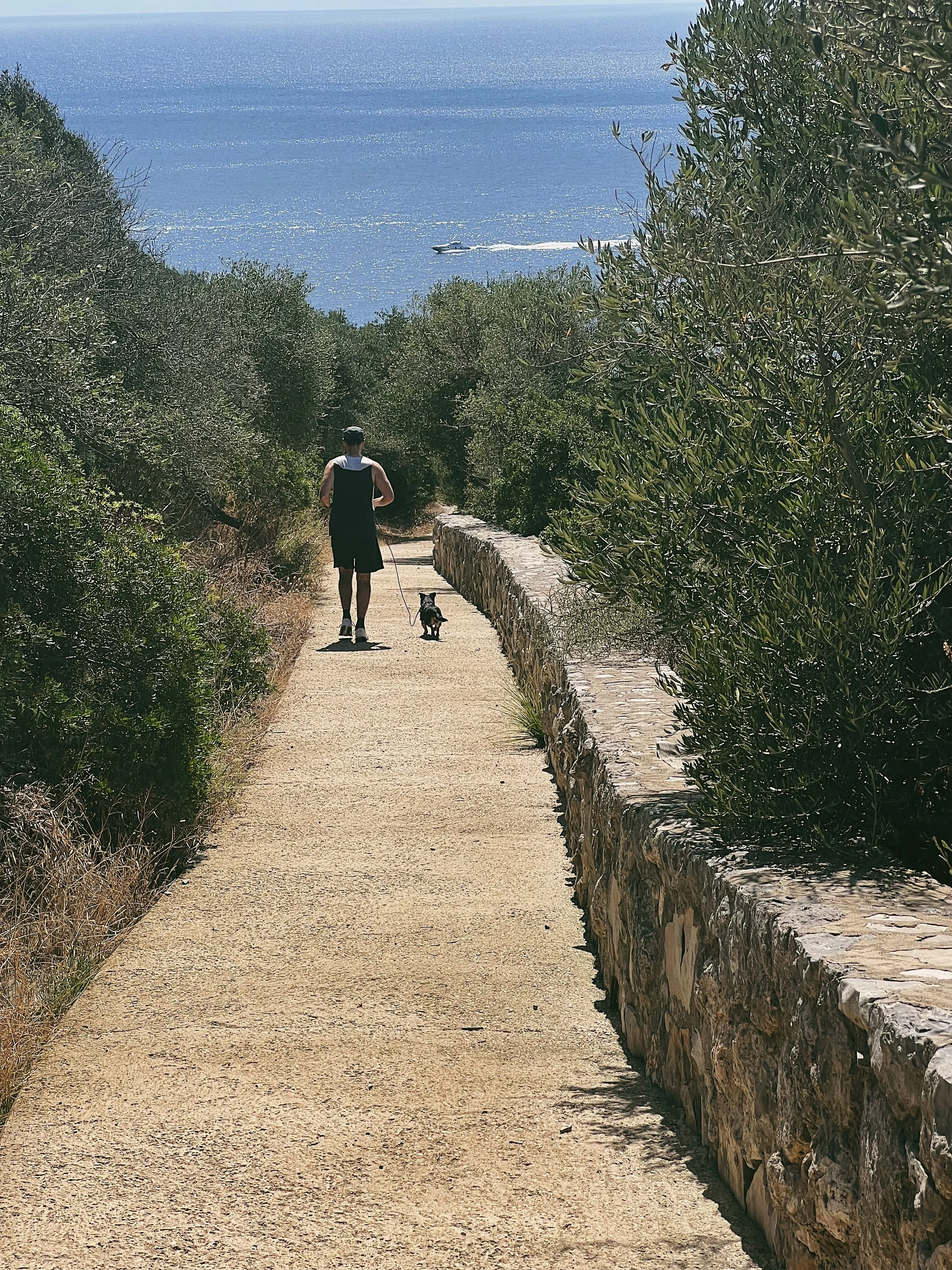
Suitable for dogs: Yes, but watch out for sudden drops down to the sea and scrambling sections
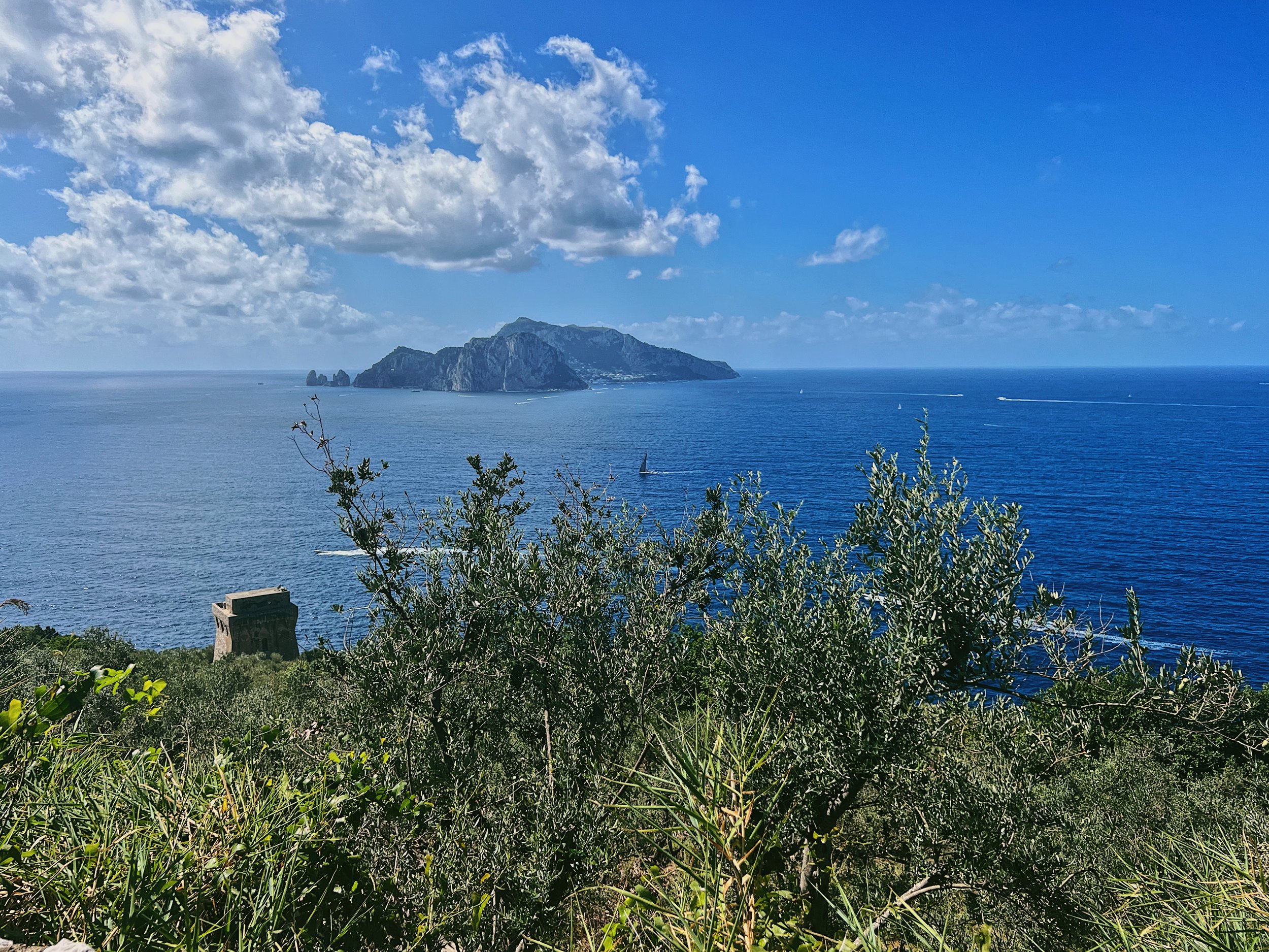
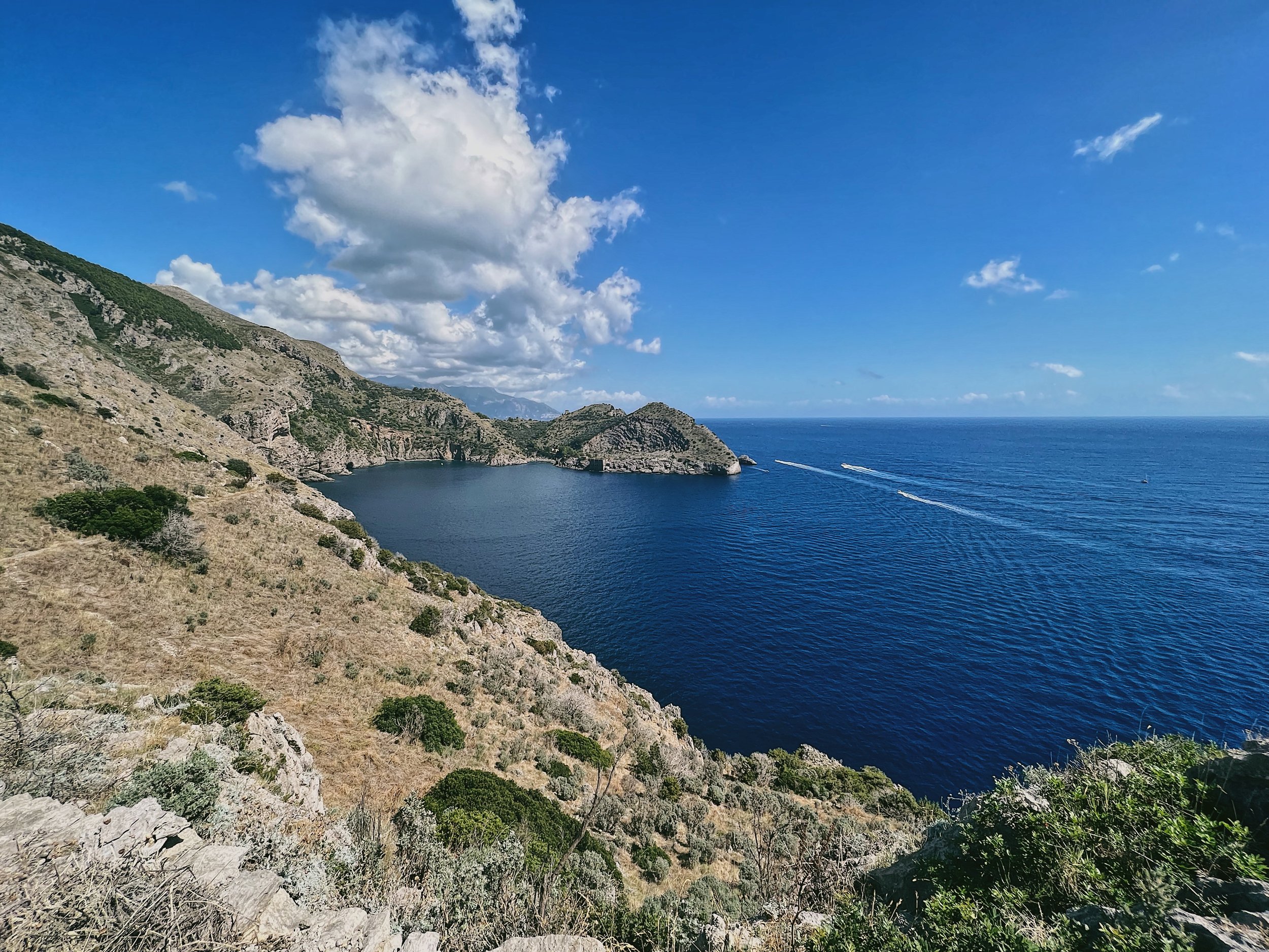
Punta Campanella: dreamy vistas towards Capri and I Faraglioni, on a moderate coastal hike
I’ll first start this introduction off by saying that there is absolutely no shame in doing this hike as an out and back, sticking only to the main path of the Punta Campanella. The first time I did this hike it was as a trail run, on an exceptionally hot September day; there wasn’t a breath of wind and somehow I had managed to forget my extra bottle of water and any snacks. We also got stuck in the typical traffic around Sorrento, adding an hour onto our journey to Termini and making our start much later than planned. Conditions were not ideal. We made it down to the lighthouse and then started the long, slow craggy switchbacks up and over the headland. It got hotter and hotter. The dog was deeply unimpressed. At several points I had to sit down and put my head between my knees. Good, solid Type II fun, but I can’t say that the uphill section back to the start gave us any better views than we would have enjoyed retracing our steps on the Punta Campanella. But I’ll let you decide what’s best for you.
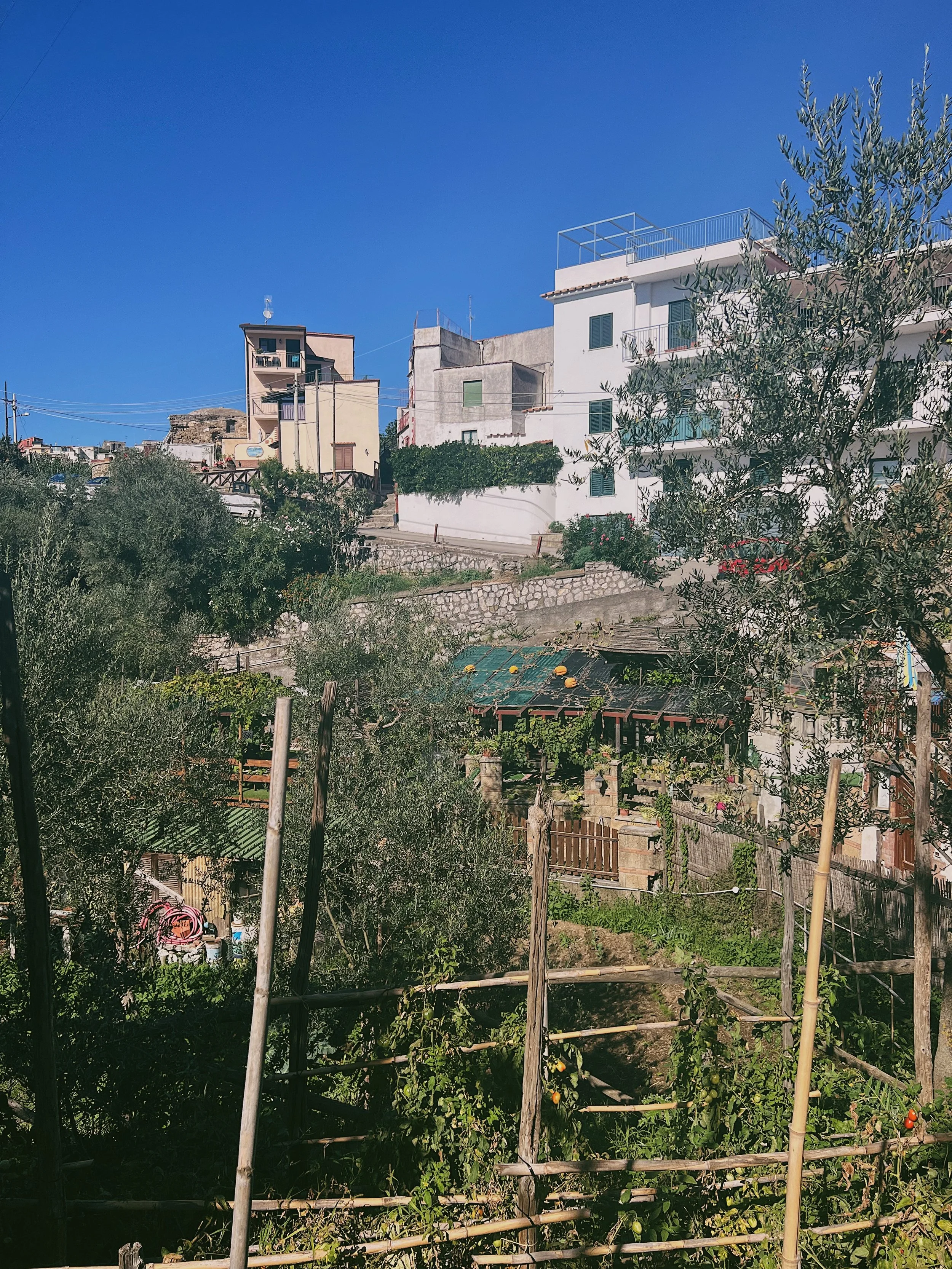
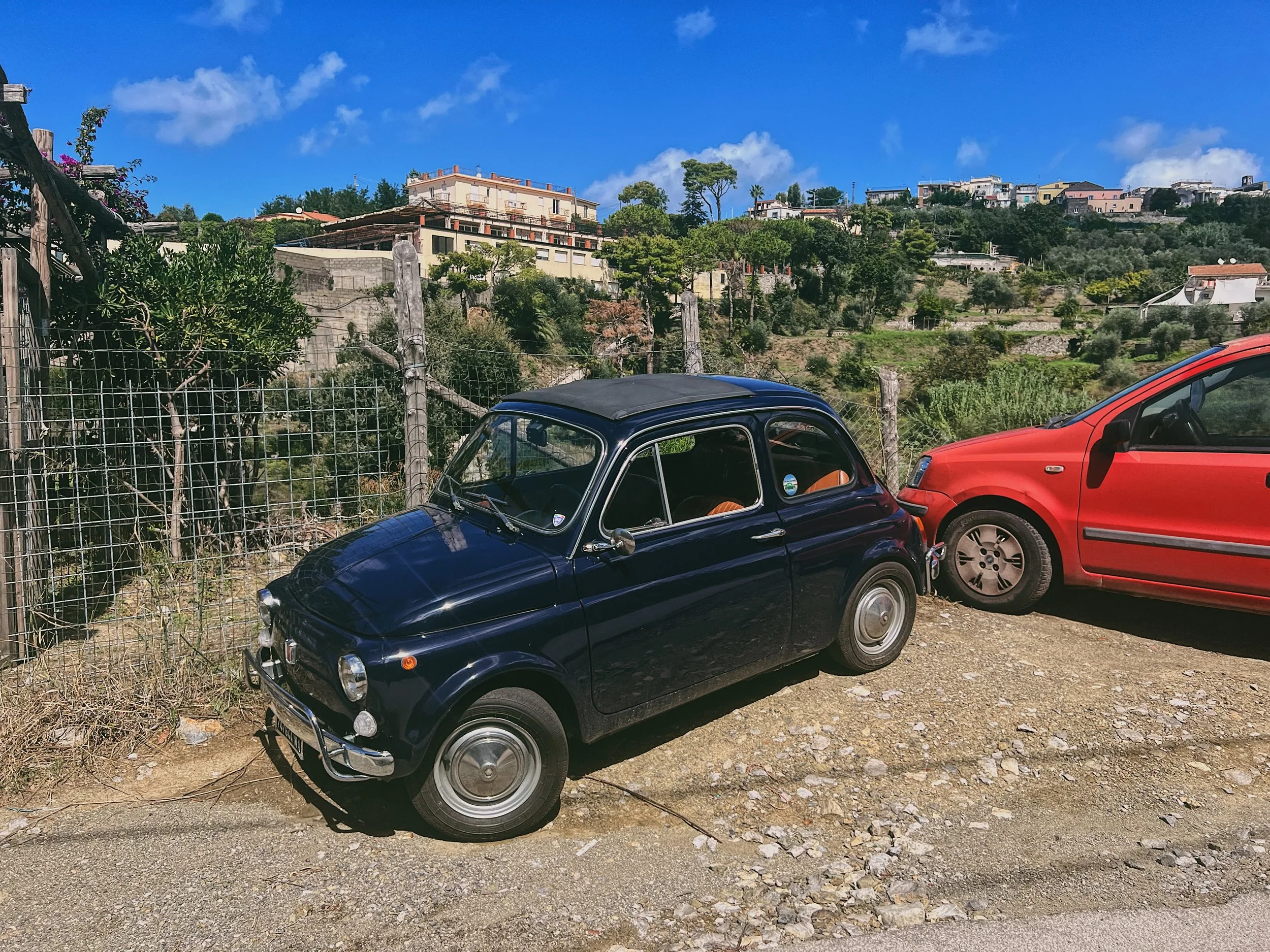
The Punta Campanella is at the very tip of the Sorrentine Peninsula. Access is from the little village of Termini: here you are away from the more touristy parts of the Amalfi Coast, where life feels much more authentic. There are farmers, vegetable patches crammed into every conceivable corner. If it will grow, grow it! Lemons lean over garden walls, pumpkins languish on tin roofs, cars are half rust, half paint job. I am not the biggest fan of the Amalfi Coast, but this part I like. Massa Lubrense, Nerano, Sirenuse, Sant’Anna and Sant’Agata. Names unknown to most, unless they have ventured this far along the peninsula. If you’re not big on heights or crowds, this is a nice alternative to the Sentiero degli Dei.
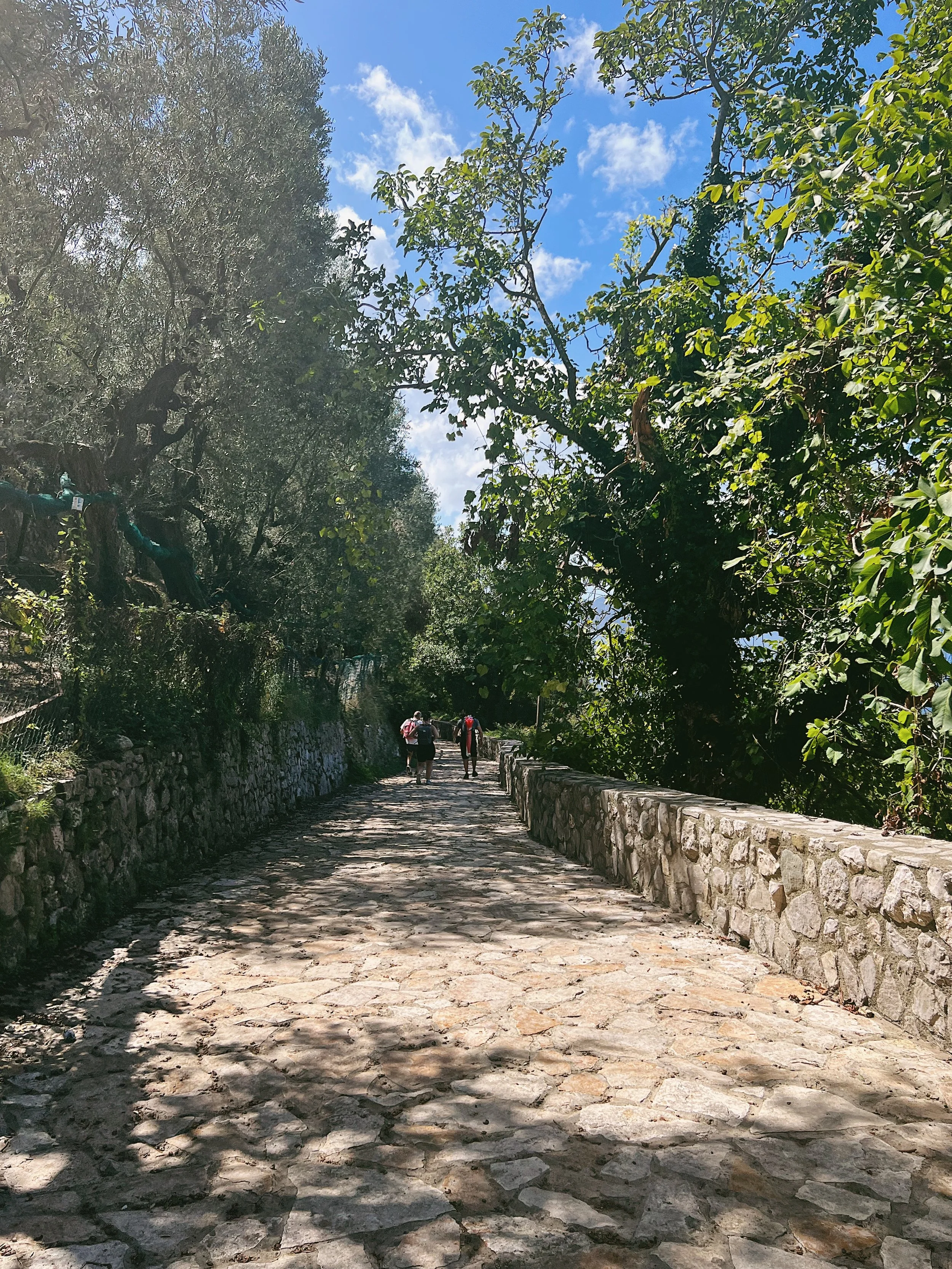
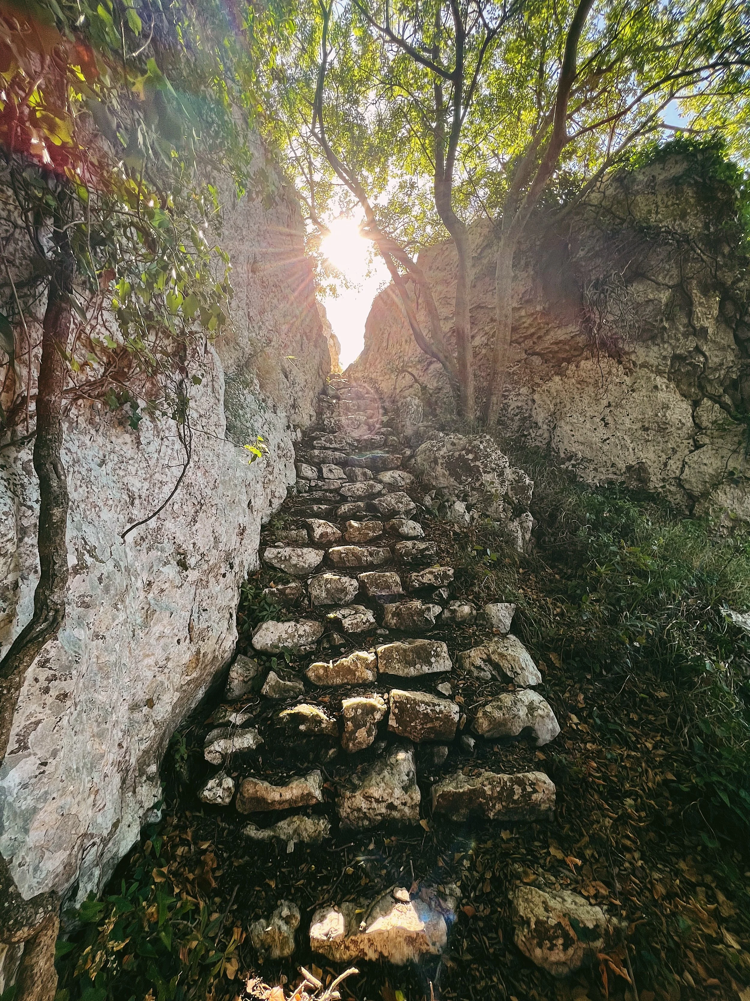
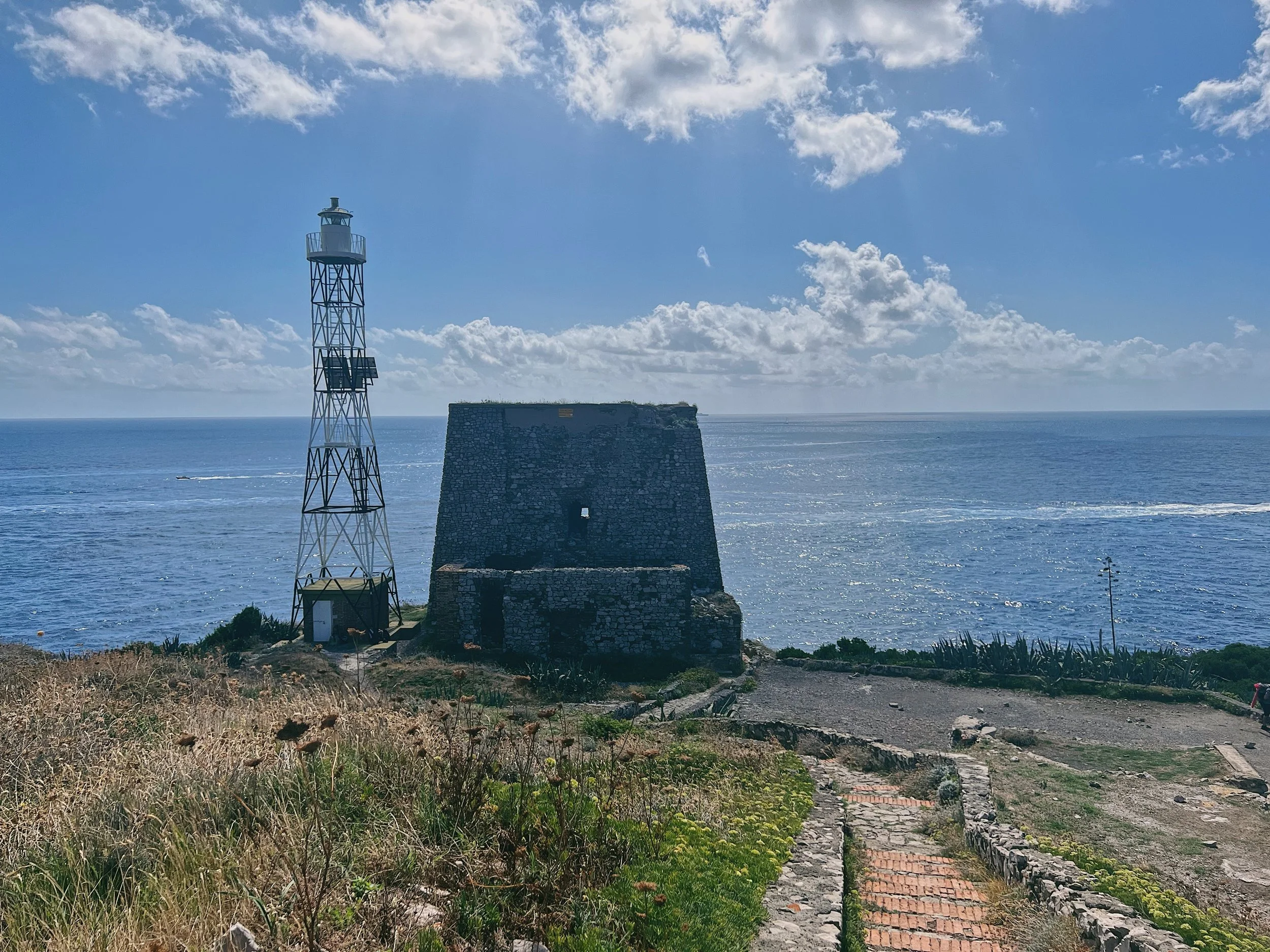
The path is old, like most on the Amalfi Coast, though in recent years it has been paved (though not particularly well maintained in the latter section). It leads downhill, all the way to the tip of the peninsula, passing the crumbling remains of Greek and Roman temples built to worship the Goddess Athena (or Minerva, if you’re Roman). According to Homer’s Odyssey, this is where Odysseus resisted the call of the Sirens, and if you look closely, you can see an Oscan inscription in the stone of the ridge which indicates the landing for Roman ships delivering offerings to the Goddess Minerva. In 1300, a Saracen tower was built at the point, to act as a lookout with a bell that could be rung to warn of incoming danger.
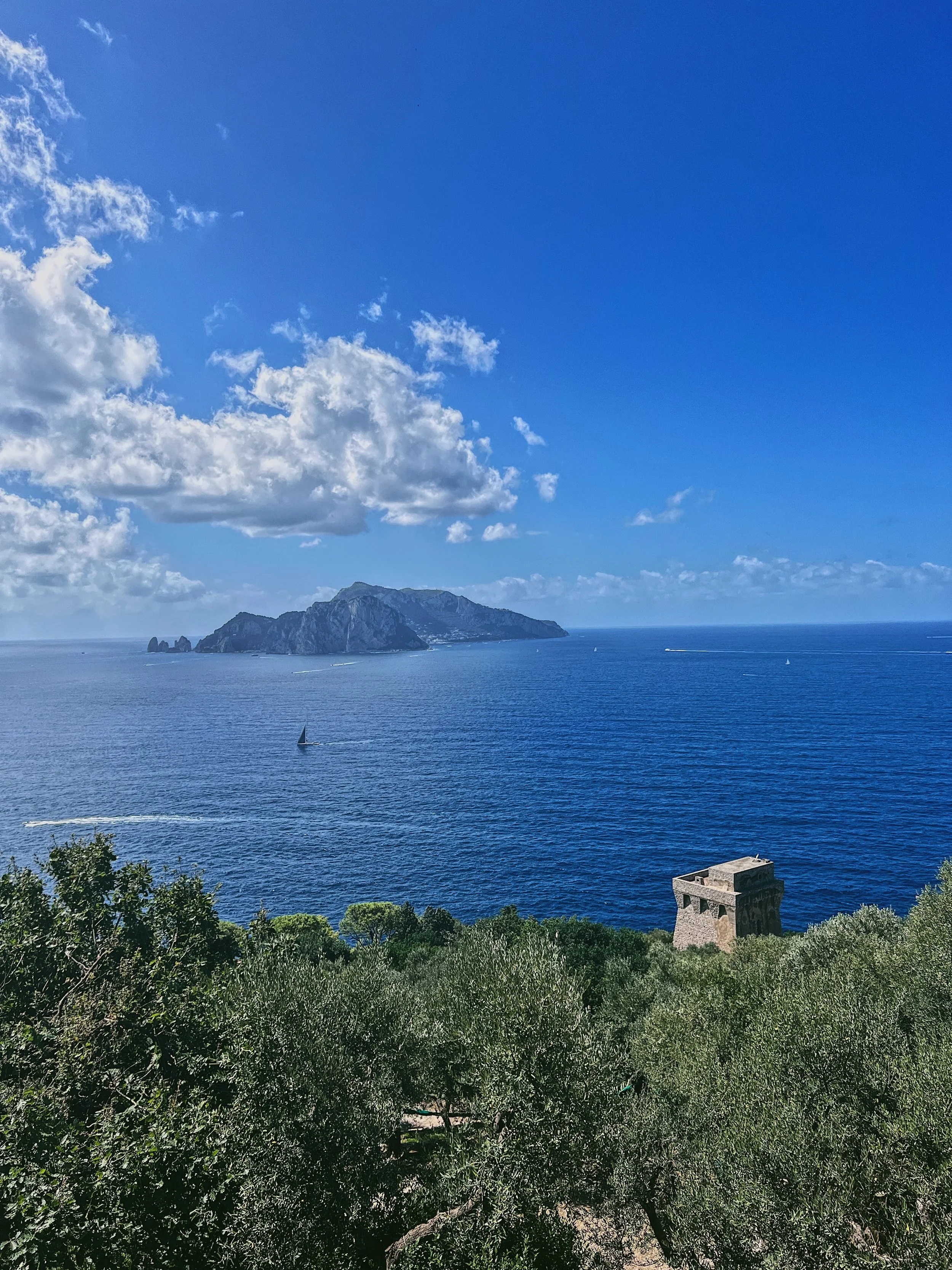
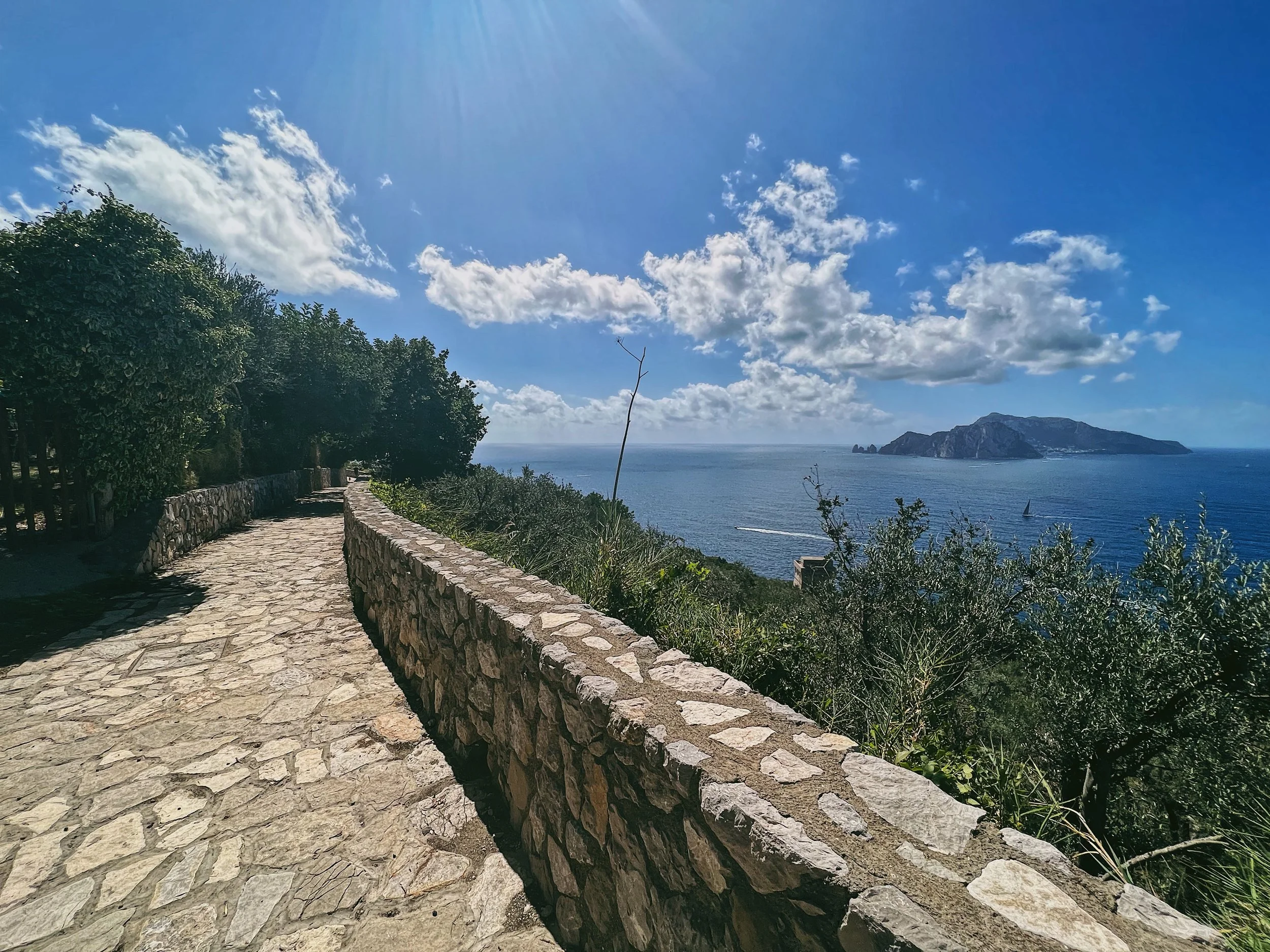
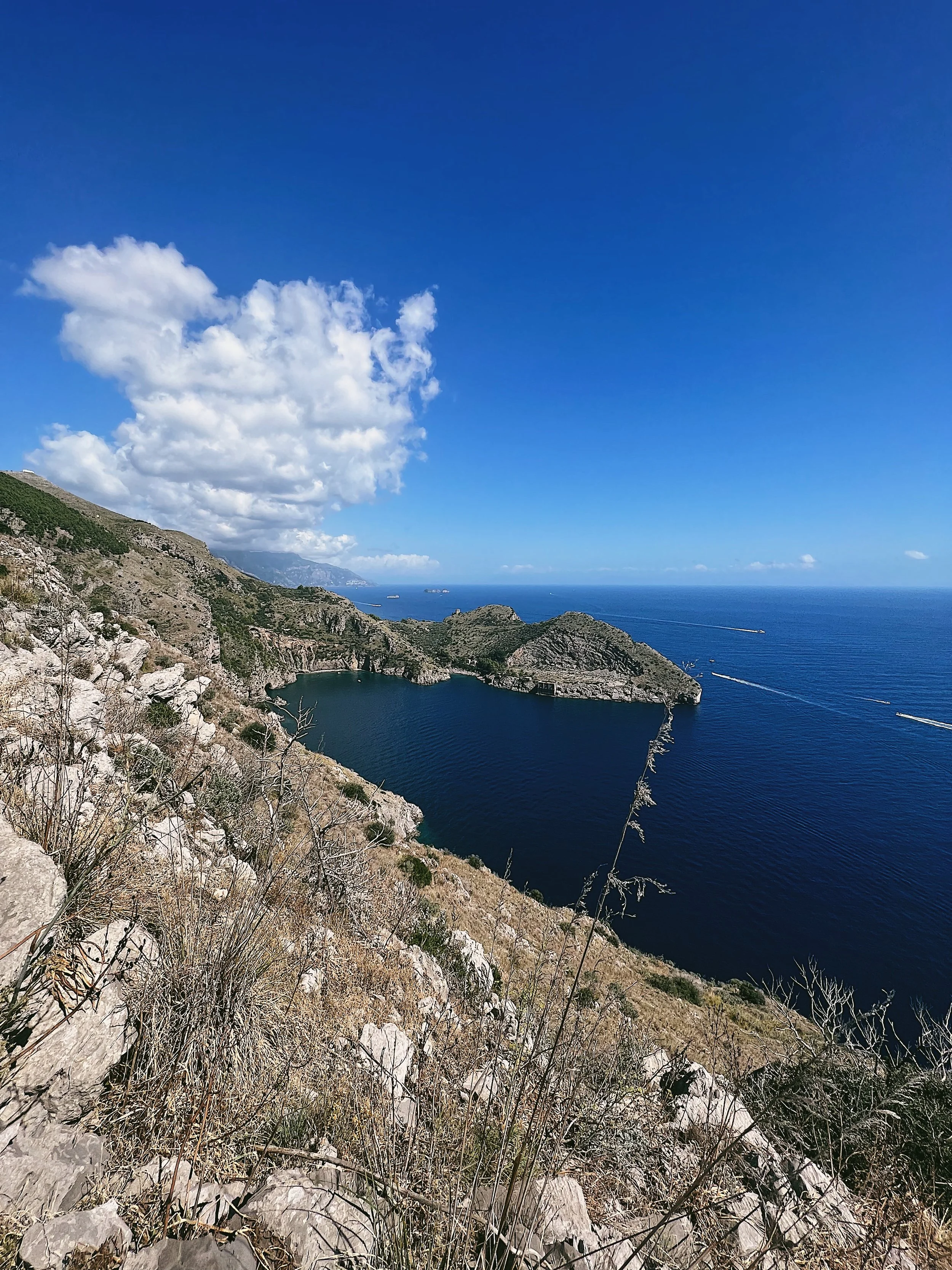
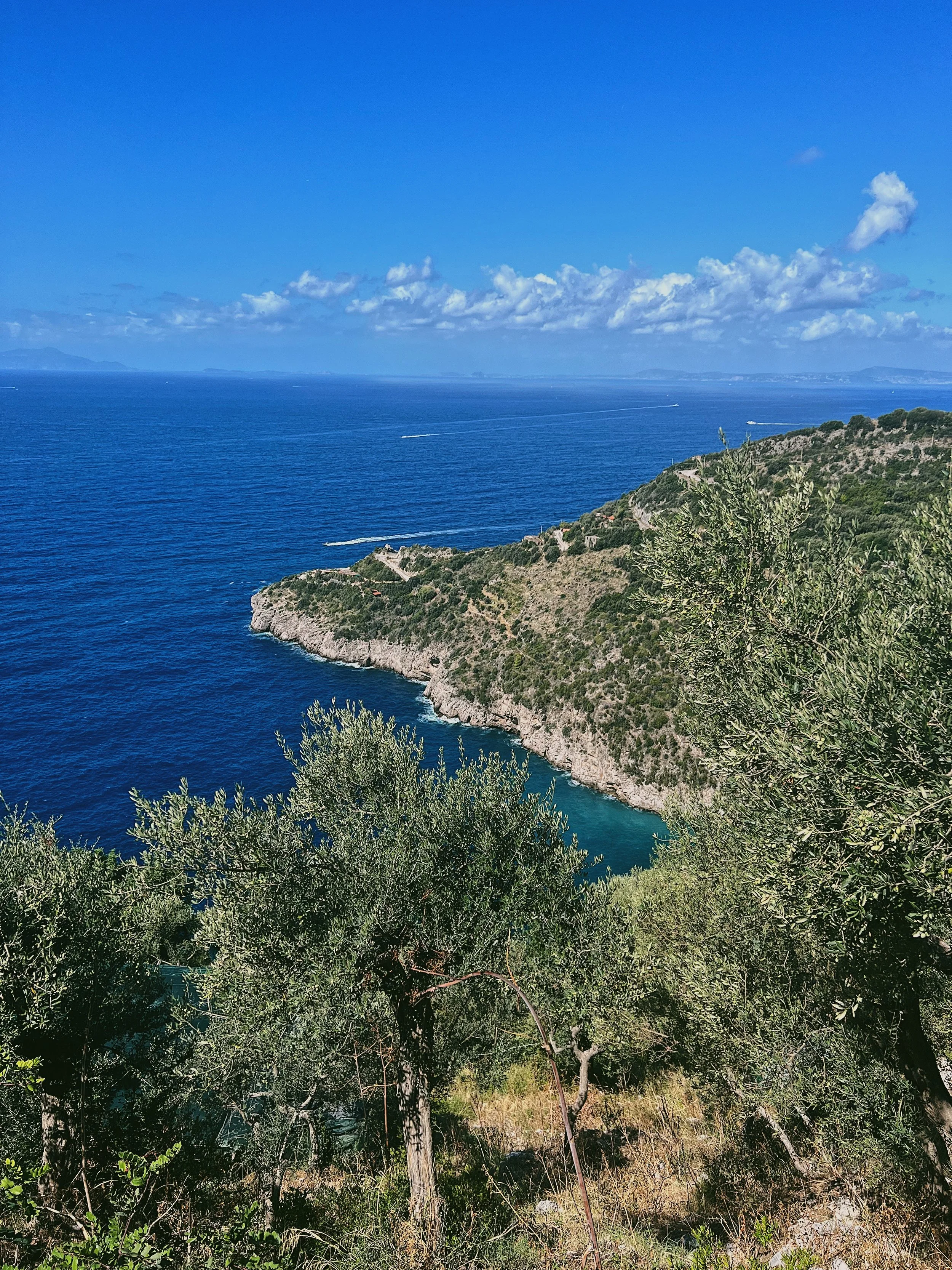
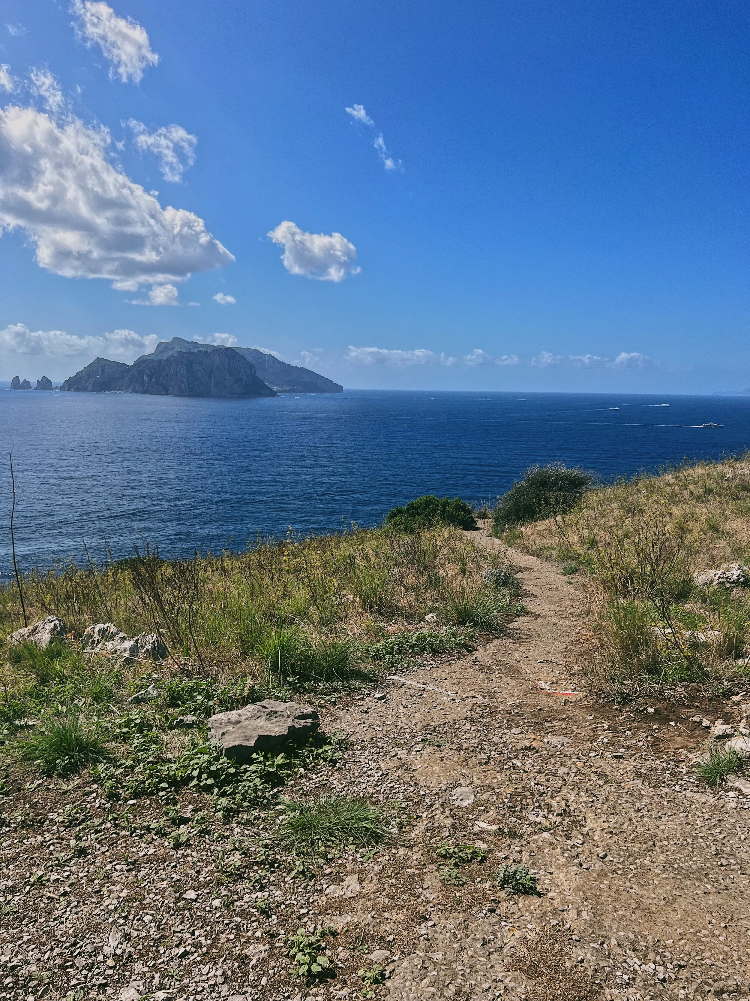
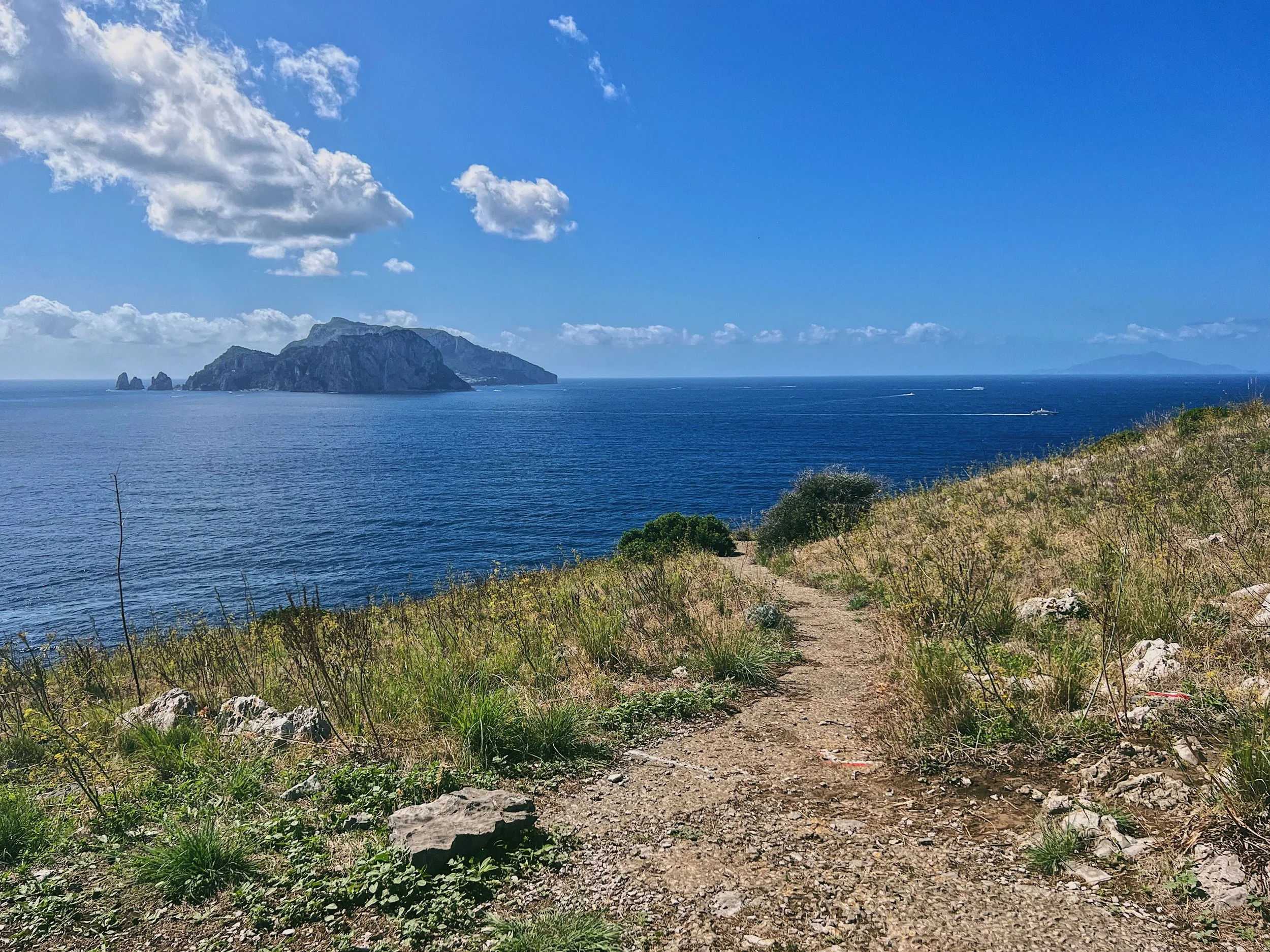
At the end of the point there is a lighthouse, the Faro di Punta Campanella, which was originally built in the 1800s though the current metal skeleton structure was built in the late 1960s and is completely automated and run on solar energy. This is a great spot for a picnic. From the very start of the walk there is a beautiful view out to see: Capri and I Faraglioni feel close enough to touch, and hundreds of boats of all sizes leave foamy white wakes as they dart between the Sorrento (north) and Amalfi (south) coastlines of the peninsula. On the opposite side there is a view down to the Baia di Ieranto, thought to be one of the coastline’s most spectacular bays. It is only accessible on foot, from Nerano, and cannot be reached from the Punta Campanella.
Flora and fauna
The landscape is very beautiful and the route offers a fantastic alternative to the Path of the Gods, which is further along the coast. There are a wide variety of plants, from cultivated olive groves and vine terraces to wild orchids, scrub and a few rather hardy trees clinging to the windy promontory. There is not much in the way of animal life apart from coastal birds, but we were lucky enough to view a pod of dolphins swimming offshore during a visit in the spring.
How to get there and parking
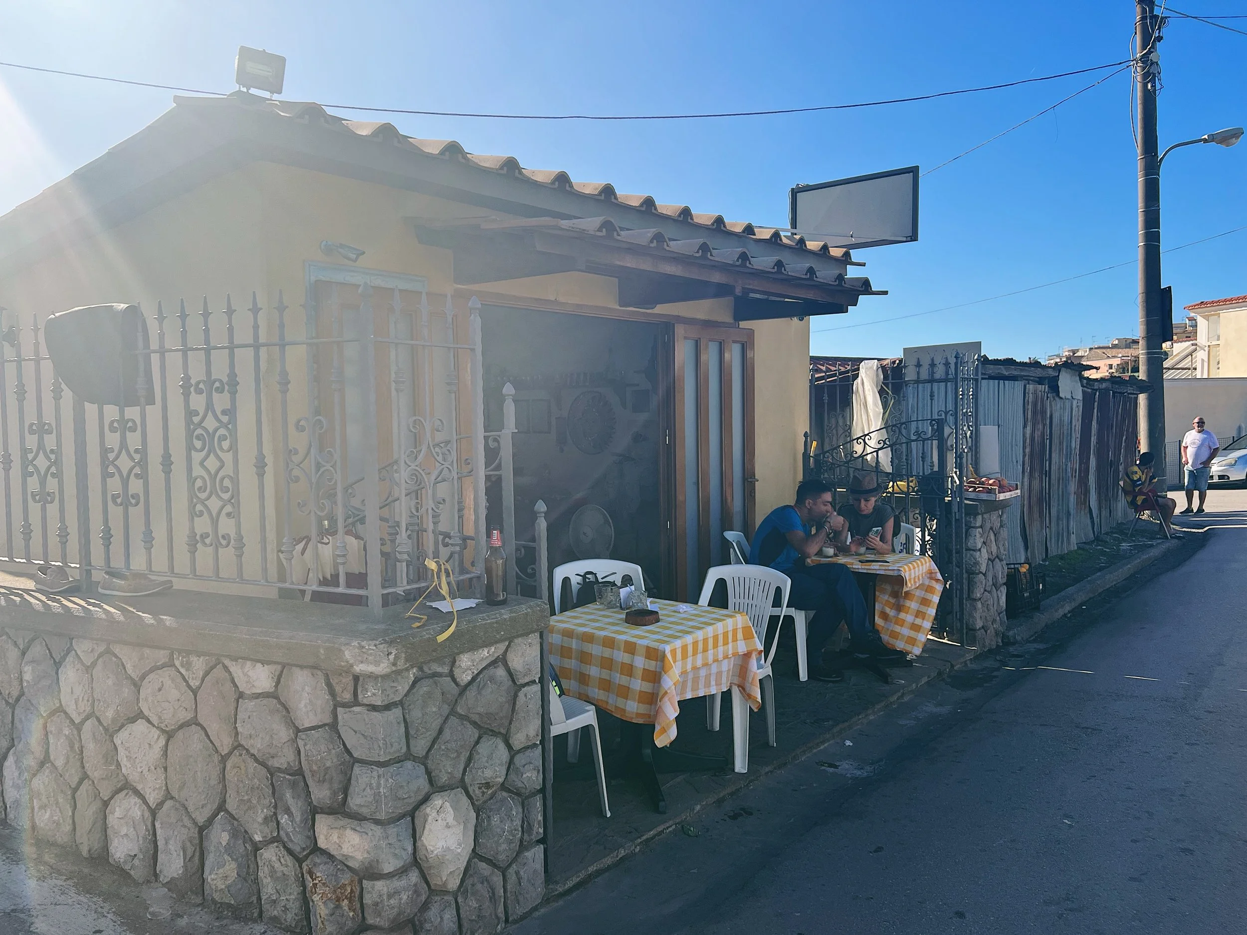
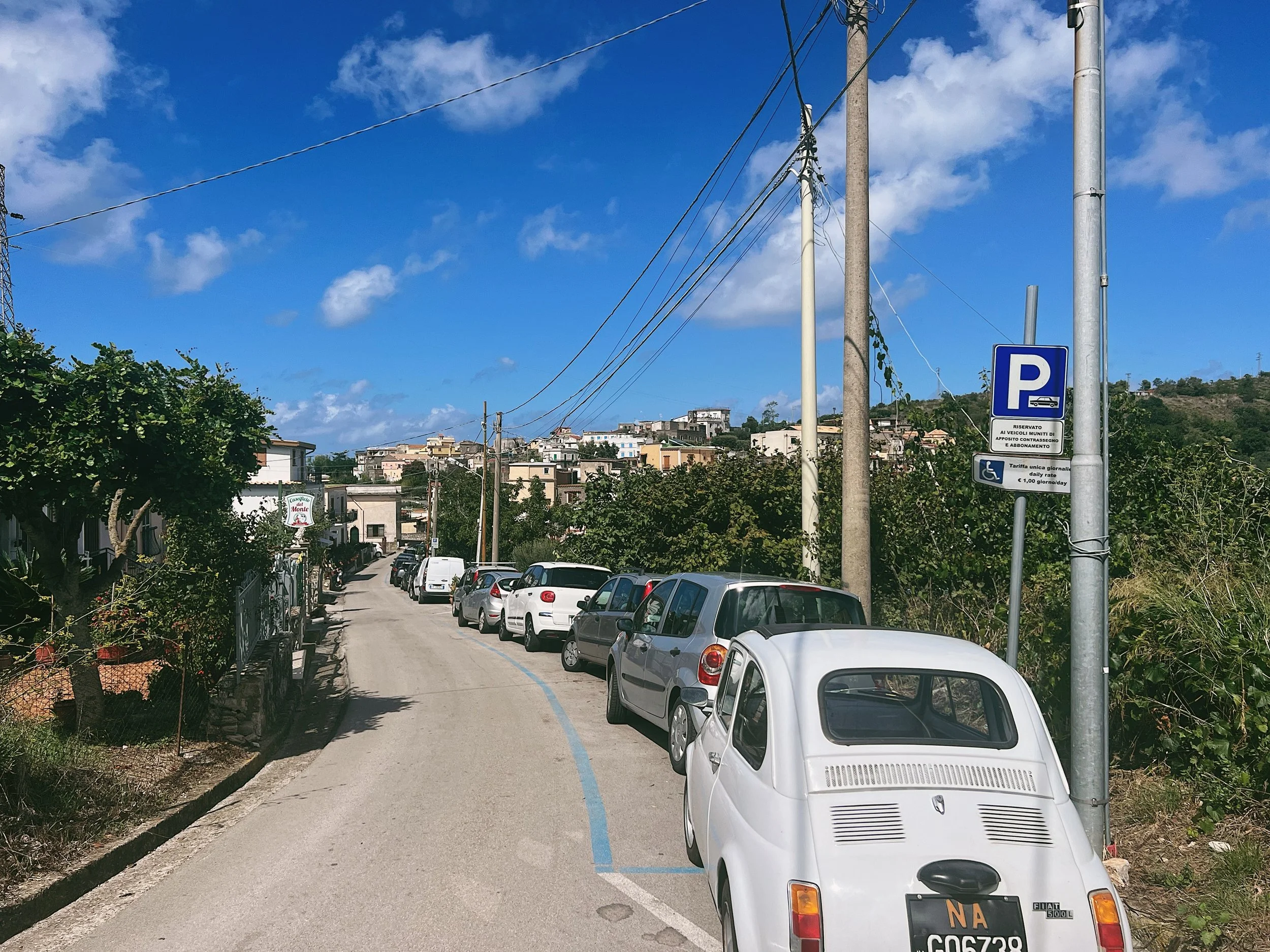
Termini is at the furthest point of the Amalfi Coast, so you’ll either need to navigate the Amalfi Drive (from Vietri through Positano) or take the somewhat easier and quicker route via Sorrento and up to Sant’Agata sui Due Golfi. Follow the switchback road to Termini, it’s narrow but scenic and there are plenty of spaces where you can pass. Go through Nerano and follow the brown signs to the Punta Campanella but stop when you reach the chiosco/café.
You can park on the side of the road opposite the café, where there is paid parking. If you park a little further up the hill there are no ‘blue bays’ and as such you don’t need to pay for parking. In the summer months and on the weekends it can get very busy, so you might need to look out for some more spaces elsewhere. Don’t try and park at the start of the proper path - the road is very narrow and it’s difficult to turn around, plus there isn’t a lot of space on the side of the road. It only takes a few minutes to walk down to the path.
Signage and trails
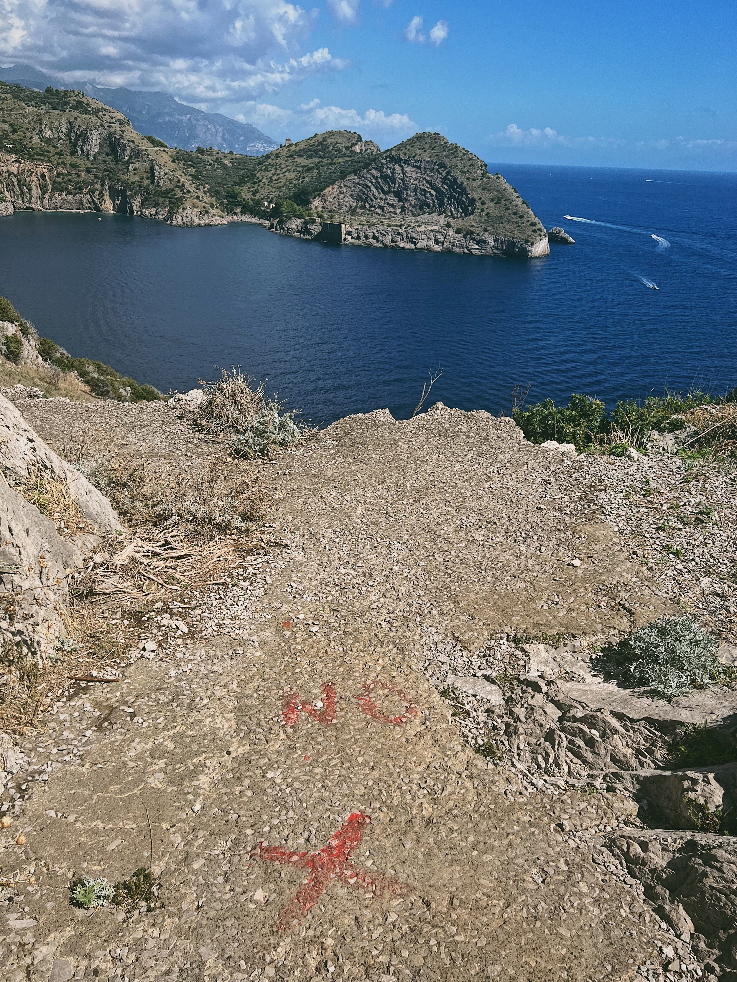
The route is relatively well marked on the way down, which first meanders through the village before reaching the start of the paved Punta Campanella section. As with many places in Campania, this begins promisingly and then deteriorates: some of the sections were very crumbly and not runnable. Around the lighthouse, someone has helpfully spray painted some big red Xs to stop you from heading off along a path which has subsided into the sea…
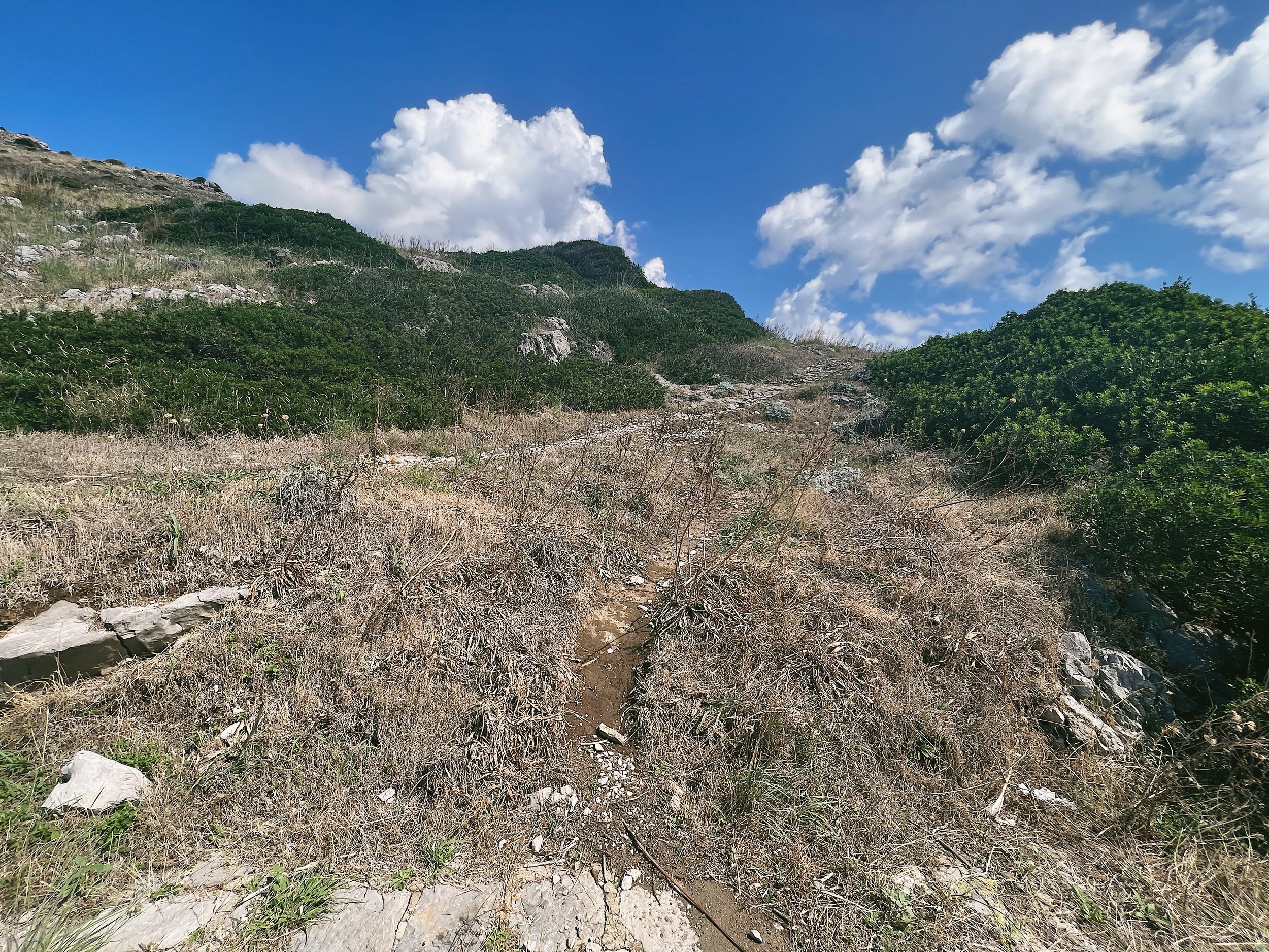
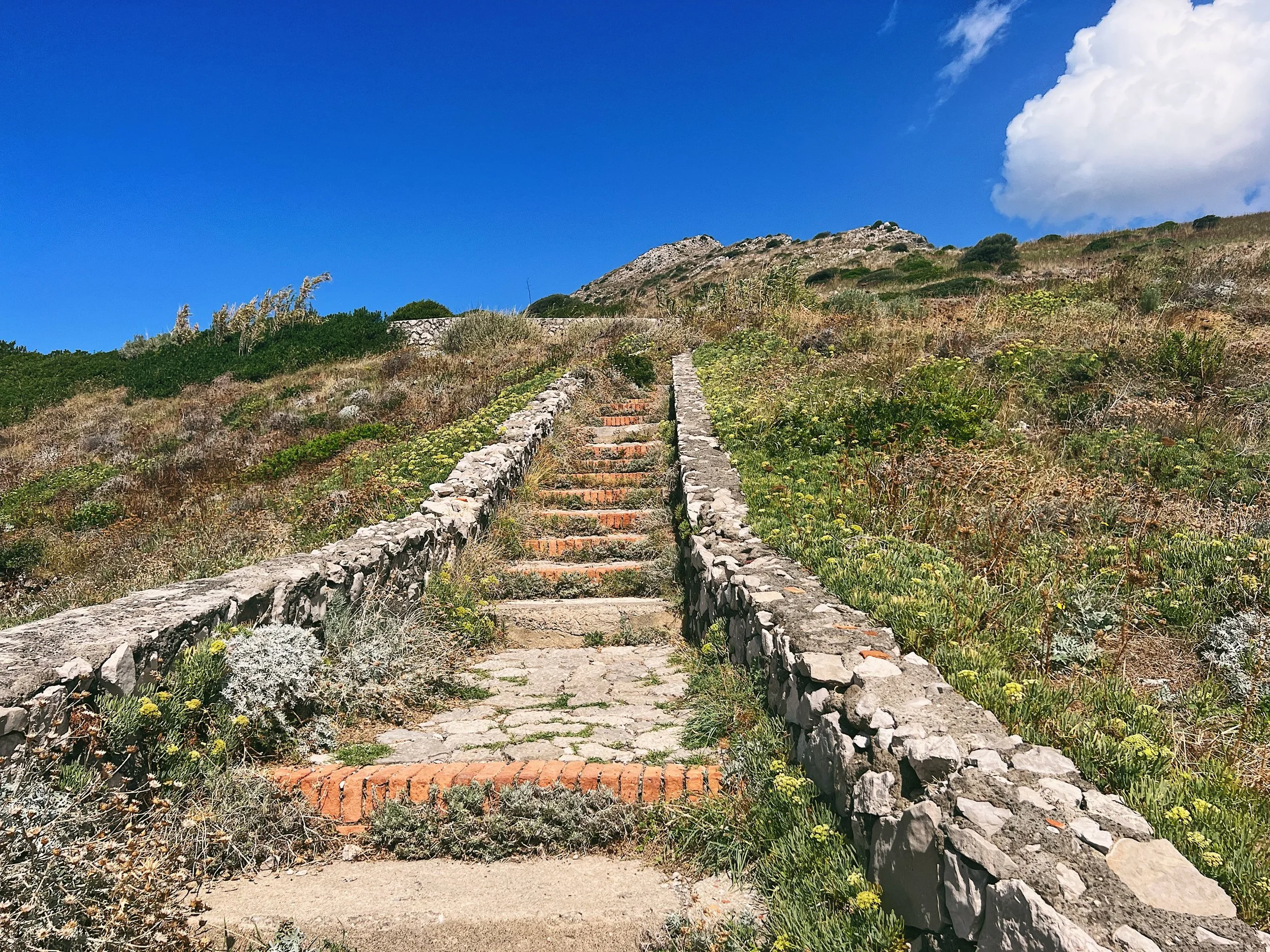
The path that runs along the high ridge and Monte San Costanzo is less well marked. There is a long section with no signs whatsoever, though the sporadic red and white painted markers on the rocks will point you in the right direction, even if you’re not really sure how far there is left to go.
Route
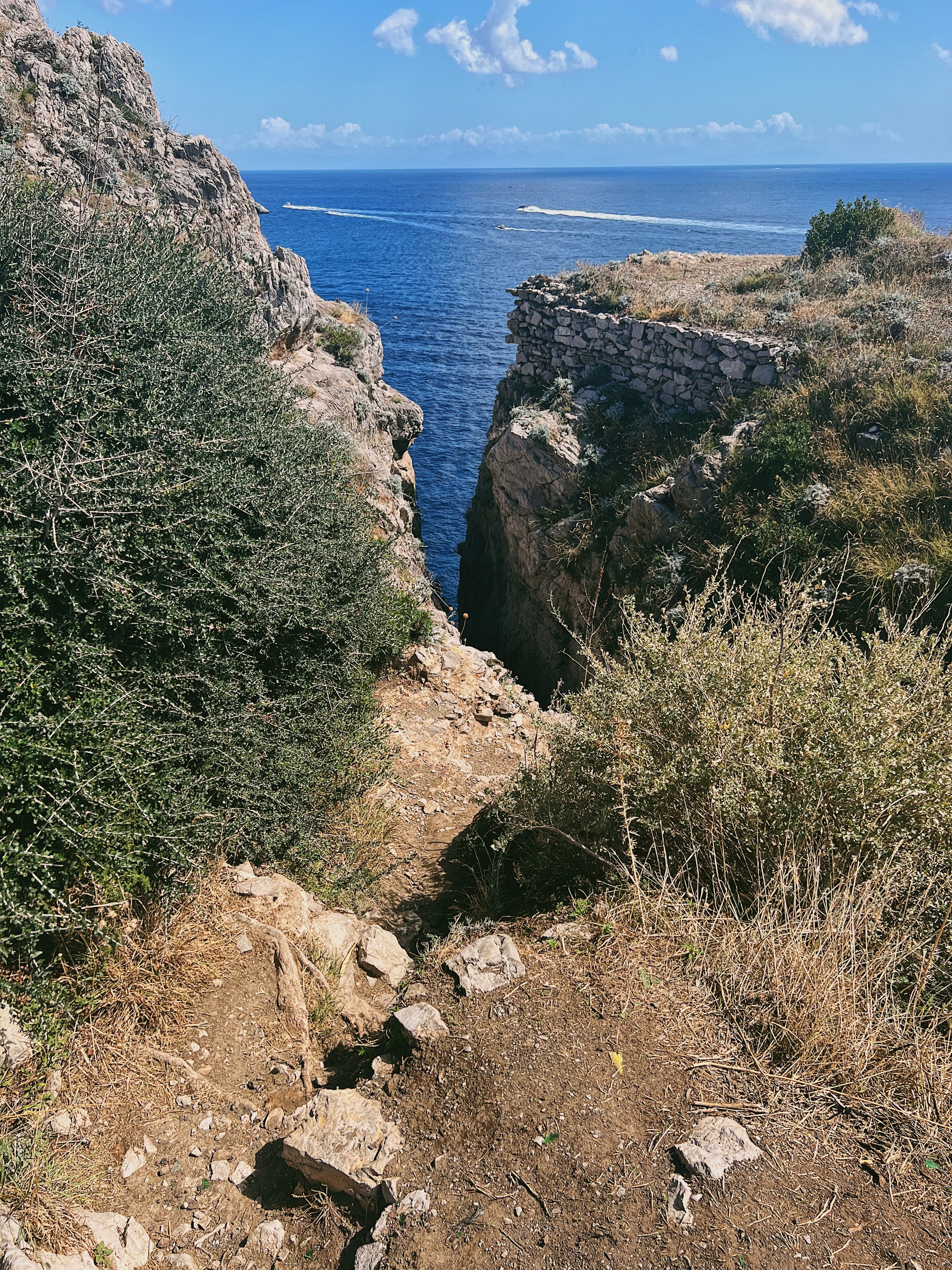
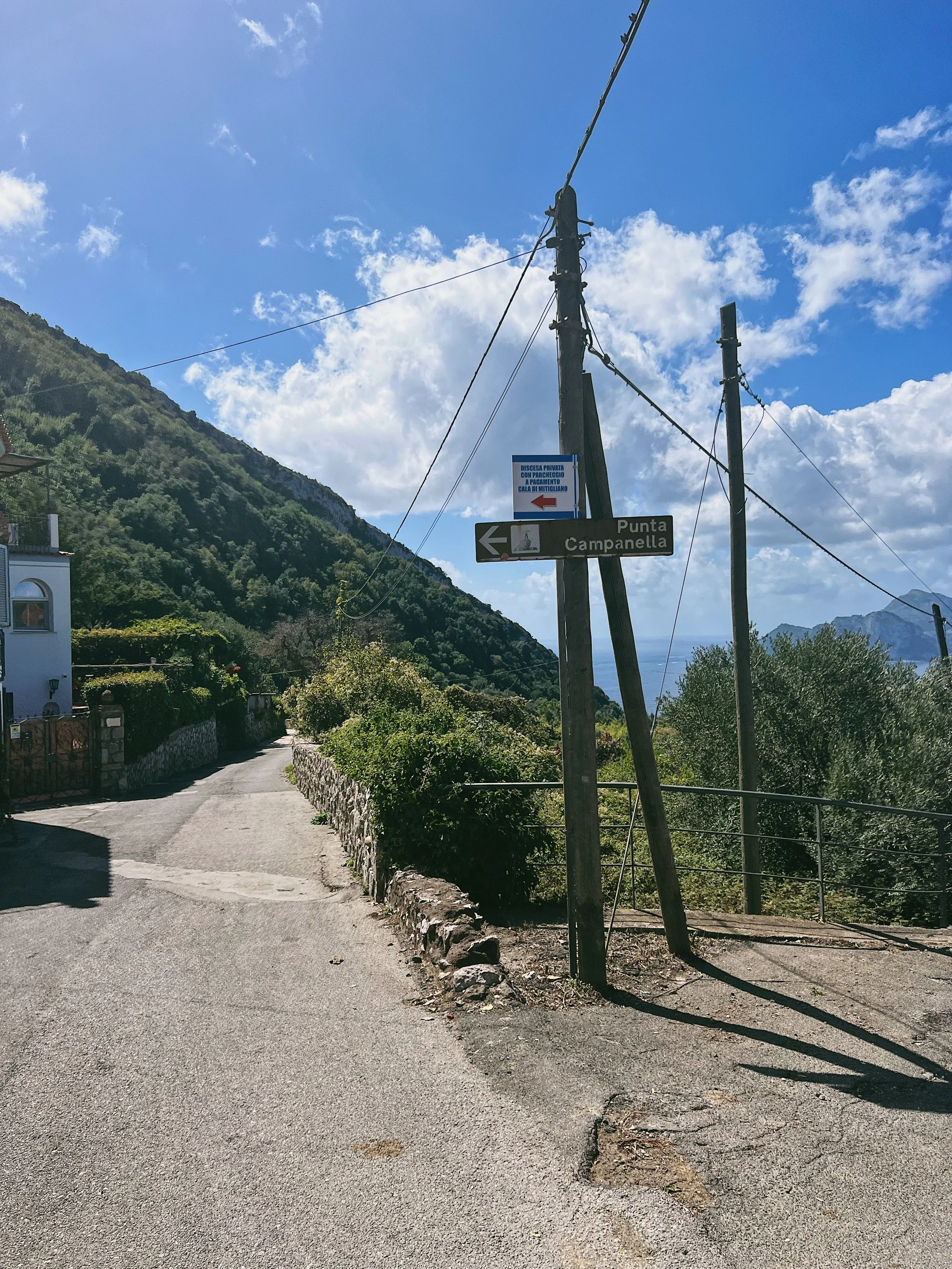
From the chiosco, follow the brown signs for the Punta Campanella downhill on narrow roads that wind between gardens and vegetable patches. Eventually the path turns left and proceeds alongside an olive grove on the right-hand side; the island of Capri is now visible to the front. The tarmac track heads downhill and eventually becomes paved - this continues for a couple of kilometres, with olive groves and scrub on the left and the cliffs dropping away to the sea on the right, hemmed in by a low wall. Despite the narrow track, there are actually some houses along the path - some of them are quite spectacular and can be glimpsed through the trees. The path is downhill all the way and does deteriorate in places where you may need to jump down over crumbling steps or watch your footing for large, loose stones.
The headland opens up as the path reaches the end of the peninsula - this is the Punta Campanella. At the end of the headland you can see the lighthouse, or take a steep section of rather precarious stone steps down to a Roman Pier. After seeing the lighthouse, head back up the steps to the path you used to come down to the point. You can either take the same path back uphill or, alternatively, take the narrow single-track gravel path that heads up through the scrub to the headland. Where the path splits there is a view down to the Bay of Ieranto - you can view it, but don’t take the path down there. A large red X and the word ‘no’ sprayed on the ground is where you’ll need to turn around, as the path eventually drops into the sea.
The path rises up through stones on a rough path (the CAI 300 of the Monti Lattari), where you’ll need to step up and over large stones. It can be indistinct in places, but it is well marked all the way with the classic CAI white and red patches painted on rocks. This track continues in the same way for several kilometres until it reaches a marker set into the ground, passing through very exposed terrain. This gives you a rough idea of where to go: the track forks left to head back towards Termini following the same route as the lower Punta Campanella track, before eventually winding between gardens and olive groves to reach the village. Alternatively, the right-hand fork passes alongside a stand of pine trees to a lookout point with a telephone mast, which has views towards Monte Faito. You then proceed via an ancient mule track which eventually joins Via de Monte, which then goes downhill to the chiosco and the parking area. I would recommend taking the left-hand fork in the path for the most attractive route.
Food and drink
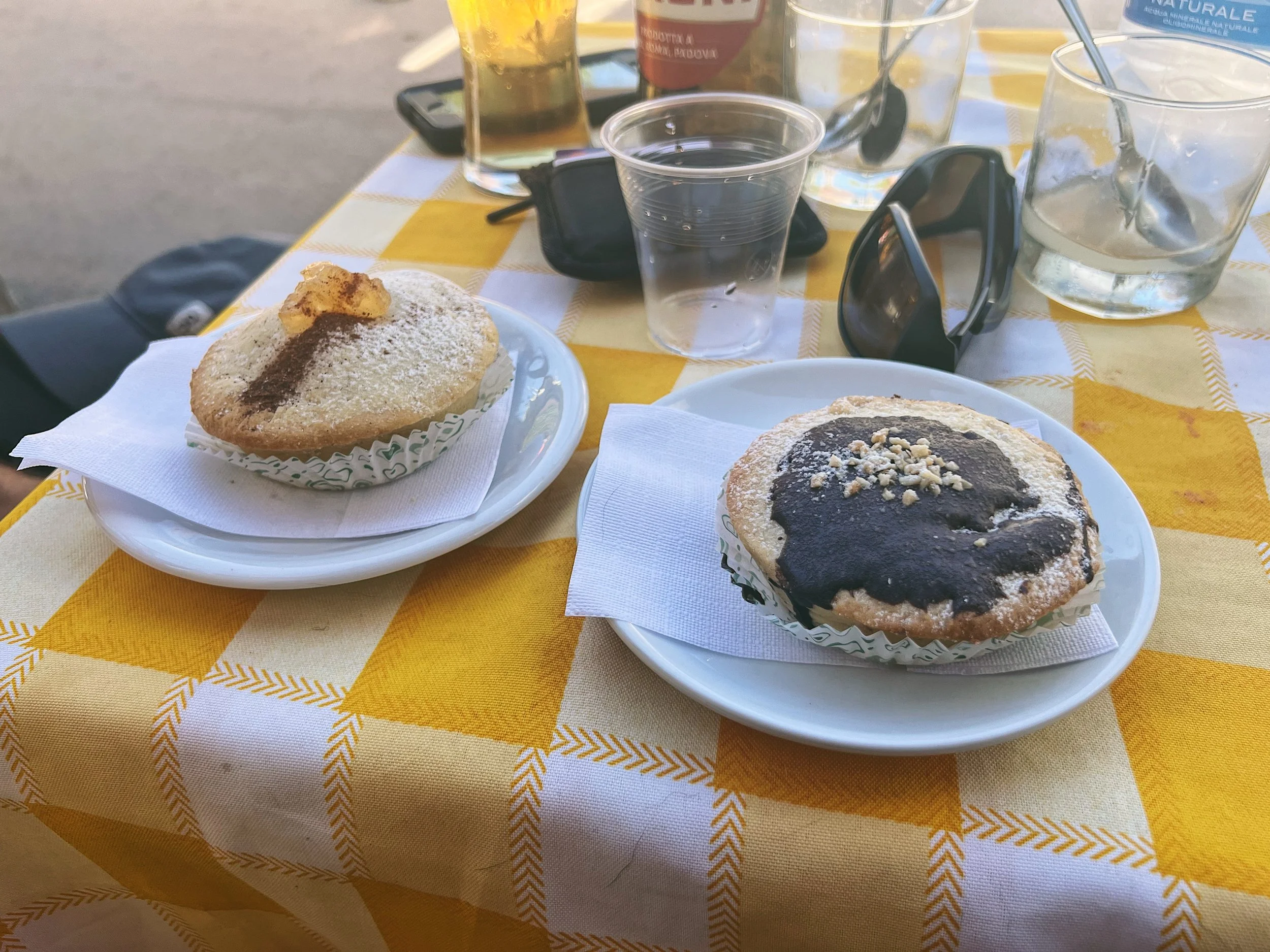
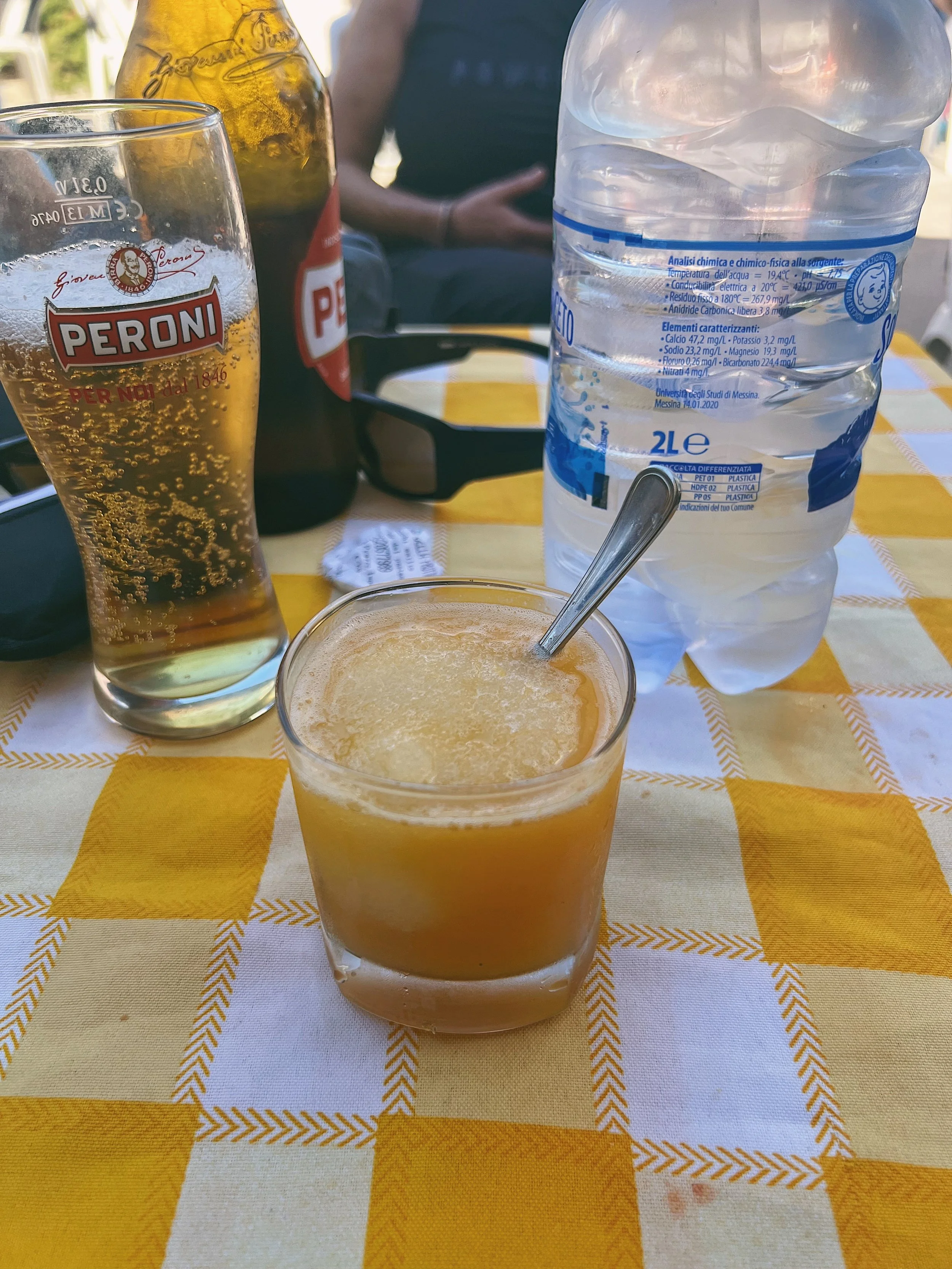
Despite the fact that you are never more than a few kilometres from the village of Termini, the route is long and often winding and whichever path you pick back from the lighthouse at the tip of the promontory, it’s an uphill slog. With this in mind: bring water and snacks. Trust me on this one: you don’t want to get to the lighthouse and then realise you don’t have enough water and you left your snacks on the kitchen counter at home. At the start and end point of the hike there is a little family run cafe which, I’m told, is open at the weekends year round, called Chiosco Bar San Costanzo (the reviews are not great - just check your bill carefully and don’t be persuaded to buy more than you need; we had no problems). The granite are just the thing to revive you after the long walk and the little chocolate and pear tarts are delicious. There are a number of other cafes, pizzerie and bars in the centre of Termini.