SENTIERO DEGLI DEI

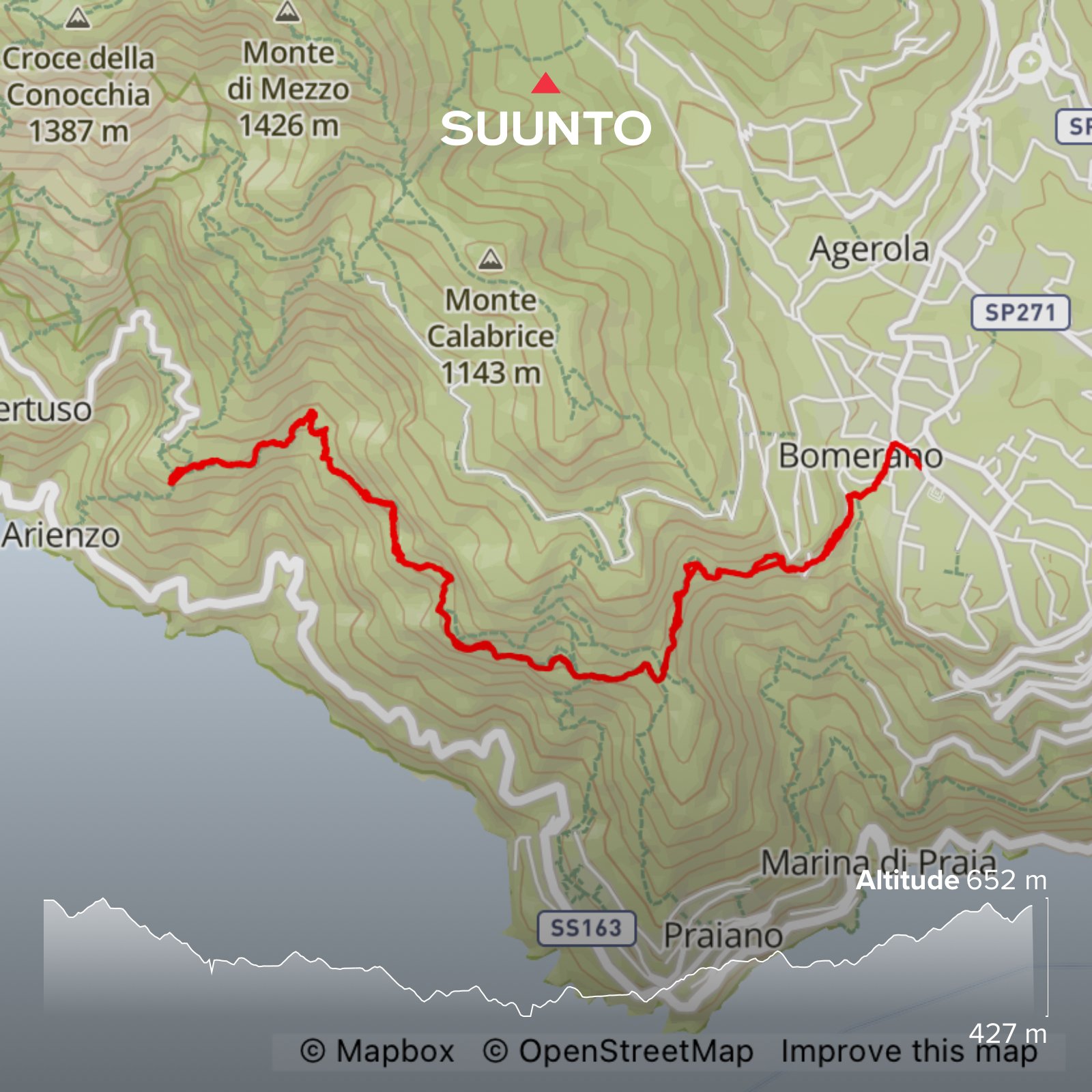
Length: 12 kilometres
Elevation gain: 740 m
Time: About 4hours with time for drinks and snacks
Parking: Car park in the centre of Agerola, via Principe di Piemonte. Coordinates: 40.628272, 14.542018. What3words: ///munchkin.jockey.tans
Best time to go: October - May. It is very exposed in sections and gets extremely hot in the summer. Very busy July- September. Go early; the guided groups start at about 10am and can really slow you down
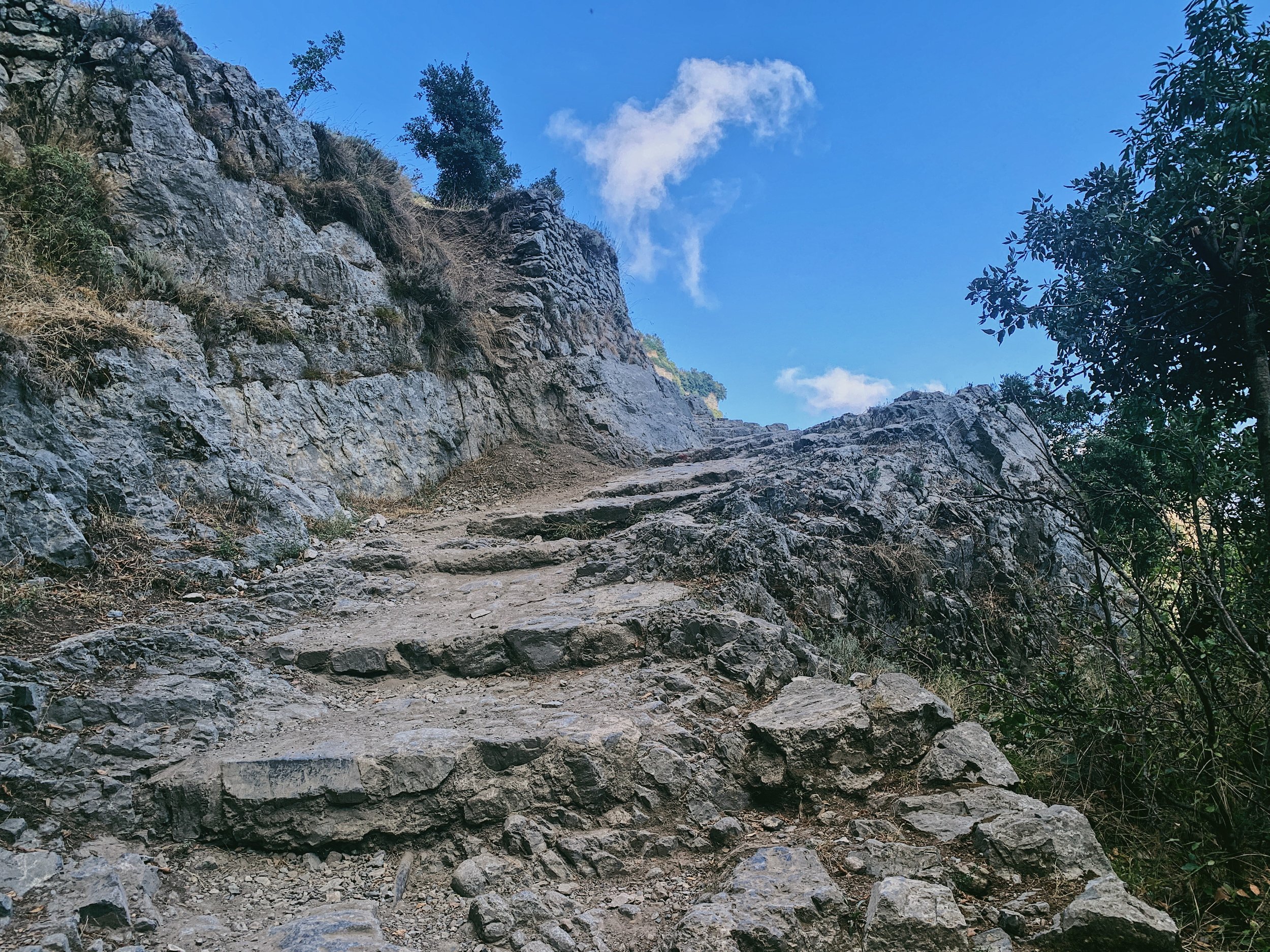
Terrain: Single track dirt path with stone steps and some scrambling. Very steep drops with no handrail
Level: Challenging for the out and back due to the length and the amount of steps
Suitable for children: Children should do the one-way version where possible
Suitable for dogs: Yes, but must be kept on a lead due to steep drops and free-roaming livestock
Sentiero degli Dei: ascend to the heavens above the Amalfi Coast
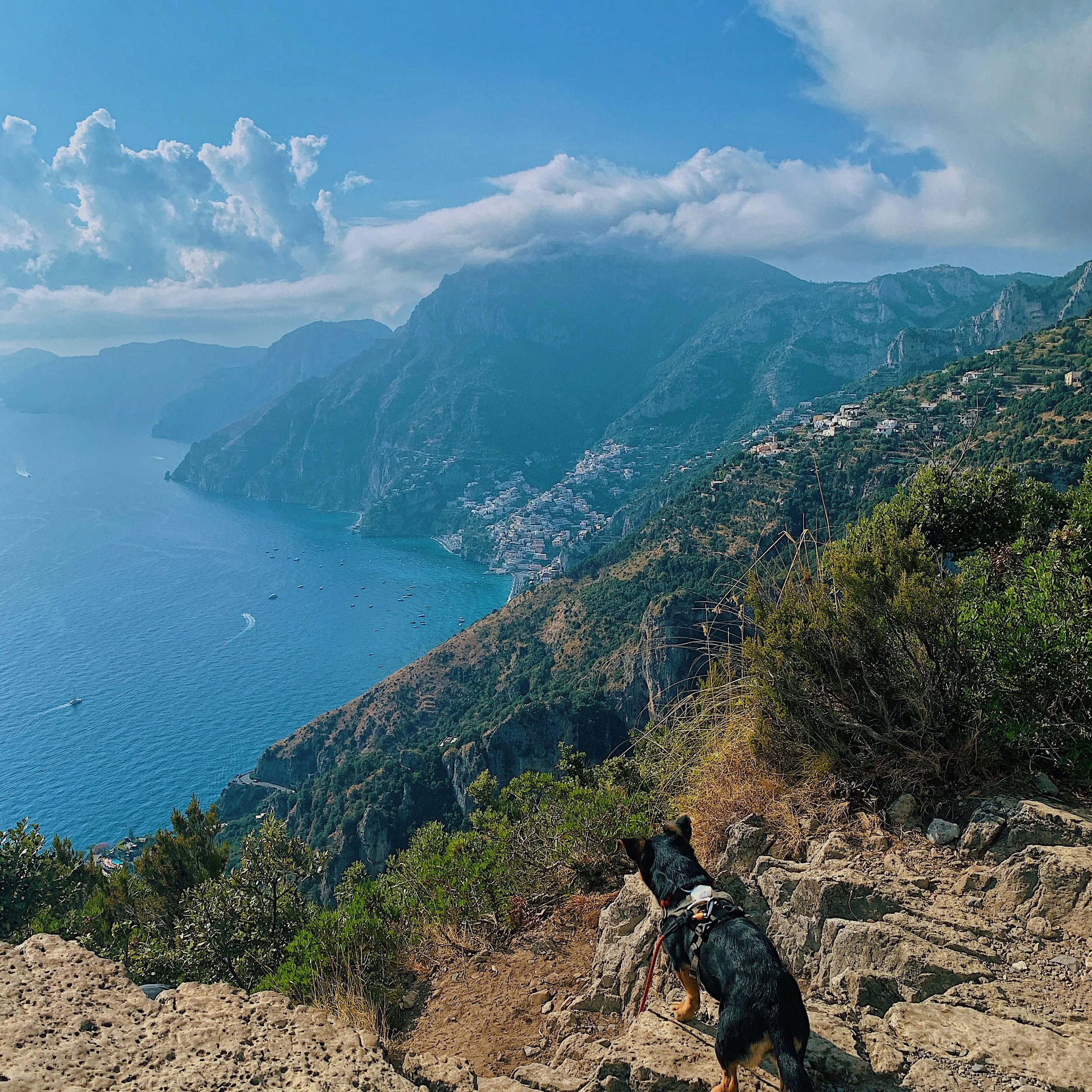
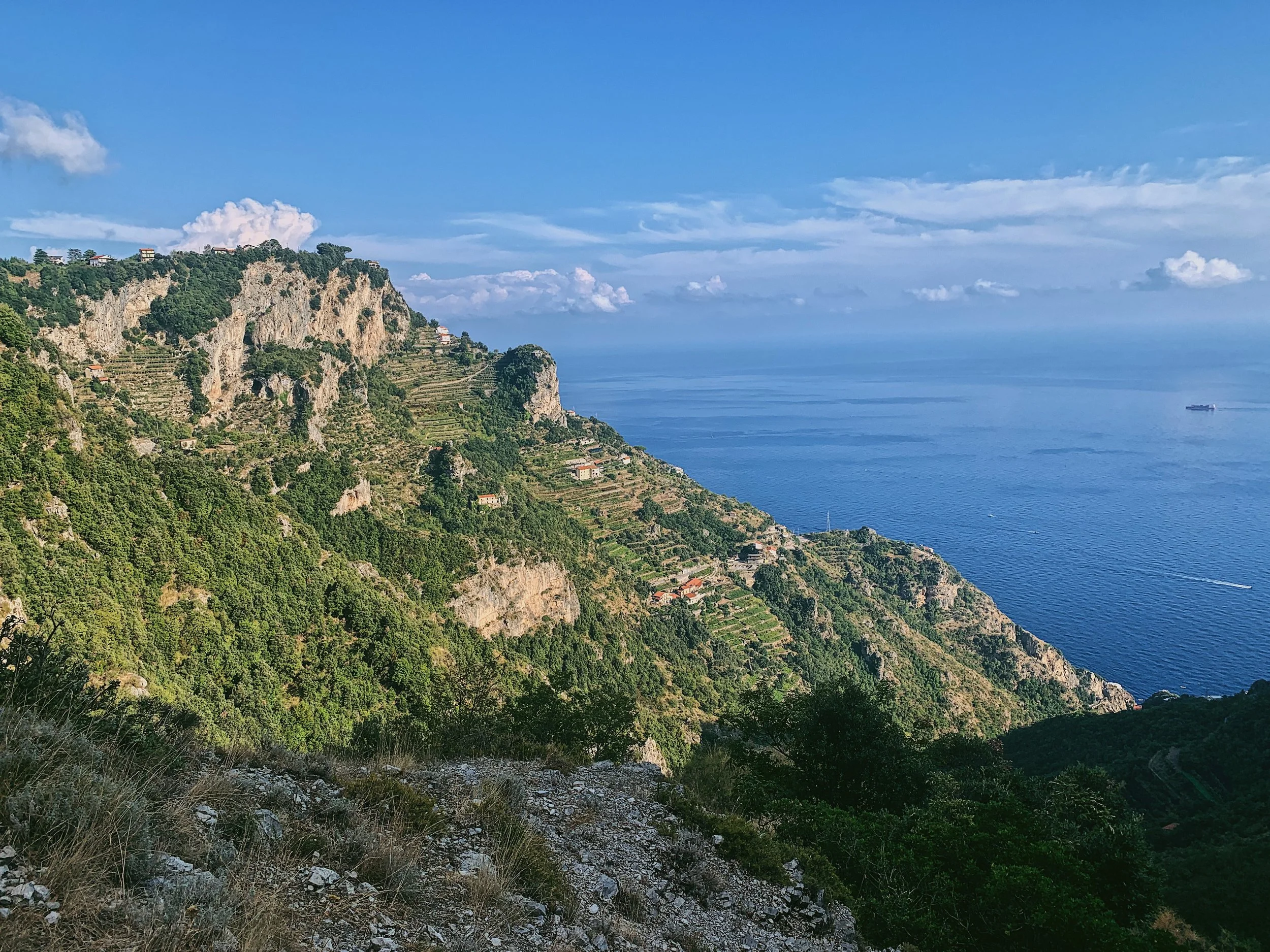
The Amalfi Coast is probably best known for its luxury hotels and restaurants, peering out to sea from a series of terraces marching down the cliffs to the Tyrrhenian Sea. The views are staggering, but you don’t need to spend thousands of euros a night to enjoy it. The walk, Sentiero degli Dei, or in English ‘the Path of the Gods’, follows an ancient mule track along one of the most picturesque stretches of coastline in the heart of the Amalfi Coast.
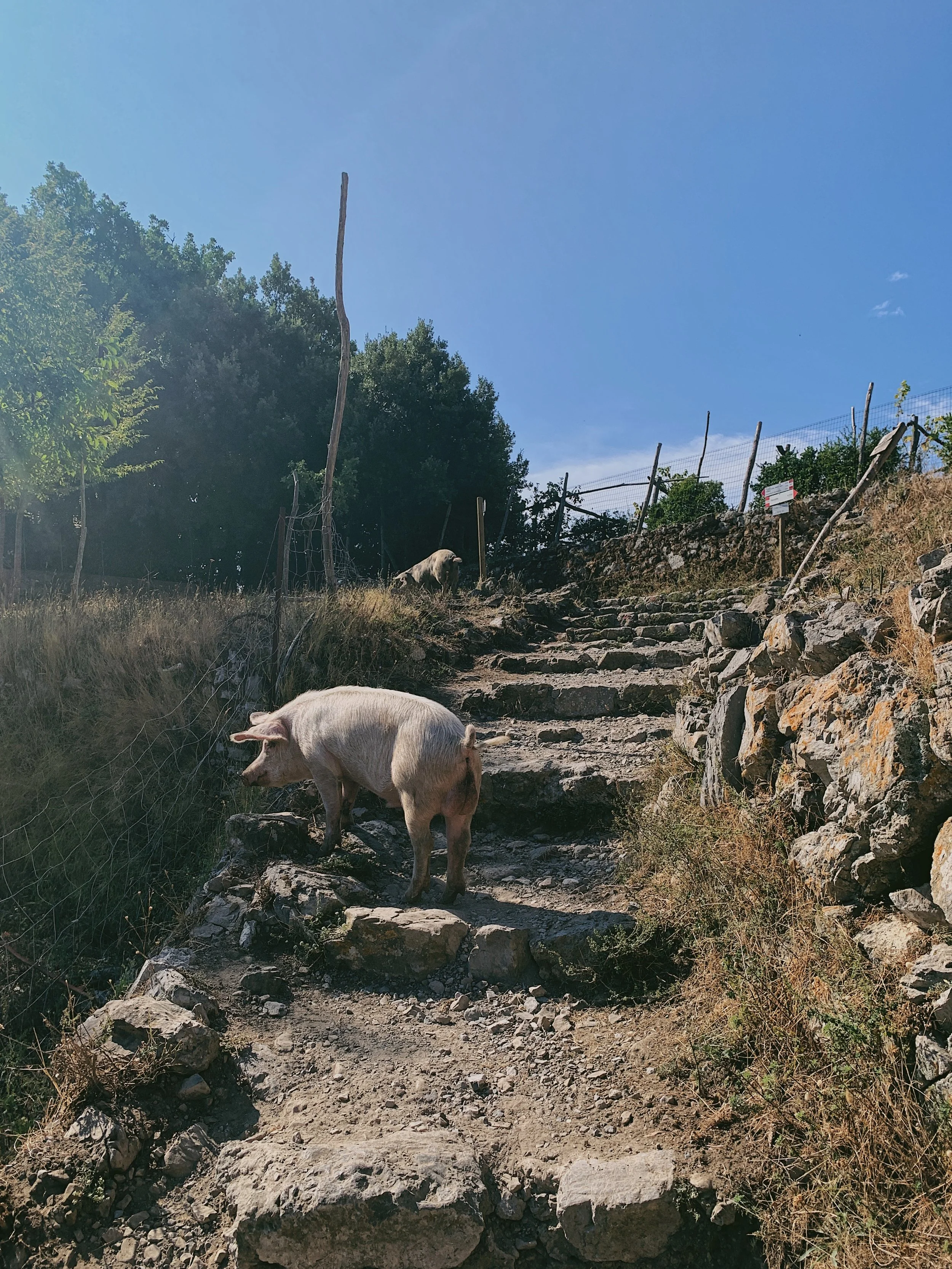
The route links the little hilltop town of Agerola - or more specifically, the little adjacent village of Bomerano - with Nocelle, the upper reaches of Positano set some 1,500 steps uphill from the main part of the village. There are no roads to cross or big settlements along the way, just little farmsteads clinging to the cliffs, lemon trees bowing under the weight of fruit and tiny pockets of vines. It’s truly idyllic: chickens pecking alongside the path, pigs and goats grazing quietly, horses flicking scraggly tails in little stables tucked under the cliffs. And all with that beautiful backdrop of endless blue.
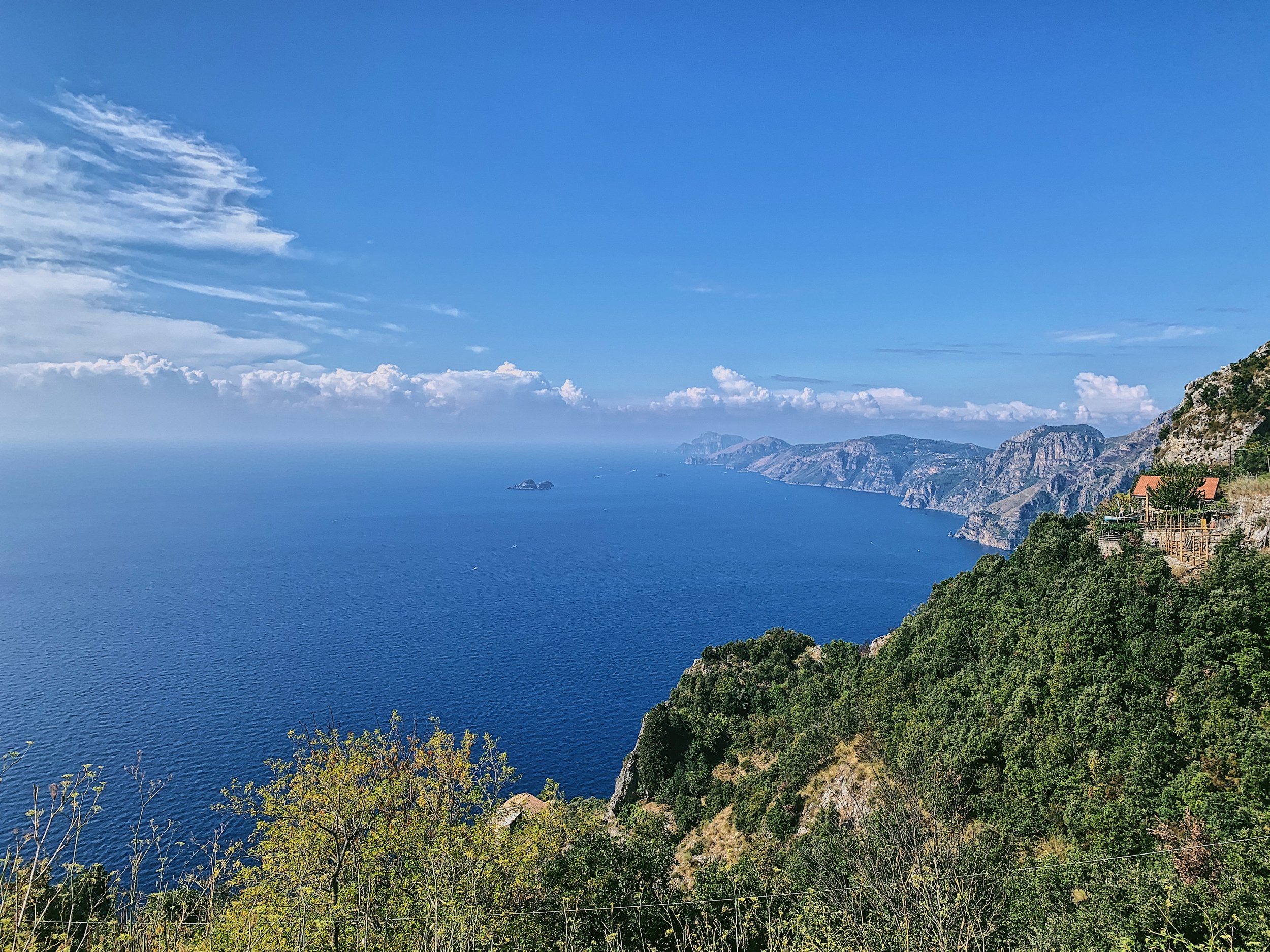
From the path you’ll catch glimpses of Positano, Capri, and on a clear day, the Faraglioni Rocks. Out to sea you can also see the Sirenusas, also know as Li Gallos; the largest island is shaped like a dolphin.
As it’s so beautiful, it is immensely popular. I would avoid the route entirely in the summer months (June - early October) and save it for late autumn or early spring, when the hills will be colourful with wildflowers. This walk is all about the views, so choose a clear day with no rain - the rocky steps are lethal in the wet.
A word of caution: there are a number of somewhat misleading travel blogs around which say things like ‘the path slopes gently downwards’ or that it is ‘relatively flat’. Ignore these. If you do the out and back route, the elevation gain is 740 metres. There is more downhill on the Bomerano-Nocelle route, but these are mainly stone steps cut into the path. There is a lot of up and down, with some scrambling involved where you may need to use hands to pull yourself up. It’s not overly taxing and most will manage fine, but it’s not a walk to be done in a dress or flip flops.
Flora and fauna
The walk changes through the seasons, with wildflowers carpeting the hills in the spring and plump olives and laden vines from summer through to autumn, when the leaves turn yellow and russet red before falling entirely. On crisp, cold days in the winter the walk is particularly beautiful, with barely a soul around.
The area still has many tiny farms and smallholdings, so expect to see horses, goats, cattle and pigs - often roaming free over the trail so it’s best to keep dogs on a lead or very close by. In the summer there are lizards, crickets and clouds of butterflies which kids will love.
How to get there and parking
The Path of the Gods starts just outside the area of Bomerano, in the larger village of Agerola (famous for its mozzarella). It’s about one hour and 15 minutes from JFC Main Gate, following the A3 Autostrada to Pompeii and then turning off onto the narrow, winding roads of the Amalfi Coast at Gragnano. The route has lots of switchbacks and you can get stuck behind buses, but it’s fairly straightforward.
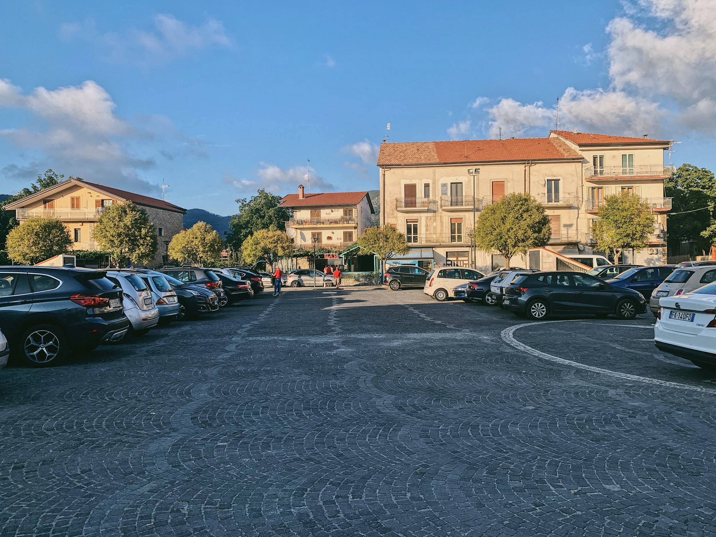
Parking at the start of the walk is easy: there is a large, free car park in the centre of Agerola marked ‘Parcheggio Gratuito’. There is limited parking on Via Sentiero Degli Dei, but I would caution against this as there’s not much space to turn around. The parking in Agerola has a water dispenser though it’s not free and you will need coins.
From the parking area there are a number of signs, including the classic white and red CAI route markers, leading to the start of the walk.

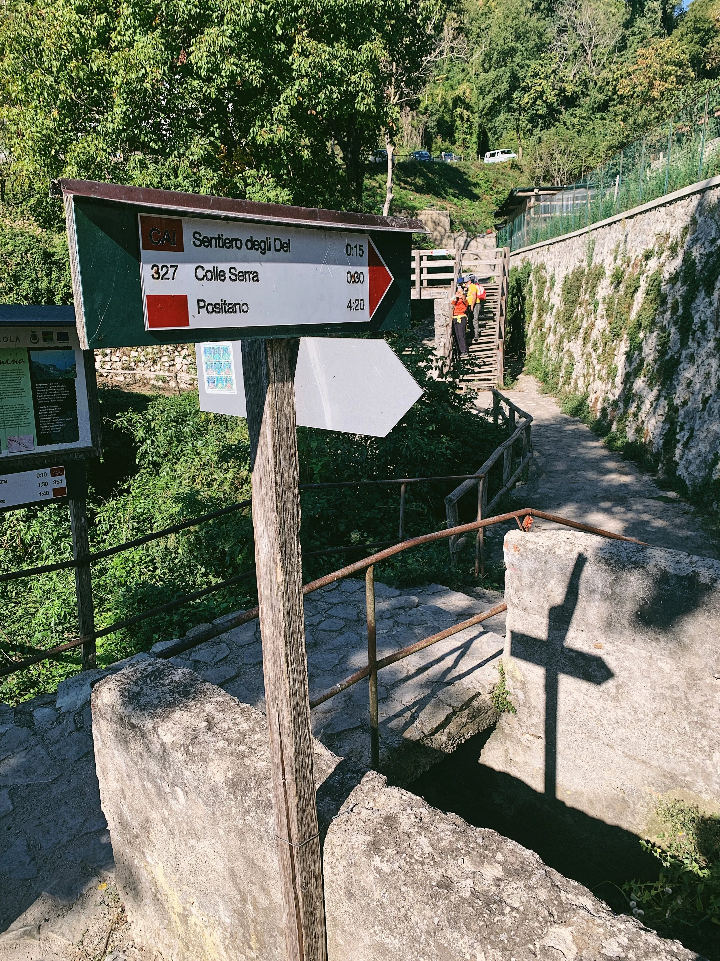
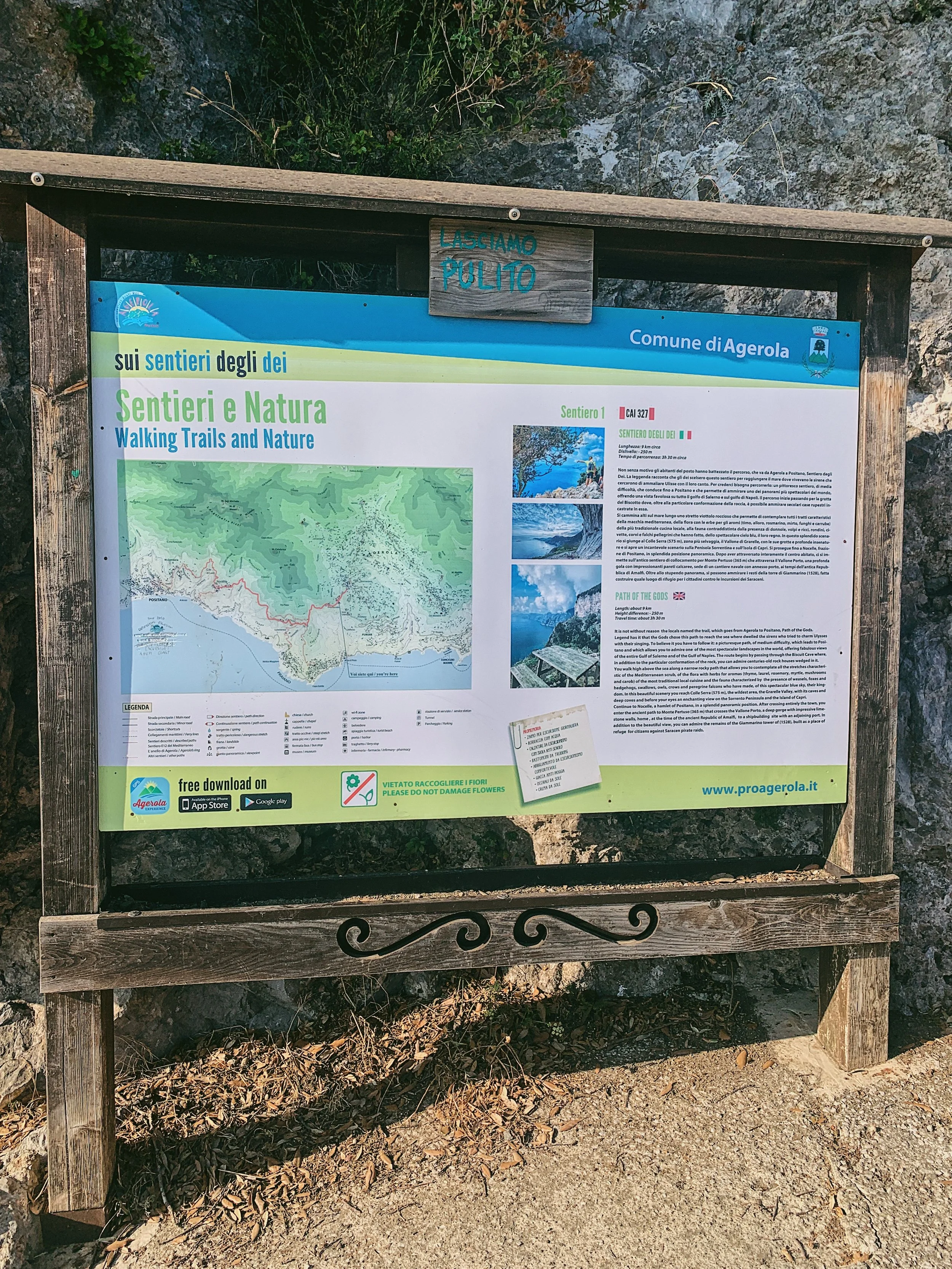
Signage and trails
The trail is well signposted and is very straightforward, leading from the Bomerano area of Agerola to Nocelle without splitting from the main path. There are a number of sign boards at the start, including the one shown in the photo to the left, and the usual CAI red and white route markers along the way (the route is 327). You’ll also see the red and white paint marks on rocks and railings en route.
There are also some very pretty hand-painted tiles mounted on walls which depict scenes from the Amalfi Coast.
Route
From the parking area in Agerola, leave the car park and turn left to walk up to the village square. There are signs for Sentiero degli Dei. At the top of the piazza, turn left and follow the road past the vending machines on the right to pass through a little residential area, following a slope downwards. Cross a wooden bridge and ignore the path to the left that leads down to Praiano. Head up a short flight of stairs and you’ll join the road at Bomerano. Turn left and follow the road up to the dead end, where there is another small parking area against the cliff. Here you’ll see the start of the walk, where there are signboards and a large sign on the cliffs.
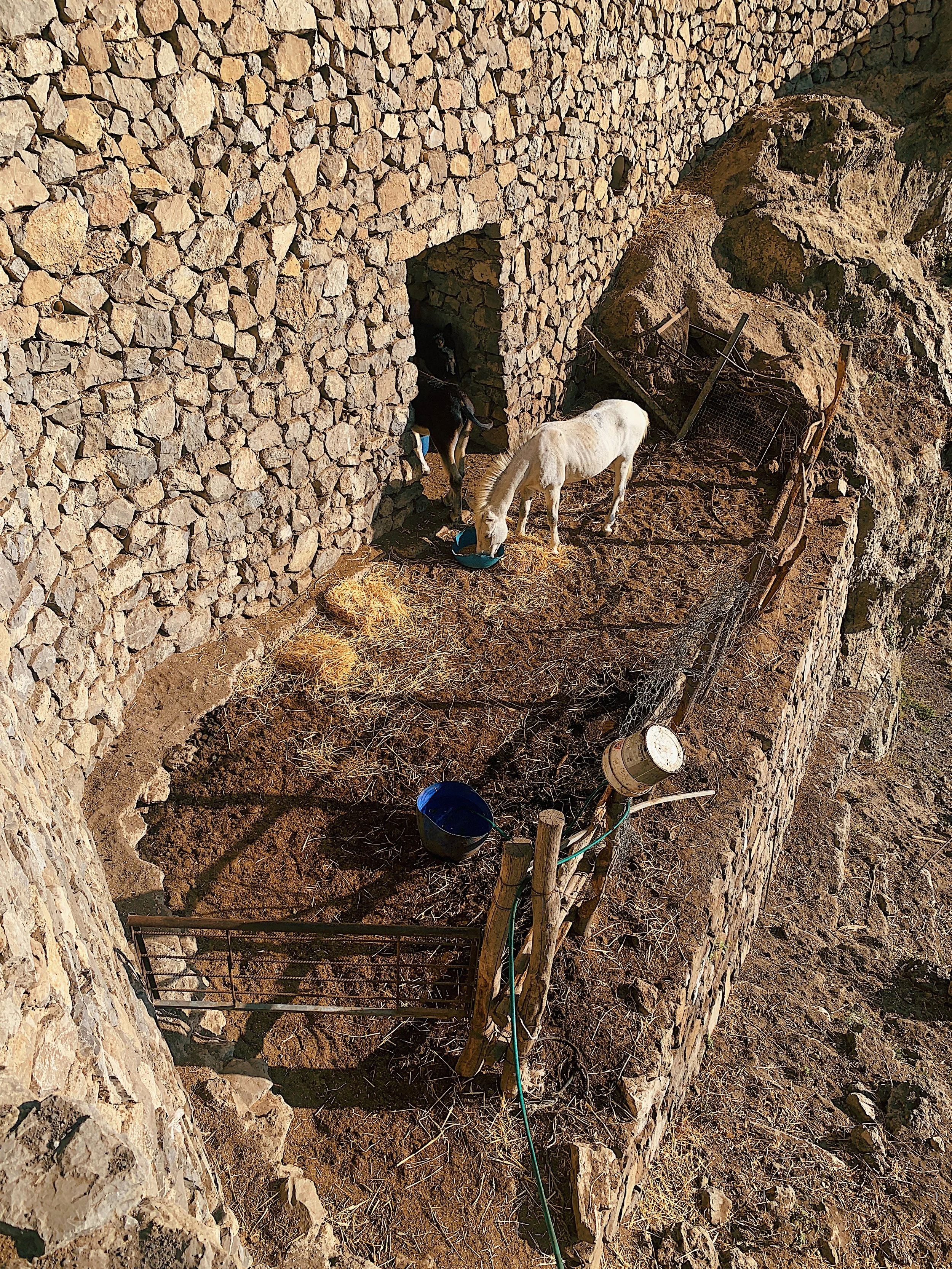
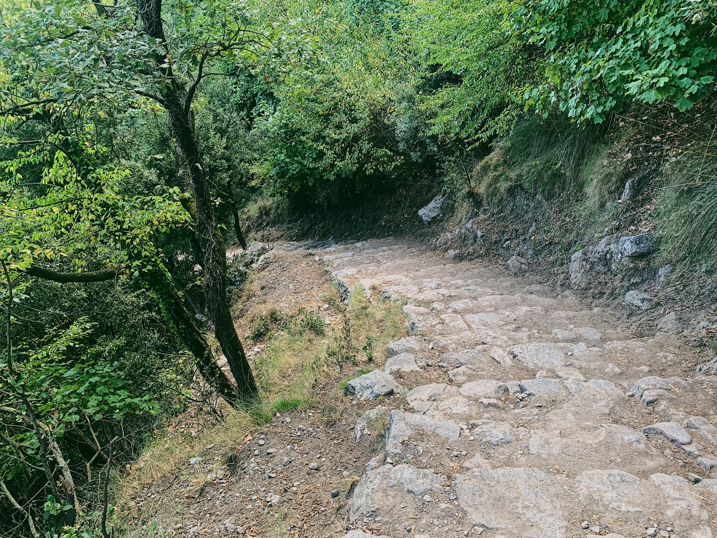
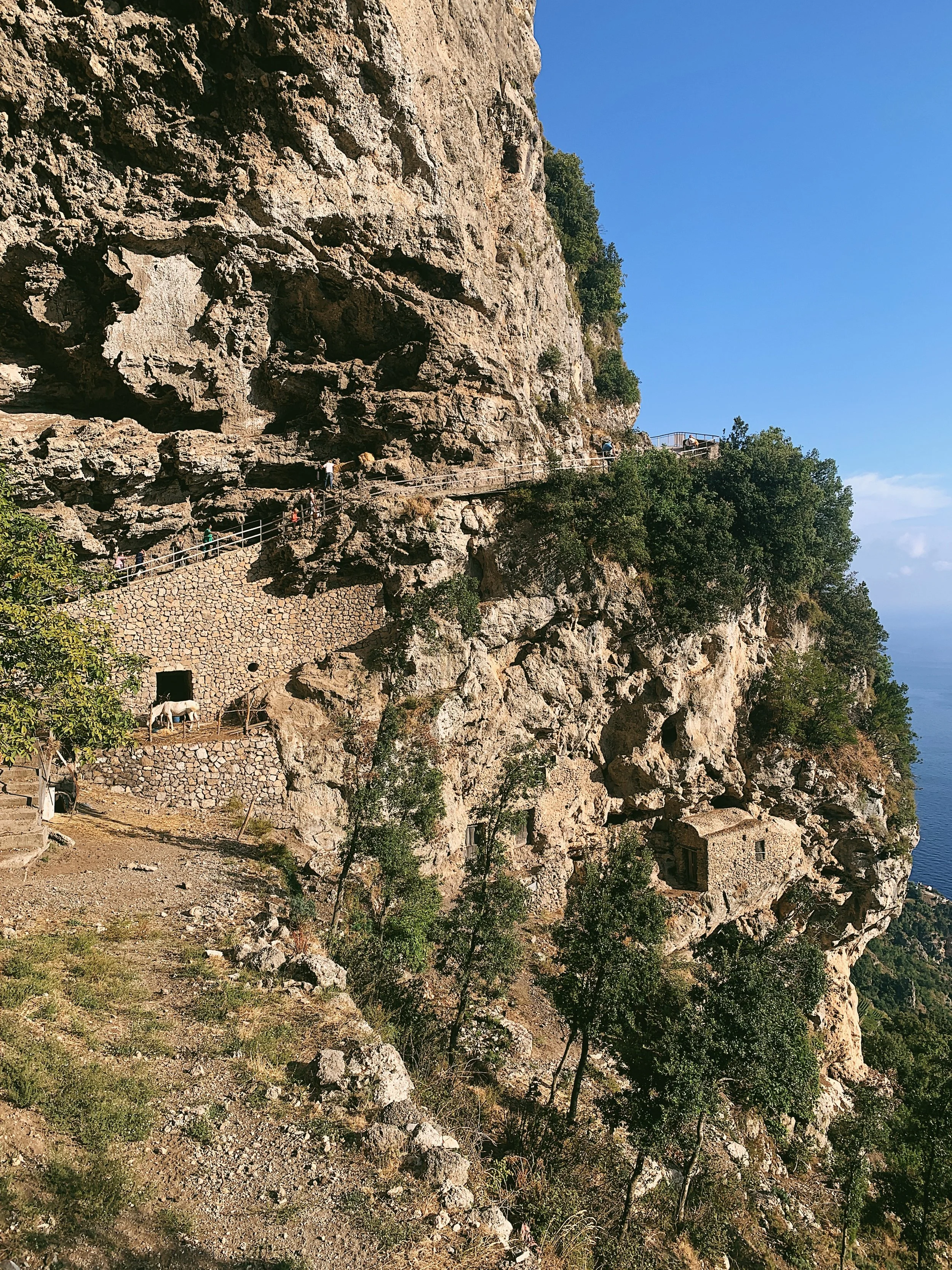
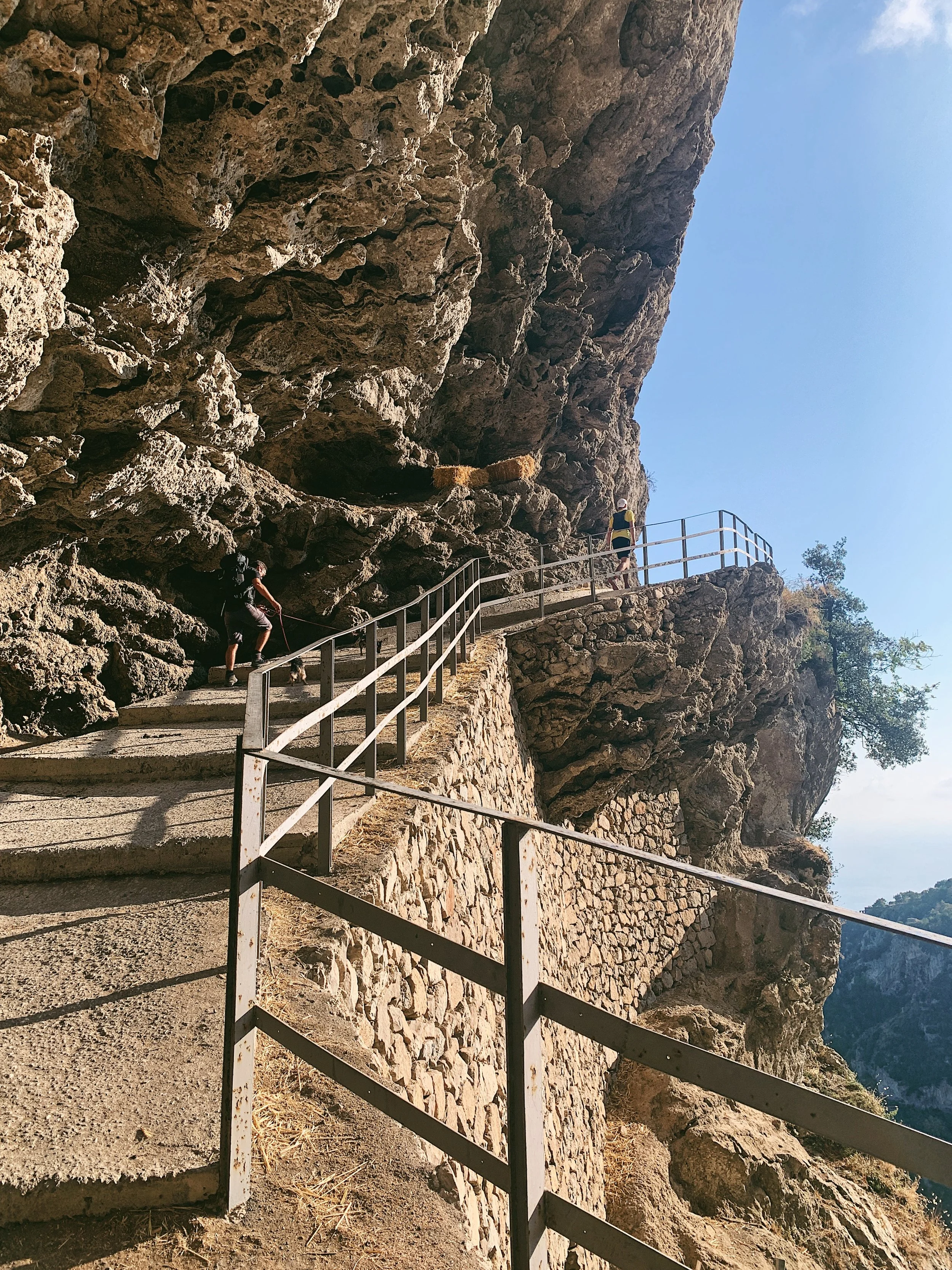
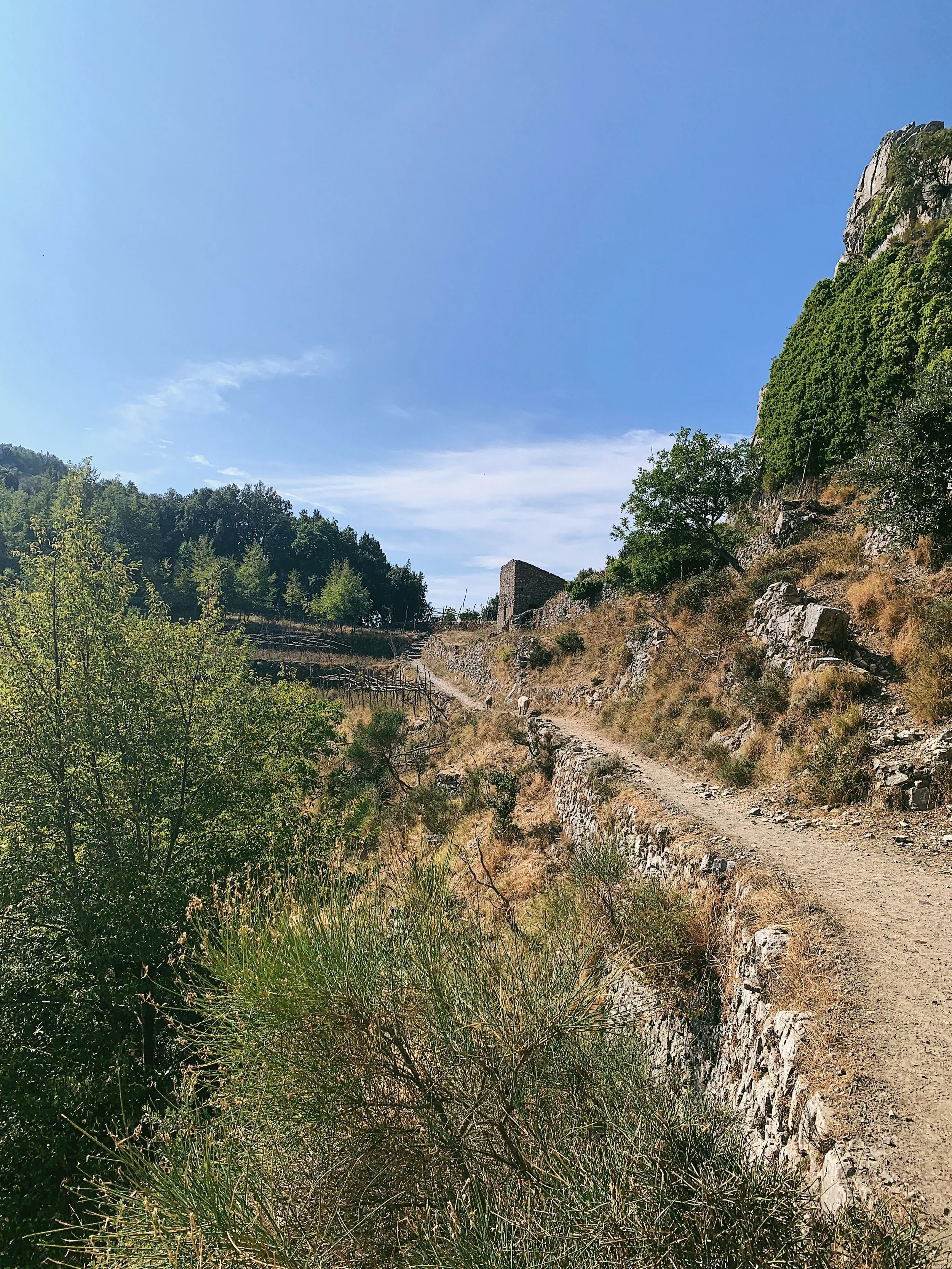
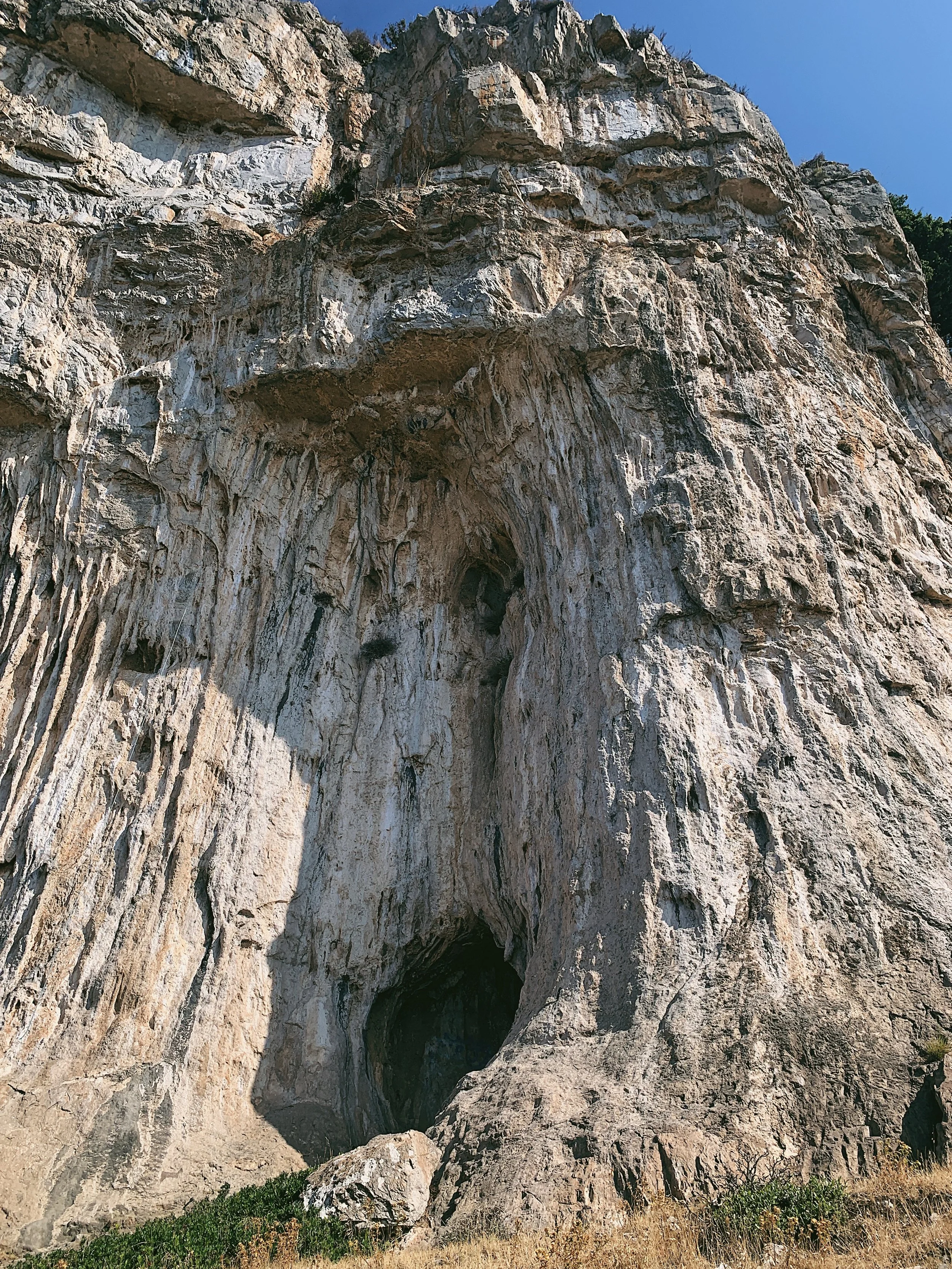
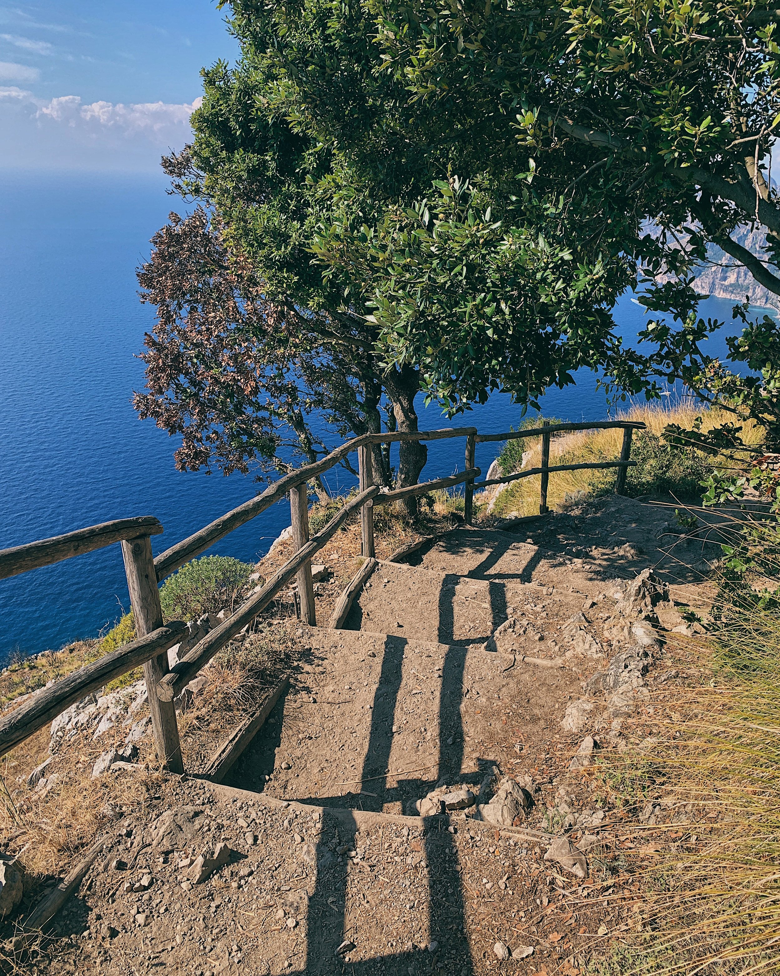
The first part of the walk follows a series of stone steps down under the Grotta Biscotto, so named for the fragility of its crumbly walls. If you look down over the barrier to the left, there is a small stable built into the cliff where there are often horses grazing around the ancient cave dwellings. The path then becomes a mix of dirt and stone track, winding in and out of the trees of the Vallone Graralle, with breath-taking glimpses of the sea between the leaves. On your left, there are some ruined farm cottages which tell a tale of times gone by at the Colle La Serra (578 m). Just after the Colle, there is the option to take the 327A path, which is a better option for those with vertigo as it runs slightly more into the interior.
After a short while you’ll reach a little settlement with a flight of steps leading down to a very impressive lookout - this is a great spot for a photo. This is the junction with the 327B path; if you turn left, the trail leads down to Praiano. Just after the right turn there is a restaurant, Ulysses’ House, which is the last option for food or drinks before Nocelle. There are, however, several picnic benches along the next stretch if you need to stop for a rest or snacks.
The path continues in and out of the trees, with several short sections of climbing and scrambling required. As the path continues there are lovely views to the front over Capri, Positano and the Li Galli islands. After a mountain hut on the right there is a fantastic climbing area, and shortly after the 327B rejoins the main path.
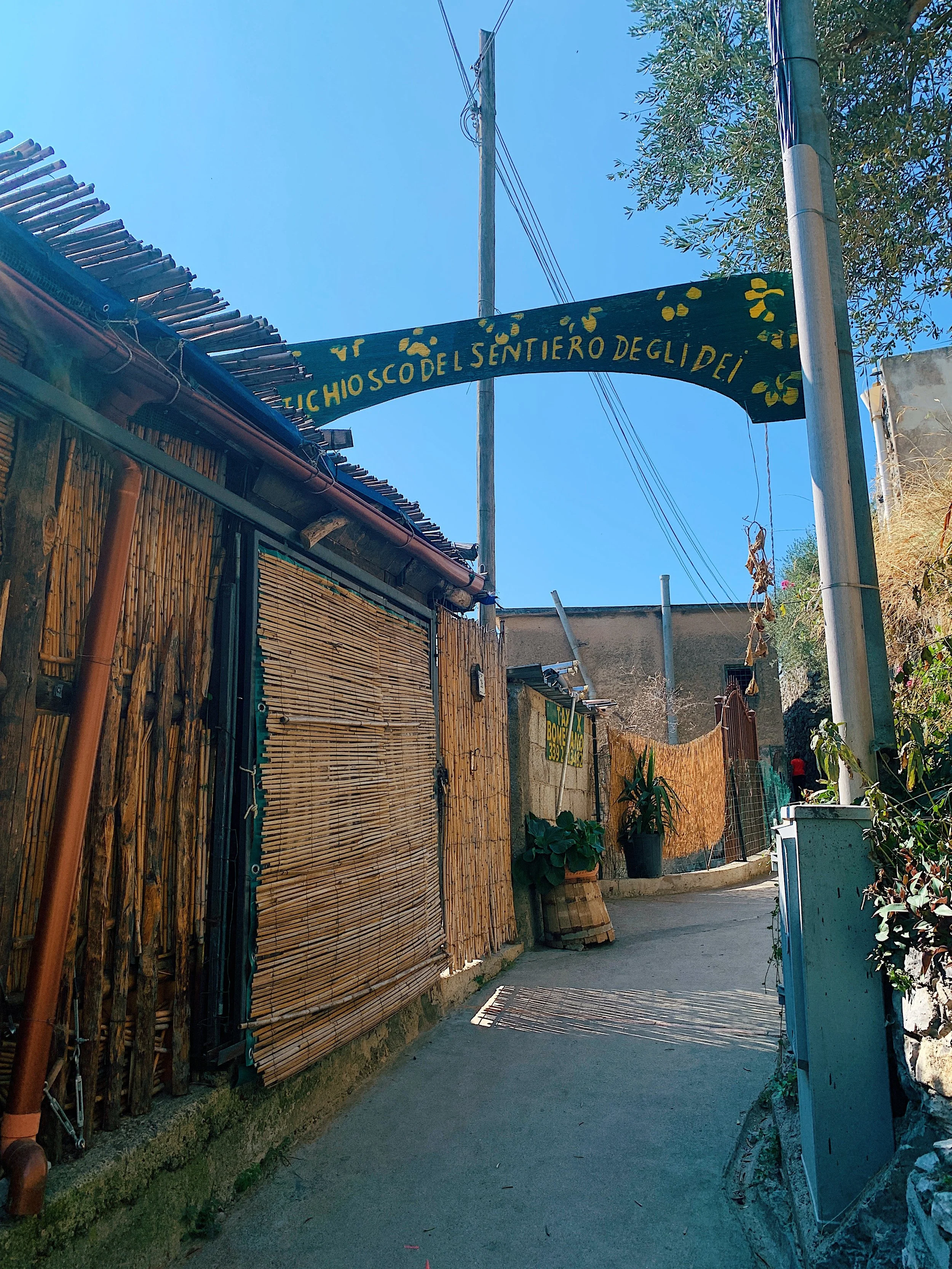
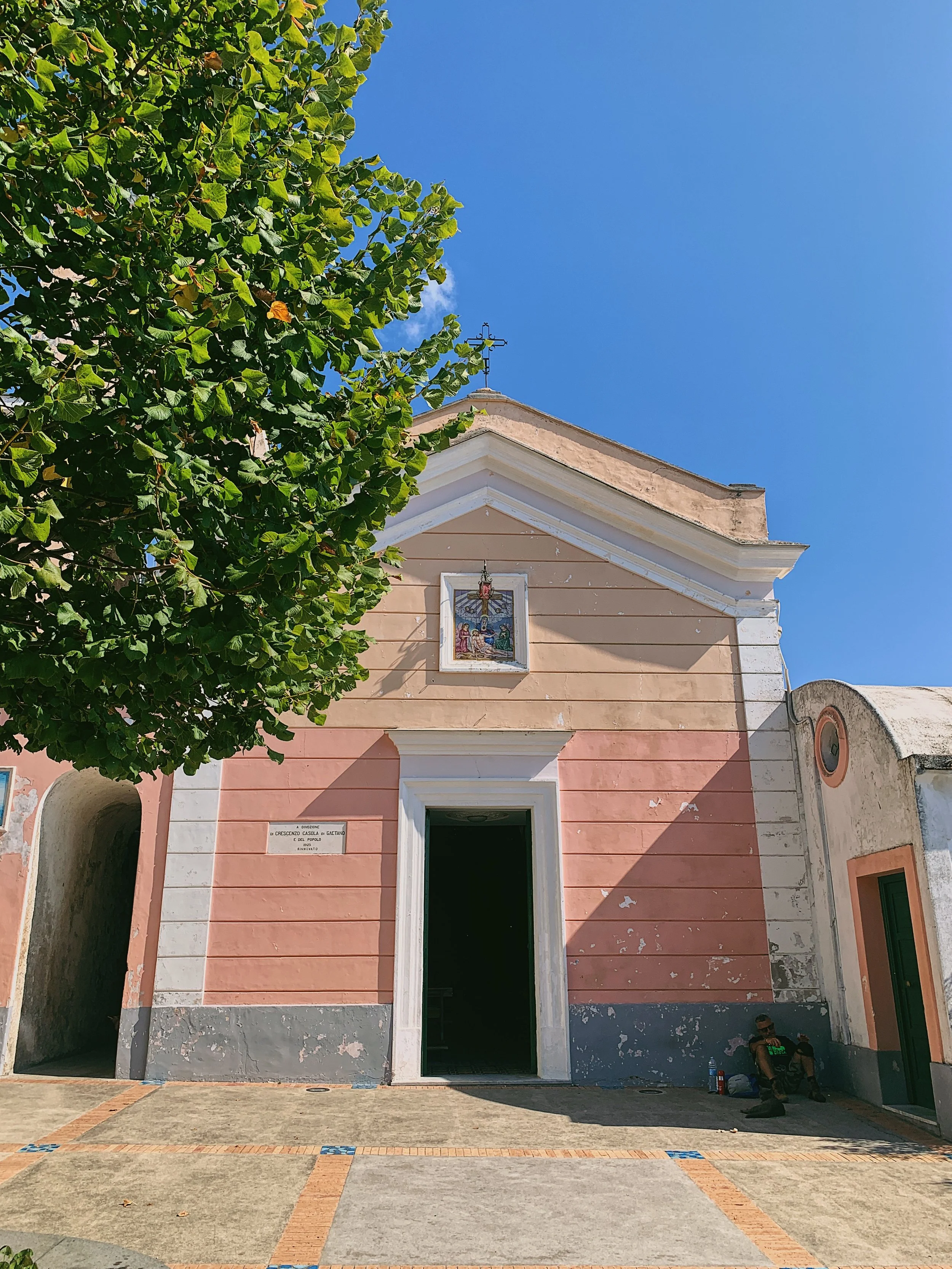
After a particularly rocky section through the trees, the path levels out slightly as the houses of Nocelle come into view. It then becomes concrete and passes under the arch of the chiosco. Continue through the village following the signs; take the short flight of stairs downhill (there is a drinking fountain on the right) until you reach the very pretty Piazza Santa Croce, where there is a granita and juice stand (Lemon Point) and a lovely church. This is a great spot for enjoying the view and a picnic.
Head back up the steps and retrace your way back to Agerola. There is slightly more uphill on the return.
Food and drink
There are many options in Agerola before you start the walk, though my preferred choices are Salumeria Manna, a little shop between the car park and the main piazza that makes sandwiches to order, and Bar Naclerio Guiseppe, which has fantastic homemade gelato. I like to stop here at the end for a well-deserved cono! As previously mentioned, there is a water station at the car park which will dispense fresh water for a fee. There are also vending machines on the right-hand side as you leave the village towards the start of the walk, in case you’ve forgotten to bring snacks.
In Nocelle the options are more limited. There are a couple of restaurants along the walk, including Ulysse’s, and a chiosco at the end which everyone knows for its deep green wooden arch over the trail. I normally pack a picnic and walk down into Nocelle’s beautiful piazza for an orange granita at Lemon Point. The little square has spaces to sit, a toilet (for a small donation) and water fountains to refill your bottles.