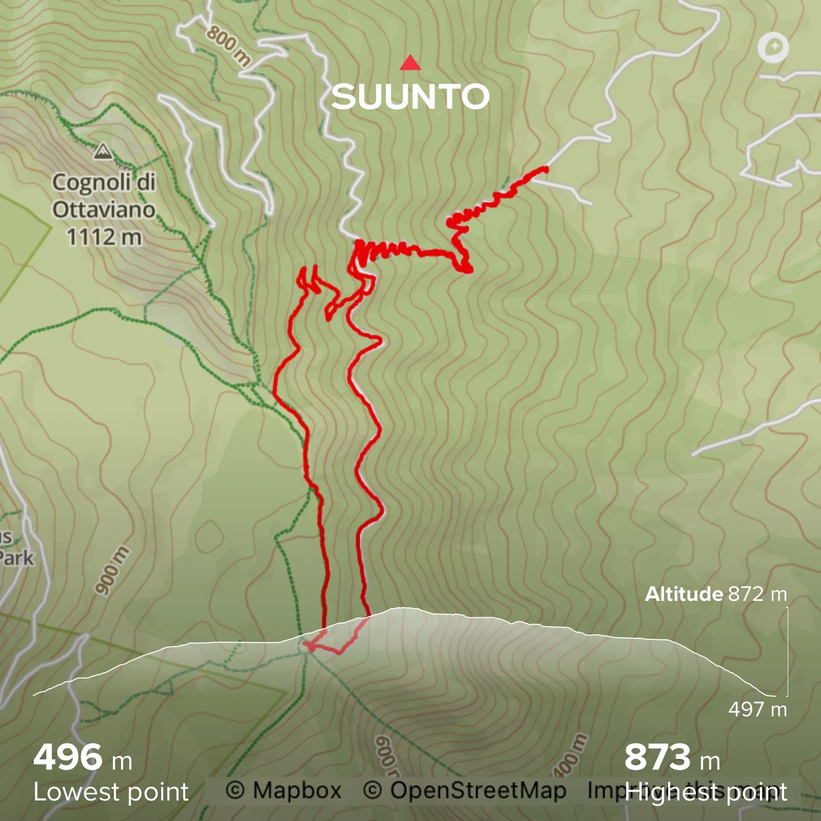
VALLE DELL'INFERNO
Length: 8.5 kilometres
Elevation gain: 405 m
Time: About 3.5 hours plus time for drinks and snacks
Parking: Parking area opposite Villa Giovanna restaurant, Ottaviano. Coordinates: 40.834288, 14.458267. What3words: ///patting.hurt.surfer
Best time to go: September - June. Part of the route is shaded by trees but at the top it is very exposed and gets very hot midsummer
Terrain: Soft pumice trails and dirt tracks. Very dusty when it’s dry. At the top there is some scrambling required over the cooled and hardened lava
Level: Easy to medium level hiking
Suitable for children: Yes, if they can manage the distance
Suitable for dogs: Yes, but should be kept on a lead due to other users of the path. The pumice may irritate sensitive paws
Sentiero Valle dell’Inferno: descend into the Valley of Hell
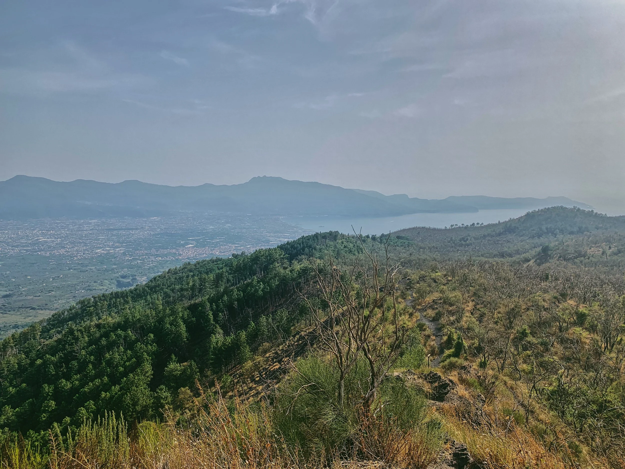
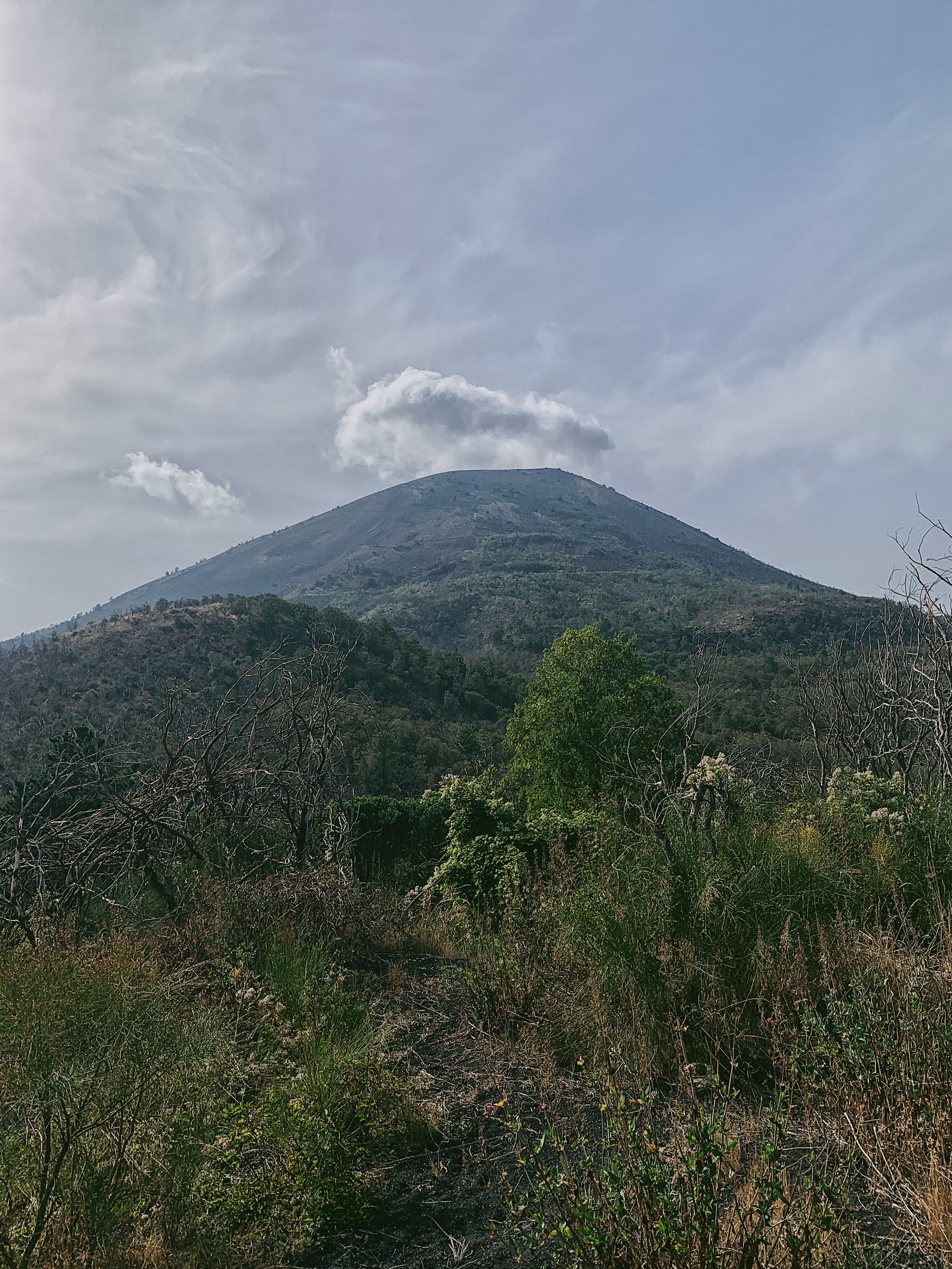
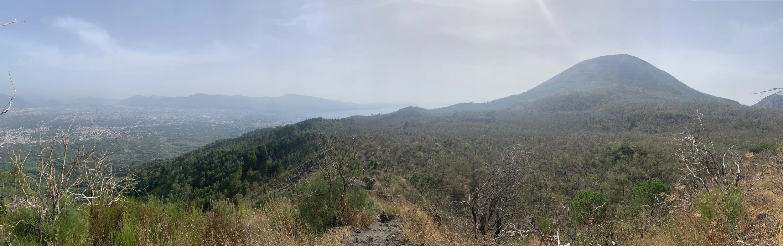
This itinerary blends two of the Parco Nazionale del Vesuvio’s most popular trails to create a shorter, but no less picturesque hike below the recognisable summit of Monte Somma - a sight that will feel very familiar to all those who reside in the area of Naples. Ascending up through the trees, the trail finally emerges into a hellscape of gnarled trees and thick, hardened ribbons of lava, with magnificent views of the cone of Vesuvio. On a clear day, you can see as far as the Sorrentine Peninsula and Capri from the highest point, as well as the Sarno River Valley and the rugged ridges of Monti Lattari.
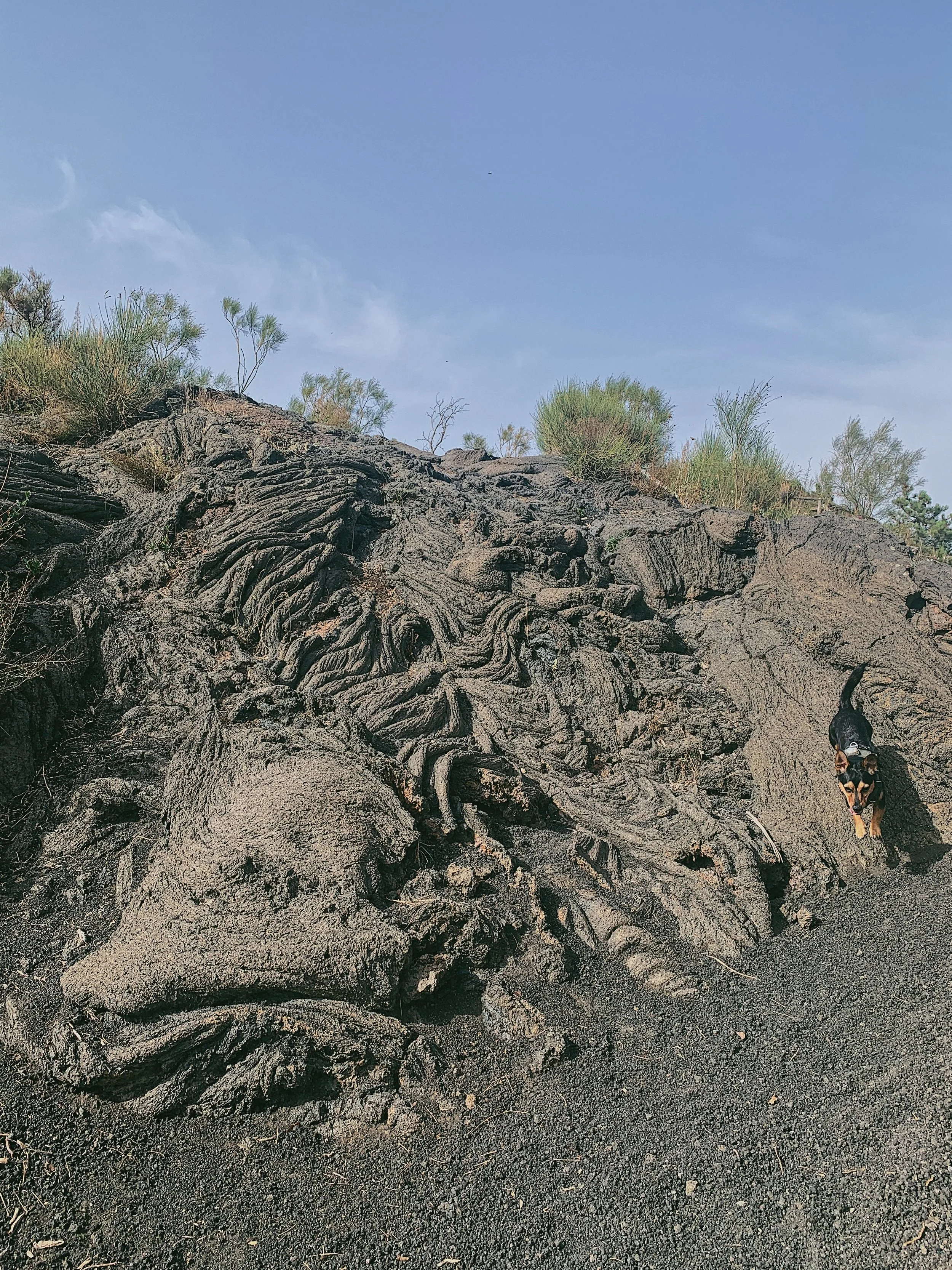
‘La Valle dell’Inferno’ translates as ‘the Valley of Hell’, and during previous eruptions of this sleeping beast that’s exactly what the area would have looked like. The crater spewed forth a terrifying and explosive cocktail of pyroclastic deposits - ash, pumice and lapilli - which rained down on the flanks of the cone leaving behind fragments of pulverised rock, minerals and volcanic glass, while changing the shape of the landscape forever. Most notable is the ‘lava a corda’, or rope lava, whose sinuous lines snake down the mountain as if the coils of thick rope. As the surface of each ripple cools, it forms an external layer which is borne along under the fluid magma underneath, curling into folds. (Personally, my favourite lava formation is called a ‘clinker’, which is basically a very irregular hardened block. It’s just fun to say).
The volcano complex dates back to almost half a million years ago, though the current cone structure is somewhat younger and has been shaped by four distinct periods of eruption.
22,000 years ago - a large central volcano with effusive eruptions
Up until 79AD - long, quiet periods followed by four massive Plinian eruptions that led to the formation of the collapsed caldera. The eruption of 79AD destroyed the cities of Pompeii, Herculaneum, Stabiae and Oplontis.
79AD - 1631 - multiple smaller eruptions, with two larger eruptions in 472AD and 1631
1631until present - between the violent eruption of 1631 and 1944 the volcano was almost constantly active. The last eruption was in 1944 and since then the volcano has been essentially dormant.
While the eruptions erased much of the original vegetation and wildlife that inhabited the flanks of the volcano, a number of pioneer species have reclaimed the hostile lava environment left behind, which is characterised by its volcanic soil. Beginning with lichen and moss, the modern-day vegetation includes red valerian, wormwood and several broom species (Spanish, common and Mount Etna).
Today we are able to walk on the pumice trails and see up close, the cooled and hardened lava. I find it endlessly fascinating that this natural spectacle is such a prominent landmark on our skyline and is reachable in around an hour.
Flora and fauna
The name ‘Valley of Hell’ may not evoke feelings of lush, colourful plants, but there are a number of plant species which can be seen growing alongside the path including 19 different varieties of protected orchid. While there is some noticeable damage by past eruptions and more recent forest fires, the tree covering is dense in places and features birch, broom, alders and conifers. You’re most likely to see birds on the walk, including falcon, raven and rock thrush, but there are also the ubiquitous lizards and beetles.
How to get there and parking
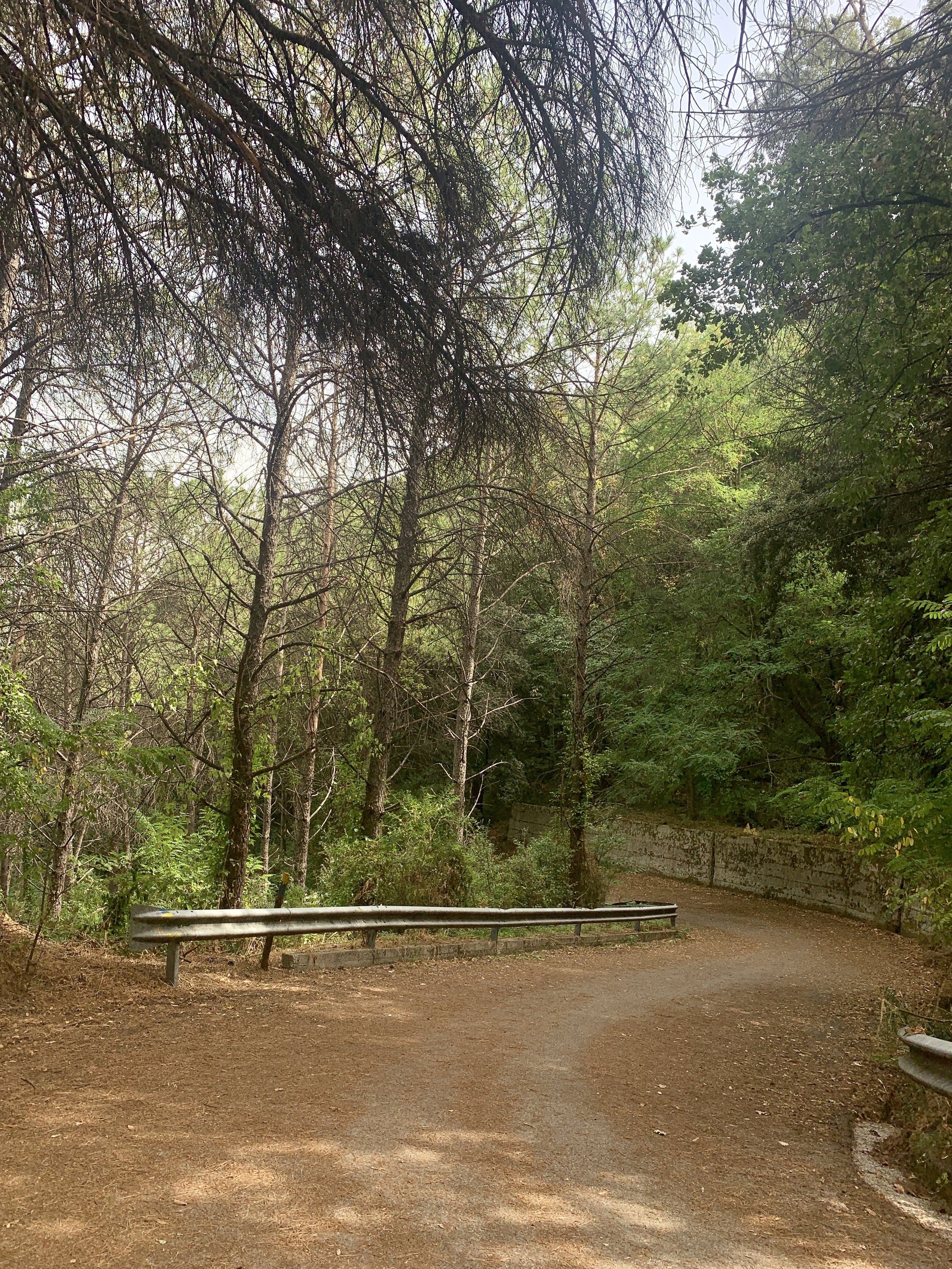
Leave the commune of Ottaviano on via delle Delizie, winding uphill on the lower slopes of the mountain through the trees. As you leave the town centre you’ll pass the Medici Palace on the left-hand side; the castle dates back to the Middle Ages and has undergone significant changes. Now in the style of a Renaissance palace it is home to the headquarters of the Parc Nazionale del Vesuvio. You’ll pass a number of rather upscale resort hotels on the way up until the road widens to a parking area on the left next to a scruffy concrete hut. There is a riding school downhill from here but if you get to it, you’ve gone too far. The parking is free and unsecured; I have left my car here without incident but do make sure you’ve removed anything that might attract thieves, as per usual.
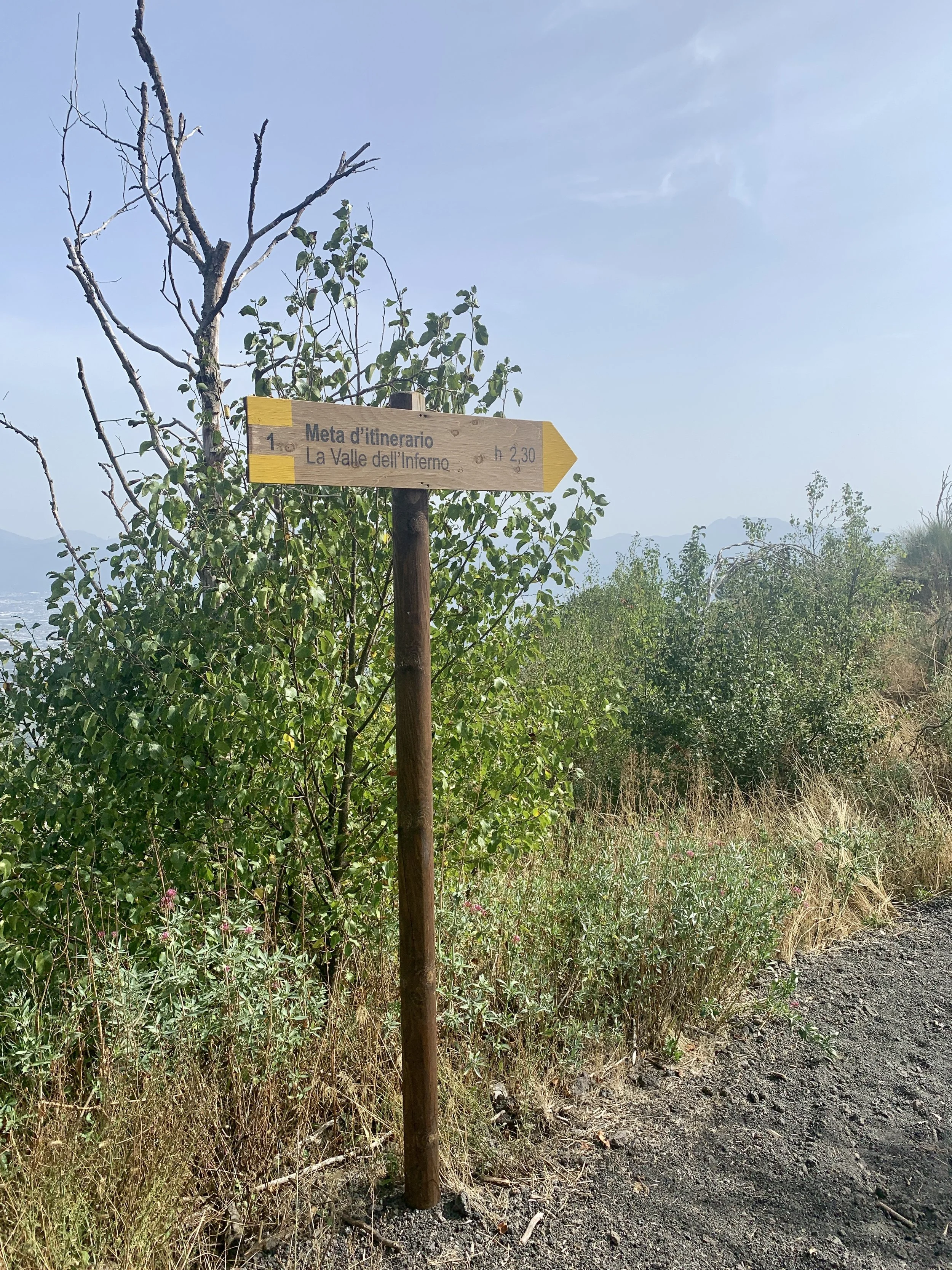
Signage and trails
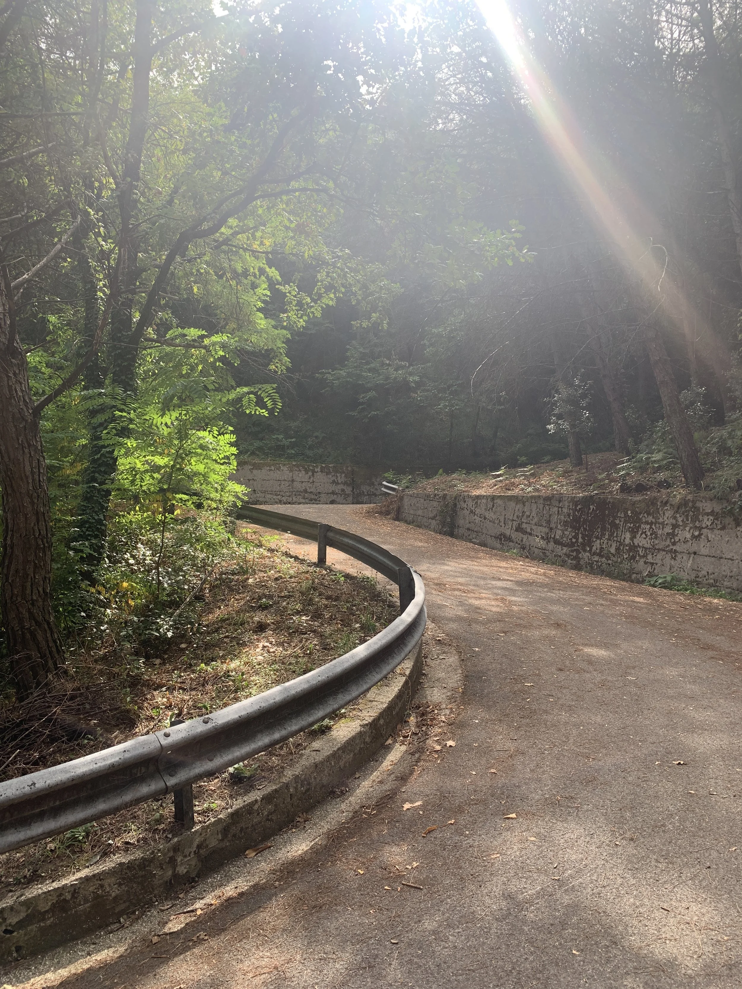
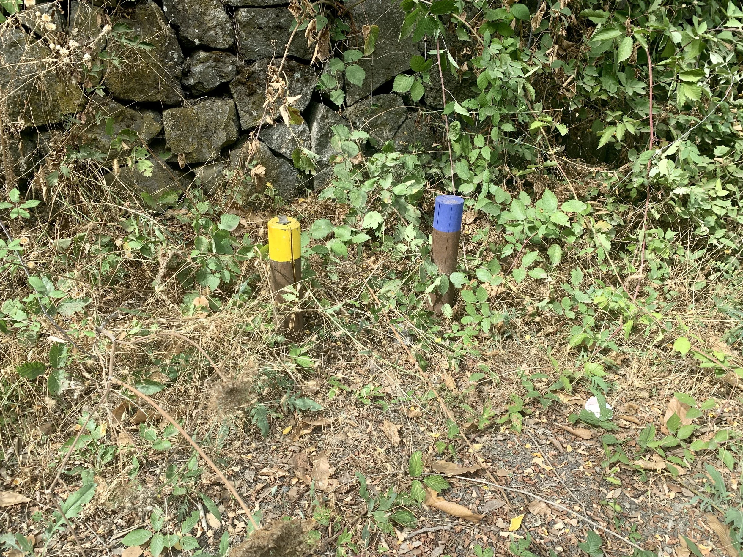
The trail begins behind the road barrier that leads uphill - it is now closed to traffic. Surprisingly the route is well signposted. If you feel like you’re going off track, keep an eye out for the blue or yellow markers as shown to the right. The trails are well maintained at the weekends by custodians of the national park and there are a number of sign boards along the way which tell you all about the flora and fauna of the route and the various different eruptions.
Route
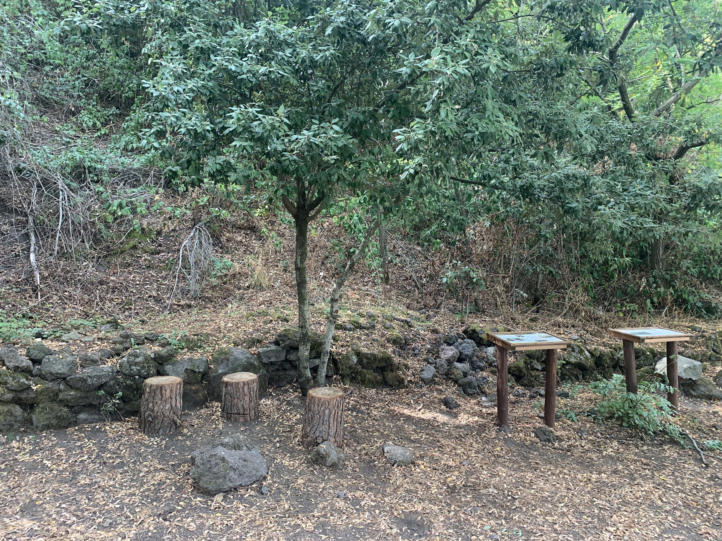
Park on the left just before Villa Giovanna Ristorante by the dodgy-looking concrete hut. Take the right-hand fork uphill and step over the barrier. Continue uphill around a series of asphalted switchbacks which begins as tarmac and turn into sharp, shingley pumice which gets very dusty in the drier months. Follow the road uphill ignoring any minor paths until you reach a clearing called Largo Angelo Prisco with information boards and a set of stumps which serve as little stools. This is a good place for a picnic. Here you’ll also find a memorial stone to Angelo Prisco, an innocent banker who was fatally shot here by poachers in 1995.
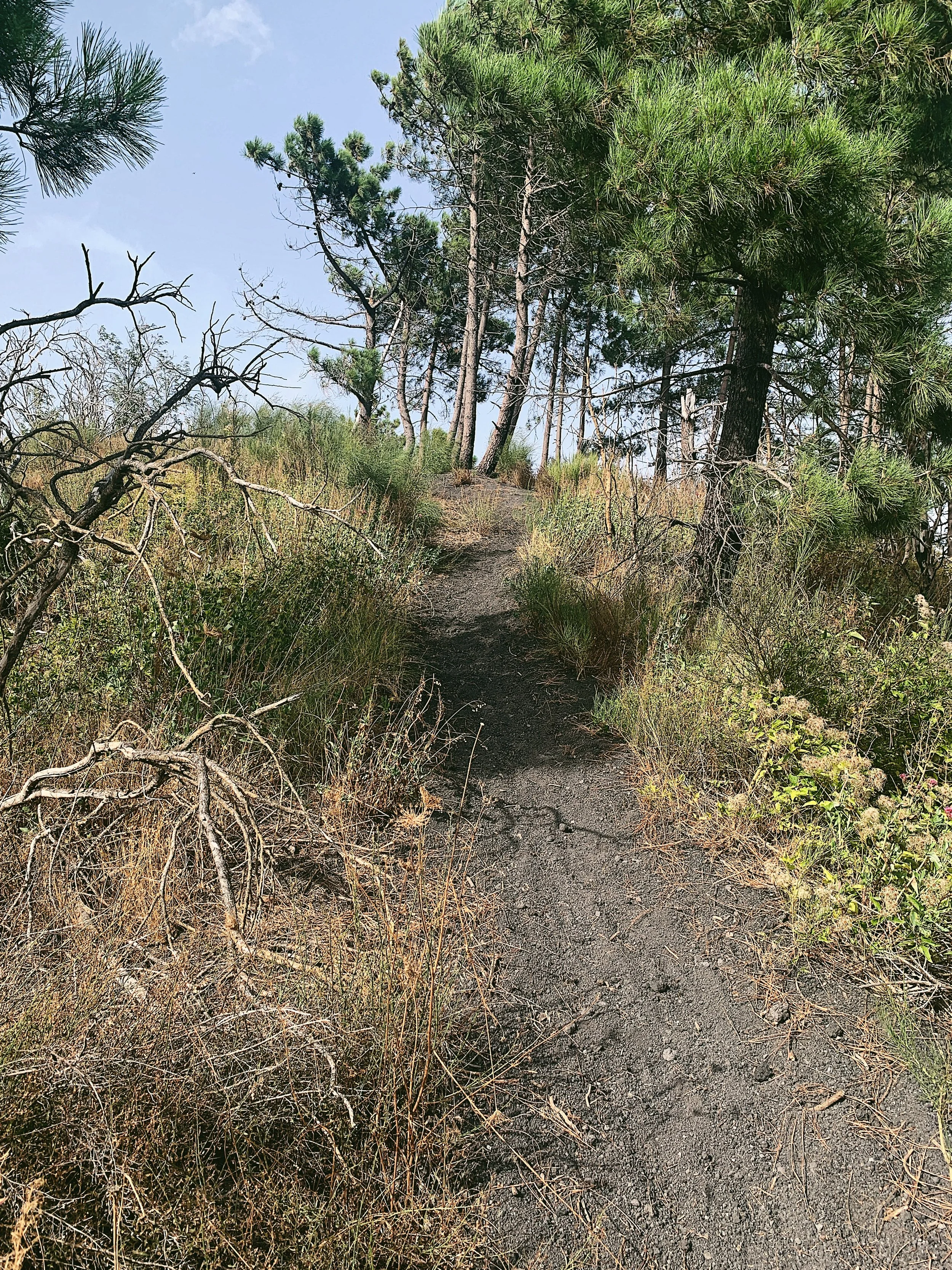
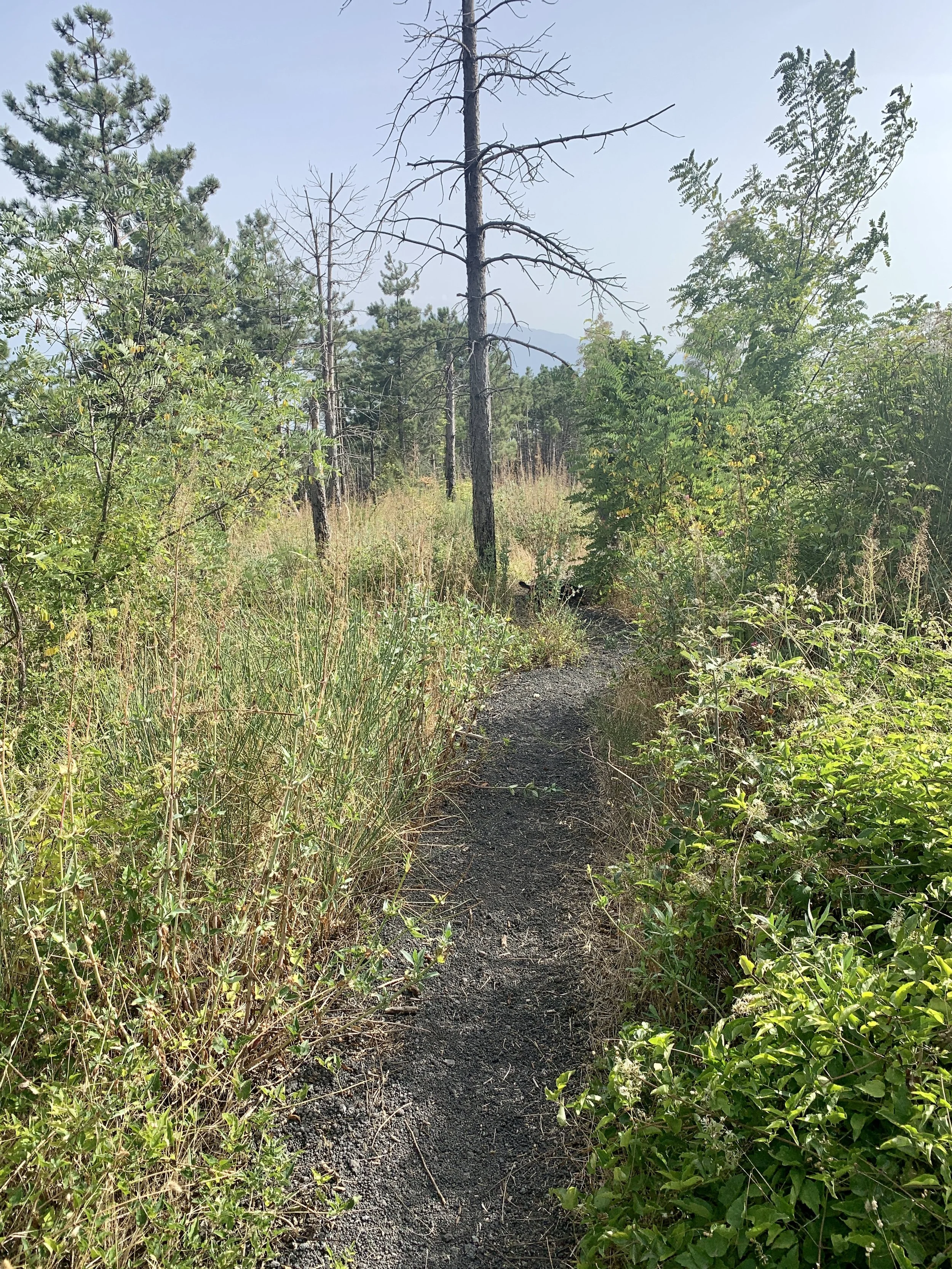
After a pause, facing the stumps, take the second major trail on the left leading uphill. This is where the trail deviates slightly from the published ‘Yellow Trail’. The wide trail continues up a series of switchbacks through the trees before ducking around the side of the hill and becoming a single track which appears to disappear behind a hill. The trail here is dense and the pumice becomes deeper. Eventually you will reach a fork in the trail. Take the left fork up towards a high ridge and enjoy the view of Naples below and a view over the Valle dell’Inferno, Punta Nasone to the right and the great cone of Vesuvio rising in front. It’s also possible to look across to the collapsed caldera of Monte Somma, which is characterised by its rugged humps called cognoli.
There is an alternative route for those who don't like heights which takes slightly longer but avoids a scramble up and down over the pumice. Turn right and then take a lower single track trail leading left, down into the valley. This meets back up with the main trail after a few hundred metres.
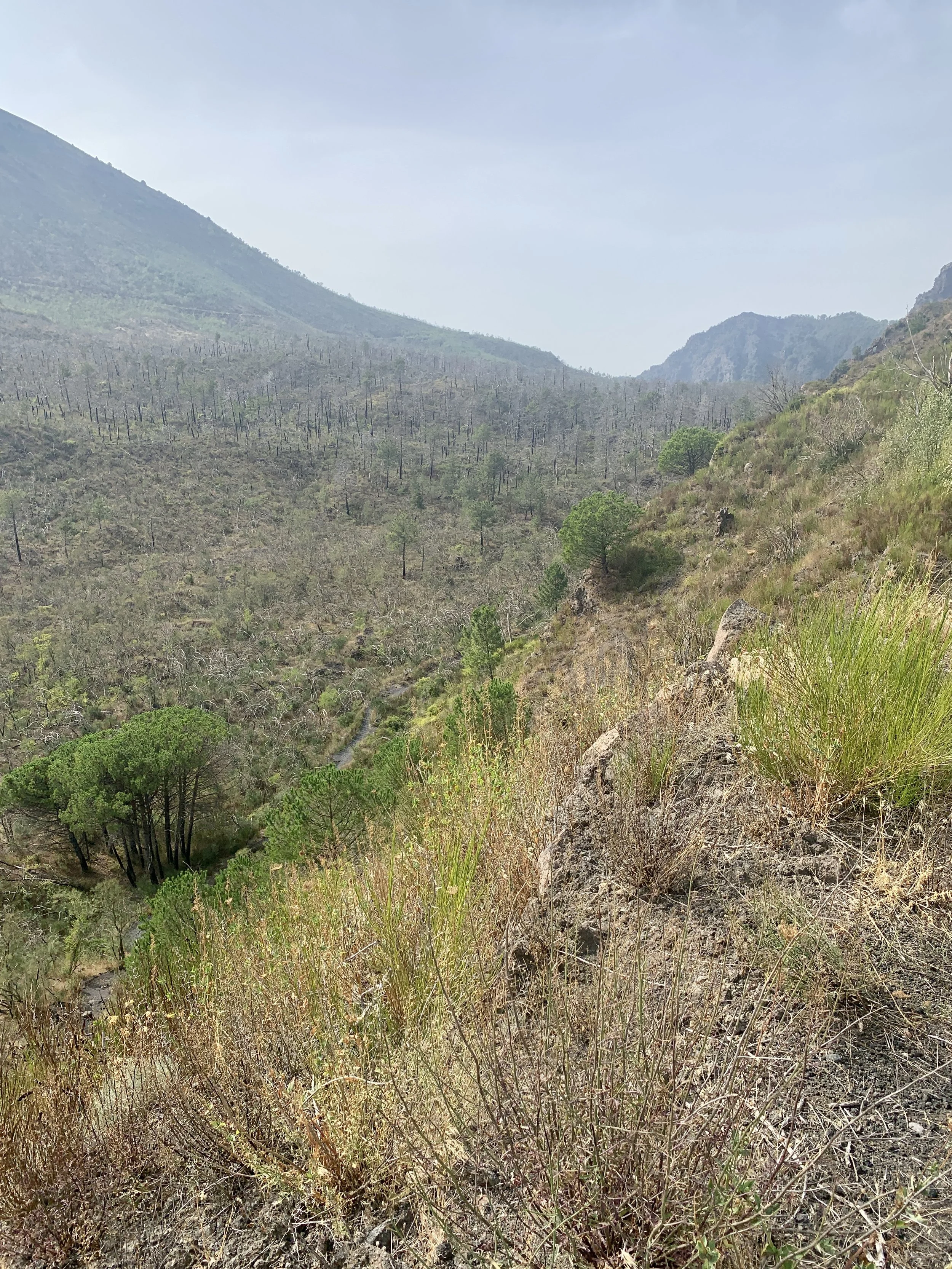
For those taking the normal route, head down from the ridge. There is some scrambling over rocks here to get down where you will need two hands to pull yourself up and over, but the trail is easy to follow; take your time. You will soon find yourself next to the fascinating cooled lava, leftover from a former eruption. This is marked on maps as lava in corda, and is from the more recent eruptions. The lava has cooled in the shape of thick ropes, and you will need to walk down over the hardened rock along the path. En route there are far reaching views over the north and east suburbs of Naples towards the Sorrentine Peninsula.
Continue downhill and fork left, following the pumice track to a wide, flat opening where several trails meet. This is marked on some maps as ‘Oasi’ and there is a small memorial at the middle between some trees where there are a couple of ramshackle benches. Take the first trail on the left (with the yellow signs) and follow the path back to the picnic area, then continue back to the car the same way that you came up. On the right, a short distance before you reach Largo Angelo Prisco again, there is path that joins the main trail with a ‘baracca forestale’ or forest shack. This is Sentiero 7 - called Il Vallone della Profica, an alternative route which, although an out-and-back route, follows a lovely trail through the dense forest, starting in San Giuseppe Vesuviana.
Ignore the right turn onto Sentiero 7 and continue back to the parking area.
Food and drink
There are a number of restaurants and cafes in Ottaviano, but this is a great walk for a picnic with a number of places to stop. The last time I actually sat on the lava itself to eat my sandwich and enjoyed a lovely, if hazy, view over Naples and the Monti Lattari. There are two restaurants near the parking area which I haven’t tried, but might suffice if you were desperate.